BlockBefore

Carroll County, Missouri

76 topographic sheets cover 32 settlements here, and 5 properties are on the National Register of Historic Places.

Research this county

From the record

“born December 21st, 1837, in Spencer county, Indiana. Son of Nathaniel and Huldah Grigsby, natives of Kentucky.”

Ephraim C. Grigsby - History of Carroll County, Missouri : Carefully Written and Compiled from the Most Authentic Official and Private Sources, Including a History of Its Townships, Cities, Towns and Villages, Together with a Condensed History of Missouri ; the Constitution of the United States, and State of Missouri ; a Military Record of Its Volunteers in Either Army of the Great Civil War ; General and Local Statistics ; Miscellany ; Reminiscences, Grave, Tragic and Humorous ; Biographical Sketches of Prominent Men and Citizens Identified with the Interests of the Country (1881). Machine-read text.

5 National Register listings published here · the county-history sources tell 7 stories and name 202 people · people the book names include Kig-De Townshid William Adams (Trotter Township, 1881) · William H. Adams (Prairie Township, 1881) (machine-read).

Sources: the county history on the Internet Archive · the National Register database, National Park Service

Missouri within the United States
Carroll County within Missouri

What the record shows

  • 516 topographic sheet readings cover the county's settlements.
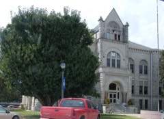
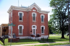
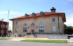
  • 5 properties here are on the National Register of Historic Places: 5 buildings.
  • 2 of the 5 listings were added during the 1970s.
  • The Geographic Names Information System records 32 populated places in this county; 32 are covered by at least one topographic sheet.
  • 1 public-domain county history, 1881, supplies 82,930 words of narrative reproduced here.

What happened here

7 accounts

Among them: Luther W. Sumpter; Perragran C. Hartis; John W. Miller. These passages come from the identified county-history source books. Each inset names its own source and opens the exact section it comes from.

From History of Carroll County, Missouri : Carefully Written and Compiled from the Most Authentic Official and Private Sources, Including a History of Its Townships, Cities, Towns and Villages, Together with a Condensed History of Missouri ; the Constitution of the United States, and State of Missouri ; a Military Record of Its Volunteers in Either Army of the Great Civil War ; General and Local Statistics ; Miscellany ; Reminiscences, Grave, Tragic and Humorous ; Biographical Sketches of Prominent Men and Citizens Identified with the Interests of the Country, published 1881 - Prairie Township

Luther W. Sumpter

born February 8th, 1854, in Monroe county. Mo. Son of John W. and Susan Sumpter. His father John W., was killed at Kirksville, Mo., July 4th, 1861, while on his way out to where the Militia were drilling. He was .attacked by George Wood, struck over the head with a loaded cane, and stabbed with a dirk. The cause of the attack was merely because Mr.

Read the rest of this passage

From History of Carroll County, Missouri : Carefully Written and Compiled from the Most Authentic Official and Private Sources, Including a History of Its Townships, Cities, Towns and Villages, Together with a Condensed History of Missouri ; the Constitution of the United States, and State of Missouri ; a Military Record of Its Volunteers in Either Army of the Great Civil War ; General and Local Statistics ; Miscellany ; Reminiscences, Grave, Tragic and Humorous ; Biographical Sketches of Prominent Men and Citizens Identified with the Interests of the Country, published 1881 - Leslie Township

Perragran C. Hartis

born July 24th, 1829, in Macklenburg county> North Carolina. Son of John and Sarah Hartis. His father was killed by a crazy man when Perragran was but a year old. His mother married again and he lived with his stepfather until 15 years of age, and after that with his brother until he went out to gain a livelihood for himself.

Read the rest of this passage

From History of Carroll County, Missouri : Carefully Written and Compiled from the Most Authentic Official and Private Sources, Including a History of Its Townships, Cities, Towns and Villages, Together with a Condensed History of Missouri ; the Constitution of the United States, and State of Missouri ; a Military Record of Its Volunteers in Either Army of the Great Civil War ; General and Local Statistics ; Miscellany ; Reminiscences, Grave, Tragic and Humorous ; Biographical Sketches of Prominent Men and Citizens Identified with the Interests of the Country, published 1881 - Leslie Township

John W. Miller

born September 13, 1835, in Burksvillci Cumberland county, Ky. He is a son of Jacob and Martha L. Miller. At 14 years he began the study of medicine, but was attacked with a hemorrhage of the lungs, and was compelled to quit his studies and take a trip to Mexico for his health. He remained there about 2 years, and then went to Texas.

Read the rest of this passage

From History of Carroll County, Missouri : Carefully Written and Compiled from the Most Authentic Official and Private Sources, Including a History of Its Townships, Cities, Towns and Villages, Together with a Condensed History of Missouri ; the Constitution of the United States, and State of Missouri ; a Military Record of Its Volunteers in Either Army of the Great Civil War ; General and Local Statistics ; Miscellany ; Reminiscences, Grave, Tragic and Humorous ; Biographical Sketches of Prominent Men and Citizens Identified with the Interests of the Country, published 1881 - Egypt Township

George W. Metcalf

George W. Metcalf was born on the 10th day of February, 1839, in White county, Ind., near the famous Tippecanoe battle ground. In 1845 he moved to Carroll county, Mo., with the family. His father, J. E. Metcalf, was formerly of New York; he ;died in 1865, with cholera, leaving George W., who was the oldest son, to look after the support of the family.

Read the rest of this passage

From History of Carroll County, Missouri : Carefully Written and Compiled from the Most Authentic Official and Private Sources, Including a History of Its Townships, Cities, Towns and Villages, Together with a Condensed History of Missouri ; the Constitution of the United States, and State of Missouri ; a Military Record of Its Volunteers in Either Army of the Great Civil War ; General and Local Statistics ; Miscellany ; Reminiscences, Grave, Tragic and Humorous ; Biographical Sketches of Prominent Men and Citizens Identified with the Interests of the Country, published 1881 - Egypt Township

George R. Ma-Gee

George R. Ma-Gee was born in Lewis county, Missouri in the month of April 1845. His father Thomas L. Ma-Gee was a prominent farmer of that county and our subject was reared on a farm and assisted his father in its management until the commencement of the great civil war. Mr. Ma-Gee, then a youth of seventeen years, enlisted first in the confederate army under Colonel Porter, but was subsequently forced by General McNeal - notorious on account of the wholesale massacre of defenceless prisoners at Palmyra, - to enter the federal army.

Read the rest of this passage

From History of Carroll County, Missouri : Carefully Written and Compiled from the Most Authentic Official and Private Sources, Including a History of Its Townships, Cities, Towns and Villages, Together with a Condensed History of Missouri ; the Constitution of the United States, and State of Missouri ; a Military Record of Its Volunteers in Either Army of the Great Civil War ; General and Local Statistics ; Miscellany ; Reminiscences, Grave, Tragic and Humorous ; Biographical Sketches of Prominent Men and Citizens Identified with the Interests of the Country, published 1881 - Egypt Township

Orsa Elliott

Appomattox Court House, in Virginia, is the birth place of Orsa Elliott. He was born on the 8th day of October, 1858. His father, John W. Elliott, was killed in battle when Orsa was only five years of age and he was left to the care of his mother with whom he lived until he reached the years of manhood.

Read the rest of this passage

From History of Carroll County, Missouri : Carefully Written and Compiled from the Most Authentic Official and Private Sources, Including a History of Its Townships, Cities, Towns and Villages, Together with a Condensed History of Missouri ; the Constitution of the United States, and State of Missouri ; a Military Record of Its Volunteers in Either Army of the Great Civil War ; General and Local Statistics ; Miscellany ; Reminiscences, Grave, Tragic and Humorous ; Biographical Sketches of Prominent Men and Citizens Identified with the Interests of the Country, published 1881 - Fairfield Township

Ephraim C. Grigsby

born December 21st, 1837, in Spencer county, Indiana. Son of Nathaniel and Huldah Grigsby, natives of Kentucky. Nathaniel Grigsby was a schoolmate of Abraham Lincoln's, and his brother, Aaron Grigsb}^ married Sallie Lincoln, sister of the President. Ephraim's grandfather Grigsby was taken prisoner, when quite young, by the Indians in Kentucky; the rest of the famil}'^ were killed and he was taken to Canada and kept prisoner for seven years.

Read the rest of this passage

Places on the National Register

5

Every property in this county listed on the National Register of Historic Places, with the year it was listed and the federal nomination document.

Photograph PropertyType ListedReference
Carroll County Court Housebuilding199595000858
Carroll County Sheriff's Quarters and Jailbuilding197979001355
Farmers Bank Buildingbuilding199494000702
U.S. Post Officebuilding197777001570
Wilcoxson and Company Bankbuilding198383000975

Wildfire, 1992 to 2020

99 fires

Every wildfire the federal occurrence database records inside this county: 99 of them, burning about 2,706 acres. 1 started naturally and 1 was recorded as arson. Each settlement page carries the fires within five miles of it.

Reported cause Fires
Debris and open burning46
Missing data/not specified/undetermined39
Equipment and vehicle use6
Smoking3
Railroad operations and maintenance1
Natural1
Recreation and ceremony1
Other causes1
Arson/incendiarism1

The five largest, by the area the report gives. One of them was set deliberately.

DateCause SizeReported by Name on the report
7 March 2020Missing data/not specified/undetermined1,072 acresMissouri Department of Conservation190330-01749-03072020-1430
18 October 1999Debris and open burning300 acresMissouri Department of Conservationnot named
30 March 2002Debris and open burning200 acresMissouri Department of Conservationnot named
4 March 2018Missing data/not specified/undetermined108 acresMissouri Department of Conservation176545-01749-03042018-1836
23 March 2018Missing data/not specified/undetermined82 acresMissouri Department of Conservation176251-01749-03232018-2122
16 April 2018Missing data/not specified/undetermined78 acresMissouri Department of Conservation176617-01749-04162018-1626
2 February 1992Arson/incendiarism70 acresMissouri Department of Conservationnot named
12 November 1999Debris and open burning60 acresMissouri Department of Conservationnot named

Every settlement page carries the fires within five miles of it - see the settlement index below.

Storms, 1955 to 2025

60 of 233 shown

The NOAA Storm Events Database holds 233 reports for this county, causing no deaths, 1 injury and about $3,502,060 in recorded property damage. Each settlement page carries the reports that name it.

Kind of event Reports
Hail112
Thunderstorm Wind71
Flash Flood21
Tornado16
Flood12
Funnel Cloud1

The most serious of them, by death, then injury, then recorded damage. The accounts are quoted exactly as the forecast office filed them.

WhenEvent Place namedHarm What the report says
May 1955Tornado (F0)not stated1 hurt, $25,000no account filed
May 1977Tornado (F4)not stated$2,500,000no account filed
April 1999Tornado (F2)Bosworth$300,000The tornado touched down 3 miles west of Bosworth and moved northeast into Chariton and Macon Counties. A home was destroyed 1 mile north of Bosworth and several large trees were downed before the tornado moved into Chariton County.
March 2006Tornado (F0)Norborne$250,000F0 tornado touched down around Norborne at 0944 CST and then lifted 2 miles east of Carrollton at 1005 CST. Damage was noted to buildings...trees and power lines.
October 2000Thunderstorm WindHale$200,000Extensive wind damage was reported just southwest of Hale. A 50-by-60 foot machine shed and a 60-by-120 foot Morton building were destroyed, and farm equipment inside was damaged. A two car garage was destroyed, and a modular home suffered roof damage. Large trees and limbs were downed, and one limb fell on the roof of a home, causing damage.
March 2002Thunderstorm WindCarrollton$25,000Roof blown off a house. Silo blown over onto church.
April 1973Tornado (F2)not stated$25,000no account filed
September 1965Tornado (F1)not stated$25,000no account filed
May 1961Tornado (F2)not stated$25,000no account filed
June 2009Thunderstorm WindNorborne$20,000Spotter reported thunderstorm wind gusts estimated to be up to 100 mph. Winds were gusting up to 60 mph, for 10 to 15 minutes, between Norborne and Carrollton. Numerous trees and power lines were down. Several power poles were snapped.
June 1998Thunderstorm WindPlymouth$20,000A barn was destroyed by severe thunderstorm winds along County Line Rd, 8 miles southwest of Plymouth.
June 2018Thunderstorm WindBogard$10,000Main power line was downed by strong winds.
May 2000Thunderstorm WindCarrollton$10,000Thunderstorm winds damaged the roof of a home east of Carrollton.
October 2000Thunderstorm WindColoma$10,000Large tree limbs were blown down and a machine shed was severely damaged.
June 2009Thunderstorm WindNorborne$5,000A part of a barn roof was ripped off. Several powerlines were also reported down.
May 2000Tornado (F1)Norborne$5,000Carroll County Emergency Management reported a tornado in open fields 4 miles south of Norborne. The tornado moved northeast for 2.5 miles, and trees and power lines were downed along its path.
May 1994HailMiami Station$5,000A sheriff's patrol car was damaged by golf ball-size hail.
July 1995Thunderstorm WindDe Witt$3,000Trees and power lines reported down as a result of thunderstorm winds over Northern Carroll County.
June 2009Thunderstorm WindNorborne$2,000Trees and powerlines were reported down.
June 2009Thunderstorm WindNorborne$2,000Thunderstorm wind gusts to 65 mph were estimated. A 50 foot tall radio tower was blown over.
June 2007Thunderstorm WindNorborne$2,000Power poles and tree limbs were reported down.
August 2006Thunderstorm WindCarrollton$2,000Trees...large limbs...and a power pole down.
June 2004Thunderstorm WindCarrollton$2,000Power lines down.
April 2010Thunderstorm WindCarrollton$1,000A power pole was broken on Highway D near Highway E.
March 2006Thunderstorm WindCarrollton$1,000Roof damage to building on Highway 65.
July 2006Thunderstorm WindCarrollton$1,000Several trees and power lines downed.
June 1994HailHale$500Large hail damaged approximately 90,000 acres of crops and pastures from just east of Hale southeastward to the Grand River. Reported by agricultural officials and a local newspaper.
June 1970Tornado (F1)not stated$250no account filed
May 1965Tornado (F0)not stated$250no account filed
June 1970Tornado (F0)not stated$30no account filed
June 2025Thunderstorm WindBogard-Downed wires near County Road 190 north of Carrollton.
June 2025Thunderstorm WindNorborne-Downed wires and power outages reported in the Norborne area.
July 2025Thunderstorm WindBosworth-Downed tree limbs and wires near Missouri Avenue in Bosworth.
August 2023Thunderstorm WindNorborne-Estimated 60 mph winds at the Casey's General Store in Norborne.
August 2023Thunderstorm WindCarrollton-Power line downed in Carrollton and power is out.
June 2021Flash FloodMandeville-Numerous roads in Carroll County, including in Carrollton were impassible due to running water.
April 2019FloodNorborne-Ongoing flooding along the Missouri River continued through the month of April and into May. Several roads were closed near the banks of the Missouri River. This flooding began in mid March and due to upstream releases and continued periods of heavy rain the flooding continued into May. Monetary damages are unknown despite the entry indicating 0 dollars of damages.
June 2019FloodSugartree-Heavy spring rains caused ongoing flooding along the Missouri River to Continue through the month. Some locations along the Missouri River experienced major flooding at times during the month. Damage estimates from roads washed out and crop damage are unknown at this time.
May 2019FloodSugartree-Heavy spring rains caused ongoing flooding along the Missouri River to Continue through the month. Some locations along the Missouri River experienced major flooding at times during the month. Damage estimates from roads washed out and crop damage are unknown at this time.
May 2019FloodStandish-Route UU was closed in both directions near Bosworth.
May 2019Thunderstorm WindHale-There were trees down on Route J, just west of Hale.
August 2018Flash FloodNorborne-Route E near Stet was closed due to running water over the road.
August 2018Flash FloodBosworth-Route UU near Bosworth was closed due to running water over the road.
March 2017Tornado (EF0)W B Jct-A squall line with embedded supercells and mesovortices moved through western Missouri and eastern Missouri on the evening of March 6. The storm took out a center point irrigation system just southwest of Carrolton; however, in the city of Carrolton several structures on the south side of the city were heavily damaged by tornadic winds. Along Main Street windows were completely blown out of several businesses and a couple buildings along Main Street even had some partial roof and external wall failure. The tornado moved east of town and did some external damage to a metal building. The tornado crossed HWY 65 and paralleled HWY 24 for a mile or two, causing damage to outbuildings along the route. About 2-3 miles east of Carrolton it crossed HWY 24 and dissipated north of HWY 24.
August 2016Flash FloodNorborne-During the long duration heavy rain event across Carroll County several area roads flooded. In the city of Carrolton a few businesses had water running up, and causing water to move into these businesses. The extent or cost of the damage is unknown.
August 2016Flash FloodCarrollton-Flash flooding washed out a basement, causing a house to come off the foundation. Cost of this damage is unknown.
July 2016Flash FloodStandish-Road UU was closed due to running water.
July 2016Thunderstorm WindCarrollton-Several large trees of unknown size or condition were down in Carrolton.
September 2016FloodPlymouth-Route N was closed along Shoal Creek due to flooding. While the damage was largely minimal the amount of damage was unknown.
September 2016FloodNorborne-Route E along Turkey Creek was closed due to flooding. While the damage was largely minimal the amount of damage was unknown.
September 2016FloodPlymouth-Route N east of Braymer was closed due to flooding. While the damage was largely minimal the amount of damage was unknown.
April 2014Thunderstorm WindCarrollton-Trees blown onto power lines and buildings damage in town.
April 2014Thunderstorm WindRoads-A number of farm outbuildings were heavily damaged.
April 2011Funnel CloudSugartree-A funnel cloud was observed just north of the Missouri River.
April 2010Thunderstorm WindHale-Thunderstorm wind gust was measured at 53 knots.
June 2010Thunderstorm WindCarrollton-Thunderstorm winds were estimated up to 60 mph.
June 2010Flash FloodCarrollton-Water was reported over Highway UU, near Big Creek.

Mines and quarries

48 recorded

The Survey's mineral resources record lists 48 workings inside this county. 1 still produces and 47 are closed or unrecorded. Each settlement page carries the workings within five miles of it.

Commodity Workings
Stone, Crushed/Broken38
Sand and Gravel, Construction10

The least common of them first, because a county's hundredth gravel pit says nothing its first ten did not.

Where SiteCommodity StatusRecorded
Carrollton Sand Dredge & PlantSand and Gravel, ConstructionProducer
Unknown - S & GSand and Gravel, ConstructionPast Producer
Austin England QuarryStone, Crushed/BrokenPast Producer
City QuarryStone, Crushed/BrokenPast Producer
George Dean QuarryStone, Crushed/BrokenPast Producer
Hurrican QuarryStone, Crushed/BrokenPast Producer
Lakeview QuarryStone, Crushed/BrokenPast Producer
Lautenslager QuarryStone, Crushed/BrokenPast Producer
Mandeville QuarryStone, Crushed/BrokenPast Producer
Minnis + Trotten QuarryStone, Crushed/BrokenPast Producer
Nance QuarryStone, Crushed/BrokenPast Producer
Stoke Mound QuarryStone, Crushed/BrokenPast Producer
Unknown - LsStone, Crushed/BrokenPast Producer
Unknown - SsStone, Crushed/BrokenPast Producer
Washington Township QuarryStone, Crushed/BrokenPast Producer
Wilcoxin QuarryStone, Crushed/BrokenPast Producer
Wright QuarryStone, Crushed/BrokenPast Producer

The townships, in 1881

82,930 words

History of Carroll County, Missouri : Carefully Written and Compiled from the Most Authentic Official and Private Sources, Including a History of Its Townships, Cities, Towns and Villages, Together with a Condensed History of Missouri ; the Constitution of the United States, and State of Missouri ; a Military Record of Its Volunteers in Either Army of the Great Civil War ; General and Local Statistics ; Miscellany ; Reminiscences, Grave, Tragic and Humorous ; Biographical Sketches of Prominent Men and Citizens Identified with the Interests of the Country devotes a chapter to each township: its boundaries and streams, who settled it and when, the mills, the schools and the churches. All 16 are reproduced here in full. Each row shows the township's own shape and where it lies in the county, drawn from the Census Bureau's boundary. Which settlements belong to which township is computed from that same boundary, not taken from the book.

Shape and position in the county TownshipSettlements in it LengthSections
Carrollton TownshipCarrollton, Standish4,119 words1
Combs TownshipLeta, Milford3,699 words14
De Witt TownshipDe Witt1,242 words1
Egypt TownshipMiles Point, Norborne20,439 words57
Eugene TownshipWakenda, White Rock1,606 words2
Fairfield TownshipRoads5,459 words21
Hill TownshipFisher, Latoh1,071 words1
Hurricane TownshipBridge Creek, Hale, Little Compton2,793 words12
Leslie TownshipMandeville7,769 words26
Moss Creek TownshipPalemon, Sugartree3,824 words11
Prairie TownshipJudd, Stet11,112 words35
Ridge TownshipBosworth1,383 words0
Stokes Mound TownshipAsper, Coloma, Grace, Tina4,939 words18
Trotter TownshipBingham5,882 words23
Van Horn TownshipBogard2,924 words8
Washington TownshipPlymouth, Quote4,669 words16

The county's history books

293,881 words

One book written about this county, cut here where the book itself is cut, at its printed chapters: 1 chapter in all. Every chapter is public domain, machine-read from the scan and reproduced complete. A chapter already given under one of the county's towns is not repeated in this list.

History of Carroll County, Missouri : Carefully Written and Compiled from the Most Authentic Official and Private Sources, Including a History of Its Townships, Cities, Towns and Villages, Together with a Condensed History of Missouri ; the Constitution of the United States, and State of Missouri ; a Military Record of Its Volunteers in Either Army of the Great Civil War ; General and Local Statistics ; Miscellany ; Reminiscences, Grave, Tragic and Humorous ; Biographical Sketches of Prominent Men and Citizens Identified with the Interests of the Country (1881)

ChapterLength
The whole text293,881 words in 19 parts

The people it describes

202 named

Everyone History of Carroll County, Missouri : Carefully Written and Compiled from the Most Authentic Official and Private Sources, Including a History of Its Townships, Cities, Towns and Villages, Together with a Condensed History of Missouri ; the Constitution of the United States, and State of Missouri ; a Military Record of Its Volunteers in Either Army of the Great Civil War ; General and Local Statistics ; Miscellany ; Reminiscences, Grave, Tragic and Humorous ; Biographical Sketches of Prominent Men and Citizens Identified with the Interests of the Country stops to write about, with the section that describes them. Among them are the men who founded the place and governed the Territory. Each name opens the passage itself, in the words of 1881.

Every populated place in the county

32

Named settlements recorded in the Geographic Names Information System, each with the topographic sheets covering it. Villages, hamlets and abandoned places alike. Each is shown with the nearest named watercourse or landform and the survey quadrangle it falls on.

The vanished settlements of Carroll County: the places named above that are no longer on the map.

Provenance

  • Topographic sheets. USGS Historical Topographic Map Collection, county index, measured from the bulk metadata.
  • Fire insurance maps. Library of Congress Sanborn collection, faceted to this county.
  • Photographs. Each place queried individually against the Library of Congress Prints and Photographs search.
  • Wildfire. Short, Karen C. 2022. Spatial wildfire occurrence data for the United States, 1992-2020 [FPA_FOD_20221014]. 6th Edition. Fort Collins, CO: Forest Service Research Data Archive. https://doi.org/10.2737/RDS-2013-0009.6 Collected with United States Government funding and usable without additional permissions or fees.
  • Mines and quarries. USGS Mineral Resources Data System (MRDS) https://mrdata.usgs.gov/mrds/ A work of the United States government, no copyright under 17 U.S.C. 105.
  • Storms. NOAA National Centers for Environmental Information, Storm Events Database https://www.ncei.noaa.gov/stormevents/ A work of the United States government, no copyright under 17 U.S.C. 105. Narratives are quoted verbatim from the National Weather Service report and are not edited or summarised.