 Block
Napier, Missouri
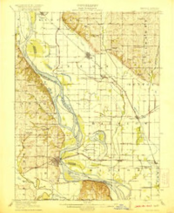
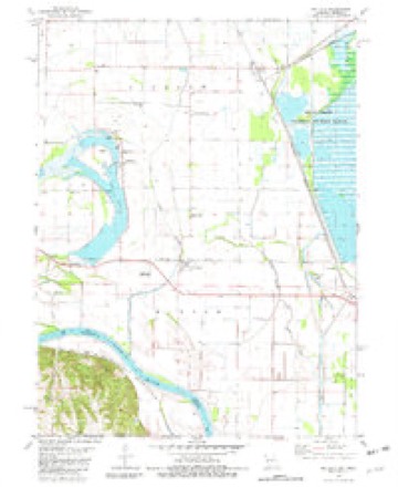
13 topographic sheets cover this place, the earliest surveyed in 1920 and the latest in 1986. It stands in Minton Township. It lies in ZIP code area 64437. It stands on Davis Creek Ditch. The Survey maps it on the Big Lake quadrangle.
Topographic sheets covering this place
6 surveys from 13 printed sheetsMatched by testing this settlement's coordinate against the published boundary of every sheet in the United States Geological Survey's historical collection. Each opens the scanned sheet at the Survey.
- 1920 USGS Craig quadrangle1:62500, 5 printings
- 1955 USGS Nebraska City quadrangle1:250000, 3 printings
- 1957 USGS Nebraska City quadrangle1:250000
- 1958 USGS Nebraska City quadrangle1:250000
- 1981 USGS Big Lake quadrangle1:24000
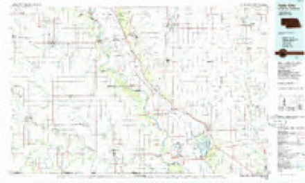
- 1986 USGS Falls City quadrangle1:100000, 2 printings
In the county-history sources
2,701 words on this townshipHistory of Holt County, Missouri : from the Time of the Platte Purchase to the End of the Year 1916 : Preceded by a Short History of Missouri : Supplemented by Biographical Sketches of Prominent Citizens, published 1917 names this settlement in its chapter on Minton Township. These are the passages that mention it, exactly as the scans read.
Napier was established as a station January 1, 1882. In 1887 the St. Joseph & Nebraska Railroad was built from Napier to a point opposite Rulo in the Missouri River. The Rulo bridge across the river was completed October 3, 1889 and was built by the Atchison & Nebraska Railroad Company. Through traffic to the west and northwest was established at once. Napier then became an important junction point and September 1, 1911, it was made a division point on the Burlington system. The town, like Fortescue, was named for an English stockholder in the railroad company.
Passage source: History of Holt County, Missouri : from the Time of the Platte Purchase to the End of the Year 1916 : Preceded by a Short History of Missouri : Supplemented by Biographical Sketches of Prominent Citizens, published 1917.
Napier became a post office in 1883. The postmasters who have served the patrons of the office are: William Brisco, E. G. Smith, S. A. Babb, J. L. Minton and W. G. Craig. The first money order issued was on July 4, 1902, and was in favor of the Akhurst-Everly Arms Company of St. Joseph.
Passage source: History of Holt County, Missouri : from the Time of the Platte Purchase to the End of the Year 1916 : Preceded by a Short History of Missouri : Supplemented by Biographical Sketches of Prominent Citizens, published 1917.
and J. L. Minton. Mr. Beasley was especially active in his efforts to interest J. F. Barnard, who at that time was superintendent of the Kansas City, St. Joseph & Council Bluffs Railroad, and who had much to do with the building of the line across the Missouri River from a point of connection with the main line at Napier. The agreement to locate a town between Napier and the Missouri River was contingent upon the land owners donating the grounds for a depot and doing the necessary grading for the side tracks. In addition to this they donated the ties for the switch tracks. Thus it is that provision was made for the building of the town of Fortescue.
Passage source: History of Holt County, Missouri : from the Time of the Platte Purchase to the End of the Year 1916 : Preceded by a Short History of Missouri : Supplemented by Biographical Sketches of Prominent Citizens, published 1917.
Machine-read from a century-old scan, so expect the errors a machine makes: misspelled names, dropped words, stray characters.
Fires near this place
18 since 1995Regional context, not property-specific evidence. The federal wildfire occurrence database lists 18 fires within 5 miles of Napier between 1995 and 2014, burning about 1,554 acres in total. None started naturally. 4 were recorded as arson. Distance is straight-line from the map coordinates, so a fire counted here may appear on a neighbouring settlement's page as well.
| Reported cause | Fires |
|---|---|
| Debris and open burning | 7 |
| Arson/incendiarism | 4 |
| Missing data/not specified/undetermined | 3 |
| Smoking | 3 |
| Railroad operations and maintenance | 1 |
The most recent of them, most recent first, with the day each was reported and the service that recorded it.
| Date | Cause | Size | Reported by | Name on the report |
|---|---|---|---|---|
| 28 April 2004 | Smoking | under an acre | Squaw Creek National Wildlife Refuge | NORTH WOODS TOUR ROUTE |
| 2 April 2011 | Missing data/not specified/undetermined | 2.0 acres | Squaw Creek National Wildlife Refuge | WILSON |
| 15 April 2006 | Missing data/not specified/undetermined | 1.0 acres | Squaw Creek National Wildlife Refuge | PENDIGON CLUB |
| 12 April 2014 | Missing data/not specified/undetermined | 8.0 acres | Squaw Creek National Wildlife Refuge | LEACH |
| 12 April 2000 | Smoking | 1.0 acres | Squaw Creek National Wildlife Refuge | THREAT |
| 1 April 2003 | Arson/incendiarism | 1.0 acres | Squaw Creek National Wildlife Refuge | WEST RAILROAD GRADE PRIVATE LAND |
| 6 March 2009 | Debris and open burning | 1.0 acres | Squaw Creek National Wildlife Refuge | BOB HALL |
| 5 March 2002 | Arson/incendiarism | 90 acres | Squaw Creek National Wildlife Refuge | DERRGAMMA |
Settlements close enough to share some of these fires:
Storms near this place
3 since 2009Regional context, not property-specific evidence. The National Weather Service names Napier in 3 storm reports between 2009 and 2016: 3 hail. No death or injury is recorded in these reports. Each account below is quoted exactly as the forecast office filed it, from the NOAA Storm Events Database, and each date opens the federal record of that event.
| When | Event | Place named | Harm | What the report says |
|---|---|---|---|---|
| May 2016 | Hail | Napier | - | no account filed |
| June 2009 | Hail | Napier | - | no account filed |
| March 2009 | Hail | Napier | - | no account filed |
Nearest settlements
The eight closest, with where each one stands in the county. Distances are straight-line, computed from the Geographic Names Information System coordinates.
| Map | Place | Distance | Sheets |
|---|---|---|---|
| Fortescue | 3.2 miles | 13 | |
| Bigelow | 4.6 miles | 13 | |
| Big Lake | 5.4 miles | 13 | |
| Forest City | 5.8 miles | 23 | |
| Mound City | 5.8 miles | 11 | |
| Oregon | 7.3 miles | 23 | |
| Curzon | 9.4 miles | 23 | |
| Nichols Grove | 9.4 miles | 11 |
Provenance
This settlement is recorded in the Geographic Names Information System as feature 723114. The sheet list is computed by point-in-boundary test against the United States Geological Survey's historical topographic inventory. Both are works of the United States government and carry no copyright under 17 U.S.C. 105.
Wildfire. Short, Karen C. 2022. Spatial wildfire occurrence data for the United States, 1992-2020 [FPA_FOD_20221014]. 6th Edition. Fort Collins, CO: Forest Service Research Data Archive. https://doi.org/10.2737/RDS-2013-0009.6 Collected with United States Government funding and usable without additional permissions or fees.
Storms. NOAA National Centers for Environmental Information, Storm Events Database https://www.ncei.noaa.gov/stormevents/ A work of the United States government, no copyright under 17 U.S.C. 105. Narratives are quoted verbatim from the National Weather Service report and are not edited or summarised.