 Block
Mound City, Missouri
11 topographic sheets cover this place, the earliest surveyed in 1926 and the latest in 1986. It stands in Benton Township. It lies in ZIP code area 64470. The Survey maps it on the Mound City quadrangle. 1,004 people lived here at the 2020 count. It stands 889 feet above sea level.
On record in Mound City
Buildings and businesses the archive holds for this place. Each opens its own page, with the source record it came from.
On the National Register 1 record
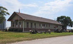 Chicago, Burlington and Quincy Depotlisted 1978
Population over time
2 figuresMound City fell from 1,159 to 1,004 between 2010 and 2020. These are the recorded population figures Wikidata holds for this place, reached through the Geographic Names Information System number this page is keyed on rather than by name, so they belong to this place and not to another of the same name. Most are census counts, but not all are: an early figure may be a founding or settlement estimate, and an estimate published within five years of a census is left out. The change column is computed, and is left blank where more than 20 years separate a figure from the one before it, because a gap that long is not a change between two counts.
| Year | People | Change |
|---|---|---|
| 2010 | 1,159 | |
| 2020 | 1,004 | -155 (-13%) |
Topographic sheets covering this place
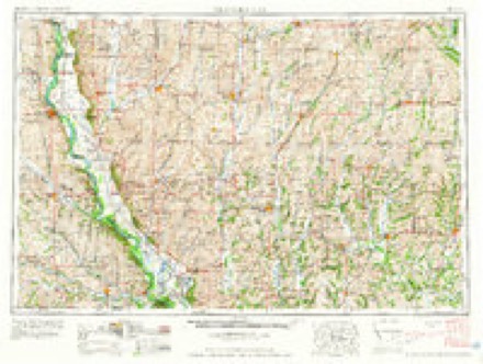
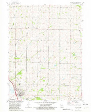
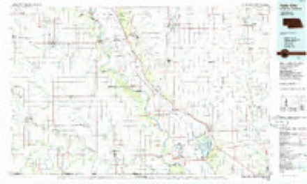
6 surveys from 11 printed sheetsMatched by testing this settlement's coordinate against the published boundary of every sheet in the United States Geological Survey's historical collection. Each opens the scanned sheet at the Survey.
- 1926 USGS Maitland quadrangle1:62500, 3 printings
- 1955 USGS Nebraska City quadrangle1:250000, 3 printings
- 1957 USGS Nebraska City quadrangle1:250000
- 1958 USGS Nebraska City quadrangle1:250000
- 1981 USGS Mound City quadrangle1:24000
- 1986 USGS Falls City quadrangle1:100000, 2 printings
In the county-history sources
8,290 words on this townshipHistory of Holt County, Missouri : from the Time of the Platte Purchase to the End of the Year 1916 : Preceded by a Short History of Missouri : Supplemented by Biographical Sketches of Prominent Citizens, published 1917 names this settlement in its chapter on Benton Township. These are the passages that mention it, exactly as the scans read.
Among other early settlers of the township were Jacob Mosher, who came in 1842, and died thirty years after. Andrew McCoy, from Ohio, and Washam came in 1848. Andrew Meyer, long a representative citizen of the township, came in 1843. William Gady, in the same year, made a claim adjoining the site of Mound City, but subsequently abandoned it. Henry Swimiller came in 1846.
Passage source: History of Holt County, Missouri : from the Time of the Platte Purchase to the End of the Year 1916 : Preceded by a Short History of Missouri : Supplemented by Biographical Sketches of Prominent Citizens, published 1917.
Among the noted settlers of Benton Township, was Levi Dodge, for many years a prominent citizen of the town of Mound City. Mr. Dodge, who was a native of the State of Maine, moved thence to Ohio, in an early day, thence to Clinton County, Missouri. When he came to Holt County he settled on section 26, township 62, range 39, a farm later owned by John Shrantz.
Passage source: History of Holt County, Missouri : from the Time of the Platte Purchase to the End of the Year 1916 : Preceded by a Short History of Missouri : Supplemented by Biographical Sketches of Prominent Citizens, published 1917.
The first postoffice established within the limits of what is now Benton Township was located here and called Jackson's Point Post Office. This was in a very early day (about 1844). A. P. Jackson was the first postmaster. In 1855 this post office was moved across Davis Creek, to the single store which then stood on the site of what is now Mound City. This was kept by a man by the name of Galen Crow, and the name of the post office was changed to North Point.
Passage source: History of Holt County, Missouri : from the Time of the Platte Purchase to the End of the Year 1916 : Preceded by a Short History of Missouri : Supplemented by Biographical Sketches of Prominent Citizens, published 1917.
Machine-read from a century-old scan, so expect the errors a machine makes: misspelled names, dropped words, stray characters.
Read the whole chapter on Benton Township - it names this place 51 more 51 times.
Fires near this place
22 since 1995Regional context, not property-specific evidence. The federal wildfire occurrence database lists 22 fires within 5 miles of Mound City between 1995 and 2018, burning about 1,656 acres in total. 1 started naturally. 4 were recorded as arson. Distance is straight-line from the map coordinates, so a fire counted here may appear on a neighbouring settlement's page as well.
| Reported cause | Fires |
|---|---|
| Debris and open burning | 8 |
| Missing data/not specified/undetermined | 5 |
| Arson/incendiarism | 4 |
| Smoking | 3 |
| Railroad operations and maintenance | 1 |
| Natural | 1 |
The most recent of them, most recent first, with the day each was reported and the service that recorded it.
| Date | Cause | Size | Reported by | Name on the report |
|---|---|---|---|---|
| 13 August 2006 | Natural | 76 acres | Squaw Creek National Wildlife Refuge | NORTH WET MEADOW FIRE |
| 19 June 2012 | Missing data/not specified/undetermined | under an acre | Squaw Creek National Wildlife Refuge | RODEO GROUNDS |
| 7 April 2014 | Missing data/not specified/undetermined | 46 acres | Squaw Creek National Wildlife Refuge | BIGELOW |
| 28 April 2004 | Smoking | under an acre | Squaw Creek National Wildlife Refuge | NORTH WOODS TOUR ROUTE |
| 2 April 2011 | Missing data/not specified/undetermined | 2.0 acres | Squaw Creek National Wildlife Refuge | WILSON |
| 15 April 2006 | Missing data/not specified/undetermined | 1.0 acres | Squaw Creek National Wildlife Refuge | PENDIGON CLUB |
| 12 April 2014 | Missing data/not specified/undetermined | 8.0 acres | Squaw Creek National Wildlife Refuge | LEACH |
| 12 April 2000 | Smoking | 1.0 acres | Squaw Creek National Wildlife Refuge | THREAT |
Settlements close enough to share some of these fires:
Storms near this place
49 since 1993Regional context, not property-specific evidence. The National Weather Service names Mound City in 49 storm reports between 1993 and 2024: 23 hail, 18 thunderstorm wind, 6 flash flood, 1 flood. No death or injury is recorded in these reports. Each account below is quoted exactly as the forecast office filed it, from the NOAA Storm Events Database, and each date opens the federal record of that event.
| When | Event | Place named | Harm | What the report says |
|---|---|---|---|---|
| July 1997 | Thunderstorm Wind | Mound City | $250,000 | Mound City Police reported 2 semi-tractor trailers blown off the road just off an Interstate 29 exit. The were also several reports of large trees and power lines blown over and the roof torn off a shed in Mound City. Mound City police estimated the damage path to be a mile wide through town. |
| June 1994 | Hail | Mound City | $50,000 | Golf ball-size hail broke windows, damaged roofs, and dented automobiles in Mound City, Fortesque, and Big Lake. Hail damage to crops nearly $500,000 alone. |
| August 2015 | Thunderstorm Wind | Mound City | $10,000 | Several power lines were reported down in Mound City as a result of strong winds. |
| July 1995 | Thunderstorm Wind | Mound City | $4,000 | Severe thunderstorm winds blew down trees and a grain trailer. |
| June 1995 | Thunderstorm Wind | Mound City | $3,000 | Severe thunderstorms produced wind gusts to 65 mph north of Mound City, knocking down trees. In Mound City trees fell on power and telephone poles, interrupting service. |
| March 2006 | Thunderstorm Wind | Mound City | $2,000 | Power lines and trees down. Sheds damaged. |
| June 1995 | Thunderstorm Wind | Mound City | $2,000 | Severe thunderstorms produced wind gusts to 65 mph north of Mound City, knocking down trees. In Mound City trees fell on power and telephone poles, interrupting service. |
| June 2024 | Thunderstorm Wind | Mound City | - | Estimated gusts up to 60 mph in Mound City. |
| April 2023 | Hail | Mound City | - | Quarter sized hail fell in Mound City. |
| July 2023 | Thunderstorm Wind | Mound City | - | Estimated 60 mph wind gusts in Mound City. |
| June 2022 | Thunderstorm Wind | Mound City | - | Dispatch reported a large tree down in Mound City. |
| August 2021 | Thunderstorm Wind | Mound City | - | A large tree was down in Mound City, which caused a street to be closed. |
| June 2019 | Tornado (EF0) | Mound City | - | After a report of a tornado was received by the office investigation using online news and inquiries to local business helped identify the path of this brief and weak tornado through portions of Mound City. Little to no damage occurred outside of several tree limbs and light objects. |
| March 2017 | Thunderstorm Wind | Mound City | - | Sheriff deputy in Mound City reported power lines down. |
| March 2017 | Thunderstorm Wind | Mound City | - | Tractor trailer rig overturned on I-29 near Mound City from thunderstorm winds. |
| July 2016 | Thunderstorm Wind | Mound City | - | A tree was reported down in Mound City. The size and condition of the tree is unknown. |
| August 2015 | Flash Flood | Mound City | - | There was 6 inches of water running over Highway 59 near Davis Creek. |
| August 2015 | Flash Flood | Mound City | - | Local sheriff estimated 8 inches of water over Route E and US Highway 59. |
| June 2015 | Flash Flood | Mound City | - | Route N was closed in both directions due to flooding. Interstate 29 also was briefly closed in Holt County due to flooding. |
| June 2015 | Flood | Mound City | - | North and south bound lanes of interstate 29 were closed near Highway 59 due to flooding from Squaw Creek. |
| September 2014 | Flash Flood | Mound City | - | Interstate 29 between mile marker 86 and 88 had water running over it from Squaw Creek. |
| September 2013 | Thunderstorm Wind | Mound City | - | A tree was reported down with thunderstorm wind gusts estimated up to 60 mph. |
| August 2009 | Thunderstorm Wind | Mound City | - | A two to three foot in diameter tree, was blown down in town. |
| August 2007 | Thunderstorm Wind | Mound City | - | Six inch tree limbs covering Highway 59. |
| May 2004 | Flash Flood | Mound City | - | Heavy rains have caused water covered roads. |
| June 2004 | Thunderstorm Wind | Mound City | - | Trees reported down. |
| June 1997 | Flash Flood | Mound City | - | Water covered roadways a mile north of Mound City. The Holt County Sheriff's office reported that mud had to be cleared from the several roads. One to two inches of rain fell during the thunderstorms that caused the flooding. |
| March 2020 | Hail | Mound City | - | no account filed |
| March 2020 | Hail | Mound City | - | no account filed |
| April 2016 | Hail | Mound City | - | no account filed |
| May 2016 | Hail | Mound City | - | no account filed |
| May 2016 | Hail | Mound City | - | no account filed |
| April 2013 | Hail | Mound City | - | no account filed |
| March 2009 | Hail | Mound City | - | no account filed |
| June 2009 | Hail | Mound City | - | no account filed |
| June 2008 | Hail | Mound City | - | no account filed |
| May 2006 | Hail | Mound City | - | no account filed |
| May 2005 | Hail | Mound City | - | no account filed |
| June 2005 | Hail | Mound City | - | no account filed |
| May 2004 | Hail | Mound City | - | no account filed |
| May 2004 | Hail | Mound City | - | no account filed |
| August 2004 | Hail | Mound City | - | no account filed |
| May 2002 | Thunderstorm Wind | Mound City | - | no account filed |
| May 2002 | Hail | Mound City | - | no account filed |
| June 2002 | Hail | Mound City | - | no account filed |
| May 2001 | Hail | Mound City | - | no account filed |
| February 2000 | Hail | Mound City | - | no account filed |
| May 1995 | Hail | Mound City | - | no account filed |
| September 1993 | Hail | Mound City | - | no account filed |
Nearest settlements
The eight closest, with where each one stands in the county. Distances are straight-line, computed from the Geographic Names Information System coordinates.
Elsewhere
Matched on this settlement's Geographic Names Information System number rather than its name, so it cannot be a different place of the same name in another state.
| Wikipedia article on Mound City | An encyclopaedic summary. Its text is share-alike, so it is linked here rather than copied. |
| Wikidata item Q964543 | The structured record the population and elevation above come from. Public domain (CC0). |
Provenance
This settlement is recorded in the Geographic Names Information System as feature 730155. The sheet list is computed by point-in-boundary test against the United States Geological Survey's historical topographic inventory. Both are works of the United States government and carry no copyright under 17 U.S.C. 105.
Wildfire. Short, Karen C. 2022. Spatial wildfire occurrence data for the United States, 1992-2020 [FPA_FOD_20221014]. 6th Edition. Fort Collins, CO: Forest Service Research Data Archive. https://doi.org/10.2737/RDS-2013-0009.6 Collected with United States Government funding and usable without additional permissions or fees.
Storms. NOAA National Centers for Environmental Information, Storm Events Database https://www.ncei.noaa.gov/stormevents/ A work of the United States government, no copyright under 17 U.S.C. 105. Narratives are quoted verbatim from the National Weather Service report and are not edited or summarised.