 Block
Oregon, Missouri
23 topographic sheets cover this place, the earliest surveyed in 1885 and the latest in 1990. It stands in Lewis Township. It lies in ZIP code area 64473. It stands on Rock Creek. The Survey maps it on the Oregon quadrangle. 837 people lived here at the 2020 count. It stands 1,093 feet above sea level.
Research this city
On record in Oregon
Buildings and businesses the archive holds for this place. Each opens its own page, with the source record it came from.
On the National Register 1 record
- Carroll Stagecoach Innlisted 1983
Population over time
2 figuresOregon fell from 857 to 837 between 2010 and 2020. These are the recorded population figures Wikidata holds for this place, reached through the Geographic Names Information System number this page is keyed on rather than by name, so they belong to this place and not to another of the same name. Most are census counts, but not all are: an early figure may be a founding or settlement estimate, and an estimate published within five years of a census is left out. The change column is computed, and is left blank where more than 20 years separate a figure from the one before it, because a gap that long is not a change between two counts.
| Year | People | Change |
|---|---|---|
| 2010 | 857 | |
| 2020 | 837 | -20 (-2%) |
Topographic sheets covering this place
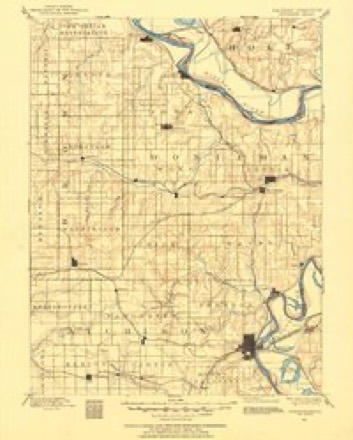
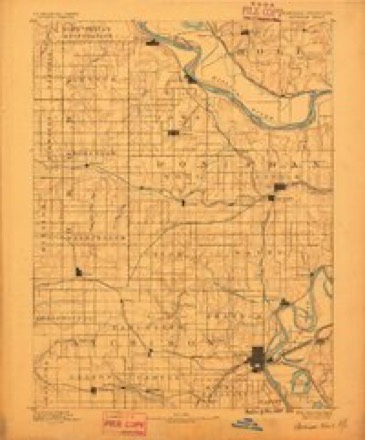
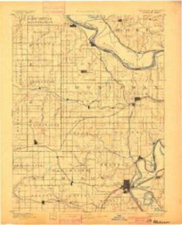
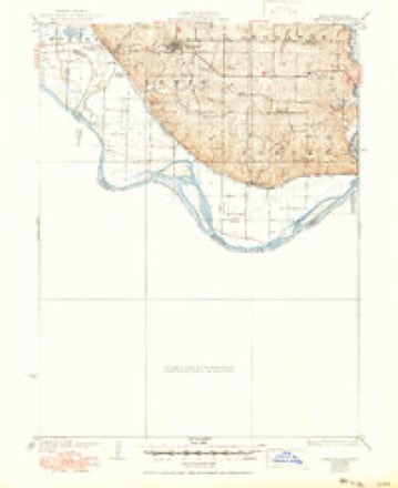
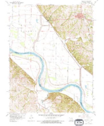
11 surveys from 23 printed sheetsMatched by testing this settlement's coordinate against the published boundary of every sheet in the United States Geological Survey's historical collection. Each opens the scanned sheet at the Survey.
- 1885 USGS Atchison quadrangle1:125000
- 1888 USGS Atchison quadrangle1:125000
- 1893 USGS Atchison quadrangle1:125000, 5 printings
- 1926 USGS Oregon quadrangle1:62500, 3 printings
- 1950 USGS Kansas City quadrangle1:250000
- 1954 USGS Kansas City quadrangle1:250000
- 1956 USGS Kansas City quadrangle1:250000, 4 printings
- 1959 USGS Oregon quadrangle1:24000, 2 printings
- 1960 USGS Kansas City quadrangle1:250000, 3 printings
- 1985 USGS Atchison quadrangle1:100000
- 1990 USGS Atchison quadrangle1:100000




In the county-history sources
15,979 words on this townshipHistory of Holt County, Missouri : from the Time of the Platte Purchase to the End of the Year 1916 : Preceded by a Short History of Missouri : Supplemented by Biographical Sketches of Prominent Citizens, published 1917 names this settlement in its chapter on Lewis Township. These are the passages that mention it, exactly as the scans read.
Before the close of the first decade of this liberal-hearted pioneer in the west, he was summoned to his last account. In the winter of 1848, while at Grand Island, Nebraska, on his way to the war, with his company, then under the command of Captain, afterwards General Craig, of St. Joseph, Kee started out in company with Alexander Boyles, an intimate and particular friend, to have, as it subsequently proved, his last hunt. Mistaking him for a turkey, in the gloom and distance, Boyles shot, and instantly killed his friend. He was overwhelmed with grief at the result of the terrible accident, and long mourned the disastrous consequences of his last hunt. He resided in Oregon, in
Passage source: History of Holt County, Missouri : from the Time of the Platte Purchase to the End of the Year 1916 : Preceded by a Short History of Missouri : Supplemented by Biographical Sketches of Prominent Citizens, published 1917.
Judge John Stewart, who was on the county bench from 1842 to 1845 was one of the earliest settlers of the county, and put up the first blacksmith shop ever started within its limits. This was in 1839. His stand was at what was in those days known as the Big Spring, on the southwest quarter of section 4, township 59, range 38, about two and a half miles southwest of Oregon, and the same distance southeast of the site of the present town of Forest City.
Passage source: History of Holt County, Missouri : from the Time of the Platte Purchase to the End of the Year 1916 : Preceded by a Short History of Missouri : Supplemented by Biographical Sketches of Prominent Citizens, published 1917.
In the fall of 1839, Jeremiah Garner began to teach the first school opened in Holt County. This was in a log cabin, 14x16 feet in extent, and built by R. H. Russel for a residence, a very rude and primitive structure. It was located on the southwest corner section 12, township 59, range 38, three and a half miles southeast of Oregon. Population, in that early day, was sparse, and the entire school included the children of John Rus- sel, Thomas Crowley, James Crowley, G. B. Thorp and John Sterrett. With the influx of population, this temporary shelter soon gave way to more extensive and better appearing buildings, and perhaps more cultivated teachers, but to Jeremiah Garner undoubtedly belongs the distinction of being the pioneer teacher of Holt County. He met with a sudden and violent death in 1845, by being struck over the head with a spade or pick, in the hands of a man with whom he was working the road.
Passage source: History of Holt County, Missouri : from the Time of the Platte Purchase to the End of the Year 1916 : Preceded by a Short History of Missouri : Supplemented by Biographical Sketches of Prominent Citizens, published 1917.
Machine-read from a century-old scan, so expect the errors a machine makes: misspelled names, dropped words, stray characters.
Read the whole chapter on Lewis Township - it names this place 73 more 73 times.
Fires near this place
5 since 2000Regional context, not property-specific evidence. The federal wildfire occurrence database lists 5 fires within 5 miles of Oregon between 2000 and 2011, burning about 57 acres in total. None started naturally. 1 was recorded as arson. Distance is straight-line from the map coordinates, so a fire counted here may appear on a neighbouring settlement's page as well.
| Reported cause | Fires |
|---|---|
| Debris and open burning | 4 |
| Arson/incendiarism | 1 |
The most recent of them, most recent first, with the day each was reported and the service that recorded it.
| Date | Cause | Size | Reported by | Name on the report |
|---|---|---|---|---|
| 28 September 2000 | Debris and open burning | 2.0 acres | Missouri Department of Conservation | not named |
| 14 September 2000 | Debris and open burning | 15 acres | Missouri Department of Conservation | not named |
| 27 March 2002 | Debris and open burning | 3.0 acres | Missouri Department of Conservation | not named |
| 22 March 2004 | Debris and open burning | 22 acres | Squaw Creek National Wildlife Refuge | BONE YARD |
| 1 November 2011 | Arson/incendiarism | 15 acres | Missouri Department of Conservation | not named |
Settlements close enough to share some of these fires:
Mines and quarries near this place
10 of 17 shownRegional context, not property-specific evidence. The federal mineral resources record lists 17 workings within 5 miles of Oregon: 14 past producers, 2 unknowns, 1 producer. 1 still produces. What was taken out: Stone, Crushed/Broken. Distance is straight-line from the map coordinates, so a quarry counted here may appear on a neighbouring settlement's page as well.
| Where | Site | Commodity | Status | Recorded |
|---|---|---|---|---|
| Oregon Quarry | Stone, Crushed/Broken | Producer | ||
| Unk | Stone, Crushed/Broken | Past Producer | ||
| Unk | Stone, Crushed/Broken | Past Producer | ||
| Unk | Stone, Crushed/Broken | Past Producer | ||
| Unk | Stone, Crushed/Broken | Past Producer | ||
| Unk | Stone, Crushed/Broken | Past Producer | ||
| Unk | Stone, Crushed/Broken | Unknown | ||
| Unk | Stone, Crushed/Broken | Past Producer | ||
| Unk | Stone, Crushed/Broken | Past Producer | ||
| Unk | Stone, Crushed/Broken | Unknown |
Storms near this place
36 since 1995Regional context, not property-specific evidence. The National Weather Service names Oregon in 36 storm reports between 1995 and 2025: 21 hail, 10 thunderstorm wind, 4 flash flood, 1 tornado. No death or injury is recorded in these reports. Each account below is quoted exactly as the forecast office filed it, from the NOAA Storm Events Database, and each date opens the federal record of that event.
| When | Event | Place named | Harm | What the report says |
|---|---|---|---|---|
| June 2009 | Hail | Oregon | $50,000 | no account filed |
| July 2008 | Thunderstorm Wind | Oregon | $10,000 | Power poles were snapped and blown down, and many large trees were blown|down. |
| April 2025 | Hail | Oregon | - | Quarter sized hail reported in Oregon. |
| June 2024 | Thunderstorm Wind | Oregon | - | Power wires downed near Oregon with power outages reported in the area. |
| July 2023 | Thunderstorm Wind | Oregon | - | Trees blown over roadway in Oregon. Estimated wind gusts up to 65 mph. |
| August 2021 | Thunderstorm Wind | Oregon | - | There was a report of 60 mph wind in Oregon, Missouri. |
| June 2020 | Tornado (EF0) | Oregon | - | The office received several videos and photos of what appeared to be a brief tornado between Oregon and Mound City, near I-29. No damage was reported. |
| June 2018 | Thunderstorm Wind | Oregon | - | A tree and some power lines were down near Oregon according to state officials. |
| June 2017 | Thunderstorm Wind | Oregon | - | Fire department reported a 70 to 80 mph wind. |
| June 2010 | Flash Flood | Oregon | - | Heavy rains caused road flooding on Highway 59 near I-29. Mudslides were also reported, along Highway T and Highway 111. |
| June 2009 | Flash Flood | Oregon | - | Route T was closed between Forest City and Route O. |
| June 2009 | Flash Flood | Oregon | - | Water was running over the road at 111th Street and Kinsey Creek. |
| July 2001 | Thunderstorm Wind | Oregon | - | 7 inch diameter tree blown down. |
| August 2000 | Thunderstorm Wind | Oregon | - | The sheriff's department reported a tree down in the roadway on Highway 111. |
| June 1998 | Hail | Oregon | - | Nickel-size hail was reported by the Holt county Sheriiff's Office in Oregon. |
| April 1997 | Hail | Oregon | - | Holt County Sheriff's office reported dime-size hail in Oregon. |
| May 2019 | Hail | Oregon | - | no account filed |
| May 2016 | Hail | Oregon | - | no account filed |
| May 2015 | Hail | Oregon | - | no account filed |
| August 2015 | Hail | Oregon | - | no account filed |
| July 2014 | Hail | Oregon | - | no account filed |
| March 2009 | Hail | Oregon | - | no account filed |
| June 2009 | Hail | Oregon | - | no account filed |
| June 2009 | Hail | Oregon | - | no account filed |
| July 2008 | Hail | Oregon | - | no account filed |
| March 2006 | Hail | Oregon | - | no account filed |
| February 2004 | Hail | Oregon | - | no account filed |
| June 2004 | Thunderstorm Wind | Oregon | - | no account filed |
| June 2002 | Hail | Oregon | - | no account filed |
| June 2002 | Thunderstorm Wind | Oregon | - | no account filed |
| May 2001 | Hail | Oregon | - | no account filed |
| September 2001 | Hail | Oregon | - | no account filed |
| March 2000 | Hail | Oregon | - | no account filed |
| July 2000 | Hail | Oregon | - | no account filed |
| May 1996 | Flash Flood | Oregon | - | no account filed |
| April 1995 | Hail | Oregon | - | no account filed |
Nearest settlements
The eight closest, with where each one stands in the county. Distances are straight-line, computed from the Geographic Names Information System coordinates.
| Map | Place | Distance | Sheets |
|---|---|---|---|
| Forest City | 2.5 miles | 23 | |
| Curzon | 3.3 miles | 23 | |
| Nichols Grove | 3.9 miles | 11 | |
| Richville | 5.2 miles | 24 | |
| New Point | 5.8 miles | 11 | |
| Forbes | 6.7 miles | 24 | |
| Napier | 7.3 miles | 13 | |
| Fortescue | 10.2 miles | 13 |
Elsewhere
Matched on this settlement's Geographic Names Information System number rather than its name, so it cannot be a different place of the same name in another state.
| Wikipedia article on Oregon | An encyclopaedic summary. Its text is share-alike, so it is linked here rather than copied. |
| Wikidata item Q959544 | The structured record the population and elevation above come from. Public domain (CC0). |
Provenance
This settlement is recorded in the Geographic Names Information System as feature 730171. The sheet list is computed by point-in-boundary test against the United States Geological Survey's historical topographic inventory. Both are works of the United States government and carry no copyright under 17 U.S.C. 105.
Wildfire. Short, Karen C. 2022. Spatial wildfire occurrence data for the United States, 1992-2020 [FPA_FOD_20221014]. 6th Edition. Fort Collins, CO: Forest Service Research Data Archive. https://doi.org/10.2737/RDS-2013-0009.6 Collected with United States Government funding and usable without additional permissions or fees.
Mines and quarries. USGS Mineral Resources Data System (MRDS) https://mrdata.usgs.gov/mrds/ A work of the United States government, no copyright under 17 U.S.C. 105.
Storms. NOAA National Centers for Environmental Information, Storm Events Database https://www.ncei.noaa.gov/stormevents/ A work of the United States government, no copyright under 17 U.S.C. 105. Narratives are quoted verbatim from the National Weather Service report and are not edited or summarised.