 Block
New Boston, Missouri
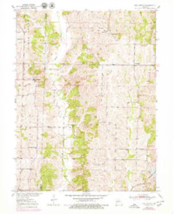
9 topographic sheets cover this place, the earliest surveyed in 1951 and the latest in 1981. It stands in Baker Township. It lies in ZIP code area 63557. The Survey maps it on the New Boston quadrangle. It stands 965 feet above sea level.
Topographic sheets covering this place
6 surveys from 9 printed sheetsMatched by testing this settlement's coordinate against the published boundary of every sheet in the United States Geological Survey's historical collection. Each opens the scanned sheet at the Survey.
- 1951 USGS New Boston quadrangle1:24000, 2 printings
- 1953 USGS Moberly quadrangle1:250000
- 1954 USGS Moberly quadrangle1:250000, 3 printings
- 1957 USGS Moberly quadrangle1:250000
- 1960 USGS Moberly quadrangle1:250000
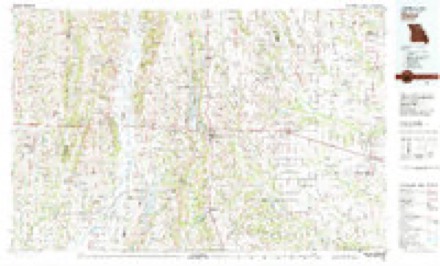
- 1981 USGS Macon quadrangle1:100000




In the county-history sources
5,555 words on this townshipThe History of Linn County, Missouri. An Encyclopedia of Useful Information, published 1882 names this settlement in its chapter on Baker Township. These are the passages that mention it, exactly as the scans read.
Charles Henderson and a Mr. Overstreet were killed during the war by the militia. Just what caused this summary proceeding, unless it was hate, is not recorded. It was in this township that Mart Hamilton succeeded in raising a portion of his company; and a spice of family war caused a Mr. Taylor Picknell to run away with a Mrs. Coffman. This was the first runaway in the county. It is also of record that two men. Baker and Williams by name, who returned from the army, concluded to turn bushwhacker, and raid it on their own account. The report is that they robbed Andrew Nestor and some two or three others, when some men hearing of it at New Boston, started in pursuit of the thieves. Baker was wounded and died of his wounds in about two weeks. There is no mention of what became of Williams.
Passage source: The History of Linn County, Missouri. An Encyclopedia of Useful Information, published 1882.
Xew Boston, the only village in Baker township, is located on section one of township lifty-nine, range eighteen, being the extreme northeastern section of land in the township. The village is principally located on the southeast quarter of said section, and is a small place, without any great pretentions to metropolitan proportions or the expectation of ever reaching any very great size. Not being on a line of railroad, it has not the vanity or importance of towns thus located, and it fears no rivalry. Thus, being comparatively free from jealous}' of rival towns, New Boston moves along with a sort of slow, humdrum life, now and then erecting a new buiding, clearing up a new garden spot, or canvassing its future prospects, if a few live and energetic farmers would move into the neighborhood, with large families. New Boston is essentially a village in all its departments. The women have their gossip, and the men congregate at some store and tell their stories, and they all feel happy and are satisfied with their little town and town-life. There is a pretty good section of country around it, and a good deal of business is done during the year. The business men keep fair stock and sell cheap, so that the f\irmers find it to their interest to patronize the village, rather than to go to more pretentious towns, pay higher prices and lose a day more time.
Passage source: The History of Linn County, Missouri. An Encyclopedia of Useful Information, published 1882.
The founders of New Boston were A. Borron and R. A. C. Wright. It has never had any town plot, nor has it been incorporated. The citizens buy their lots by the acre instead of by the foot, and a garden spot is as necessary as the ground the houses stand on. The village has not yet reached the height of a vegetable market, and the inhabitants do their own raising in that line. New Boston became a post-office in 1872, with E.. A. 0. Wright as the first postmaster. Messrs. Borron & Wright erected the first store, and in that was kept the post-office, and they were the first merchants.
Passage source: The History of Linn County, Missouri. An Encyclopedia of Useful Information, published 1882.
Machine-read from a century-old scan, so expect the errors a machine makes: misspelled names, dropped words, stray characters.
Read the whole chapter on Baker Township - it names this place 9 more 9 times.
Fires near this place
2 since 2002Regional context, not property-specific evidence. The federal wildfire occurrence database lists 2 fires within 5 miles of New Boston between 2002 and 2020, burning about 39 acres in total. None started naturally. None was recorded as arson. Distance is straight-line from the map coordinates, so a fire counted here may appear on a neighbouring settlement's page as well.
| Reported cause | Fires |
|---|---|
| Missing data/not specified/undetermined | 1 |
| Misuse of fire by a minor | 1 |
The most recent of them, most recent first, with the day each was reported and the service that recorded it.
| Date | Cause | Size | Reported by | Name on the report |
|---|---|---|---|---|
| 12 March 2002 | Misuse of fire by a minor | 35 acres | Missouri Department of Conservation | not named |
| 8 February 2020 | Missing data/not specified/undetermined | 4.4 acres | Missouri Department of Conservation | 189989-05810-02082020-2345 |
Settlements close enough to share some of these fires:
Mines and quarries near this place
1 within 5 milesRegional context, not property-specific evidence. The federal mineral resources record lists 1 working within 5 miles of New Boston: 1 past producer. None of them still produces. What was taken out: Stone, Crushed/Broken. Distance is straight-line from the map coordinates, so a quarry counted here may appear on a neighbouring settlement's page as well.
| Where | Site | Commodity | Status | Recorded |
|---|---|---|---|---|
| Unknown | Stone, Crushed/Broken | Past Producer |
Storms near this place
11 since 1996Regional context, not property-specific evidence. The National Weather Service names New Boston in 11 storm reports between 1996 and 2019: 4 hail, 4 thunderstorm wind, 1 flash flood, 1 funnel cloud. No death or injury is recorded in these reports. Each account below is quoted exactly as the forecast office filed it, from the NOAA Storm Events Database, and each date opens the federal record of that event.
| When | Event | Place named | Harm | What the report says |
|---|---|---|---|---|
| June 2011 | Thunderstorm Wind | New Boston | - | High voltage power lines were reported down. Thunderstorms wind gusts were estimated up to 60 mph. |
| June 2011 | Tornado (EF0) | New Boston | - | At 21:53CST an EF0 tornado touched down 1 mile west of New Boston. The tornado tracked east-northeast for 2 miles, before exiting Linn County 1 mile east-northeast of New Boston at 21:55CST. Only tree damage was observed. |
| June 2011 | Thunderstorm Wind | New Boston | - | Several trees were reported blocking Highway 11. Thunderstorm wind gusts were estimated up to 60 mph. |
| July 2010 | Funnel Cloud | New Boston | - | A funnel cloud was observed 5 miles northwest of New Boston. |
| August 2008 | Thunderstorm Wind | New Boston | - | Trees were reported down. |
| May 2002 | Flash Flood | New Boston | - | Highway 129 at highway 11 closed due to debris and water over roadway. |
| April 2019 | Hail | New Boston | - | no account filed |
| May 2009 | Hail | New Boston | - | no account filed |
| July 2006 | Thunderstorm Wind | New Boston | - | no account filed |
| June 2001 | Hail | New Boston | - | no account filed |
| May 1996 | Hail | New Boston | - | no account filed |
Nearest settlements
The eight closest, with where each one stands in the county. Distances are straight-line, computed from the Geographic Names Information System coordinates.
| Map | Place | Distance | Sheets |
|---|---|---|---|
| Benson | 3.8 miles | 9 | |
| Sedgwick | 4.6 miles | 8 | |
| Garner | 6.3 miles | 11 | |
| Hybrid (historical) | 6.4 miles | 11 | |
| Snowdon (historical) | 6.6 miles | 11 | |
| Johnstown | 6.9 miles | 11 | |
| Shelby | 8.5 miles | 11 | |
| North Salem | 8.8 miles | 8 |
Elsewhere
Matched on this settlement's Geographic Names Information System number rather than its name, so it cannot be a different place of the same name in another state.
| Wikipedia article on New Boston | An encyclopaedic summary. Its text is share-alike, so it is linked here rather than copied. |
| Wikidata item Q3471077 | The structured record the population and elevation above come from. Public domain (CC0). |
Provenance
This settlement is recorded in the Geographic Names Information System as feature 723188. The sheet list is computed by point-in-boundary test against the United States Geological Survey's historical topographic inventory. Both are works of the United States government and carry no copyright under 17 U.S.C. 105.
Wildfire. Short, Karen C. 2022. Spatial wildfire occurrence data for the United States, 1992-2020 [FPA_FOD_20221014]. 6th Edition. Fort Collins, CO: Forest Service Research Data Archive. https://doi.org/10.2737/RDS-2013-0009.6 Collected with United States Government funding and usable without additional permissions or fees.
Mines and quarries. USGS Mineral Resources Data System (MRDS) https://mrdata.usgs.gov/mrds/ A work of the United States government, no copyright under 17 U.S.C. 105.
Storms. NOAA National Centers for Environmental Information, Storm Events Database https://www.ncei.noaa.gov/stormevents/ A work of the United States government, no copyright under 17 U.S.C. 105. Narratives are quoted verbatim from the National Weather Service report and are not edited or summarised.