 Block
North Salem, Missouri
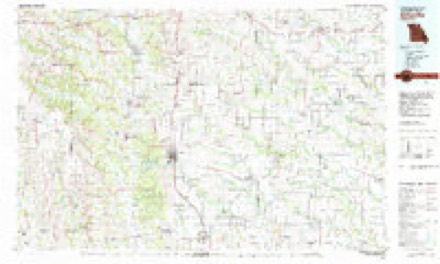
8 topographic sheets cover this place, the earliest surveyed in 1954 and the latest in 1981. It stands in North Salem Township. It lies in ZIP code area 63566. The Survey maps it on the Winigan quadrangle.
Topographic sheets covering this place
5 surveys from 8 printed sheetsMatched by testing this settlement's coordinate against the published boundary of every sheet in the United States Geological Survey's historical collection. Each opens the scanned sheet at the Survey.
- 1954 USGS Centerville quadrangle1:250000, 3 printings
- 1957 USGS Centerville quadrangle1:250000
- 1958 USGS Centerville quadrangle1:250000
- 1963 USGS Winigan quadrangle1:24000, 2 printings
- 1981 USGS Kirksville quadrangle1:100000
What happened here
An account from the chapter on North Salem township. The inset identifies its exact source book and publication year.
Post-Offices
Sedgwick post-oflBce, section fifteen, township sixty, range eighteen, in this township, was established some years since, and named in honor of the Union general of that name who was killed in one of the battles of the Wilderness, in Yirginia, in the spring of 1864. Captain Seevey was the first postmaster.
In the county-history sources
2,881 words on this townshipThe History of Linn County, Missouri. An Encyclopedia of Useful Information, published 1882 names this settlement in its chapter on North Salem Township. These are the passages that mention it, exactly as the scans read.
The general surface of this township is broken and rough, owing to the presence of so many streams and water-courses. The headwaters of Yellow Creek, Winnegan, and Badger Creek, are all in this township. The soil is usually not verj' productive, and much of it is unbroken and unimproved. Some tracts, however, are remarkably fertile. In 1877, J. F. Baker, living three miles east of North Salem town, raised a watermelon weighing fifty-one and one-half pounds.
Passage source: The History of Linn County, Missouri. An Encyclopedia of Useful Information, published 1882.
There are no towns in the township and the prospects are that there will never be any. The hamlet of North Salem, instead of w^axing populous and great, is on the wane, and each year grows " smaller by degrees and beautifully less." No railroads. In October, 1871, North Salem township voted 825,000 in aid of that wild-cat scheme known as the " Salera, Brookfield ife Northern Railway," but that so-called "enterprise" never amounted to more than to take $13,000 out of Brookfield township, and render no equivalent therefor. It is doubtful if any legitimate enterprise, no inatter how feasible, would now receive any encouragement at the hands of the people, who, owing to their circumstances, seem to have lost all sentiments of public spirit, as a thing they cannot aiford to indulge.
Passage source: The History of Linn County, Missouri. An Encyclopedia of Useful Information, published 1882.
The population of the township in 1870, when its boundaries were larger than at present, was nine hundred and twenty-three. In 1880 it was eight hundred and seventy-two. The total valuation of the property in 1881 was $118,060. The township, therefore, has the least population and the lowest valuation in the county, considering its area, as it contains nearly 25,000 acres of land. The township was named for the village of North Salem
Passage source: The History of Linn County, Missouri. An Encyclopedia of Useful Information, published 1882.
Machine-read from a century-old scan, so expect the errors a machine makes: misspelled names, dropped words, stray characters.
Read the whole chapter on North Salem Township - it names this place 14 more 14 times.
Fires near this place
2 since 2002Regional context, not property-specific evidence. The federal wildfire occurrence database lists 2 fires within 5 miles of North Salem in 2002, burning about 60 acres in total. None started naturally. None was recorded as arson. Distance is straight-line from the map coordinates, so a fire counted here may appear on a neighbouring settlement's page as well.
| Reported cause | Fires |
|---|---|
| Misuse of fire by a minor | 1 |
| Debris and open burning | 1 |
The most recent of them, most recent first, with the day each was reported and the service that recorded it.
| Date | Cause | Size | Reported by | Name on the report |
|---|---|---|---|---|
| 12 March 2002 | Misuse of fire by a minor | 35 acres | Missouri Department of Conservation | not named |
| 14 February 2002 | Debris and open burning | 25 acres | Missouri Department of Conservation | not named |
Settlements close enough to share some of these fires:
Storms near this place
2 since 2008Regional context, not property-specific evidence. The National Weather Service names North Salem in 2 storm reports between 2008 and 2023: 2 tornado. No death or injury is recorded in these reports. Each account below is quoted exactly as the forecast office filed it, from the NOAA Storm Events Database, and each date opens the federal record of that event.
| When | Event | Place named | Harm | What the report says |
|---|---|---|---|---|
| August 2023 | Tornado (EF0) | North Salem | - | A brief EF-0 tornado began just south of Highway O in far northern Linn County just south of the Linn and Sullivan County line. The tornado initially damaged some trees and small outbuildings before moving to the east and damaging the roof, siding, and garage doors of a newly built barndominium type building on the north side of Highway O just west of the Highway O and Highway V intersection. The tornado traveled just over a mile and was on the ground for about 3 minutes. Thanks to the Linn County EM for their assistance on the survey. |
| July 2008 | Tornado (EF0) | North Salem | - | An EFO tornado entered Linn County from Sullivan county at 19:30CST,|near the town of New Salem. The tornado dissipated at 19:40CST 2.5 miles northwest of New Boston. Only tree damage in rural areas were observed. |
Nearest settlements
The eight closest, with where each one stands in the county. Distances are straight-line, computed from the Geographic Names Information System coordinates.
| Map | Place | Distance | Sheets |
|---|---|---|---|
| Garner | 4.6 miles | 11 | |
| Shelby | 4.6 miles | 11 | |
| Sedgwick | 4.7 miles | 8 | |
| Enterprise | 5.1 miles | 7 | |
| Bear Branch | 6.7 miles | 11 | |
| Leverton | 7.1 miles | 11 | |
| Hybrid (historical) | 7.6 miles | 11 | |
| New Boston | 8.8 miles | 9 |
Elsewhere
Matched on this settlement's Geographic Names Information System number rather than its name, so it cannot be a different place of the same name in another state.
| Wikipedia article on North Salem | An encyclopaedic summary. Its text is share-alike, so it is linked here rather than copied. |
| Wikidata item Q27985779 | The structured record the population and elevation above come from. Public domain (CC0). |
Provenance
This settlement is recorded in the Geographic Names Information System as feature 735752. The sheet list is computed by point-in-boundary test against the United States Geological Survey's historical topographic inventory. Both are works of the United States government and carry no copyright under 17 U.S.C. 105.
Wildfire. Short, Karen C. 2022. Spatial wildfire occurrence data for the United States, 1992-2020 [FPA_FOD_20221014]. 6th Edition. Fort Collins, CO: Forest Service Research Data Archive. https://doi.org/10.2737/RDS-2013-0009.6 Collected with United States Government funding and usable without additional permissions or fees.
Storms. NOAA National Centers for Environmental Information, Storm Events Database https://www.ncei.noaa.gov/stormevents/ A work of the United States government, no copyright under 17 U.S.C. 105. Narratives are quoted verbatim from the National Weather Service report and are not edited or summarised.