 Block
Oak Grove, Missouri
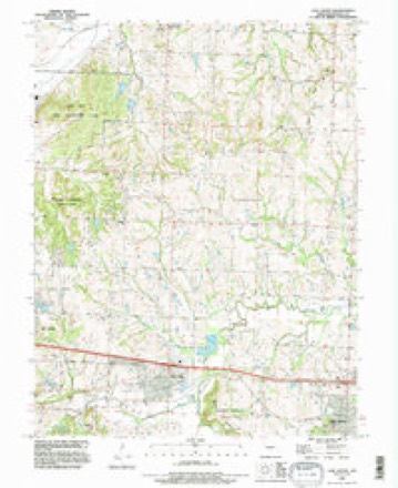
21 topographic sheets cover this place, the earliest surveyed in 1894 and the latest in 1990. It stands in Sni-A-Bar Township. It lies in ZIP code area 64075. The Survey maps it on the Oak Grove quadrangle. 8,157 people lived here at the 2020 count. It stands 853 feet above sea level.
Population over time
2 figuresOak Grove grew from 7,795 to 8,157 between 2010 and 2020. These are the recorded population figures Wikidata holds for this place, reached through the Geographic Names Information System number this page is keyed on rather than by name, so they belong to this place and not to another of the same name. Most are census counts, but not all are: an early figure may be a founding or settlement estimate, and an estimate published within five years of a census is left out. The change column is computed, and is left blank where more than 20 years separate a figure from the one before it, because a gap that long is not a change between two counts.
| Year | People | Change |
|---|---|---|
| 2010 | 7,795 | |
| 2020 | 8,157 | +362 (+5%) |
Topographic sheets covering this place
9 surveys from 21 printed sheetsMatched by testing this settlement's coordinate against the published boundary of every sheet in the United States Geological Survey's historical collection. Each opens the scanned sheet at the Survey.
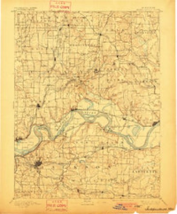
- 1894 USGS Independence quadrangle1:125000, 5 printings
- 1934 USGS Oak Grove quadrangle1:24000, 2 printings
- 1950 USGS Kansas City quadrangle1:250000
- 1954 USGS Kansas City quadrangle1:250000
- 1956 USGS Kansas City quadrangle1:250000, 4 printings
- 1960 USGS Kansas City quadrangle1:250000, 3 printings
- 1965 USGS Oak Grove quadrangle1:24000, 3 printings
- 1983 USGS Kansas City quadrangle1:100000
- 1990 USGS Oak Grove quadrangle1:24000




In the county-history sources
6,834 words on this townshipThe History of Jackson County, Missouri, Containing a History of the County, Its Cities, Towns, Etc., Biographical Sketches of Its Citizens, Jackson County in the Late War... History of Missouri, Map of Jackson County .., published 1881 names this settlement in its chapter on Sni-A-Bar Township. These are the passages that mention it, exactly as the scans read.
Sni-a-bar or ' ' Shnee-a-bar " township, as it occurs in some old records, was first organized May 5, 1834, but has undergone many changes since that date. Sni-a-bar township is bounded north by Fort Osage, east by Lafayette county, south by Van Buren and Prairie, and west by Prairie and Blue townships. It is the central eastern township, and enjoys as great a variety of surface and soil as any in Jackson county. The population is between 4,350 and 5,000, and the agricultural resources are very superior especially in the western portion. The township contains 600 farms under cultivation, averaging 100 acres each, and these farms are valued at from $20 to $35 per acre, depending on location and improvements. The Chicago & Alton Railroad runs through the township in an easterly and westerly direction, and upon this line Blue Springs, Grain Valley and Oak Grove, three little villages within its borders are located. Pink Hill, another little post village, is situated about four miles north of the Chicago & Alton Railroad.
Passage source: The History of Jackson County, Missouri, Containing a History of the County, Its Cities, Towns, Etc., Biographical Sketches of Its Citizens, Jackson County in the Late War... History of Missouri, Map of Jackson County .., published 1881.
William Cox who came from Tennessee about the year 1820, nearly the same time with Welch, lived near the eastern boundary of the township on a stream called the Horseshoe Branch of the Sni-a-bar. He went to Texas many years ago where it is supposed he long since died. He sold his premises to John McKinney, a Methodist minister, who obtained the estabhshment of a post-office at that place and called it Oak Grove. This was the first post-office in Sni-a-bar townsfiip. Mr. McKinney went to Oregon and William Philpot was appointed postmaster, and removed the ofifice one mile west. William Philpot then went to Oregon and Alexander Joyce was appointed postmaster and removed the postoffice one half mile north of Philpot's. A. Joyce kept the office here several years, then Dr. Frick obtained the office and removed it one mile east, to a little settlement called Lickskillet, but afterward Oak Grove. This, then, was the origin of the town named Oak Grove.
Passage source: The History of Jackson County, Missouri, Containing a History of the County, Its Cities, Towns, Etc., Biographical Sketches of Its Citizens, Jackson County in the Late War... History of Missouri, Map of Jackson County .., published 1881.
Alexander Joyce, Caleb Darby, Adison Philpot, David George, and John Hudson, all lived in the vicinity of Oak Grove, but are now dead, their descendants still live in the vicinity. They were all good citizens and men of prominence. Caleb Darby came from Virginia originally, as also Alexander Joyce, John Hudson and Adison Philpot, but David George was from Tennessee.
Passage source: The History of Jackson County, Missouri, Containing a History of the County, Its Cities, Towns, Etc., Biographical Sketches of Its Citizens, Jackson County in the Late War... History of Missouri, Map of Jackson County .., published 1881.
Machine-read from a century-old scan, so expect the errors a machine makes: misspelled names, dropped words, stray characters.
Read the whole chapter on Sni-A-Bar Township - it names this place 8 more 8 times.
Fires near this place
1 since 2018Regional context, not property-specific evidence. The federal wildfire occurrence database lists 1 fire within 5 miles of Oak Grove in 2018, burning about 1 acre in total. None started naturally. None was recorded as arson. Distance is straight-line from the map coordinates, so a fire counted here may appear on a neighbouring settlement's page as well.
| Reported cause | Fires |
|---|---|
| Debris and open burning | 1 |
The most recent of them, most recent first, with the day each was reported and the service that recorded it.
| Date | Cause | Size | Reported by | Name on the report |
|---|---|---|---|---|
| 3 March 2018 | Debris and open burning | 1.3 acres | Missouri Department of Conservation | 166068-04828-03032018-1657 |
Settlements close enough to share some of these fires:
Mines and quarries near this place
5 within 5 milesRegional context, not property-specific evidence. The federal mineral resources record lists 5 workings within 5 miles of Oak Grove: 4 past producers, 1 producer. 1 still produces. What was taken out: Stone, Crushed/Broken. Distance is straight-line from the map coordinates, so a quarry counted here may appear on a neighbouring settlement's page as well.
| Where | Site | Commodity | Status | Recorded |
|---|---|---|---|---|
| Covenant Enterprises | Stone, Crushed/Broken | Producer | ||
| Mitchell Qsuarry | Stone, Crushed/Broken | Past Producer | ||
| Unknown | Stone, Crushed/Broken | Past Producer | ||
| Unknown | Stone, Crushed/Broken | Past Producer | ||
| Unknown-Ls | Stone, Crushed/Broken | Past Producer |
Storms near this place
56 since 1993Regional context, not property-specific evidence. The National Weather Service names Oak Grove in 56 storm reports between 1993 and 2025: 31 hail, 20 thunderstorm wind, 3 flash flood, 1 tornado. No death or injury is recorded in these reports. Each account below is quoted exactly as the forecast office filed it, from the NOAA Storm Events Database, and each date opens the federal record of that event.
| When | Event | Place named | Harm | What the report says |
|---|---|---|---|---|
| July 2020 | Thunderstorm Wind | Oak Grove | $5,000 | A large fireworks tent was destroyed. |
| June 1997 | Tornado (F0) | Oak Grove | $5,000 | An F0 torrnado briefly touched down a mile east of Oak Grove. A Jackson County resident saw and reported the tornado. Damage was done to aluminum siding of a house and 3 to 4 inch diamter trees were knocked down at their base. |
| March 2025 | Thunderstorm Wind | Oak Grove | - | Estimated 60 mph winds in Oak Grove. |
| March 2025 | Thunderstorm Wind | Oak Grove | - | Public reported siding torn from a business and estimated winds of 60 MPH. |
| July 2025 | Hail | Oak Grove | - | Quarter size hail reported south of Oak Grove. |
| July 2025 | Thunderstorm Wind | Oak Grove | - | Downed tree limbs three inches in diameter on Route H north of Oak Grove. |
| September 2025 | Thunderstorm Wind | Oak Grove | - | Social media report and photos of downed trees at a residence in Oak Grove. |
| September 2025 | Thunderstorm Wind | Oak Grove | - | Downed wires reported near Owings Street in Oak Grove. |
| March 2024 | Hail | Oak Grove | - | Golf ball sized hail about 4 miles north of Oak Grove. |
| March 2024 | Hail | Oak Grove | - | Quarter sized hail in Oak Grove. |
| July 2023 | Thunderstorm Wind | Oak Grove | - | Measured 70 mph wind gust on truck anemometer in Oak Grove. |
| October 2023 | Hail | Oak Grove | - | Photo of golf ball sized hail between Grain Valley and Oak Grove. |
| October 2023 | Hail | Oak Grove | - | Quarter sized hail on the west side of Oak Grove south of Interstate 70. |
| July 2023 | Thunderstorm Wind | Oak Grove | - | Large tree limbs downed across Oak Grove with power out. |
| July 2019 | Flash Flood | Oak Grove | - | Several streets in Oak Grove were flooded due to heavy rain. |
| June 2017 | Thunderstorm Wind | Oak Grove | - | A public spotter reported a 70 mph wind. |
| July 2016 | Thunderstorm Wind | Oak Grove | - | A large tree of unknown size or condition was down in Oak Grove. |
| July 2016 | Thunderstorm Wind | Oak Grove | - | Reports of several large tree limbs, 3 to 4 inches in diameter, were broken. |
| July 2016 | Flood | Oak Grove | - | Several roads were closed across eastern Jackson County due to lingering flooding from heavy rains. |
| July 2015 | Thunderstorm Wind | Oak Grove | - | Eight to twelve inch diameter limbs were blown down causing a power outage. |
| August 2011 | Thunderstorm Wind | Oak Grove | - | Thunderstorm wind gusts were estimated up to 60 mph. Tree branches up to 12 inches in diameter were snapped off. |
| July 2010 | Thunderstorm Wind | Oak Grove | - | Thunderstorm wind gusts were estimated to 70 mph, at I-70 and H Highway. |
| July 2010 | Thunderstorm Wind | Oak Grove | - | Several trees and large limbs were reported down. Thunderstorm wind gusts were estimated up to 60 mph. |
| June 2005 | Flash Flood | Oak Grove | - | Highway H closed due to high water. |
| July 2004 | Flash Flood | Oak Grove | - | Water flowing over Interstate 70. |
| May 1997 | Hail | Oak Grove | - | Jackson County Emergency Management reported dime-size hail about a mile north of Oak Grove. |
| April 1995 | Hail | Oak Grove | - | Dime-size hail was covering the ground from Highway 50, north to Lake Lotawana, piled in drifts six inches deep. |
| September 1993 | Hail | Oak Grove | - | Several thunderstorms lead to flash flooding on several roads, including a small section of Interstate 70. Large hail was also reported in Oak Grove. |
| August 2021 | Hail | Oak Grove | - | no account filed |
| February 2017 | Hail | Oak Grove | - | no account filed |
| April 2014 | Hail | Oak Grove | - | no account filed |
| June 2011 | Hail | Oak Grove | - | no account filed |
| May 2011 | Hail | Oak Grove | - | no account filed |
| August 2011 | Hail | Oak Grove | - | no account filed |
| May 2011 | Hail | Oak Grove | - | no account filed |
| May 2011 | Hail | Oak Grove | - | no account filed |
| May 2010 | Hail | Oak Grove | - | no account filed |
| September 2010 | Hail | Oak Grove | - | no account filed |
| September 2010 | Hail | Oak Grove | - | no account filed |
| June 2010 | Hail | Oak Grove | - | no account filed |
| June 2009 | Hail | Oak Grove | - | no account filed |
| May 2008 | Hail | Oak Grove | - | no account filed |
| May 2007 | Hail | Oak Grove | - | no account filed |
| March 2006 | Thunderstorm Wind | Oak Grove | - | no account filed |
| May 2004 | Hail | Oak Grove | - | no account filed |
| June 2004 | Hail | Oak Grove | - | no account filed |
| May 2003 | Hail | Oak Grove | - | no account filed |
| May 2003 | Hail | Oak Grove | - | no account filed |
| May 2002 | Thunderstorm Wind | Oak Grove | - | no account filed |
| May 2002 | Thunderstorm Wind | Oak Grove | - | no account filed |
| May 2001 | Thunderstorm Wind | Oak Grove | - | no account filed |
| August 2001 | Thunderstorm Wind | Oak Grove | - | no account filed |
| April 2000 | Hail | Oak Grove | - | no account filed |
| June 2000 | Hail | Oak Grove | - | no account filed |
| April 1995 | Hail | Oak Grove | - | no account filed |
| April 1993 | Hail | Oak Grove | - | no account filed |
Nearest settlements
The eight closest, with where each one stands in the county. Distances are straight-line, computed from the Geographic Names Information System coordinates.
| Map | Place | Distance | Sheets |
|---|---|---|---|
| Grain Valley | 3.7 miles | 21 | |
| Sni Mills | 4.4 miles | 18 | |
| Pink Hill | 4.8 miles | 21 | |
| Tarsney Lakes | 5.5 miles | 18 | |
| Hiler | 6.2 miles | 21 | |
| Tarsney | 6.3 miles | 18 | |
| Blue Springs | 8.1 miles | 23 | |
| Hicks City | 8.2 miles | 13 |
Elsewhere
Matched on this settlement's Geographic Names Information System number rather than its name, so it cannot be a different place of the same name in another state.
| Wikipedia article on Oak Grove | An encyclopaedic summary. Its text is share-alike, so it is linked here rather than copied. |
| Wikidata item Q956596 | The structured record the population and elevation above come from. Public domain (CC0). |
Provenance
This settlement is recorded in the Geographic Names Information System as feature 735757. The sheet list is computed by point-in-boundary test against the United States Geological Survey's historical topographic inventory. Both are works of the United States government and carry no copyright under 17 U.S.C. 105.
Wildfire. Short, Karen C. 2022. Spatial wildfire occurrence data for the United States, 1992-2020 [FPA_FOD_20221014]. 6th Edition. Fort Collins, CO: Forest Service Research Data Archive. https://doi.org/10.2737/RDS-2013-0009.6 Collected with United States Government funding and usable without additional permissions or fees.
Mines and quarries. USGS Mineral Resources Data System (MRDS) https://mrdata.usgs.gov/mrds/ A work of the United States government, no copyright under 17 U.S.C. 105.
Storms. NOAA National Centers for Environmental Information, Storm Events Database https://www.ncei.noaa.gov/stormevents/ A work of the United States government, no copyright under 17 U.S.C. 105. Narratives are quoted verbatim from the National Weather Service report and are not edited or summarised.