 Block
Vigus, Missouri
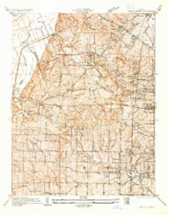
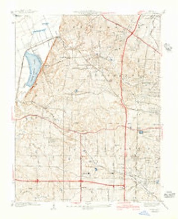
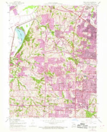
22 topographic sheets cover this place, the earliest surveyed in 1933 and the latest in 1985. It stands in Northwest Township. It lies in ZIP code area 63043. It stands on Fee Fee Creek. The Survey maps it on the Creve Coeur quadrangle.
Topographic sheets covering this place
9 surveys from 22 printed sheetsMatched by testing this settlement's coordinate against the published boundary of every sheet in the United States Geological Survey's historical collection. Each opens the scanned sheet at the Survey.
- 1933 USGS Creve Coeur quadrangle1:24000
- 1940 USGS Creve Coeur quadrangle1:24000, 3 printings
- 1949 USGS Saint Louis quadrangle1:250000
- 1949 USGS St. Louis quadrangle1:250000
- 1954 USGS Creve Coeur quadrangle1:24000, 7 printings
- 1962 USGS St. Louis quadrangle1:250000
- 1963 USGS St. Louis quadrangle1:250000, 4 printings
- 1966 USGS St. Louis quadrangle1:250000
- 1985 USGS St Louis quadrangle1:100000, 3 printings






Mines and quarries near this place
10 of 13 shownRegional context, not property-specific evidence. The federal mineral resources record lists 13 workings within 5 miles of Vigus: 9 past producers, 4 producers. 4 still produce. What was taken out: Stone, Crushed/Broken, Sand and Gravel, Construction, Clay. Distance is straight-line from the map coordinates, so a quarry counted here may appear on a neighbouring settlement's page as well.
| Where | Site | Commodity | Status | Recorded |
|---|---|---|---|---|
| Alton Brick Co Pit & Plant | Clay | Producer | ||
| Sand Plant | Sand and Gravel, Construction | Producer | ||
| Crystal Springs Quarry | Stone, Crushed/Broken | Past Producer | ||
| Fern Ridge Quarry | Stone, Crushed/Broken | Past Producer | ||
| St Charles Quarry - Plant | Stone, Crushed/Broken | Producer | ||
| St Charles Quarry and Mill | Stone, Crushed/Broken | Producer | ||
| Thompson and Gray Company Quarry | Stone, Crushed/Broken | Past Producer | ||
| Unk | Stone, Crushed/Broken | Past Producer | ||
| Unk | Stone, Crushed/Broken | Past Producer | ||
| Unknown - Ls | Stone, Crushed/Broken | Past Producer |
Storms near this place
10 since 2011Regional context, not property-specific evidence. The National Weather Service names Vigus in 10 storm reports between 2011 and 2025: 5 thunderstorm wind, 2 tornado, 1 lightning, 1 hail. The reports record 6 injuries. Each account below is quoted exactly as the forecast office filed it, from the NOAA Storm Events Database, and each date opens the federal record of that event.
| When | Event | Place named | Harm | What the report says |
|---|---|---|---|---|
| April 2011 | Tornado (EF4) | Vigus | 5 hurt, $250,000,000 | During the evening of Friday April 22nd, an intense supercell thunderstorm produced a long-track tornado which tore a path of destruction from west to east across the St. Louis Metropolitan Area, from St. Louis County Missouri eastward through the far northern portions of the City of St. Louis, then across the Mississippi River into Madison County Illinois. The tornado reached a maximum intensity of EF4 on the Enhanced Fujita Scale as it tracked through the community of Bridgeton, just west of Lambert St. Louis International Airport, in St. Louis County. The total path length was 21.3 miles, with a width of up to half a mile.||The tornado initially touched down along the northern edge of Creve Coeur Lake at approximately 759 pm. It tracked nearly due east at about 40 mph, and intensified as it entered Maryland Heights. There it produced up to EF3 damage to many homes and businesses with a damage swath of 200 to 400 yards wide. Damage continued eastward in an unbroken track, crossing I-270 about 1 mile south of I-70. The tornado reached peak intensity of EF4 as it devastated the community of Bridgeton along Old St. Charles Road. From there the tornado paralleled Interstate 70 through the community of St. Ann, and then took aim directly on Lambert-St. Louis International Airport. Many of the large windows in the main terminal building were blown out or damaged by flying debris and a large section of roof was peeled from Concourse C. Although the vast majority of people were evacuated to lower levels and to interior rooms before the tornado hit, five people were treated and released from area hospitals for injuries due to flying debris. The airport was closed due to the extensive damage. Damage at the airport was estimated to be between $35 to 40 million.| |The tornado exited Lambert-St. Louis International Airport crossing near the McDonnell Boulevard/Harmon Lane intersection. It then moved into Berkeley where it crossed Interstate 170 between Airport Road and Scudder Avenue. Extensive damage was noted along Fourth Avenue, especially at the Garfield Avenue and Hancock Avenue intersections where a vacant house and several homes lost their entire roof structure. The greatest damage in this neighborhood was rated EF2. The tornado continued to the northeast through neighborhoods south of Airport Road producing significant tree damage including many large trees falling on homes. The tornado then crossed Airport Road near Abston Street. The tornado crossed North Florissant Road where it caused extensive roof damage to the Newger Materials building and the First Baptist Church of Ferguson. Across the road, a Little Caesars Restaurant lost its entire roof. Damage to these structures was rated EF1. The tornado then continued through neighborhoods along and just the north of Hereford Avenue/Chambers Road where it continued to cause extensive tree damage as well as additional partial roof damage to homes along the path toward West Florissant Road. Also along this part of its path, it partially removed the roof at the Griffith Elementary School which was rated as EF1. This is also where the tornado widened to one quarter of a mile with damage noted to trees and some homes on both sides of Chambers Road. Along the entire path from Berkeley to Dellwood, damage varied in intensity from EF1 to low end EF2 with a maximum estimated wind speed of 120 mph, and included numerous snapped power poles in addition to the extensive number of snapped and downed trees.||EF2 damage was uncovered at three different locations east of Dellwood. One area was located one quarter mile south of Chambers Road on Halls Ferry Road where four large utility poles were snapped. The second area of EF2 damage was located a quarter of a mile south of Chambers Road along Bellefontaine Road where significant tree damage occurred. The last area of damage was located in Bellefontaine Neighbors just south of Chambers Road on La Roux Court. Roofs were removed from three homes at this location, while other homes sustained varying degrees of damage. The width of the damage area varies from 100 yards to four tenths of a mile with the widest area of damage east of Halls Ferry and south of Chambers Road. ||The tornadic damage continued as the tornado traveled eastward south of Chambers road, crossing into the far northern portions of the city of St. Louis. The majority of the damage in this area was rated EF1 due to fallen trees. Some of these trees fell on homes while a few others fell through homes causing damage not directly relating to the intensity of the wind within the tornado. ||Overall, in St. Louis County, 233 structures (homes and businesses) sustained major damage, 776 structures sustained moderate damage, and 1,487 structures sustained minor damage. Estimated dollar amount damage is $250 million. |
| August 2014 | Lightning | Vigus | 1 hurt | Storms moved through the St. Louis metro area. A cyclist traveling along Maryland Heights Expressway, Highway 141, was struck in the head by a bolt of lightning. He went into cardiac arrest. Numerous motorists and paramedics stopped to assist him and were able to revive him, but he was in critical condition. The 51 year old man has since recovered and was back to work after a month off. He has hearing loss due to a perforated ear drum, which is where the lightning struck him. |
| May 2013 | Tornado (EF2) | Vigus | $10,000,000 | The tornado crossed the Missouri River from St. Charles County into St. Louis County just south of Interstate 70. As it moved through the Riverport area, it caused major damage to one of the buildings at Hollywood Casino. Part of the roof and most of the siding were torn off of a section of the casino that housed maintenance and staff offices. Five large power poles were snapped off at the base. The damage in this area was rated EF2. Also, numerous trees were snapped off. Further to the east in the Riverport area, a gas station lost part of its canopy and a nearby hotel sustained minor roof damage as well as several windows blown out. The tornado then crossed Interstate 70 into the Earth City area. As it crossed the highway at the intersection of I-70 and Earth City Expressway it knocked down the large steel truss that holds signs for the east bound side of I-70 into the west bound lanes of the highway. Traffic was backed up for hours in this area due to the fallen sign and numerous power lines as well as debris laying across the interstate. North of I-70 the tornado widened to a mile wide with the most significant damage centered just northwest of the I-70/Earth City Expressway interchange. One warehouse building had a section of the pre-cast concrete wall collapse outward and fall onto the parking lot on the southeast corner. Meanwhile on the north facing side of the warehouse, several bay doors were blown in and several tractor trailers and delivery trucks were blown over. The building next door had roof damage and an unoccupied car nearby was flipped onto its roof and another one was rolled as well. The damage in this area was rated EF2. Further to the east and northeast, the Point 70 office building sustained extensive window damage and another warehouse had a quarter of its roof peeled off. Spectrum Brands warehouse building on Corporate Exchange Drive had a very large section of pre-cast concrete walls collapse inward and damage here was rated EF2. The tornado continued to the east, crossing Interstate 270 between Interstate 70 and St. Charles Rock Road. Numerous trees, power poles and power lines were blown down across Bridgeton. An apartment building on Natural Bridge Road lost its entire roof with some of the debris landing on cars in the parking lot. Several other apartment buildings had minor roof damage. Damage in this area was rated EF2. The tornado crossed the northern portions of Lambert-St. Louis International Airport, causing minor damage to four outbuildings. From there the tornado continued east, blowing down or uprooting numerous large trees, power poles and power lines in Berkley, Kinloch, Ferguson, and Dellwood mainly along and north of Chambers Road. Several of the large trees fell onto houses and vehicles causing minor to major damage. As it crossed New Halls Ferry Road it began to go in a more east northeasterly direction, paralleling Interstate 270 for a time. A gas station at the intersection of Dunn Road and Old Halls Ferry Road had one of its canopies collapsed. Just east of Highway 367, six power poles were snapped off along Dunn Road on the north side of I-270. A bit further east, just east of Bellefontaine Road, an apartment complex on N. Garden Drive had eight of its buildings sustain major roof damage. Otherwise, most of the damage in the area was to trees and power lines. A few of the trees landed on homes causing varying degrees of damage. The tornado then lifted and dissipated on the banks of the Mississippi River about six tenths of a mile north northeast of the intersection of I-270 and Columbia Bottom Road. The tornado caused damage to 612 homes in St. Louis County. Five hundred and ten homes suffered minor damage, 101 homes suffered major damage, and one home was destroyed. One hundred twenty-one businesses sustained minor damage, while 5 businesses had major damage. Cleanup costs alone for St. Louis County was 4.3 million dollars.||The path length of the tornado in St. Louis County was 17.0 miles with a max path width of a mile wide. The damage for this segment was estimated to be EF2 with max wind speeds of 130 MPH. Overall, the entire tornado path length was 31.8 miles with a max path width of 1 mile and a maximum damage rating of EF3. |
| April 2025 | Flash Flood | Vigus | $30,000 | Multiple instances of flash flooding were reported in St. Louis County due to heavy rain. Reports of flash flooding varied across the county. One report stated there was 2 to 3 feet of standing water on a road adjacent to Wildhorse Creek near Chesterfield. Another was of a stranded vehicle at the intersection of I-70 and I-270. Cold Water Creek also rose out of its banks in Hazelwood and entered the parking garage of the Hazelwood Civic Center on Dunn Road. The same creek came about 1 foot from reaching businesses on Bypasse Drive in Hazelwood. There was also a public report of roads closed due to flooding in Oakville. Rainfall amounts across the county vary from 2.5 to 6.3 inches ending on April 6th. |
| March 2025 | Thunderstorm Wind | Vigus | $10,000 | Thunderstorm winds blew an entire intact garage or shed roof onto the ground and into a standing tree, splitting the roof around the tree. |
| May 2023 | Hail | Vigus | - | A wide swath of large hail fell across northern portions of St. Louis County. Large hail was reported in Earth City, Maryland Heights, Bridgeton, St. Ann, Breckenridge Hills, Saint John, Overland and Woodson Terrace. |
| August 2021 | Thunderstorm Wind | Vigus | - | Widespread thunderstorm wind damage across a large portion of St. Louis County. Numerous trees, tree limbs and power lines were blown down. In Eureka, several houses had minor shingle damage. In Florissant, a large tree limb was blown down onto a house causing moderate damage. In Kirkwood, a number of trees were blown down near the intersection of Manchester Road and Geyer Road. A large tree was snapped in half on Pine Avenue in Brentwood, landing on a nearby house, causing moderate damage. A tree was blown down onto Watson Road in Webster Groves. |
| May 2017 | Thunderstorm Wind | Vigus | - | Thunderstorm winds blew down several large tree limbs throughout Creve Coeur Park. Further east, there were four large trees either blown down and/or uprooted on Sherwood Drive in Overland. |
| July 2016 | Thunderstorm Wind | Vigus | - | A line of severe storms moved through St. Louis County. Across the northern portions of the county, damage was reported in Maryland Heights, Bridgeton, Berkeley and Jennings. Several large trees, numerous tree limbs and power lines were blown down. In Maryland Heights, one person sustained minor injuries due to a folding table hitting them on the head at an amphitheater. In Berkeley, a large tree crashed through the roof of a house into a bedroom. Fortunately no one in the home was hurt. |
| June 2011 | Thunderstorm Wind | Vigus | - | no account filed |
Nearest settlements
The eight closest, with where each one stands in the county. Distances are straight-line, computed from the Geographic Names Information System coordinates.
| Map | Place | Distance | Sheets |
|---|---|---|---|
| Champ | 1.1 miles | 22 | |
| Natural Bridge Junction | 2.3 miles | 25 | |
| Earth City | 2.3 miles | 25 | |
| Maryland Heights | 2.4 miles | 22 | |
| Bonfils | 2.7 miles | 25 | |
| Pattonville | 3.1 miles | 22 | |
| Benbush | 3.5 miles | 22 | |
| Bridgeton | 3.6 miles | 25 |
Provenance
This settlement is recorded in the Geographic Names Information System as feature 756847. The sheet list is computed by point-in-boundary test against the United States Geological Survey's historical topographic inventory. Both are works of the United States government and carry no copyright under 17 U.S.C. 105.
Mines and quarries. USGS Mineral Resources Data System (MRDS) https://mrdata.usgs.gov/mrds/ A work of the United States government, no copyright under 17 U.S.C. 105.
Storms. NOAA National Centers for Environmental Information, Storm Events Database https://www.ncei.noaa.gov/stormevents/ A work of the United States government, no copyright under 17 U.S.C. 105. Narratives are quoted verbatim from the National Weather Service report and are not edited or summarised.