 Block
Walnut Grove, Missouri
16 topographic sheets cover this place, the earliest surveyed in 1886 and the latest in 1982. It stands in Walnut Grove Township. It lies in ZIP code area 65770. The Survey maps it on the Walnut Grove quadrangle. 652 people lived here at the 2020 count. It stands 1,207 feet above sea level.
Population over time
2 figuresWalnut Grove fell from 665 to 652 between 2010 and 2020. These are the recorded population figures Wikidata holds for this place, reached through the Geographic Names Information System number this page is keyed on rather than by name, so they belong to this place and not to another of the same name. Most are census counts, but not all are: an early figure may be a founding or settlement estimate, and an estimate published within five years of a census is left out. The change column is computed, and is left blank where more than 20 years separate a figure from the one before it, because a gap that long is not a change between two counts.
| Year | People | Change |
|---|---|---|
| 2010 | 665 | |
| 2020 | 652 | -13 (-2%) |
Topographic sheets covering this place
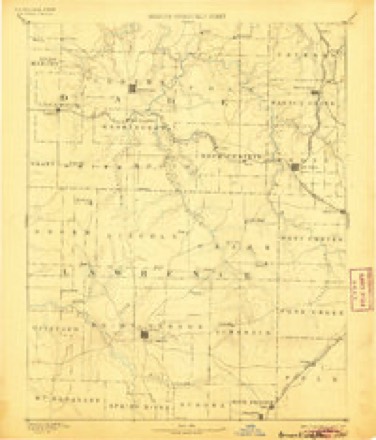
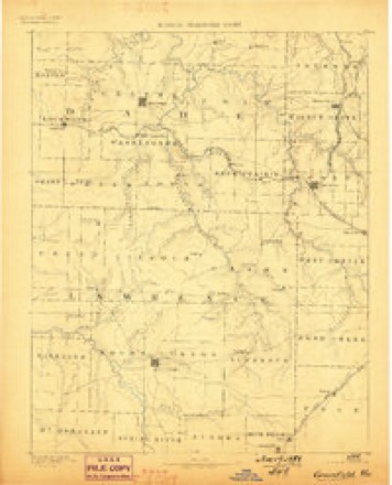
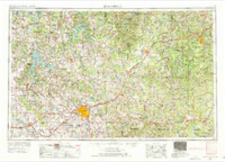
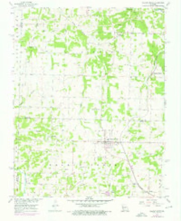
7 surveys from 16 printed sheetsMatched by testing this settlement's coordinate against the published boundary of every sheet in the United States Geological Survey's historical collection. Each opens the scanned sheet at the Survey.
- 1886 USGS Greenfield quadrangle1:125000, 4 printings
- 1888 USGS Greenfield quadrangle1:125000
- 1954 USGS Springfield quadrangle1:250000, 6 printings
- 1956 USGS Walnut Grove quadrangle1:24000, 2 printings
- 1958 USGS Springfield quadrangle1:250000
- 1959 USGS Springfield quadrangle1:250000
- 1982 USGS Springfield quadrangle1:100000
In the county-history sources
6,495 words on this townshipHistory of Greene County, Missouri .., published 1883 names this settlement in its chapter on Walnut Grove Township. These are the passages that mention it, exactly as the scans read.
Walnut Grove township is the smallest civil township in Greene county, but by no means the least in importance. It contains 24 sections of land, the most of which is very valuable. The grove of walnut timl)er from which the township took its name Avas widely known from the earliest period of the settlement of the country. Large quantities of this valuable sort of timber have been taken out of this township and Boone, in recent years, and much of it shipped to the furniture manufactories not onl}'^ of the United States, but even to England and Germany.
Passage source: History of Greene County, Missouri .., published 1883.
It is difficult at this late day to determine who was the very first bona fide settler of Walnut Grove township. Allen Williams came in 1832 and located in section 21, but some time afterward removed to Texas. The same year came Michael Walsh and located on section 22. Walsh was an Irishman. It is stated that one William Mallory built the first cabin which stood on the farm of A. J. McElmore.
Passage source: History of Greene County, Missouri .., published 1883.
Dr. A. S. Clinton was a pioneer physician, and Rev. Wm. Tatum. a Baptist, held religious services at an early day at Mt. Pleasant church, on Clear creek. The nearest school house in early days was the Kelly school house, on section 15, near Walnut Grove. During the tirst few years of Mr. Killingsworth's settlement, game of all sorts was abundant, and it was but little trouble to go out and kill a deer or a number of turkeys at almost any time. Wolves, too were disagreeably plentiful, and exasperatingly bold. The latter animals Avere often hunted on horseback, and this was considered rare sport, and no doubt it was.
Passage source: History of Greene County, Missouri .., published 1883.
Machine-read from a century-old scan, so expect the errors a machine makes: misspelled names, dropped words, stray characters.
Read the whole chapter on Walnut Grove Township - it names this place 27 more 27 times.
Fires near this place
40 since 1992Regional context, not property-specific evidence. The federal wildfire occurrence database lists 40 fires within 5 miles of Walnut Grove between 1992 and 2020, burning about 916 acres in total. None started naturally. 1 was recorded as arson. Distance is straight-line from the map coordinates, so a fire counted here may appear on a neighbouring settlement's page as well.
| Reported cause | Fires |
|---|---|
| Debris and open burning | 22 |
| Missing data/not specified/undetermined | 13 |
| Equipment and vehicle use | 4 |
| Arson/incendiarism | 1 |
The most recent of them, most recent first, with the day each was reported and the service that recorded it.
| Date | Cause | Size | Reported by | Name on the report |
|---|---|---|---|---|
| 23 September 2020 | Missing data/not specified/undetermined | under an acre | Missouri Department of Conservation | 220633-03911-09232020-1635 |
| 10 September 1996 | Missing data/not specified/undetermined | 1.0 acres | Missouri Department of Conservation | not named |
| 25 August 2000 | Equipment and vehicle use | 1.0 acres | Missouri Department of Conservation | not named |
| 23 August 2020 | Missing data/not specified/undetermined | under an acre | Missouri Department of Conservation | 220634-03911-08232020-1625 |
| 27 July 1997 | Debris and open burning | 20 acres | Missouri Department of Conservation | not named |
| 19 July 2012 | Missing data/not specified/undetermined | 590 acres | Missouri Department of Conservation | WALNUT GROVE |
| 19 April 1994 | Debris and open burning | 3.0 acres | Missouri Department of Conservation | not named |
| 9 March 2018 | Debris and open burning | 48 acres | Missouri Department of Conservation | 176574-03911-03092018-1130 |
Settlements close enough to share some of these fires:
Mines and quarries near this place
5 within 5 milesRegional context, not property-specific evidence. The federal mineral resources record lists 5 workings within 5 miles of Walnut Grove: 5 past producers. None of them still produces. What was taken out: Stone, Crushed/Broken, Limestone, Dimension, Iron. Distance is straight-line from the map coordinates, so a quarry counted here may appear on a neighbouring settlement's page as well.
| Where | Site | Commodity | Status | Recorded |
|---|---|---|---|---|
| Henney Mine | Iron | Past Producer | ||
| Unknown | Limestone, Dimension | Past Producer | ||
| Edmondson Quarry | Stone, Crushed/Broken | Past Producer | ||
| Mugen Quarry | Stone, Crushed/Broken | Past Producer | ||
| Unknown | Stone, Crushed/Broken | Past Producer |
Storms near this place
60 of 70 shownRegional context, not property-specific evidence. The National Weather Service names Walnut Grove in 70 storm reports between 1993 and 2026: 37 thunderstorm wind, 24 hail, 7 flash flood, 1 tornado. No death or injury is recorded in these reports. Each account below is quoted exactly as the forecast office filed it, from the NOAA Storm Events Database, and each date opens the federal record of that event.
| When | Event | Place named | Harm | What the report says |
|---|---|---|---|---|
| August 2007 | Flash Flood | Walnut Grove | $2,000,000 | Excessive rainfall associated with the remnants of Tropical Storm Erin impacted northern Greene County. Numerous roads and low water crossings were washed out and had to be fully repaired. Flooding also impacted a bank in Walnut Grove. Specific locations that were impacted include, hundreds of sections of secondary roads across northern Greene County, a section there Route V between Highway 160 and Route BB, and numerous sections of Highway 123 between Walnut Grove and Willard. |
| March 2008 | Flash Flood | Walnut Grove | $1,000,000 | Four to seven inches of rain fell over Greene County. Nearly all county roads experienced flooding. The Greene County Emergency Management Director stated that the county had insufficient barracades to block all flooded areas from motorists. An elderly couple was surveying flooded areas along the James River from a park in southeast Springfield when the river was rising so quickly that it eventually surrounded their vehicle and swept them into the river. The 67 year old husband died from a heart attack from the stress of being swept into the river. The wife was later rescued by the Rogersville Swift Water Rescue Team. The rescue attempt took two hours and the car was almost fully submerged by the time the rescue team had positioned themselves near the car. |
| April 2026 | Hail | Walnut Grove | $250,000 | Golf ball sized hail was reported in Walnut Grove. Some vehicles, homes and businesses suffered minor damage. |
| April 1994 | Tornado (F1) | Walnut Grove | $50,000 | Skywarn spotters reported severe damage to two homes. A mobile home was also hit tearing the roof off and knocking down large trees nearby. A 3-year-old boy was blown off a porch from the high wind but not injured. |
| April 2019 | Thunderstorm Wind | Walnut Grove | $35,000 | Several outbuildings were reported damaged, an RV was knocked on its side, and multiple trees were downed or damaged. |
| May 1998 | Hail | Walnut Grove | $15,000 | Hail damaged cars. |
| May 2011 | Hail | Walnut Grove | $10,000 | no account filed |
| October 2012 | Thunderstorm Wind | Walnut Grove | $5,000 | A large tree was blown down. An above ground pool was damaged and a swingset was also destroyed. |
| September 2012 | Thunderstorm Wind | Walnut Grove | $5,000 | Several power lines were down. |
| May 2006 | Thunderstorm Wind | Walnut Grove | $5,000 | Severe thunderstorm wind gusts blew a tin roof off of a house. |
| June 1994 | Thunderstorm Wind | Walnut Grove | $5,000 | Skywarn spotters reported power outages and roads blocked by downed trees. |
| June 1994 | Thunderstorm Wind | Walnut Grove | $5,000 | Skywarn spotters reported wind gusts to 75 mph at Walnut Grove while the Greene County Sheriff reported wind gusts to 60 mph. |
| June 1994 | Thunderstorm Wind | Walnut Grove | $5,000 | The volunteer fire department reported trees and power lines down. |
| April 1993 | Thunderstorm Wind | Walnut Grove | $5,000 | Numerous large trees were blown down. At Fair Grove, several small sheds and outbuildings were destroyed. |
| July 1996 | Thunderstorm Wind | Walnut Grove | $5,000 | no account filed |
| June 2024 | Thunderstorm Wind | Walnut Grove | $4,000 | Multiple trees were down in the Walnut Grove area. |
| October 2012 | Thunderstorm Wind | Walnut Grove | $2,000 | Tree uprooted on a house and an awning was ripped off the house. |
| June 2024 | Thunderstorm Wind | Walnut Grove | $1,000 | A large tree was down blocking farm road 5 west of Walnut Grove. |
| July 2014 | Thunderstorm Wind | Walnut Grove | $1,000 | A tree was blown down at Highway BB and Farm Road 61. Time was estimated by radar. |
| July 2014 | Thunderstorm Wind | Walnut Grove | $1,000 | A tree was blown down at Highway BB and Farm Road 61. |
| March 1998 | Thunderstorm Wind | Walnut Grove | $1,000 | Thunderstorm winds downed several trees. |
| April 1993 | Hail | Walnut Grove | $500 | Numerous large trees were blown down. At Fair Grove, several small sheds and outbuildings were destroyed. |
| June 2009 | Thunderstorm Wind | Walnut Grove | $100 | Thunderstorm wind gusts peeled shingles from a roof. |
| April 1994 | Hail | Walnut Grove | $50 | no account filed |
| May 2024 | Hail | Walnut Grove | - | Report of quarter size hail. |
| May 2023 | Hail | Walnut Grove | - | Quarter sized hail was reported. |
| September 2023 | Thunderstorm Wind | Walnut Grove | - | Winds were estimated at between 50 and 60 mph. |
| September 2023 | Thunderstorm Wind | Walnut Grove | - | Several large limbs were reported down. |
| August 2020 | Thunderstorm Wind | Walnut Grove | - | Multiple large limbs were reported down. |
| August 2020 | Thunderstorm Wind | Walnut Grove | - | Winds were estimated at 60 mph by the fire department. |
| March 2017 | Hail | Walnut Grove | - | This hail report was from social media with a picture. |
| March 2017 | Thunderstorm Wind | Walnut Grove | - | Winds were estimated up to 60 mph but there were no reports of damage from this report. |
| August 2016 | Thunderstorm Wind | Walnut Grove | - | Several large tree limbs were blown down in the Walnut Grove area. |
| August 2015 | Thunderstorm Wind | Walnut Grove | - | There were several small limbs blown down. |
| August 2015 | Thunderstorm Wind | Walnut Grove | - | Several large tree limbs were blown down. |
| August 2015 | Thunderstorm Wind | Walnut Grove | - | Large tree limbs were blown down. |
| August 2015 | Thunderstorm Wind | Walnut Grove | - | Several large trees were blown down in Walnut Grove. |
| June 2014 | Flood | Walnut Grove | - | The intersection of Highway Y and U was flooded. |
| May 2013 | Flash Flood | Walnut Grove | - | A foot of water was over the road in Walnut Grove. |
| September 2012 | Thunderstorm Wind | Walnut Grove | - | Several trees were down. |
| June 2011 | Thunderstorm Wind | Walnut Grove | - | Winds were estimated around 60 mph by local police. No damage was reported. |
| March 2008 | Flash Flood | Walnut Grove | - | Saturated antecedent conditions existed prior to this period of excessive rainfall. Some regional locations experienced record rainfall totals from February and March. One to three inches of rain fell across the county causing widespread flash flooding of low water crossings, county roads, and low lying areas near creeks and rivers. Ultimately, all locations that typically flood during periods of excessive rainfall were flooded. |
| April 2008 | Flash Flood | Walnut Grove | - | One to three inches of rain fell over Greene County. Any areas that typically flood during periods of excessive rainfall were flooded. Approximately 160 road closures occurred on secondary roads and state highways. |
| June 2008 | Flash Flood | Walnut Grove | - | Widespread flash flooding occurred over Greene County. Specific locations that flooded included a section of Farm Road 137 near its intersection with Cardinal Road, a section of Highway EE near White Capel Memorial Gardens Cemetery, and the intersection of Farm Road 124 and Farm Road 101. |
| June 2008 | Flash Flood | Walnut Grove | - | Major flash flooding occurred in the city of Springfield. Thirty five water rescues were performed as hundreds of streets became impassable to motorists. Pearson and Wilson creeks experienced record flooding, while South Creek, Jordan Creek, and Dry Sac Creek experienced near record flooding. Several rainfall measurements over the city of Springfield indicated that widespread four to six inches of rain occurred. Widespread flooding also occurred in rural areas of Greene County. A few locations that flooded within the county included several streets near the community of Republic, a section of Nicholas Road north of Highway AA, numerous sections of Highway CC between Highway 13 and Highway 65, the intersection of Highway 125 and Highway OO, the intersection of Highway 125 and Highway A, a section of Highway O near its intersection with the Sac River, sections of Farm Road 148 and Farm Road 150 near the Brookline area, and the intersection of Farm Road 144 and Farm Road 193. |
| May 1995 | Hail | Walnut Grove | - | A macroburst damaged many homes, schools and businesses across northern Springfield. A smaller microburst also downed trees in Brookline. |
| March 2017 | Hail | Walnut Grove | - | no account filed |
| May 2017 | Hail | Walnut Grove | - | no account filed |
| April 2012 | Hail | Walnut Grove | - | no account filed |
| April 2011 | Hail | Walnut Grove | - | no account filed |
| April 2009 | Thunderstorm Wind | Walnut Grove | - | no account filed |
| March 2007 | Hail | Walnut Grove | - | no account filed |
| March 2006 | Hail | Walnut Grove | - | no account filed |
| January 2005 | Hail | Walnut Grove | - | no account filed |
| May 2004 | Hail | Walnut Grove | - | no account filed |
| May 2003 | Thunderstorm Wind | Walnut Grove | - | no account filed |
| May 2003 | Thunderstorm Wind | Walnut Grove | - | no account filed |
| July 2003 | Hail | Walnut Grove | - | no account filed |
| July 2003 | Hail | Walnut Grove | - | no account filed |
| August 2003 | Thunderstorm Wind | Walnut Grove | - | no account filed |
Nearest settlements
The eight closest, with where each one stands in the county. Distances are straight-line, computed from the Geographic Names Information System coordinates.
| Map | Place | Distance | Sheets |
|---|---|---|---|
| Buckley (historical) | 1.3 miles | 16 | |
| Phenix | 2.3 miles | 16 | |
| Harold | 2.9 miles | 16 | |
| Pearl | 5.3 miles | 21 | |
| Cave Spring | 6.1 miles | 21 | |
| Sacville | 6.5 miles | 17 | |
| Ash Grove | 6.9 miles | 16 | |
| Hackney | 9.4 miles | 21 |
Elsewhere
Matched on this settlement's Geographic Names Information System number rather than its name, so it cannot be a different place of the same name in another state.
| Wikipedia article on Walnut Grove | An encyclopaedic summary. Its text is share-alike, so it is linked here rather than copied. |
| Wikidata item Q954111 | The structured record the population and elevation above come from. Public domain (CC0). |
Provenance
This settlement is recorded in the Geographic Names Information System as feature 735899. The sheet list is computed by point-in-boundary test against the United States Geological Survey's historical topographic inventory. Both are works of the United States government and carry no copyright under 17 U.S.C. 105.
Wildfire. Short, Karen C. 2022. Spatial wildfire occurrence data for the United States, 1992-2020 [FPA_FOD_20221014]. 6th Edition. Fort Collins, CO: Forest Service Research Data Archive. https://doi.org/10.2737/RDS-2013-0009.6 Collected with United States Government funding and usable without additional permissions or fees.
Mines and quarries. USGS Mineral Resources Data System (MRDS) https://mrdata.usgs.gov/mrds/ A work of the United States government, no copyright under 17 U.S.C. 105.
Storms. NOAA National Centers for Environmental Information, Storm Events Database https://www.ncei.noaa.gov/stormevents/ A work of the United States government, no copyright under 17 U.S.C. 105. Narratives are quoted verbatim from the National Weather Service report and are not edited or summarised.