 Block
Winston, Missouri
15 topographic sheets cover this place, the earliest surveyed in 1924 and the latest in 1986. It stands in Colfax Township. It lies in ZIP code area 64689. The Survey maps it on the Winston quadrangle. 229 people lived here at the 2020 count. It stands 1,050 feet above sea level.
Population over time
2 figuresWinston fell from 259 to 229 between 2010 and 2020. These are the recorded population figures Wikidata holds for this place, reached through the Geographic Names Information System number this page is keyed on rather than by name, so they belong to this place and not to another of the same name. Most are census counts, but not all are: an early figure may be a founding or settlement estimate, and an estimate published within five years of a census is left out. The change column is computed, and is left blank where more than 20 years separate a figure from the one before it, because a gap that long is not a change between two counts.
| Year | People | Change |
|---|---|---|
| 2010 | 259 | |
| 2020 | 229 | -30 (-12%) |
Topographic sheets covering this place
7 surveys from 15 printed sheetsMatched by testing this settlement's coordinate against the published boundary of every sheet in the United States Geological Survey's historical collection. Each opens the scanned sheet at the Survey.
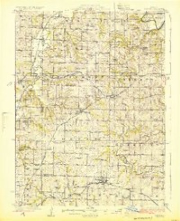
- 1924 USGS Winston quadrangle1:62500, 3 printings
- 1950 USGS Kansas City quadrangle1:250000
- 1954 USGS Kansas City quadrangle1:250000
- 1956 USGS Kansas City quadrangle1:250000, 4 printings
- 1960 USGS Kansas City quadrangle1:250000, 3 printings
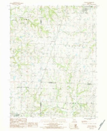
- 1984 USGS Winston quadrangle1:24000
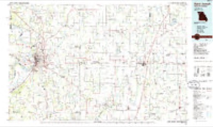
- 1986 USGS Saint Joseph quadrangle1:100000, 2 printings




What happened here
An account from the chapter on Colfax township. The inset identifies its exact source book and publication year.
Samuel &8Tecker
Was born near Easton, Northampton county, Pennsylvania, August 1s, 1841. His parents are John and Sarah Stecker, who were born and reared in the same county. Te lived with them until he was twenty, and was educated in the public schools of his native county. On leaving home in 1860, he went to Illinois and worked as a hand on a farm near Freeport for one year, and then went to Three Rivers, Michigan, where he worked until 1862, when he enlisted in Company D, Twenty-fifth Michigan Volunteer Infantry to serve for three years, but being wounded at the battle of Tibb's- Bend, Kentucky, July 4, 1863, he was sent to the United States Hospital No.
In the county-history sources
8,078 words on this townshipThe History Of Daviess County, Missouri (Birdsall & Dean, 1882), published 1882 names this settlement in its chapter on Colfax Township. These are the passages that mention it, exactly as the scans read.
This township lies in the form of asquare and is in the southeast corner of the county. It is bounded on the north by Jefferson, and east by Sheridan township, on the south by Caldwell and DeKalb counties. It is in size a congressional township - six miles each way. It has an area of twentythree thousand and thirty and thirty one-hundredths acres of land, threefourths of which is a high and rolling prairie, rich in soil and prolific in produetion, being one of the best corn producing townships in the county. The highest point of land in the county of Daviess is said to be the ground upon which the town of Winston stands, and the view of the surrounding country from that point is really a magnificent one. On a clear day, can be seen Gallatin, eleven miles distant, also Cameron, Kidder, Hamilton, and Breckinridge, and the iron horse with his extended train of living freight, moving like a thing of life marks a lightning-like passage plainly discernable for miles across the prairies leaving a long line of smoky clouds that whirl and twist and take fanciful, queer, and fantastic shapes as they dissolve into nothingness. The timber lies principally along Marrowbone and other creeks and branches which wind their way through its territory. The first named ereek and its branches constitute the main water supply of the township, with Dog Creek in the northeast, Long Branch in the southwest, and Rice, Brushy, Wood, and Smith ereeks in the northwest. These last named are all small streams, which, however, in a rainy season generally ran bank-full and sometimes eover the bottom lands toa considerable depth. There is here and there a spring, but they are not numerous, while water ean be reached by wells, from twelve to forty feet deep, in abundance. Colfax was, on theorganization of the county, a partof Sugar Creek township one of the three first townships formed, but when Jefferson township was formed the latter was taken from Sugar Creek and Grindstone, and the part of Sugar Creek taken was what is now known as Colfax. It remained a part of Jefferson township until 1869, when Jefferson and Gallatin were curtailed of their dimensions and Liberty, Sheridan, and Colfax were the re- - sult, The names of the first justices of the peace and where the first cleetion was held will be found in the general history of the year 1869, when its metes and bounds and incorporation were made.
Passage source: The History Of Daviess County, Missouri (Birdsall & Dean, 1882), published 1882.
There is a coal strata or formation in the northeast corner of the township, some two miles east of Winston, Some has been taken out, tried and found to burn well and of a good quality of coal, and was discovered on the farm of John 8 Hughes. Several specimens were taken out in December, 1871, and an effort was made to organize a company to find ont the extent of the vein, but it proved a failure. There is undoubtedly a paving vein of eoal in Daviess county, but so long as wood ean be purchased at from two to three dollars per cord, it will be many years before capital will embark ina coal-mining enterprise.
Passage source: The History Of Daviess County, Missouri (Birdsall & Dean, 1882), published 1882.
The progress of the township of Colfax wasslow watil the advent of the railroad. In 1871, the Chicago & Sonthwestern road was built, entering the township two miles east on its northern border and running diagonally, bearing to the west, through the township, giving it six miles of railroad and making an important station, Winston, between Gallatin and Cameron, an equal distance from each, The station is nearly in the center of the north part of the township. On its southern border nearly touching and running clear across from east to west is the Hannibal & St. Joseph Railroad, and reaching its southeastern corner is the enterprising town of Kidder, in Caldwell county. The town line and county line being the same, it has, therefore, splendid shipping facilities, no farm within the township being over three or four miles from a shipping point. This makes the land valuable, yet there are plenty of good and cheap lands which should invite the attention of the immigrant. For good land, schools, churches, and transportation facilities, there are few better opportunities for investment than in Colfax township.
Passage source: The History Of Daviess County, Missouri (Birdsall & Dean, 1882), published 1882.
Machine-read from a century-old scan, so expect the errors a machine makes: misspelled names, dropped words, stray characters.
Read the whole chapter on Colfax Township - it names this place 34 more 34 times.
Fires near this place
4 since 1997Regional context, not property-specific evidence. The federal wildfire occurrence database lists 4 fires within 5 miles of Winston between 1997 and 2002, burning about 196 acres in total. None started naturally. None was recorded as arson. Distance is straight-line from the map coordinates, so a fire counted here may appear on a neighbouring settlement's page as well.
| Reported cause | Fires |
|---|---|
| Debris and open burning | 4 |
The most recent of them, most recent first, with the day each was reported and the service that recorded it.
| Date | Cause | Size | Reported by | Name on the report |
|---|---|---|---|---|
| 28 March 2002 | Debris and open burning | 11 acres | Missouri Department of Conservation | not named |
| 23 March 2002 | Debris and open burning | 70 acres | Missouri Department of Conservation | not named |
| 21 March 1997 | Debris and open burning | 100 acres | Missouri Department of Conservation | not named |
| 12 March 1997 | Debris and open burning | 15 acres | Missouri Department of Conservation | not named |
Settlements close enough to share some of these fires:
Mines and quarries near this place
4 within 5 milesRegional context, not property-specific evidence. The federal mineral resources record lists 4 workings within 5 miles of Winston: 4 past producers. None of them still produces. What was taken out: Stone, Crushed/Broken. Distance is straight-line from the map coordinates, so a quarry counted here may appear on a neighbouring settlement's page as well.
Storms near this place
29 since 1994Regional context, not property-specific evidence. The National Weather Service names Winston in 29 storm reports between 1994 and 2022: 16 hail, 10 thunderstorm wind, 1 lightning, 1 flood. The reports record 3 injuries. Each account below is quoted exactly as the forecast office filed it, from the NOAA Storm Events Database, and each date opens the federal record of that event.
| When | Event | Place named | Harm | What the report says |
|---|---|---|---|---|
| August 2011 | Thunderstorm Wind | Winston | 2 hurt, $7,000 | A gas station awning was blown down. Two injuries were reported in a car underneath the fallen awning. Thunderstorm wind gusts were estimated up to 70 mph. |
| August 2010 | Thunderstorm Wind | Winston | 1 hurt, $750 | A tractor trailer was blown off of Interstate 35, near exit 61. The driver suffered minor injuries. Numerous trees were blown down, and blocked portions of Highway 69 near Winston. Thunderstorm wind gusts were estimated to 70 mph. |
| May 2013 | Thunderstorm Wind | Winston | $6,000 | A roof was reported blown off a house. Thunderstorm wind gusts were estimated up to 70 mph. |
| November 2006 | Lightning | Winston | $5,000 | Lightning struck a school in Winston. The lightning hit at the computer lab. There was extensive damage to 7 computers, and the intercom system became inoperable as well. Damage was observed in the roof where the lightning struck. There were no students or teachers in the lab when the lightning hit. |
| August 2011 | Thunderstorm Wind | Winston | $2,000 | Damage was reported to a roof. A 40 foot tall radio tower was blown over. Thunderstorm wind gusts were estimated up to 70 mph. |
| April 2022 | Thunderstorm Wind | Winston | - | Powerlines were reported down from 60 mph wind in the area. |
| June 2018 | Thunderstorm Wind | Winston | - | A large tree was down over Highway 6. |
| April 2016 | Tornado (EF0) | Winston | - | A tornado formed in southwest Daviess County and had intermittent ground circulations along a 4 mile path that saw it dissipate 2 miles southwest of Altamont, Missouri. This tornado remained in rural areas away from any structures, so little to no damage resulted from this tornado. |
| May 2013 | Thunderstorm Wind | Winston | - | A thunderstorm wind gust was measured at 62 mph. |
| June 2010 | Flood | Winston | - | Two to four inches of water was reported across area roads. |
| August 2006 | Thunderstorm Wind | Winston | - | 4 to 6 inch tree limbs snapped off. |
| June 2002 | Thunderstorm Wind | Winston | - | Large tree down at Highway O and 170. |
| May 2020 | Hail | Winston | - | no account filed |
| April 2014 | Hail | Winston | - | no account filed |
| May 2013 | Hail | Winston | - | no account filed |
| June 2011 | Hail | Winston | - | no account filed |
| June 2010 | Hail | Winston | - | no account filed |
| June 2010 | Hail | Winston | - | no account filed |
| October 2010 | Hail | Winston | - | no account filed |
| March 2009 | Hail | Winston | - | no account filed |
| April 2009 | Hail | Winston | - | no account filed |
| June 2009 | Hail | Winston | - | no account filed |
| May 2008 | Hail | Winston | - | no account filed |
| May 2008 | Hail | Winston | - | no account filed |
| May 2008 | Hail | Winston | - | no account filed |
| March 2006 | Hail | Winston | - | no account filed |
| June 2006 | Hail | Winston | - | no account filed |
| April 2003 | Thunderstorm Wind | Winston | - | no account filed |
| May 1994 | Hail | Winston | - | no account filed |
Nearest settlements
The eight closest, with where each one stands in the county. Distances are straight-line, computed from the Geographic Names Information System coordinates.
| Map | Place | Distance | Sheets |
|---|---|---|---|
| Altamont | 3.0 miles | 15 | |
| Alta Vista | 4.4 miles | 15 | |
| Mabel | 4.6 miles | 15 | |
| Civil Bend | 9.0 miles | 15 | |
| Gallatin | 9.9 miles | 10 | |
| Wabash Crossing | 11.4 miles | 10 | |
| Old Pattonsburg | 12.2 miles | 16 | |
| Jameson | 12.6 miles | 13 |
Elsewhere
Matched on this settlement's Geographic Names Information System number rather than its name, so it cannot be a different place of the same name in another state.
| Wikipedia article on Winston | An encyclopaedic summary. Its text is share-alike, so it is linked here rather than copied. |
| Wikidata item Q2614191 | The structured record the population and elevation above come from. Public domain (CC0). |
Provenance
This settlement is recorded in the Geographic Names Information System as feature 730251. The sheet list is computed by point-in-boundary test against the United States Geological Survey's historical topographic inventory. Both are works of the United States government and carry no copyright under 17 U.S.C. 105.
Wildfire. Short, Karen C. 2022. Spatial wildfire occurrence data for the United States, 1992-2020 [FPA_FOD_20221014]. 6th Edition. Fort Collins, CO: Forest Service Research Data Archive. https://doi.org/10.2737/RDS-2013-0009.6 Collected with United States Government funding and usable without additional permissions or fees.
Mines and quarries. USGS Mineral Resources Data System (MRDS) https://mrdata.usgs.gov/mrds/ A work of the United States government, no copyright under 17 U.S.C. 105.
Storms. NOAA National Centers for Environmental Information, Storm Events Database https://www.ncei.noaa.gov/stormevents/ A work of the United States government, no copyright under 17 U.S.C. 105. Narratives are quoted verbatim from the National Weather Service report and are not edited or summarised.