 Block
From the record
One of 32 National Register listings published here for Lafayette County · listed in 2023 · category: Building.
Sources: the National Register database, National Park Service
Listed on the National Register of Historic Places in 2023.
One of 32 National Register listings published here for Lafayette County · listed in 2023 · category: Building.
Sources: the National Register database, National Park Service
An account from the chapter on Davis township. The inset identifies its exact source book and publication year.
The Federals had occupied as a hospital the then magnificent residence of Oliver Anderson, Esq., a two-and-a-half story brick building, down the slope about twenty rods west from the outer line of their intrenchments [See diagram,] and several hundred rods from the " Masonic College. " On top of this building there was a yellow flag displayed, marking it as a hospital, and in it were 24 sick and 96 wounded, according to Mulligan's report.
The chapter on Davis Township in History of Lafayette County, Mo. , Carefully Written and Compiled from the Most Authentic Official and Private Sources, Including a History of Its Townships, Cities, Towns, and Villages, Together with a Condensed History of Missouri; the Constitution of the United States, and State of Missouri; a Military Record of Volunteers in Either Army of the Great Civil War .., published 1881 names Higginsville. This is what it says, exactly as the scans read.
Wm. Collins, Senior, a soldier of the revolutionary war from Carolina, also his son and son-in-law and their families, amounting to eight persons, were among the first settlers of this township, settling here in 1825. The first marriage in the township was that of Martin D. Warren to Miss Dillingham. The first male child born »here was James Anderson, son of Wm. H. and D Anderson; the first female child was Nancy, daughter of Larkin and Sarah Graham. The first death occurred in the township in the latter part ot 1837, and was buried at Johnson's Grove, near Higginsville. The first Christian minister in this township was Rev. Thomas McBride, of the Christian church, in a log cabin south of where Higginsville now stands. "We had no roads in the early times of Davis township, but traveled by courses - our principal market place was Lexington. The boys would often have a big deer hunt, kill as many as eight deer, and get home to dinner."
The first regular physician was Dr. C. W. Seeber, who still resides near the city engaged in a lucrative practice of his profession. The first religious services were held in the Evangelical church, conducted by the Rev. Henry Haefer. The Evangelical burial ground is located about one mile east of town and is tastefully laid out. The present city officers are as follows: Mayor, B. M. Hutcherson; councilmen, W. L. Smiley, M. A. Brady, H. Horstmann and H. G. Smith. Two years ago, when the Chicago & Alton road was built through, Higginsville was comparatively small. It now has a newspaper, a bank, two steam flouring mills, a steam elevator and grain warehouse, two freight and passenger depots, eight churches, a fine graded public school, a select school, flourishing civic societies, a large lumber yard, and about twenty business houses. According to the official report of the United States census, taken June 1, 1880, it has a population of 797. It, however, has grown quite rapidly during the past year, and now considerably exceeds that number.
Machine-read from a century-old scan, so expect the errors a machine makes: misspelled names, dropped words, stray characters.
Read the whole chapter on Davis Township - 45,418 words on its settlement, mills, schools and churches.
Regional context, not property-specific evidence. The federal wildfire occurrence database lists 36 fires within 5 miles of Douglass School between 2014 and 2020, burning about 249 acres in total. None started naturally. None was recorded as arson. Distance is straight-line from the map coordinates, so a fire counted here may appear on a neighbouring settlement's page as well.
| Reported cause | Fires |
|---|---|
| Missing data/not specified/undetermined | 25 |
| Debris and open burning | 9 |
| Equipment and vehicle use | 2 |
The most recent of them, most recent first, with the day each was reported and the service that recorded it.
| Date | Cause | Size | Reported by | Name on the report |
|---|---|---|---|---|
| 22 September 2018 | Debris and open burning | 4.8 acres | Missouri Department of Conservation | 177731-05440-09222018-1823 |
| 22 August 2016 | Missing data/not specified/undetermined | 1.0 acres | Missouri Department of Conservation | 142911-02459-08222016-1040 |
| 13 August 2015 | Missing data/not specified/undetermined | 1.0 acres | Missouri Department of Conservation | 129856-05438-08132015-1915 |
| 12 August 2015 | Missing data/not specified/undetermined | 1.0 acres | Missouri Department of Conservation | 129855-05438-08122015-1300 |
| 4 July 2018 | Missing data/not specified/undetermined | under an acre | Missouri Department of Conservation | 178149-05438-07042018-1613 |
| 8 June 2018 | Debris and open burning | under an acre | Missouri Department of Conservation | 178152-05438-06082018-1707 |
| 24 June 2017 | Missing data/not specified/undetermined | 1.0 acres | Missouri Department of Conservation | not named |
| 8 May 2018 | Missing data/not specified/undetermined | under an acre | Missouri Department of Conservation | 178147-05438-05082018-1320 |
Regional context, not property-specific evidence. The federal mineral resources record lists 3 workings within 5 miles of Douglass School: 3 past producers. None of them still produces. What was taken out: Stone, Crushed/Broken. Distance is straight-line from the map coordinates, so a quarry counted here may appear on a neighbouring settlement's page as well.
| Where | Site | Commodity | Status | Recorded |
|---|---|---|---|---|
| Hoefer Qsuarry | Stone, Crushed/Broken | Past Producer | ||
| Unknown | Stone, Crushed/Broken | Past Producer | ||
| Unknown | Stone, Crushed/Broken | Past Producer |
Regional context, not property-specific evidence. The National Weather Service names Higginsville, the town this property stands in, in 53 storm reports between 1993 and 2020: 27 thunderstorm wind, 22 hail, 3 tornado, 1 flash flood. No death or injury is recorded in these reports. Each account below is quoted exactly as the forecast office filed it, from the NOAA Storm Events Database, and each date opens the federal record of that event.
| When | Event | Place named | Harm | What the report says |
|---|---|---|---|---|
| May 1995 | Tornado (F0) | Higginsville | $25,000 | A severe thunderstorm dropped up to golfball size hail on Bates City, and then went on to develop 2 weak tornadoes. The first tornado touched down south of Bates City at 1820 CST and was crossing Interstate 70 3 miles west of Odessa at 1831 CST. Only minor tree damage was reported. It then lifted north of Odessa. A second touchdown occurred about 5 miles northwest of Higginsville at 1845 CST. The track took it across State Route 13 5 miles northwest of Higginsville near the Tabo Creek bridge at 1900 CST. At 1905 CST, the tornado crossed Route 213 3 miles southwest of Dover, and then lifted 1 mile southwest of Dover at 1906 CST. A house along state Route 13, 6 miles southeast of the junction with Route E, had shingles removed from the roof as the funnel apparently lifted as it passed overhead. Eyewitnesses reported that the tornado bounced up and down as it continued on a path about 4.5 miles to the east-northeast. The damage path varied from about 30 to 40 yards wide, with most of the path over cultivated farm fields. Most damage was minimal, but the most significant damage occurred at the Humfeldt farm 2.6 miles south of U.S. Route 24 along state Route 213. A corrugated steel equipment building was destroyed when the south and west walls were blown in, and the roof was partially peeled off. There was only minor damage to the equipment inside. The tornado passed to the south of the house and garage, missing them by 25 feet. Only one shutter was blown off of the upper floor of the house with no other damage. Mud was splattered on all four sides of both the house and garage. The tornado was photographed as it was dissipating, in its rope stage between 1901 and 1906 CST. In addition, tree damage occurred in Corder with the gust front ahead of the parent thunderstorm. |
| May 2002 | Thunderstorm Wind | Higginsville | $5,000 | Roof blown off car wash. |
| September 1993 | Thunderstorm Wind | Higginsville | $5,000 | Large trees were uprooted and dime-size hail fell. |
| July 2020 | Flash Flood | Higginsville | - | Water was flowing over Highway AA just east of Higginsville. |
| June 2019 | Thunderstorm Wind | Higginsville | - | COOP Observer reported 60 mph wind. |
| July 2019 | Thunderstorm Wind | Higginsville | - | A COOP observer reported a measured 71 mph wind gust. |
| August 2017 | Hail | Higginsville | - | Dime to quarter sized hail lasted at this location for about 15 minutes, starting at 9:15 PM CDT (8:15 CST). |
| April 2016 | Hail | Higginsville | - | There was minor vehicle damage. |
| April 2016 | Hail | Higginsville | - | This report was received via social media. |
| October 2016 | Thunderstorm Wind | Higginsville | - | Some structural damage occurred to a tractor company in Higginsville. A few sheds and an hoop building were blown down. |
| July 2015 | Thunderstorm Wind | Higginsville | - | A 4 apple tree was snapped and blown over. |
| April 2011 | Thunderstorm Wind | Higginsville | - | Thunderstorm wind gust was measured at 59 mph. |
| May 2011 | Tornado (EF0) | Higginsville | - | At 1425CST a brief EF0 tornado touchdown, was observed by television helicopter, a little over a half north of Higginsville. The tornado moved about a tenth of a mile to the east, and lifted at 1427CST. Touchdown was in an open field with no damage observed. |
| May 2011 | Tornado (EF0) | Higginsville | - | At 1207CST a brief EF0 tornado touchdown, was observed 1.9 miles south southwest of Higginsville. The tornado touched down and went right back up. No Damage was observed. |
| August 2011 | Thunderstorm Wind | Higginsville | - | Thunderstorm wind gust was measured at 95 mph, at the Higginsville water plant. |
| July 2010 | Thunderstorm Wind | Higginsville | - | Thunderstorm wind gusts were estimated up to 60 mph. |
| June 2010 | Thunderstorm Wind | Higginsville | - | Thunderstorm winds were estimated up to 60 mph. |
| May 2000 | Hail | Higginsville | - | The same supercell storm that produced the tornado southeast of Lexington also produced dime to quarter size hail, which covered the ground in Higginsville. |
| May 2000 | Thunderstorm Wind | Higginsville | - | Highway Patrol officers estimated wind gusts up to 70 mph near mile marker 46 on Interstate 70. |
| June 2000 | Thunderstorm Wind | Higginsville | - | A wind gust of 76 mph was measured at the Higginsville Water Plant. Tree limbs 6 inches in diameter were downed. |
| September 2000 | Thunderstorm Wind | Higginsville | - | A 75 mph wind gust was recorded by the NWS co-op observer at the Higginsville Water Plant. |
| August 2000 | Thunderstorm Wind | Higginsville | - | The NWS co-op observer at Higginsville recorded a 61 mph wind gust. |
| April 1998 | Hail | Higginsville | - | Dime-size hail was reported during a severe thunderstorm in Higginsville. |
| August 1997 | Thunderstorm Wind | Higginsville | - | A Higginsville spotter measured 62 MPH winds during a severe thunderstorm. |
| September 1993 | Thunderstorm Wind | Higginsville | - | A wind gust to 63 mph was recorded at the Higginsville Water Plant. |
| September 1993 | Hail | Higginsville | - | Large trees were uprooted and dime-size hail fell. |
| April 2014 | Hail | Higginsville | - | no account filed |
| April 2014 | Thunderstorm Wind | Higginsville | - | no account filed |
| May 2011 | Hail | Higginsville | - | no account filed |
| May 2011 | Hail | Higginsville | - | no account filed |
| May 2011 | Hail | Higginsville | - | no account filed |
| June 2008 | Thunderstorm Wind | Higginsville | - | no account filed |
| April 2006 | Hail | Higginsville | - | no account filed |
| June 2006 | Hail | Higginsville | - | no account filed |
| April 2005 | Hail | Higginsville | - | no account filed |
| April 2005 | Hail | Higginsville | - | no account filed |
| April 2005 | Hail | Higginsville | - | no account filed |
| July 2005 | Thunderstorm Wind | Higginsville | - | no account filed |
| April 2003 | Hail | Higginsville | - | no account filed |
| May 2003 | Thunderstorm Wind | Higginsville | - | no account filed |
| May 2003 | Hail | Higginsville | - | no account filed |
| May 2002 | Thunderstorm Wind | Higginsville | - | no account filed |
| April 2001 | Thunderstorm Wind | Higginsville | - | no account filed |
| April 2001 | Hail | Higginsville | - | no account filed |
| July 2001 | Thunderstorm Wind | Higginsville | - | no account filed |
| September 2001 | Thunderstorm Wind | Higginsville | - | no account filed |
| February 2000 | Thunderstorm Wind | Higginsville | - | no account filed |
| May 2000 | Hail | Higginsville | - | no account filed |
| August 1999 | Thunderstorm Wind | Higginsville | - | no account filed |
| October 1998 | Hail | Higginsville | - | no account filed |
| May 1996 | Hail | Higginsville | - | no account filed |
| June 1995 | Hail | Higginsville | - | no account filed |
| March 1993 | Thunderstorm Wind | Higginsville | - | no account filed |
No historic map-sheet match is published for this property yet. That does not mean no map exists. This record needs a coordinate-quality review before it can be joined to a sheet boundary. Browse the county's mapped places while that work is pending.
Other National Register properties close enough to walk or drive between, ordered by distance from this one. Both positions come from the same geocoding pass that matched these properties to their map sheets.
| Photograph | Property | Distance | Listed |
|---|---|---|---|
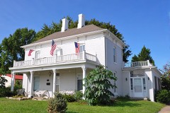 | Houx-Hoefer-Rehkop House | 0.2 miles | 1983 |
 | Chicago and Alton Railroad Depot at Higginsville | 0.6 miles | 1987 |
| Confederate Chapel, Cemetery and Cottage | 1.4 miles | 1981 | |
| Thomas Shelby House | 7.8 miles | 1997 | |
| James M. Dinwiddie House | 7.9 miles | 1997 |
| National Archives record | The nomination case file for reference 100008715 in Record Group 79. |
| Lafayette County | All 32 listed properties in this county. |