BlockBefore
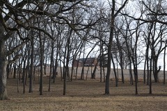
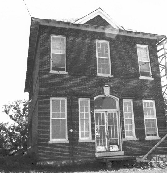
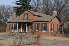
Photograph of Pleasant Ridge School
Photograph by SamuelNelsonGISP, CC BY-SA 4.0. Via Wikimedia Commons.

Pleasant Ridge School

Listed on the National Register of Historic Places in 1985.

From the record

“Pleasant Ridge School was a historic school building in Buchanana County, Missouri, United States, south of St.”

Wikipedia article Pleasant Ridge School, CC BY-SA 4.0.

One of 63 National Register listings published here for Buchanan County · listed in 1985 · category: Building.

Sources: the Wikipedia article · the case file at the National Archives · the National Register database, National Park Service
The listing

  • What is counted as historic. The nomination lists 1 building as contributing to the listing.
  • Address. R.F.D. #4, St. Joseph, 64507
  • When was it listed? May 1985
  • Category. building
  • Township. Center township
  • National Register reference number. 85000941 - the number the National Park Service assigned this property when it was listed, and the key its nomination file is catalogued under at the National Archives.

The ground it stands on

9,459 words

The chapter on Center Township in History of Buchanan County and the City of St. Joseph and Representative Citizens : 1826 to 1904, published 1904; The History of Buchanan County, Missouri : Containing a History of the County, Its Cities, Towns, Etc., Biographical Sketches of Its Citizens, Buchanan County in the Late War, General and Local Statisics, Portraits of Early Settlers and Prominent Men, History of Missouri, Map of Buchanan County, Etc., Etc, published 1881 names St. Joseph. This is what it says, exactly as the scans read.

Sparta, which was the name of the first county seat, exists on the map only, the ground being now a part of the McCauley farm. Sparta had a brief existence of six years. It was platted in 1840 ancL its streets were named Hazel, Prune, Olive, Vine, Market, Chestnut, Cedar, Cherry, Walnut, Main and Harrison. There was the log court house, a tavern, kept Ijy Robert Duncan, several general stores, a saloon and wagon and blacksmith shops. It was only a small town when at the height of its prosperity. During the struggle between Sparta and St. Joseph over the county seat, a newspaper called The Rooster, was published at Sparta. When the county seat was moved to St. Joseph, Sparta faded out of existence.

Passage source: History of Buchanan County and the City of St. Joseph and Representative Citizens : 1826 to 1904, published 1904.

farmer and stock raiser, section 5, postoffice St. Joseph, was born March 14, 18 18, in Livingston County, New York. His parents were natives of Connecticut, and moved to New York State about 1800. Norton spent his boyhood days on a farm and received a common school education. When thirteen years of age he moved with his parents to Sandusky County, Ohio, resided there two years, and then emigrated to DeKalb County, Indiana, where he remained thirty years engaged in agricultural pursuits. During the late war he assisted in organizing the Thirtieth and Forty-fourth Regiments, and Company H of the Eightyeighth Indiana Infantry; also Company M of the Second Indiana Cavalry; his brother became captain of this company. Norton was appointed wagon master of the commissary department, but his health failing he was compelled to resign this position. His only son, Judson, became a member of the Second Indiana Cavalry, and had his right shoulder shattered while fighting against John Morgan in Tennessee. He came home and remained a few months, when he re-enlisted in the lEighth Illinois Cavalry and served until the close of the war, serving with General Sheridan. In 1863, our subject took a trip west, and visited St. Joseph, Atchison, Topeka and other places. During 1864 he worked at the carpenter trade in Chicago, and held the position of foreman of the West Side Street Car Company. Emigrated to Andrew County, Missouri, in 1865, and from there to St. Joseph in 1867. He remained there three years and then moved to his present location. He owns a fine 'farm of 165 acres, which is very highly improved. The outbuildings are well arranged and everything around his place denotes neatness and a successful farmer. He has about fifteen hundred fruit trees and a small vineyard. He has been twice married. First, March 9, 1843, to Miss H. A. Holmes, a native of Seneca County, Ohio, born May 21, 1826; she died in November, 1863, leaving three children: Judson, born March 22, 1844; Lucy E., born April 27, 1846; G. J., born August 4, 1850, now Mrs. William Bealey. Was again married, December 18, 1866, to Miss Mary Thompson, a resident of St. Joseph, born March 21, 1839, ^^ County Tire, Ireland. They have had one child, Sarah I., now Mrs. Robert I. Young. Mrs. B. is a member of the Westminster Church of St. Joseph. Mr. B. is a member of the Masonic fraternity and ihekjiigs to King Hill Lx^dge.

Passage source: The History of Buchanan County, Missouri : Containing a History of the County, Its Cities, Towns, Etc., Biographical Sketches of Its Citizens, Buchanan County in the Late War, General and Local Statisics, Portraits of Early Settlers and Prominent Men, History of Missouri, Map of Buchanan County, Etc., Etc, published 1881.

Machine-read from a century-old scan, so expect the errors a machine makes: misspelled names, dropped words, stray characters.

Read the whole chapter on Center Township - 9,459 words on its settlement, mills, schools and churches.

Fires near this property

19 since 1999

Regional context, not property-specific evidence. The federal wildfire occurrence database lists 19 fires within 5 miles of Pleasant Ridge School between 1999 and 2020, burning about 244 acres in total. None started naturally. 5 were recorded as arson. Distance is straight-line from the map coordinates, so a fire counted here may appear on a neighbouring settlement's page as well.

Reported cause Fires
Missing data/not specified/undetermined8
Arson/incendiarism5
Debris and open burning5
Smoking1

The most recent of them, most recent first, with the day each was reported and the service that recorded it.

DateCause SizeReported by Name on the report
12 August 1999Smoking1.0 acresMissouri Department of Conservationnot named
12 August 1999Debris and open burning55 acresMissouri Department of Conservationnot named
24 July 2018Missing data/not specified/undeterminedunder an acreMissouri Department of Conservation177407-01180-07242018-2100
15 March 2018Arson/incendiarism3.2 acresMissouri Department of Conservation176117-01180-03152018-1613
14 March 2018Arson/incendiarism2.1 acresMissouri Department of Conservation176118-01180-03142018-1336
13 March 2018Arson/incendiarismunder an acreMissouri Department of Conservation176115-01180-03132018-1540
13 March 2018Arson/incendiarism6.4 acresMissouri Department of Conservation176116-01180-03132018-1626
29 February 2020Missing data/not specified/undetermined24 acresMissouri Department of Conservation190307-01180-02292020-1405

Every fire recorded in Buchanan County

Mines and quarries near this property

10 of 16 shown

Regional context, not property-specific evidence. The federal mineral resources record lists 16 workings within 5 miles of Pleasant Ridge School: 15 past producers, 1 producer. 1 still produces. What was taken out: Stone, Crushed/Broken, Sand and Gravel, Construction. Distance is straight-line from the map coordinates, so a quarry counted here may appear on a neighbouring settlement's page as well.

Where SiteCommodity StatusRecorded
St Joseph DredgeSand and Gravel, ConstructionProducer
UnknownSand and Gravel, ConstructionPast Producer
City QuarryStone, Crushed/BrokenPast Producer
South St Joe QuarryStone, Crushed/BrokenPast Producer
UnknownStone, Crushed/BrokenPast Producer

Every working recorded in Buchanan County

Map coverage status

No historic map-sheet match is published for this property yet. That does not mean no map exists. This record needs a coordinate-quality review before it can be joined to a sheet boundary. Browse the county's mapped places while that work is pending.

Listed places nearby

6 within 8 miles

Other National Register properties close enough to walk or drive between, ordered by distance from this one. Both positions come from the same geocoding pass that matched these properties to their map sheets.

Photograph PropertyDistance Listed
Thompson-Brown-Sandusky House2.4 miles1983
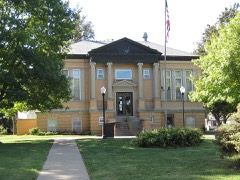
St. Joseph Public Library-Carnegie Branch3.0 miles1999
Nelson-Pettis Farmsteads Historic District3.1 miles1995
Livestock Exchange Building3.3 miles2004
Neely Elementary School4.7 miles2014
Hall School4.8 miles2017

Sources for this property

National Archives recordThe nomination case file for reference 85000941 in Record Group 79.
Wikipedia articleCommunity-written account of this property, licensed CC BY-SA.
Buchanan CountyAll 63 listed properties in this county.

Provenance

  • Listing record. National Park Service National Register of Historic Places, listed-properties dataset, current to 2026-05-22.
  • Map join. Address geocoded through the United States Census geocoder, then tested against the published boundary of every sheet in the USGS Historical Topographic Map Collection.
  • How this page is made. Listing fields come from federal records; map-sheet coverage is a labelled coordinate-to-boundary calculation, not a source-field claim.
  • Wildfire. Short, Karen C. 2022. Spatial wildfire occurrence data for the United States, 1992-2020 [FPA_FOD_20221014]. 6th Edition. Fort Collins, CO: Forest Service Research Data Archive. https://doi.org/10.2737/RDS-2013-0009.6 Collected with United States Government funding and usable without additional permissions or fees.
  • Mines and quarries. USGS Mineral Resources Data System (MRDS) https://mrdata.usgs.gov/mrds/ A work of the United States government, no copyright under 17 U.S.C. 105.