BlockBefore

Buchanan County, Missouri

79 topographic sheets cover 36 settlements here, and 63 properties are on the National Register of Historic Places.

Research this county

From the record

63 National Register listings published here, 1 of them a National Historic Landmark · the county-history sources tell 2 stories and name 298 people · people the book names include James Henry Allison (Rush Township, 1881) · James Anderson (Jackson Township, 1881) (machine-read).

Sources: the county history on the Internet Archive · the National Register database, National Park Service

Missouri within the United States
Buchanan County within Missouri

What the record shows

  • 705 topographic sheet readings cover the county's settlements.
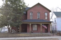
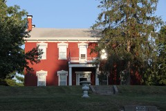
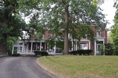
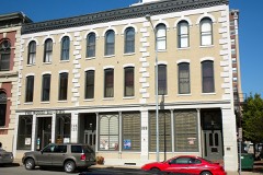
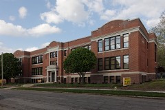
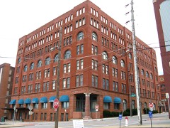
  • 63 properties here are on the National Register of Historic Places: 44 buildings, 18 districts and 1 site.
  • 10 of the 63 listings were added during the 1970s.
  • The Geographic Names Information System records 36 populated places in this county; 36 are covered by at least one topographic sheet.
  • 4 public-domain county histories, 1881 to 1915, supply 56,533 words of narrative reproduced here.

What happened here

2 accounts

Among them: Jasper Wilson; Jasper Wtlson. These passages come from the identified county-history source books. Each inset names its own source and opens the exact section it comes from.

From The History of Buchanan County, Missouri : Containing a History of the County, Its Cities, Towns, Etc., Biographical Sketches of Its Citizens, Buchanan County in the Late War, General and Local Statisics, Portraits of Early Settlers and Prominent Men, History of Missouri, Map of Buchanan County, Etc., Etc, published 1881 - Bloomington Township

Jasper Wilson

farmer, section 14, postoffice DeKalb. His father, James, was a native of North Carolina, and was one of the early pioneers of this county, and was murdered at the beginning of the war in 1861. His mother, Priscilla (Moore), was a native of Tennessee. Jasper was born in Orange County, Indiana, April 8, 1822, and when thirteen years of age' his parents moved to Will County, Illinois, and in the fall of 1837 moved to Buchanan County, Missouri, where he has since resided.

Read the rest of this passage

From The History of Buchanan County, Missouri : Containing a History of the County, Its Cities, Towns, Etc., Biographical Sketches of Its Citizens, Buchanan County in the Late War, General and Local Statisics, Portraits of Early Settlers and Prominent Men, History of Missouri, Map of Buchanan County, Etc., Etc, published 1881 - Bloomington Township

Jasper Wtlson

farmer, section 14, postoffice DeKalb. His father, James, was a native of North Carolina, and was one of the early pioneers of this county, and was murdered at the beginning of the war in 1861. His mother, Priscilla (Moore), was a native of Tennessee. Jasper was born in Orange County, Indiana, April 8, 1822, and when thirteen years of age his parents moved to Will County, Illinois, and in the fall of 1837 moved to Buchanan County, Missouri, where he has since resided.

Read the rest of this passage

Places on the National Register

63

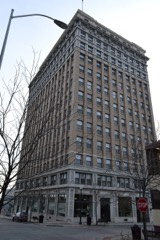
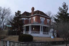
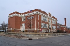
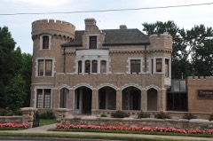
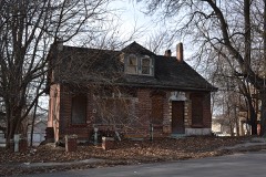
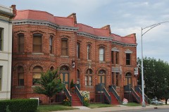
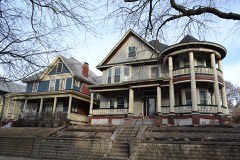
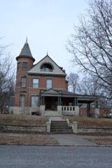
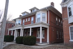
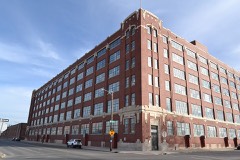
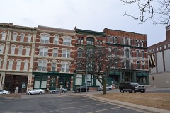
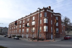
Every property in this county listed on the National Register of Historic Places, with the year it was listed and the federal nomination document.

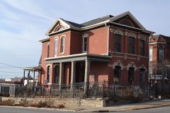
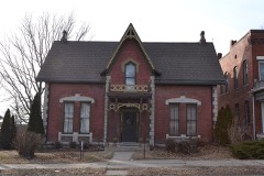
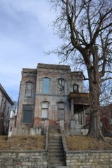
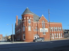
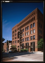
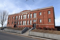
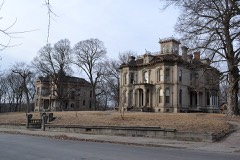
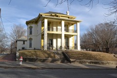
Photograph PropertyType ListedReference
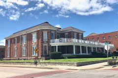
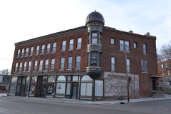
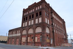
Benton Club of St. Joseph, Thebuilding2017100001687
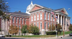
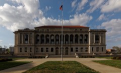
Buchanan County Courthouse (Boundary Decrease)building197878003397
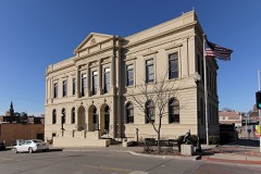
Buchanan County Courthouse and Jailbuilding197272001563
Buchanan County Infirmarybuilding200908001386
Charles A. and Annie Buddy Housebuilding200404000427
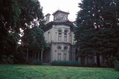
Burnside-Sandusky Gothic Housebuilding200504001518
Cathedral Hill Historic Districtdistrict200000000691
Central Police Stationbuilding200909000887
Central-North Commercial Historic Districtdistrict199191000125
Century Apartmentsbuilding200101000712
Christian Sachau Saloonbuilding198585003358
City Hose Company No. 9building198585003357
Corby-Forsee Buildingbuilding198080002317
Dewey Avenue-West Rosine Historic Districtdistrict200202000816
Edmond Jacques Eckel Housebuilding198080002318
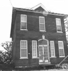
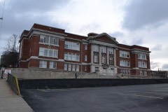
Everett Schoolbuilding200505001023
Enoch Madison Fenton Housebuilding198282003126
Dr. Jacob Geiger House-Maud Wyeth Painter Housebuilding198686000826
German-American Bank Buildingbuilding197878001638
Hall Schoolbuilding2017100000607
Hall Street Historic Districtdistrict197979001352
Harris Addition Historic Districtdistrict200301000723
Alois Herbert Double Housebuilding200706000992
Jesse James Housebuilding198080002319
Kelley and Browne Flatsdistrict198989000991
Kemper Addition Historic Districtdistrict200201000721
Krug Park Place Historic Districtdistrict200202000817
Lawler Motor Company Buildingbuilding200908001285
Livestock Exchange Buildingbuilding200404000342
John Sublett Jr. and Caroline Ashton Logan Housebuilding200706000991
Maple Grovebuilding197474001070
McIntyre-Burri Housebuilding200505001435
Issac Miller Housebuilding198080002320
Miller-Porter-Lacy Housebuilding198282003127
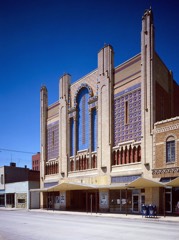
Missouri Theater and Missouri Theater Buildingbuilding197979001353
Missouri Valley Trust Company Historic Districtdistrict197575001063
Mount Mora Cemeterysite200606000626
Museum Hill Historic Districtdistrict199191000112
Museum Hill Historic District (Boundary Increase)district200909000598
Neely Elementary Schoolbuilding201414000328
Nelson-Pettis Farmsteads Historic Districtdistrict199595000587
Patee Town Historic Districtdistrict200202000818
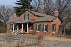
John Patee Housebuilding196666000414
Pleasant Ridge Schoolbuilding198585000941
Pony Express Stablesbuilding197070000322
John D. Richardson Dry Goods Companybuilding198282003128
Robidoux Hill Historic Districtdistrict198989000992
Robidoux Rowbuilding197373001037
Robidoux Schoolbuilding198383000973
Ryan Blockbuilding201312001242
South Fourth Street Commercial Historic Districtdistrict199191000124
St. Joseph City Hallbuilding198585003356
St. Joseph Park and Parkway Systemdistrict199594001566
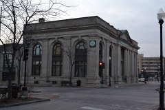
St. Joseph Public Librarybuilding198282003129
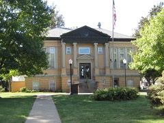
St. Joseph Public Library-Carnegie Branchbuilding199999000595
St. Joseph's Commerce and Banking Historic Districtdistrict200101000709
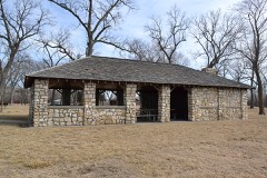
Sugar Lake State Park Open Shelterbuilding198585000522
Thompson-Brown-Sandusky Housebuilding198383004297
Virginia Flatsbuilding199292000586
Vosteen-Hauck Housebuilding198282003130
Western Tablet and Stationery Company, Building #2building200707000814
Wholesale Rowdistrict197777000800
Wyeth Flatsbuilding198585003355

Wildfire, 1995 to 2020

59 fires

Every wildfire the federal occurrence database records inside this county: 59 of them, burning about 1,132 acres. None started naturally and 6 were recorded as arson. Each settlement page carries the fires within five miles of it.

Reported cause Fires
Missing data/not specified/undetermined28
Debris and open burning18
Arson/incendiarism6
Smoking4
Equipment and vehicle use1
Other causes1
Railroad operations and maintenance1

The five largest, by the area the report gives. None of them was recorded as arson.

DateCause SizeReported by Name on the report
20 August 1999Missing data/not specified/undetermined500 acresMissouri Department of Conservationnot named
15 March 2018Missing data/not specified/undetermined150 acresLeavenworth CountyMCGEE
30 November 1999Debris and open burning90 acresMissouri Department of Conservationnot named
12 August 1999Debris and open burning55 acresMissouri Department of Conservationnot named
12 April 2014Debris and open burning40 acresMissouri Department of Conservationnot named
29 February 2020Missing data/not specified/undetermined38 acresMissouri Department of Conservation190309-01180-02292020-1510
30 April 2018Missing data/not specified/undetermined26 acresMissouri Department of Conservation176954-01180-04302018-1750
29 February 2020Missing data/not specified/undetermined24 acresMissouri Department of Conservation190307-01180-02292020-1405

Every settlement page carries the fires within five miles of it - see the settlement index below.

Storms, 1955 to 2025

60 of 492 shown

The NOAA Storm Events Database holds 492 reports for this county, causing 1 death, 23 injuries and about $6,329,280 in recorded property damage. Each settlement page carries the reports that name it.

Kind of event Reports
Thunderstorm Wind245
Hail178
Tornado26
Flash Flood22
Flood20
Funnel Cloud1

The most serious of them, by death, then injury, then recorded damage. The accounts are quoted exactly as the forecast office filed them.

WhenEvent Place namedHarm What the report says
October 1998Flash FloodSt Joseph1 killed, $500,000no account filed
June 1973Tornado (F2)not stated14 hurt, $2,500,000no account filed
May 1985Tornado (F1)not stated3 hurt, $250,000no account filed
April 1965Tornado (F3)not stated2 hurt, $250,000no account filed
May 1971Tornado (F2)not stated2 hurt, $25,000no account filed
June 2009Thunderstorm WindWinthrop2 hurt, $1,000A fifth wheel camper was blown into another camper.
July 2000Thunderstorm WindSt Joseph$1,000,000The highway department reported downed trees up to 4 feet in diameter, and a tree blown down onto a car. A 90-foot flagpole was broken. A building under construction in an industrial park sustained over $1 million in damage.
June 2005Tornado (F0)St Joseph$300,000F0 tornado crossed into Missouri near the Pony Express Bridge. The tornado produced a skipping path through northwest and north portions of St. Joseph. Numerous trees were damaged or uprooted. A few homes also lost their porches. Most damage to homes was caused by falling trees and tree limbs. The tornado exited into Andrew county 2 miles east of I-29 along U.S.Highway 169.
May 1985Tornado (F1)not stated$250,000no account filed
July 1969Tornado (F2)not stated$250,000no account filed
January 1967Tornado (F2)not stated$250,000no account filed
July 1995TornadoN St Joseph$120,000Severe thunderstorms produced golf ball-size hail and downed trees near Cosby. Tornadoes touched down along Route D and over Country Club Village. Near Savanah a lumbar yard was destroyed.
March 2019FloodHurlingen$100,000Once the Missouri River started flooding on March 9, it remained in flood through the remainder of the month. The gauge in St. Joseph, Missouri reached 32.12 feet on March 22 (preliminarily a new record). The flooding was caused by several rounds of heavy snow across the Northern Plains through the winter months, followed by a rapid warm-up and several days of heavy rain. The Missouri River Basin across the Northern Plains flooded with catastrophic consequences as numerous dams and levees failed. As the water flowed into the Missouri River upstream of Buchanan County, the river swelled and ultimately overwhelmed the levees along the river. About 1,500 residents and 6,000 employees of neighboring businesses were ushered out of the southern end of town, a city official said. Most of the evacuated dwellings were trailer homes interspersed among factories, warehouses and stockyards along a stretch of the riverfront known as the Bottoms.| Local fields were also submerged, which delayed the growing season in the region, but several roads were washed away across Atchison County, and I-29 from St. Joseph northward to the Iowa/Missouri border was closed until mid May. Note: The dollar valued assigned to this event is likely inaccurate as a full tally of the extent of the physical damages is unknown. The Missouri River remained in flood through the rest of the month, into April.
April 2008Tornado (EF0)St Joseph$70,000Brief EF0 tornado touchdown at 1930 CST in the southern portion of Saint Joseph. Several buildings were damaged before the tornado lifted at 1932 CST. One injury was reported as well.
May 2007FloodIndustrial City$50,000The Missouri River at Saint Joseph crested at 25.26 feet, or 8.26 feet above flood stage.
June 1998Thunderstorm WindDe Kalb$50,000The Buchanan County Sheriff's Office reported damage to the roof of a school in De Kalb as a result of severe thunderstorm winds. Thunderstorm winds also blew a semi tractor trailer off the road along Highway 59 in South St. Joseph. There was also the report of structural damage to a home in South St. Joseph as a result of the strong winds. St. Joseph Power and Light reported that four main transmission line structures were destroyed in the storm resulting in a power loss for many customers for over 24 hours. Two barns were destroyed between De Kalb and Taos, and several other outbuildings were damaged.
June 2010Thunderstorm WindLake Contrary$40,000Roofs were blown off several trailer roofs. The debris was strewn from southwest to northeast. An unstrapped trailer home was blown off its blocks and rolled. One to two foot diamater trees were blown down. Based on the EF kit, winds were estimated up to 89 mph.
May 2002Thunderstorm WindSt Joseph$30,000200 foot cell telephone tower blown over.
June 2008Thunderstorm WindSt Joseph$25,000Numerous reports of tree damage. Tree was reported down on a house at the 800 block of Main Street. Another tree also fell on a truck.
November 1975Tornado (F1)not stated$25,000no account filed
May 1971Tornado (F2)not stated$25,000no account filed
June 1964Tornado (F1)not stated$25,000no account filed
June 1960Tornado (F2)not stated$25,000no account filed
June 2010Thunderstorm WindLake Contrary$20,000Multiple trailers were damaged by winds, estimated up to 80 mph near Lake Contrary.
June 2004Thunderstorm WindSt Joseph$20,000Car and garage heavily damaged.
August 2011Thunderstorm WindIndustrial City$15,000Missouri Highway Patrol radio tower was blown down. Thunderstorm wind gusts were estimated up to 70 mph.
November 2005Thunderstorm WindFaucett$15,000Siding ripped off building. Also deck damage and TV antennae ripped off of a trailer home. Swing set in yard was destroyed and an above ground pool was damaged.
November 2013Thunderstorm WindLake Contrary$10,000Severe straight line winds, estimated up to 70 mph, destroyed a garage and an outbuilding along Sandy Lane. Hail was also observed to cover the ground, but the size was unknown.
July 2001Thunderstorm WindSt Joseph$10,000Widespread wind damage reported with many trees reported down. Tractor trailer blown over and roof partially blown off.
September 2000HailSt Joseph$10,000The Highway Patrol reported golfball to baseball size hail on the north side of St Joseph. Several windshields were broken by the large hailstones.
April 1995Thunderstorm WindSt. Joseph$10,000Thunderstorm winds gusted to 61 mph (53 knots) at the St. Joseph Rosecrans Airport.
April 1995HailSouth St. Joseph$10,000no account filed
July 1995Thunderstorm WindArcadia$8,000Severe thunderstorm winds tore a roof off of a house.
September 2013Thunderstorm WindSt Joseph$7,000Damage was reported to an ongoing construction site, of a new Hyvee gas station, at the intersection of Faraon Street and Belt Highway. Walls were blown over. Thunderstorm wind gusts were estimated up to 60 mph.
May 1996Thunderstorm WindSt Joseph$7,000no account filed
July 2022Flash FloodSt Joseph$5,000Widespread heavy rain accumulated approximately 3 to 4 inches of water in the St. Joseph area. There were not many impacts from this rain, but there was a single water rescue reported in St. Joseph. No injuries occurred from this heavy rain and flooding.
July 1999Thunderstorm WindFaucett$5,000Thunderstorm winds blew the roof off of a barn.
May 1996Thunderstorm WindSt Joseph$5,000no account filed
May 2013Thunderstorm WindHurlingen$2,000Power poles were reported down, with thunderstorm wind gusts estimated up to 70 mph.
June 2009Thunderstorm WindAgency$2,000Powerlines were reported down.
August 2006Thunderstorm WindFaucett$2,000Trees and power lines down.
June 1995Thunderstorm WindSt. Joseph$2,000Severe thunderstorm winds knocked down large tree limbs southwest of St. Joseph.
July 2010Thunderstorm WindSouth St Joseph$1,000A power pole was reported snapped off on Pickett Road.
August 2010Thunderstorm WindSaxton$1,000Numrous vendor tents were blown down, at the Kansas City Chiefs training camp, at Missouri Western State College. Debris was strewn about the practice field, with winds estimated up to 60 mph.
August 2007Thunderstorm WindSt Joseph$1,000Power lines down in the city of St. Joseph.
April 1956Tornado (F1)not stated$250no account filed
May 1962Tornado (F1)not stated$30no account filed
May 2025Thunderstorm WindAgency-Several reports of downed wires and power outages south of St. Joseph.
May 2025Thunderstorm WindAgency-Social media video of a downed tree on power lines in southeast Saint Joseph.
May 2025Thunderstorm WindLake Contrary-Side of industrial building damaged with wall collapse.
May 2025Thunderstorm WindSouth St Joseph-Downed wires and power outages near King Hill Road.
May 2025Tornado (EF0)South St Joseph-Storm survey found evidence of a 4 mile long EF-0 tornado in northern Buchanan County, with only minor tree damage found along the path. This was associated with a QLCS mesovortex.
May 2025Thunderstorm WindSan Antonio-Downed trees in the Easton area.
March 2025Thunderstorm Wind(Stj)St Joseph Mem A-St. Joseph ASOS measured another 58 mph wind gust.
March 2025Thunderstorm WindRushville-Downed wires and numerous power outages between Rushville and De Kalb.
March 2025Thunderstorm WindAgency-Fence blown over and minor property damage at a residence in Agency.
March 2025Thunderstorm Wind(Stj)St Joseph Mem A-St. Joseph ASOS measured a 58 mph wind gust.
June 2025Thunderstorm WindSaxton-Downed tree and wires near 82nd Road.
June 2025Thunderstorm WindSaxton-Downed tree near Whitson Road and 80th Road.
June 2025Thunderstorm WindSaxton-Downed tree near U.S. Highway 169 and 75th Road.

Mines and quarries

66 recorded

The Survey's mineral resources record lists 66 workings inside this county. 3 still produce and 63 are closed or unrecorded. Each settlement page carries the workings within five miles of it.

Commodity Workings
Stone, Crushed/Broken59
Sand and Gravel, Construction7

The least common of them first, because a county's hundredth gravel pit says nothing its first ten did not.

Where SiteCommodity StatusRecorded
St Joseph DredgeSand and Gravel, ConstructionProducer
UnknownSand and Gravel, ConstructionPast Producer
City QuarryStone, Crushed/BrokenPast Producer
City Quarry #2Stone, Crushed/BrokenPast Producer
Dearborn QuarryStone, Crushed/BrokenPast Producer
Everett QuarryStone, Crushed/BrokenPast Producer
Everett Quarry No 54Stone, Crushed/BrokenProducer
Fanning QuarryStone, Crushed/BrokenProducer
Farmer & Dunn QuarryStone, Crushed/BrokenPast Producer
Franks QuarryStone, Crushed/BrokenPast Producer
Heuemander QuarryStone, Crushed/BrokenPast Producer
Heumander QuarryStone, Crushed/BrokenPast Producer
Mathews QuarryStone, Crushed/BrokenPast Producer
Roth QuarryStone, Crushed/BrokenPast Producer
South St Joe QuarryStone, Crushed/BrokenPast Producer
Spencer #1 QuarryStone, Crushed/BrokenPast Producer
Spencer #2 QuarryStone, Crushed/BrokenPast Producer
Steele QuarryStone, Crushed/BrokenPast Producer
UnknownStone, Crushed/BrokenPast Producer

The townships, in 1881

56,533 words

The History of Buchanan County, Missouri : Containing a History of the County, Its Cities, Towns, Etc., Biographical Sketches of Its Citizens, Buchanan County in the Late War, General and Local Statisics, Portraits of Early Settlers and Prominent Men, History of Missouri, Map of Buchanan County, Etc., Etc devotes a chapter to each township: its boundaries and streams, who settled it and when, the mills, the schools and the churches. All 10 are reproduced here in full. Each row shows the township's own shape and where it lies in the county, drawn from the Census Bureau's boundary. Which settlements belong to which township is computed from that same boundary, not taken from the book.

The county's history books

982,078 words

3 books written about this county, cut here where the book itself is cut, at its printed chapters: 102 chapters in all. Every chapter is public domain, machine-read from the scan and reproduced complete. A chapter already given under one of the county's towns is not repeated in this list.
The History of Buchanan County, Missouri : Containing a History of the County, Its Cities, Towns, Etc., Biographical Sketches of Its Citizens, Buchanan County in the Late War, General and Local Statisics, Portraits of Early Settlers and Prominent Men, History of Missouri, Map of Buchanan County, Etc., Etc (1881)

ChapterLength
Chapter 1: Louisiana Purchase2,503 words
Chapter 3: Geology of Missouri2,472 words
Chapter 4: Title and Early Settlements1,866 words
Chapter 6: Application of Missouri to Be Admitted I^ft0 the Union - Agitation of the Slavery Question-" Missouri Compromise "-Constitutional Convention1,956 words
Chapter 8: Early Military Record1,936 words
Chapter 9: Civil War in Missouri2,394 words
Chapter 10: Agriculture and Material Wealth1,697 words
Chapter 11: Education1,831 words
Chapter 12: Religious Denominations1,970 words
Prefatory3,312 words
Physical Features3,314 words
Chapter 3: Geology of Buchanan County1,644 words
Chapter 4: Platte Purchase3,350 words
Chapter 5: Early Settlements9,270 words
Chapter 6: Pioneer Life4,724 words
Chapter 7: Legislative Act Organizing Buchanan and Platte Counties - Appointment6,425 words
Chapter 8: The First Records2,570 words
Chapter 9: First Court House3,124 words
Chapter 10: Second Court House, Ordered to Be Built at Sparta - Six Thousand Dollars to Be Appropriated Therefor-Agitation of the County Seat Question3,472 words
Chapter 11: Mexican War - Oregon Expedition1,555 words
Chapter 12: The California Gold Excitement3,474 words
The County Lunatic Asylum, Poor House and Farm4,684 words
Chapter 15: Bench and Bar10,018 words
Chapter 16: Crimes, Incidents and Accidents16,568 words in 2 parts
Chapter 17: Review of the Progress of Agricultural Enterprise-Fairs and Exp0sitions6,102 words
Reunion11,974 words
Chapter 19: Buchanan County During the War2,820 words
Chapter 20: Court House5,006 words
Churches in Rural Districts2,005 words
Schools7,260 words
Chapter 1: Introductory1,569 words
Chapter 2: Early Expeditions and Settlements4,248 words
Chapter 3: From 1840 to 18433,847 words
Chapter 4: Old Settlers and What They Did6,707 words
Chapter 5: City Officers - 1845 to 18815,095 words
Chapter 7: Churches of St. Joseph12,267 words
Chapter 8: Secret and Benevolent Societies in Buchanancounty7,894 words
Chapter 9: Public Schools of St. Joseph12,642 words
Chapter 10: Railroads5,981 words
Trade, Commerce, Etc7,674 words
Chapter with an unread heading (no. 42 of those read)6,187 words
Horack Greeley-Lincoln -Seward - Seward's Speech-Grant-Sherman-Hayes4,728 words
Chapter 14: The Great Iron Bridge and Union Depot3,876 words
Chapter 15: The Fire Department of St. Joseph678 words
Biographical sketches186,933 words in 12 parts

The Daily News' History of Buchanan County and St. Joseph, Mo. : from the Time of the Platte Purchase to the End of the Year 1898 : Preceded by a Short History of Missouri : Supplemented by Biographical Sketches of Noted Citizens, Living and Dead (1900)

ChapterLength
Chapter 1 (1 of 2 so headed)1,999 words
Chapter 3: The Civil War. - Agitation of the Abolition of1,792 words
Chapter 4: Second Session of the Convention. - Hamilton R. Gamble Made Governor, Willard P. Hall1,599 words
Chapter 6: Missouri's Representatives in the United States Senate from Benton and Barton to the Present. - First Members of the Lower2,117 words
Chapter 7 (1 of 2 so headed)3,172 words
Chapter 1 (2 of 2 so headed)1,761 words
Chapter 2: Buchanan County Formed and Named. - First County Court, Sheriff and Surveyor. -1,330 words
Chapter 3: The Courts of Buchanan County. - First Session of the Circuit Court. - Judges from 1839 to2,007 words
County Offices and the Incumbents Thereof, from the Earliest Days to the Present Time. - Prosecutors, Clerks of Circuit2,748 words
Chapter 53,444 words
Chapter 63,976 words
Chapter 7 (2 of 2 so headed)3,150 words
Chapter 8: A Review of the Progress of St. Joseph from the Overland Period to the Present Time. -2,058 words
Chapter 9: The Municipal Government of St. Joseph. - the Old City Charter and the Evils That Were3,488 words
Chapter 10: The Police Department of St. Joseph, Its History and the Various Chiefs from the Begi N X Inc T( ) the Present Time. - the Police2,550 words
Chapter 113,491 words
Chapter 12: Municipal Offices and Their Incumbents. - the Board of Town Trustees, and the City Council. - President and Mayor, Clerk, Register3,046 words
Chapter 133,085 words
Chapter 14: Buchanan County's Three Court Houses - the Court House Fire in March of 1885. - the First Market House and City Hall and the2,603 words
Chapter 15: The Public and Private Charities of Buchanan County and St. Joseph. - History of Asylum No. 2. - the County Paupers and How They3,340 words
Chapter 16: The Schools of Buchanan County and St. Joseph-Primitive Schools of Early Days - the Public Schools; How They Are Supported4,714 words
Chapter 17: St. Joseph Branches of Federal Service. - the1,957 words
Chapter 18: Religion in Buchanan County and St. Joseph. - the First Preachers and the First Churches. - a Review of the Progress of the5,365 words
Chapter 19: Buchanan County and St. Joseph in War. - the9,568 words
Chapter 20: The Days of the Steamboat. - St. Joseph As the Business Center and Distributing Point of River Traffic. - a List of the Boats That3,248 words
Chapter 21: The Railroads of St. Joseph. - Early Struggles of Railroad Projectors and Builders. - the Hannibal & St. Joseph, the K. C., St. J. & C. B.5,744 words
Chapter 225,722 words
Chapter 23: Legal Executions. - Otis Jennings, the First Man to Die Upon the Scaffold in Buchanan County. - Execution of Green, the Slave4,424 words
Chapter 24: Some of the Casulties That Have Occurred in Buchanan County and St. Joseph. - the Platte River Bridge Disasters. - Collapse2,616 words
Chapter 25: The Fairs of Former Days. - the First Effort When the Grounds Were Located on North Eleventh Street. - the Fairs at the East End2,538 words
Chapter 26: Industries of the Past and What Some of Them Have Led to in the Present. - Hemp Raising5,879 words
Chapter 272,422 words
Chapter 28: The Banks and Financial Institutions That Have Existed in St. Joseph in the Past, and Those That Live in the Present. - Various3,963 words
Chapter 29: Reminiscences. - Negro Slavery in Buchanan County. - Recollections of Rev. Moses Lard6,197 words
Biographical sketches81,652 words in 6 parts

History of Buchanan County and the City of St. Joseph and Representative Citizens : 1826 to 1904 (1904)

The people it describes

298 named

Everyone The History of Buchanan County, Missouri : Containing a History of the County, Its Cities, Towns, Etc., Biographical Sketches of Its Citizens, Buchanan County in the Late War, General and Local Statisics, Portraits of Early Settlers and Prominent Men, History of Missouri, Map of Buchanan County, Etc., Etc stops to write about, with the section that describes them. Among them are the men who founded the place and governed the Territory. Each name opens the passage itself, in the words of 1881.

Every populated place in the county

36

Named settlements recorded in the Geographic Names Information System, each with the topographic sheets covering it. Villages, hamlets and abandoned places alike. Each is shown with the nearest named watercourse or landform and the survey quadrangle it falls on.

The vanished settlements of Buchanan County: the places named above that are no longer on the map.

Provenance

  • Topographic sheets. USGS Historical Topographic Map Collection, county index, measured from the bulk metadata.
  • Fire insurance maps. Library of Congress Sanborn collection, faceted to this county.
  • Photographs. Each place queried individually against the Library of Congress Prints and Photographs search.
  • Wildfire. Short, Karen C. 2022. Spatial wildfire occurrence data for the United States, 1992-2020 [FPA_FOD_20221014]. 6th Edition. Fort Collins, CO: Forest Service Research Data Archive. https://doi.org/10.2737/RDS-2013-0009.6 Collected with United States Government funding and usable without additional permissions or fees.
  • Mines and quarries. USGS Mineral Resources Data System (MRDS) https://mrdata.usgs.gov/mrds/ A work of the United States government, no copyright under 17 U.S.C. 105.
  • Storms. NOAA National Centers for Environmental Information, Storm Events Database https://www.ncei.noaa.gov/stormevents/ A work of the United States government, no copyright under 17 U.S.C. 105. Narratives are quoted verbatim from the National Weather Service report and are not edited or summarised.