 Block
From the record
One of 6 National Register listings published here for Iron County · listed in 1998 · category: District.
Sources: the case file at the National Archives · the National Register database, National Park Service
Listed on the National Register of Historic Places in 1998.
One of 6 National Register listings published here for Iron County · listed in 1998 · category: District.
Sources: the case file at the National Archives · the National Register database, National Park Service
Regional context, not property-specific evidence. The federal wildfire occurrence database lists 35 fires within 5 miles of Ursuline Academy-Arcadia College Historic District between 1992 and 2017, burning about 508 acres in total. 1 started naturally. 4 were recorded as arson. Distance is straight-line from the map coordinates, so a fire counted here may appear on a neighbouring settlement's page as well.
| Reported cause | Fires |
|---|---|
| Debris and open burning | 16 |
| Missing data/not specified/undetermined | 5 |
| Arson/incendiarism | 4 |
| Equipment and vehicle use | 3 |
| Recreation and ceremony | 3 |
| Misuse of fire by a minor | 2 |
| Natural | 1 |
| Smoking | 1 |
The most recent of them, most recent first, with the day each was reported and the service that recorded it.
| Date | Cause | Size | Reported by | Name on the report |
|---|---|---|---|---|
| 3 September 1996 | Recreation and ceremony | 10 acres | Missouri Department of Conservation | not named |
| 2 September 1995 | Debris and open burning | 2.0 acres | Missouri Department of Conservation | not named |
| 30 July 1997 | Missing data/not specified/undetermined | 1.0 acres | Missouri Department of Conservation | not named |
| 12 May 1997 | Smoking | 223 acres | Mark Twain National Forest | LAKE KILLARNEY |
| 7 April 2013 | Debris and open burning | 8.3 acres | Mark Twain National Forest | 334 |
| 6 April 2000 | Arson/incendiarism | 102 acres | Mark Twain National Forest | TURKEY FOOT |
| 4 April 1992 | Misuse of fire by a minor | 1.0 acres | Missouri Department of Conservation | not named |
| 29 April 1992 | Equipment and vehicle use | 1.0 acres | Missouri Department of Conservation | not named |
Regional context, not property-specific evidence. The federal mineral resources record lists 31 workings within 5 miles of Ursuline Academy-Arcadia College Historic District: 26 past producers, 2 occurrences, 2 prospects, 1 producer. 1 still produces. What was taken out: Iron, Limestone, Dimension, Iron, Manganese, Manganese. Distance is straight-line from the map coordinates, so a quarry counted here may appear on a neighbouring settlement's page as well.
| Where | Site | Commodity | Status | Recorded |
|---|---|---|---|---|
| Cuthbertson Mtn Mine | Manganese, Iron | Past Producer | ||
| Shepherd Mountain | Iron, Sulfur, Phosphorus-Phosphates | Past Producer | 1815 | |
| Jones Quarry | Stone, Crushed/Broken | Past Producer | ||
| Unknown - Ls | Stone, Crushed/Broken | Past Producer | ||
| Russel Property | Manganese | Past Producer | ||
| Unknown - Manganese | Manganese | Past Producer | ||
| Unknown - Manganese | Manganese | Prospect | ||
| Buford Mtn Mine | Iron, Manganese | Past Producer | ||
| Cuthbertson's Hill | Iron, Manganese | Occurrence | ||
| John Baird Property | Iron, Manganese | Past Producer |
Regional context, not property-specific evidence. The National Weather Service names Arcadia, the town this property stands in, in 8 storm reports between 1994 and 2024: 4 thunderstorm wind, 2 hail, 1 lightning, 1 tornado. The reports record 4 injuries. Each account below is quoted exactly as the forecast office filed it, from the NOAA Storm Events Database, and each date opens the federal record of that event.
| When | Event | Place named | Harm | What the report says |
|---|---|---|---|---|
| July 2000 | Lightning | Arcadia | 4 hurt | Four Boy Scouts were injured by a lightning strike while camping on Taum Sauk Mountain, the highest peak in Missouri. The lightning hit a pine tree about 130 feet away. The electricity apparently went through the roots into the boys tent, blowing 4 holes into the bottom of the tent. One boy was knock unconscious. He was not breathing and would likely have died were it not for CPR applied by one of the Scout Leaders. The other boys suffered burns from first to third degree on their backs and arms. |
| May 2024 | Tornado (EF1) | Arcadia | - | A tornado touched down in the southwestern portion of Arcadia, near the intersection of W. Maple Street and S. Main Street. As it tracked to the east it uprooted or snapped off several large trees as it crossed Highway 21 and tracked along Highway 72. It eventually moved northeast, skirting the south shore of Lake Killarney snapping off more trees before lifting and dissipating near Ozark Drive. Overall, the tornado was rated EF1 with a path length of 4.08 miles and a max path width of 100 yards. No deaths or injuries were reported. |
| May 2017 | Thunderstorm Wind | Arcadia | - | Thunderstorm winds blew down numerous large trees and power lines along Highway 21 and Route E. |
| May 2011 | Thunderstorm Wind | Arcadia | - | Thunderstorm winds blew down numerous trees between Johnson Shut-Ins State Park and Ironton. |
| April 1994 | Hail | Arcadia | - | Hail reached dime-size just south of Arcadia. |
| March 2006 | Hail | Arcadia | - | no account filed |
| October 2001 | Thunderstorm Wind | Arcadia | - | no account filed |
| September 2000 | Thunderstorm Wind | Arcadia | - | no account filed |
No historic map-sheet match is published for this property yet. That does not mean no map exists. This record needs a coordinate-quality review before it can be joined to a sheet boundary. Browse the county's mapped places while that work is pending.
Other National Register properties close enough to walk or drive between, ordered by distance from this one. Both positions come from the same geocoding pass that matched these properties to their map sheets.
| Photograph | Property | Distance | Listed |
|---|---|---|---|
 | Iron County Courthouse Buildings | 1.1 miles | 1979 |
 | St. Paul's Episcopal Church | 1.2 miles | 1969 |
 | Ironton Lodge Hall | 1.3 miles | 2013 |
 | Immanuel Evangelical Lutheran Church | 3.1 miles | 1979 |
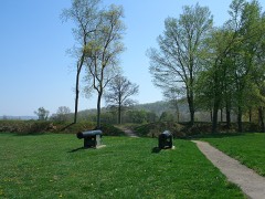 | Fort Davidson | 3.3 miles | 1970 |
| National Archives record | The nomination case file for reference 98000816 in Record Group 79. |
| Iron County | All 6 listed properties in this county. |