Block
From the record
90 National Register listings published here, 1 of them a National Historic Landmark.
Sources: the National Register database, National Park Service
139 topographic sheets cover 56 settlements here, and 90 properties are on the National Register of Historic Places.
90 National Register listings published here, 1 of them a National Historic Landmark.
Sources: the National Register database, National Park Service
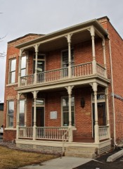
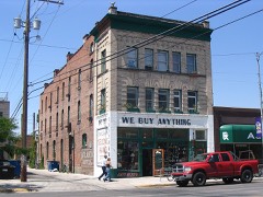
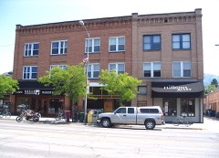
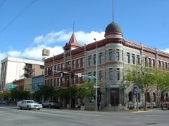
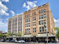
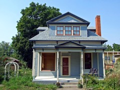
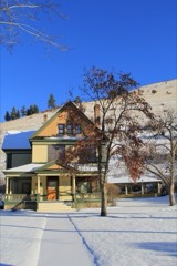
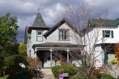
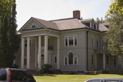
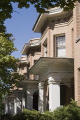
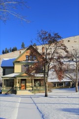
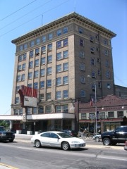
Every property in this county listed on the National Register of Historic Places, with the year it was listed and the federal nomination document.
Every wildfire the federal occurrence database records inside this county: 4,864 of them, burning about 397,234 acres. 1,755 started naturally and 67 were recorded as arson. Each settlement page carries the fires within five miles of it.
| Reported cause | Fires |
|---|---|
| Natural | 1755 |
| Missing data/not specified/undetermined | 1368 |
| Debris and open burning | 723 |
| Recreation and ceremony | 561 |
| Equipment and vehicle use | 107 |
| Power generation/transmission/distribution | 88 |
| Arson/incendiarism | 67 |
| Fireworks | 63 |
| Smoking | 49 |
| Misuse of fire by a minor | 38 |
| Railroad operations and maintenance | 37 |
| Other causes | 8 |
The five largest, by the area the report gives. None of them was recorded as arson.
| Date | Cause | Size | Reported by | Name on the report |
|---|---|---|---|---|
| 24 July 2017 | Natural | 147,529 acres | Lolo National Forest | RICE RIDGE |
| 15 July 2017 | Natural | 53,902 acres | Lolo National Forest | LOLO PEAK |
| 3 August 2007 | Natural | 36,388 acres | Flathead Agency | JOCKO LAKES |
| 15 July 2017 | Natural | 30,580 acres | Flathead Agency | LIBERTY |
| 9 August 2003 | Natural | 25,202 acres | Lolo National Forest | MINERAL/PRIMM |
| 4 August 2000 | Natural | 17,817 acres | Lolo National Forest | UPPER NINEMILE |
| 10 August 2003 | Natural | 11,300 acres | Flathead National Forest | CRAZY HORSE |
| 14 August 2007 | Missing data/not specified/undetermined | 10,766 acres | Southwestern Land Office | BLACK CAT |
Every settlement page carries the fires within five miles of it - see the settlement index below.
The NOAA Storm Events Database holds 273 reports for this county, causing 2 deaths, 6 injuries and about $8,298,530 in recorded property damage. Each settlement page carries the reports that name it.
| Kind of event | Reports |
|---|---|
| Hail | 117 |
| Thunderstorm Wind | 109 |
| Flood | 21 |
| Heavy Rain | 12 |
| Flash Flood | 3 |
| Lightning | 3 |
| Dust Devil | 3 |
| Tornado | 2 |
| Wildfire | 2 |
| Funnel Cloud | 1 |
The most serious of them, by death, then injury, then recorded damage. The accounts are quoted exactly as the forecast office filed them.
| When | Event | Place named | Harm | What the report says |
|---|---|---|---|---|
| July 1998 | Lightning | Missoula | 1 killed, 1 hurt | no account filed |
| July 1998 | Thunderstorm Wind | Missoula | 1 killed, $260,000 | no account filed |
| August 2003 | Dust Devil | Nine Mile | 3 hurt | no account filed |
| July 2002 | Thunderstorm Wind | Missoula | 1 hurt | no account filed |
| July 2002 | Lightning | Missoula | 1 hurt | no account filed |
| July 2024 | Thunderstorm Wind | Lolo Hot Spgs | $4,000,000 | A state of emergency was declared by both the Missoula County Commission Chair and Missoula Mayor because of the unprecedented wind damage that occurred. The 80 to 100 mph winds brought thousands of trees down across the county. It wasn't just a quick gust, but rather high winds that lasted for a couple of minutes. This led to power and transmission poles breaking in half and triggering power outages that lasted for up to a week after, affecting close to 40,000 customers, many of which had to toss out spoiled food. One utility reported 80 power poles were broken across their service area with 42 of those knocked down or shattered along Mullan Road, located approximately 7 miles west of US-93. Many traffic lights did not work until two days after the event. The Missoula County 911 call center received over 600 calls with many people not getting through. The main repeater on Horseback Ridge, located southwest of Missoula, went down because of the wind and firefighters could only use line-of-sight radio communication throughout the night. Natural gas meters and natural gas lines were damaged. The DNRC gave a conservative estimate that 1,000 city trees were uprooted, splintered at the truck or suffered some other total failure. Their Missoula Campus lost 52 mature ponderosa pines, and over 25 tree species. Water conservation restrictions were put up in place because the Missoula Water was running on generators. Many parts of the city were shut down including parks and mainstem rivers due to downed power lines. Live power lines trapped many people traveling through the city, including two teenagers who sat in their car for over an hour until rescue personnel could reach them in the Lower Miller Creek area. Over a hundred homes had some sort of shingle or siding damage, and many could not get roofers to fix it until 2 months later. Portions of the Blackfoot River were closed due to downed power lines and damaged power poles and lines were also reported in the Clinton, Salmon Lake, Condon and Seeley Lake areas. |
| June 2012 | Thunderstorm Wind | (Mso)Missoula Intl A | $1,500,000 | Multiple tree branches were broken across the Pleasant View subdivision. Lawn furniture swing was thrown 10 yards from the back to front yard of a residence. |
| August 2015 | Thunderstorm Wind | (Mso)Missoula Intl A | $1,000,000 | A macroburst brought damaging winds to the city of Missoula. A 74 mph wind gust was measured at the Missoula airport, but a majority of the damage occurred towards the |South Hills area. Major power lines and large trees were knocked down, and some residents were without power for four days. A local power company reported that several power poles, rated at 80 mph, were snapped in half. Over a million dollars in damages is estimated for this event. |
| May 2018 | Flood | Post | $450,000 | Low lying areas adjacent to the Clark Fork River below Missoula to Frenchtown were flooded. The river also flooded numerous homes in the vicinity of Harpers Road from both surface water and groundwater; some homes were evacuated by Missoula County Sheriff's Department. Sandbagging of homes occurred on Mallard Way to keep from flooding. |
| August 2003 | Wildfire | Missoula | $250,000 | no account filed |
| August 2024 | Thunderstorm Wind | Seeley Lake Arpt | $100,000 | Social media reported lots of damage in Seeley Lake. Essential travel only was declared at about 5:17pm MST and lifted on Aug 24 at 5:46pm MST. Social media produced several images of trees down on houses and decks. |
| April 2004 | Thunderstorm Wind | Nine Mile | $100,000 | no account filed |
| June 2021 | Thunderstorm Wind | Clearwater Junction | $75,000 | Strong southerly outflow winds of 45 to 60 mph downed hundreds of live trees, primarily ponderosa and larch varieties. Most of the trees were uprooted but a few had tops blown out. The main area of damage extended from Salmon Lake to the Seeley Lake area with isolated areas of damage around the Morrell Falls trailhead and near Condon. Multi-hour power outages were common along with several vehicles damaged by fallen trees. In addition, hikers were stranded by fallen trees for a time at the Morrell Falls trailhead. |
| July 2017 | Thunderstorm Wind | Seeley Lake | $60,000 | Multiple trees of varying thicknesses were either blown over or snapped in the Lake Alva campground. One spruce tree larger than 20 inches in diameter fell lengthwise onto a camper, totaling the trailer but sparing an infant in a bassinet. Another camper was also damaged as a tree fell lengthwise onto it but no one was injured. Property damage of both campers was estimated to be sixty thousand dollars. |
| May 1994 | Thunderstorm Wind | West of Missoula | $50,000 | Powerlines and trees were blown down. |
| August 1993 | Thunderstorm Wind | Missoula | $50,000 | Strong winds destroyed a tent at the Western Montana Fair and blewdown several trees. |
| August 1993 | Thunderstorm Wind | Missoula | $50,000 | Trees and powerlines were downed by thunderstorm winds. |
| June 2011 | Flood | Missoula Southwest | $40,000 | Streets and homes were flooded in the Orchard homes area of the city of Missoula. |
| July 2003 | Dust Devil | Missoula | $40,000 | no account filed |
| June 2003 | Thunderstorm Wind | Missoula | $30,000 | no account filed |
| August 2003 | Thunderstorm Wind | Missoula | $25,000 | no account filed |
| July 2021 | Thunderstorm Wind | (Mso)Missoula Intl A | $20,000 | An outflow wind from a northerly moving thunderstorm produced strong to severe winds from roughly 6-7 pm MDT, with a peak gust of 64 mph at Missoula Intl. Airport. These winds caused downed trees and powerlines, and also damaged a roof. The outflow boundary snapped a tree north of Seeley Lake at 7 MDT. The first reported downed tree happened at 5:52 pm MDT in the Mullan Trail area. Additionally, a homeless camp in South Missoula suffered ripped tents. |
| June 2012 | Thunderstorm Wind | (Mso)Missoula Intl A | $20,000 | Missoula International airport reported damage to a hanger door, a portable jet way rolled into a couple of planes, a sign fell on a rental car and roof damage. A large tree fell over at the National Weather Service office. Tree branches were broken off across western Missoula. |
| April 2012 | Thunderstorm Wind | Missoula | $18,000 | The broadcast media reported a tree limb fell and crushed an outbuilding in the Orchard homes development at 315pm. |
| April 2018 | Flood | Seeley Lake | $15,000 | Increasing water levels in Seeley Lake, as well as a rising water table lead to flooding of 15 to 20 homes. Most of the flooding occurred on the southwest side of Seeley Lake near C Street where water had surrounded 10 to 15 homes. Several homes in the town of Seeley Lake also had groundwater-filled basements. |
| April 2018 | Flood | Missoula Southwest | $15,000 | Increasing river levels and a rising ground water table resulted in flooding around ten homes in the Orchard Homes subdivision of Missoula. The main impacts observed were water covering parts of Tower Street and Kehrwald Drive with adjacent homes being surrounded by water. Some of the affected homes also had basements fill with water. The full details including damages are in the May report. |
| June 2012 | Hail | Desmet | $15,000 | Hail damaged roof shingles and sidings from homes. Several cars were also damaged. |
| August 2008 | Thunderstorm Wind | Clinton | $15,000 | National Weather Service employee reported the metal roof on the Rock Creek Lodge was blown off from thunderstorm winds. |
| August 2024 | Thunderstorm Wind | Desmet | $10,000 | A severe thunderstorm produced a gust of 67 mph at the ASOS at the Missoula Airport. An NWS employee estimated a gust to 90 mph in Frenchtown. A mesonet site in Turah measured a gust of 54 mph. There were reports of trees across the roads in Missoula. The power company showed a few thousand without power. |
| May 2024 | Thunderstorm Wind | Potomac | $10,000 | Several large, mature trees were uprooted. One tree landed on a car in Johnsrud Park and completely crushed it. Windspeed estimated from Beaufort Scale. |
| August 2008 | Thunderstorm Wind | Clinton | $10,000 | National Weather Service employee reported 2 tree tops blown off with structural damage to a neighbor's roof. Winds estimated to be 53 mph. |
| August 2013 | Thunderstorm Wind | (Mso)Missoula Intl A | $7,000 | The Missoula International airport ASOS reported a gust to 54 mph from the south-southeast direction. An intense thunderstorm near Florence produced a strong outflow that traveled north into the Missoula Valley causing multiple trees to be uprooted, downed power lines, & damage to a tent at the Western Montana Fair. The Missoula 911 dispatch reported at least 13 calls related to either power outages or lines down. |
| June 2012 | Hail | (Mso)Missoula Intl A | $6,000 | Hail damaged cars parked outside the National Weather Service office at the Missoula International airport. |
| August 2008 | Thunderstorm Wind | Nimrod | $6,000 | National Weather Service employee reported several cottonwood trees blown down along Interstate 90, 4 miles west of Nimrod. The trees fell onto the highway obstructing traffic. |
| August 2025 | Heavy Rain | Missoula | $5,000 | A public report described torrential rain of approximately 20 minutes in duration and roadway ponding near Bernices Bakery around 1600MST; additionally, the roof of new annex started leaking. |
| August 2023 | Thunderstorm Wind | Lolo Hot Spgs | $5,000 | Radar velocity data indicated wind speeds over 50 knots. An emergency manager reported a tree falling on a house in Target Range. A wind gust of 51 mph was recorded at the Missoula International Airport. |
| August 2023 | Thunderstorm Wind | Lolo | $5,000 | Multiple car crashes were reported on Interstate-90 near Missoula as a thunderstorm with strong winds and heavy rain moved through. A wind gust of 52 mph was recorded at the Missoula International Airport, with the main core of the storm passing to the east of the airport. |
| May 2018 | Thunderstorm Wind | Missoula | $5,000 | Several large trees were uprooted and fell onto two cars and a house. The Missoula International Airport ASOS reported a gust to 48 mph while a sensor on top of Mount Sentinel recorded a 68 mph wind gust. A local power company reported at least 2,000 customers were without power for at least three hours. |
| August 2016 | Thunderstorm Wind | Missoula | $5,000 | Two transmission poles located in the South Hills area of Missoula were knocked out by the wind which caused a power outage. Multiple trees were pushed over by the wind including a 50 foot Ponderosa Pine tree that fell onto a home. A NWS employee reported that a Maple tree was snapped in half at the corner of Mount and Brooks Street. |
| August 2013 | Thunderstorm Wind | Seeley Lake | $5,000 | The Missoula 911 dispatch reported multiple trees and power lines down on Whitetail Dr and Dolly Varden Dr. |
| May 1993 | Thunderstorm Wind | Missoula | $5,000 | no account filed |
| August 2009 | Thunderstorm Wind | Missoula | $4,000 | Thunderstorms that moved from the Bitterroot Valley northward to the Missoula Valley, blew down two rotten cottonwood trees in Hamilton, and three trees in the city of Missoula. |
| May 2013 | Thunderstorm Wind | Orchard Homes | $3,000 | Power lines were reported down across Mullan Rd. Large tree branches were reported down at the Missoula Country Club golf course. Large trees were also reported down in the university district and along Daly Avenue. |
| August 2024 | Thunderstorm Wind | Missoula Southwest | $2,000 | Missoula County reported eastbound traffic closed at Reserve Street as well as westbound at Paxon St for a tree in the road. The power company reported over 1000 customers without power. The ASOS at Missoula Airport measured a gust of 72 mph. |
| August 2023 | Thunderstorm Wind | Seeley Lake Arpt | $2,000 | A weather spotter reported that a large tree, approximately 18 inches in diameter, fell down one mile east of Seeley Lake. Trees were also reported down on Morrell Creek Road and 13 miles south of Condon, on Highway-83. A couple hundred customers lost power near Condon. |
| August 2016 | Thunderstorm Wind | Lolo | $2,000 | The Missoula dispatch reported a lot of tree limbs down around town with numerous power lines down. A couple of lightning strikes started fires with one strike to a house in Missoula and a field in Florence. A private weather sensor located southeast of Lolo recorded a wind gust to 60 mph ahead of the main thunderstorm cells. |
| July 2025 | Thunderstorm Wind | Nagos | $1,000 | In East Missoula, a wedding tent was collapsed by the winds. Northwest of the Wye, gusts were estimated to be over 50 mph. The University of Montana campus also sustained damage, with several downed trees, one of which fell onto a roof. |
| August 2015 | Thunderstorm Wind | Lolo | $1,000 | NWS employee reported a power outage, and tree limbs 5 to 6 inches in diameter broke off. Estimated winds of 50 mph. |
| June 2012 | Thunderstorm Wind | Missoula | $1,000 | Multiple trees were blown down on the south side of Missoula. One tree was 10-12 inches in diameter and was snapped off at the base. |
| July 2012 | Hail | Missoula | $500 | Hail of 1/4 to 1/2 inch diameter was reported, also 0.45 inch of rain fell in 10 minutes. |
| July 1983 | Tornado (F0) | not stated | $30 | no account filed |
| July 2025 | Hail | Grass Vly | - | A slow-moving thunderstorm impacted the area northwest of Missoula, producing both large hail and heavy, localized rainfall. Quarter-sized (1.00 inch) hail was estimated via photos near the Frenchtown Mill. The storm's torrential downpour resulted in an official measurement of 0.92 inches at the Missoula International Airport (KMSO), with radar estimating up to 1.40 inches nearby. This intense rainfall overwhelmed drainage systems on Broadway, causing water to flood the eastbound lane. A downed tree was reported on the northbound lane of Highway 83 near milepost 31, north of Summit Lake. |
| July 2025 | Hail | Carlton | - | Hail estimated slightly over one inch in diameter was reported in Lolo, an event confirmed by at least two separate photos submitted by local residents. |
| August 2024 | Hail | (Mso)Missoula Intl A | - | An NWS employee reported one inch hail in Missoula. |
| August 2024 | Hail | Huson | - | An NWS employee measured 1 inch hail near Frenchtown. |
| August 2024 | Hail | Frenchtown | - | An NWS employee reported one inch hail in Frenchtown at 17:04 MST. |
| May 2023 | Flood | Missoula Southwest | - | The Clark Fork River above Missoula reached minor flood stage of 7.5 feet by 1100MST on May 3rd. The river remained above minor flood stage through 1900MST on May 11th. The river crested at 9.5 feet around 0400MST on May 7th. This did cause sandbagging efforts in the frequently flooded area of Tower and Kehrwald streets in the Orchard Homes neighborhood of Missoula. |
| July 2022 | Hail | Frenchtown | - | A member of the public sent in a photo demonstrating 1.25 hail. Hail around 2.5 was reported by an employee of the NWS near Wye, MT. |
| July 2022 | Hail | Seeley Lake Arpt | - | A member of the public sent in a photo of 2 hail that fell near Seeley Lake. |
| July 2022 | Hail | Clinton | - | There were two reports of 1 hail near Clinton, followed by another near US-200 2 miles from Potomac, MT. |
The Survey's mineral resources record lists 250 workings inside this county. 21 still produce and 229 are closed or unrecorded. Each settlement page carries the workings within five miles of it.
| Commodity | Workings |
|---|---|
| Gold | 87 |
| Copper | 58 |
| Barium-Barite | 23 |
| Silver | 23 |
| Lead | 14 |
| Silver, Gold | 12 |
| Gold, Silver | 12 |
| Pumice | 11 |
| Copper, Silver | 8 |
| Silver, Lead | 6 |
| Silica | 6 |
| Sand and Gravel, Construction | 6 |
| Antimony | 5 |
| Zinc | 4 |
The least common of them first, because a county's hundredth gravel pit says nothing its first ten did not.
| Where | Site | Commodity | Status | Recorded |
|---|---|---|---|---|
| Black Diamond Mica Mine | Mica | Producer | ||
| Blacktail | Silver, Zinc, Lead | Past Producer | ||
| Blacktail Mine | Silver, Lead, Copper, Zinc, Gold | Past Producer | 1947 | |
| Cape Nome Mine | Copper, Silver, Gold, Lead, Barium-Barite, Antimony, Arsenic | Past Producer | 1897 | |
| Clay Deposit In Northeast Missoula | Brick Clay | Past Producer | Unconsolidated Sediments | |
| Clinton District | Lead, Copper, Silver, Gold, Zinc, Barium-Barite, Bismuth | Past Producer | 1889 | |
| Copper Cliff District | Copper, Gold, Silver, Arsenic, Antimony | Past Producer | 1891 | |
| Copper Cliff Mine | Copper, Gold, Silver, Antimony, Arsenic | Past Producer | 1890 | |
| Copper King | Lead, Copper, Gold, Silver, Zinc | Unknown | ||
| Coppersmith | Copper, Nickel | Past Producer | ||
| Dixie Group | Gold, Silver, Zinc | Past Producer | Gold | |
| Eureka Mining Co. | Gold, Silver, Copper | Producer | Gold | |
| Four V's Claims | Quartz, Semiprecious Gemstone | Producer | ||
| Frances Copper Prospect | Copper, Silver, Gold, Lead, Zinc, Antimony | Occurrence | Chalcopyrite, Galena, Gold, Silver, Sphalerite | |
| Frances Mine | Copper, Gold, Lead, Silver, Antimony | Past Producer | ||
| Granite Hot Springs | Geothermal | Producer | ||
| Hauttula Prospect | Silver, Gold, Zinc, Copper | Past Producer | ||
| Hobo | Silver, Antimony, Copper, Iron, Lead | Past Producer | ||
| Holiday Claim | Silver, Lead, Zinc, Gold | Occurrence | Vein | |
| Iron-Copper Occurrence | Copper, Iron | Occurrence | ||
| Jenlo Mines | Lead, Zinc, Copper, Silver | Past Producer | ||
| Mc Quarrie Quarry | Stone, Crushed/Broken | Plant | ||
| Mcdonald-Southerland Prospect | Copper, Lead, Zinc | Occurrence | ||
| Nellie Mine | Silver, Lead, Copper, Gold | Past Producer | Chalcopyrite, Galena, Gold | |
| Nugget Mine | Zinc, Lead, Copper, Silver | Prospect | Vein | |
| Nugget Mine | Lead, Zinc, Silver, Copper | Prospect | ||
| Olympiad Mine | Gold, Copper, Mica, Silver | Unknown | ||
| Pine Creek Mine | Copper, Gold, Silver | Occurrence | ||
| Rock Creek Quarry | Granite | Producer | ||
| San Martina Mine | Gold, Silver, Copper, Lead | Past Producer | ||
| Schroeder | Quartz | Occurrence | ||
| Shoestring Property | Lead, Gold, Silver | Prospect | ||
| Unnamed Barite | Barium-Barite, Thorium, Antimony | Unknown | ||
| Ward Lode Mine | Gold, Silver, Copper, Lead, Zinc | Occurrence | ||
| Ward Lode Mine | Gold, Zinc, Silver, Lead, Copper | Past Producer | ||
| Whaley Copper | Copper, Lead, Silver, Zinc | Prospect | ||
| Whaley Mining Claims | Barium-Barite, Copper, Gold, Lead, Silver | Occurrence | Barite, Chalcocite, Chalcopyrite, Malachite | |
| White Cap Prospect | Beryllium | Prospect | ||
| Adaline Mine | Lead, Copper, Silver, Gold | Past Producer | Chalcopyrite, Galena, Gold, Specularite | |
| Bellview | Silver, Gold, Copper | Past Producer | ||
| Blue Bell Mine | Copper, Gold, Silver, Arsenic | Past Producer | 1957 | |
| Bonner Quarry | Stone | Past Producer | ||
| Charcoal Mine | Lead, Silver, Copper, Gold, Zinc | Past Producer | 1957 | |
| Copper King | Lead, Silver, Copper, Gold, Zinc | Past Producer | Cuprite, Galena, Malachite | |
| Daisy Mine | Lead, Silver, Gold, Copper | Past Producer | Chalcopyrite, Galena, Gold | |
| Hidden Treasure | Copper, Silver, Gold, Lead, Zinc, Arsenic | Past Producer | 1879, 1889 | |
| Hobo Claim | Silver, Copper, Lead, Antimony | Past Producer | Copper | |
| Holliday | Silver, Zinc, Lead | Occurrence | ||
| Kennedy Creek Mine | Lead, Zinc, Copper, Silver, Gold | Past Producer | Vein | |
| L.S. Jensen & Sons Inc. | Stone | Producer | ||
| Lost Cabin | Zinc, Silver, Lead | Past Producer | ||
| Lost Cabin Group | Zinc, Lead, Gold, Silver, Copper | Past Producer | Chalcopyrite, Covellite, Galena, Gold, Silver, Sphalerite | |
| Mammoth Mine | Gold, Silver, Copper | Past Producer | ||
| Mongar Mine | Silver, Lead, Copper | Unknown | ||
| Rambled Mine | Gold, Silver, Copper, Antimony | Past Producer | Chalcopyrite, Gold, Tetrahedrite | |
| San Martina Mine | Gold, Lead, Copper, Silver | Unknown | ||
| Shawbut | Zinc, Silver, Lead | Past Producer | ||
| Sheldon Mine | Copper, Lead | Occurrence | Vein | |
| Whaley | Barium-Barite, Copper | Occurrence | Vein | |
| Bonita | Manganese | Past Producer | ||
| Cook Prospect | Manganese, Silver, Gold | Past Producer | 1917 | |
| Cook Prospect | Manganese | Unknown | ||
| Charcoal Mine | Lead, Zinc | Past Producer | ||
| Chester | Lead, Silver, Gold | Past Producer | Contact Metasomatic | |
| Elk Creek Barite Mine | Barium-Barite, Lead, Zinc | Producer | 1951 | |
| Hautilla Prospect | Copper, Silver, Gold, Zinc | Past Producer | Chalcopyrite, Malachite | |
| Kennedy Creek Mines | Lead, Zinc | Past Producer | ||
| Lime Kiln Prospect | Limestone, General | Occurrence | ||
| Limestone Prospect | Limestone, General | Occurrence | ||
| Looks Grim Prospect | Copper, Lead, Zinc | Prospect | ||
| Missoula Limestone | Limestone, General | Unknown | ||
| Stock Pile | Lead, Zinc | Unknown | ||
| Torgelson Property | Clay | Producer | ||
| Torgelson Property | Clay | Occurrence | ||
| Unnamed Kaolin | Clay | Occurrence | ||
| Unnamed Kaolin | Clay | Occurrence | ||
| Unnamed Limestone Prospect | Limestone, General | Occurrence | ||
| Mammoth Mine | Gold, Silver, Copper, Antimony | Past Producer | 1897 | |
| Olympiad Mine | Gold, Silver, Copper, Antimony | Past Producer | Chalcopyrite, Gold | |
| Chloride | Silver, Lead | Prospect | ||
| Clinton Pit | Silica | Past Producer | ||
| Diamond Mountain Gravel | Sand and Gravel, Construction | Producer | ||
| Gowrie Mine | Silver, Lead | Past Producer | Galena | |
| Gravel Pit | Sand and Gravel, Construction | Unknown | ||
| Lolo Quartz Deposit | Silica | Past Producer | Quartz | |
| Maclay | Silica | Unknown | ||
| Pattee Canyon Gravel Pit | Sand and Gravel, Construction | Past Producer | ||
| Portable Crusher No. 1 | Sand and Gravel, Construction | Past Producer | ||
| Sanders Lake Silica Prospect | Silica | Occurrence | ||
| Shoestring Property | Gold, Silver, Lead | Occurrence | ||
| Silicon Prospect | Silica | Occurrence | ||
| Silicon Prospect | Silica | Occurrence | ||
| Western Materials Inc | Sand and Gravel, Construction | Past Producer | ||
| Wheeler Pit | Sand and Gravel, Construction | Producer | ||
| Belleview Mine | Copper, Silver, Gold | Past Producer | Chalcopyrite, Gold | |
| Blue Lode | Gold, Copper, Silver | Occurrence | ||
| Clemantha | Gold, Copper, Silver | Past Producer | ||
| Eureka Mining Co. | Gold, Copper, Silver | Occurrence | ||
| Mongar Mine | Copper, Silver, Lead | Past Producer | ||
| Rambled Mine | Gold, Copper, Silver | Past Producer | ||
| Valley Mine | Gold, Copper, Silver | Past Producer | ||
| Unknown | Pumice | Occurrence | ||
| Unknown | Pumice | Occurrence | ||
| Unknown | Pumice | Occurrence | ||
| Unnamed Pumice | Pumice | Occurrence | ||
| Unnamed Pumice | Pumice | Occurrence | ||
| Unnamed Pumice | Pumice | Occurrence | ||
| Unnamed Pumice | Pumice | Occurrence | ||
| Unnamed Pumice | Pumice | Occurrence | ||
| Unnamed Pumice | Pumice | Unknown | ||
| Unnamed Pumice | Pumice | Occurrence | ||
| Unnamed Pumice | Pumice | Occurrence | ||
| Aladdin Mine | Copper, Gold, Silver | Past Producer | Bornite, Chalcopyrite, Copper, Gold, Specularite | |
| Cape Nome Mine | Copper, Gold, Silver | Past Producer | ||
| Copper Cliff Mine | Copper, Silver, Gold | Past Producer | ||
| Grass Widow | Copper, Silver, Gold | Past Producer | ||
| Hidden Treasure Mine | Copper, Gold, Silver | Past Producer | ||
| Jack Pot | Copper, Silver, Gold | Past Producer | ||
| Jack Pot Mine | Copper, Silver, Gold | Past Producer | Chalcocite, Chalcopyrite, Gold, Specularite | |
| Klondike | Copper, Silver, Gold | Past Producer | ||
| La Chambre Placer Mine | Silver, Gold | Past Producer | Placer | |
| Leonard | Copper, Gold, Silver | Past Producer | ||
| Pine Creek | Copper, Gold, Silver | Unknown | ||
| Queen Mary Copper Prospect | Copper, Silver, Gold, Barium-Barite | Past Producer | 1899 | |
| Triangle | Copper, Silver, Gold | Past Producer | ||
| Triangle and Grass Widow Mines | Copper, Silver, Gold | Past Producer | Ankerite, Chalcopyrite, Gold, Specularite | |
| Waldbillig Mine | Copper, Gold, Silver | Past Producer | ||
| Chester | Lead | Past Producer | ||
| Chloride Mine | Silver, Lead | Past Producer | Galena | |
| Daisy | Lead, Silver | Past Producer | ||
| Gowrie | Lead, Silver | Past Producer | ||
| Lead King Mine | Lead | Past Producer | ||
| Nellie | Lead, Silver | Past Producer | ||
| Sheldon Mine | Copper, Lead | Prospect | ||
| Bonanza Group Barite Mine | Barium-Barite | Occurrence | Vein | |
| Coloma Barite Mine | Barium-Barite | Past Producer | 1955, 1956 | |
| Coloma Barite Vein | Barium-Barite | Past Producer | ||
| Copper Angel Prospect | Silver | Unknown | ||
| Copper Prospect | Copper, Silver | Occurrence | ||
| Crystal Springs Mine | Gold, Silver | Past Producer | ||
| Dorite Claims | Barium-Barite | Producer | ||
| Elk Creek Barite Mine & Deposit | Barium-Barite | Plant | 1943, 1951 | |
| Frenchman's Prospect | Silver, Gold | Occurrence | ||
| Frostbite Deposit | Barium-Barite | Past Producer | ||
| Greenough Deposits | Barium-Barite | Past Producer | ||
| Joyce Number Two | Barium-Barite | Producer | ||
| Kennebeck | Silver, Copper | Past Producer | ||
| Lawyers Combination | Copper, Silver | Occurrence | Vein | |
| Lawyers Combination | Silver, Copper | Prospect | ||
| Missoula Barite Deposit | Barium-Barite | Occurrence | Barite | |
| Missoula Barite Deposit | Barium-Barite | Occurrence | ||
| Montana Barite | Barium-Barite | Producer | ||
| Montana Barite Mill | Barium-Barite | Producer | ||
| Montana Power Co. Barite Prospect | Barium-Barite | Occurrence | ||
| Nine Mile Mine | Gold, Silver | Past Producer | 1890, 1894, 1964 | |
| Queen Mary | Copper, Silver | Prospect | ||
| Rattlesnake Creek Barite | Barium-Barite | Occurrence | ||
| Sheep Moutain Prospect | Barium-Barite | Occurrence | ||
| Sierra Mine | Copper, Silver | Prospect | ||
| Sinkwater Creek Barite Deposit | Barium-Barite | Occurrence | Barite | |
| Stinkwaters Pit | Barium-Barite | Producer | ||
| Sumpter | Copper, Silver | Past Producer | ||
| Susan Mine | Silver, Copper | Past Producer | ||
| Sweet Bye and Bye Mine | Gold, Silver | Past Producer | ||
| Unnamed Barite | Barium-Barite | Occurrence | ||
| Unnamed Barite | Barium-Barite | Unknown | ||
| Wheeler's Mill | Barium-Barite | Past Producer | ||
| Adeline | Copper | Past Producer | ||
| Aladdin | Copper | Unknown | ||
| Bonanza Lime Prospect | Gold, Copper | Occurrence | ||
| Chickaman Mine | Copper | Occurrence | Vein | |
| Chickaman Mine | Gold, Copper | Past Producer | ||
| Copper Bell | Copper | Past Producer | ||
| Copper Bell Mine | Copper, Gold | Occurrence | Chalcopyrite, Gold | |
| Copper Smith | Copper | Occurrence | Vein | |
| Inverness Group | Copper | Occurrence | Vein | |
| Josephine | Copper | Prospect | ||
| Juniper Prospect | Copper | Occurrence | ||
| Morse & Kennedy | Copper | Past Producer | ||
| Morse and Kennedy Mine | Copper | Past Producer | Contact Metasomatic | |
| Petty Creek Placers | Gold, Copper | Producer | Gold | |
| Senate | Copper | Prospect | ||
| Senate Mine | Copper | Occurrence | Chalcopyrite | |
| Sherman & Lattimer Claim | Copper, Gold | Unknown | ||
| Sumpter | Copper | Prospect | ||
| Triantler | Copper | Occurrence | Chalcopyrite | |
| Triantler Mine | Copper | Prospect | ||
| Unnamed Copper | Copper | Occurrence | ||
| Unnamed Copper | Copper | Occurrence | ||
| Able Placer | Gold | Occurrence | Placer | |
| Annie Placer | Gold | Occurrence | Placer | |
| B. S. P. T. | Gold | Occurrence | ||
| Big Rock Placer Claim | Gold | Occurrence | Placer | |
| Billie Boo Placer | Gold | Occurrence | Placer | |
| Busted Crock Placer | Gold | Occurrence | Placer | |
| Cato | Gold | Past Producer | ||
| Coloma Placer | Gold | Past Producer | ||
| Dixie | Gold | Past Producer | ||
| Double 1 & 2 Placers | Gold | Occurrence | Placer | |
| Eileen Marcia Placer Mine | Gold | Past Producer | Placer | |
| Eileen Marsha Placer Mine | Gold | Past Producer | ||
| Elk Creek Placer | Gold | Past Producer | 1886 | |
| Envy Placers Nos. 1-4 | Gold | Occurrence | Placer | |
| Favorite Mine | Gold | Occurrence | Placer | |
| First Hope Placer | Gold | Occurrence | Placer | |
| Fool Hen Placer | Gold | Occurrence | Placer | |
| Gold Prospect | Gold | Occurrence | ||
| Gold Prospect | Gold | Prospect | ||
| Gooley Placer | Gold | Occurrence | Placer | |
| Granite Pass Prospect | Gold | Prospect | ||
| Hobo Placer | Gold | Occurrence | Placer | |
| Housum Placer | Gold | Occurrence | Placer | |
| Housum Placer | Gold | Past Producer | Placer | |
| Ida A Placer | Gold | Producer | Placer | |
| Ida A. Placer | Gold | Past Producer | ||
| Index Granite Prospect | Gold | Occurrence | ||
| Josephine Creek Placer Mine | Gold | Producer | Placer | |
| Kennedy Creek Placer Mine | Gold | Past Producer | 1880 | |
| La Chambre Placer Mine | Gold | Past Producer | ||
| Lolo Creek Placer | Gold | Past Producer | ||
| Lubelle Placer | Gold | Occurrence | Placer | |
| Marion Creek Placer | Gold | Past Producer | ||
| Marrion Creek Gold Mining Company Placer | Gold | Occurrence | Placer | |
| Mattie V | Gold | Past Producer | ||
| Mattie V Placer | Gold | Occurrence | Placer | |
| Mcginnis and Washoe Creek Placer | Gold | Past Producer | 1975 | |
| Mineral Peak Prospect | Gold | Occurrence | ||
| Nine Mile Operation | Gold | Past Producer | ||
| Nine Mile Placer | Gold | Past Producer | Placer Au-PGE | |
| Ninemile Creek District | Gold | Producer | PLACER DEPOSITS | |
| Petty Creek Placer | Gold | Past Producer | ||
| Platinum Placer | Gold | Occurrence | Placer | |
| Robin L. Placer | Gold | Occurrence | Placer | |
| Robin L. Placer | Gold | Occurrence | ||
| Sauerkraut Placer | Gold | Prospect | ||
| Silica Prospect | Gold | Occurrence | ||
| Swede Prospect | Gold | Occurrence | ||
| The Chinamen Mine | Gold | Occurrence | Placer | |
| Twin Creeks Placer | Gold | Occurrence | Placer | |
| Twin Creeks Placer | Gold | Unknown | ||
| Unnamed Gold | Gold | Occurrence | ||
| Unnamed Gold | Gold | Occurrence | ||
| Unnamed Gold | Gold | Occurrence | ||
| Unnamed Mine | Gold | Unknown | ||
| Unnamed Placer | Gold | Occurrence | Placer | |
| Unnamed Prospect | Gold | Prospect | ||
| Unnamed Prospect | Gold | Occurrence | ||
| Unnamed Prospect | Gold | Occurrence | ||
| W.S. Placer | Gold | Past Producer | ||
| Wallace Creek Mine | Gold | Past Producer |
Named settlements recorded in the Geographic Names Information System, each with the topographic sheets covering it. Villages, hamlets and abandoned places alike. Each is shown with the nearest named watercourse or landform and the survey quadrangle it falls on.
Frenchtown-Wye census division · 59808 · Near Marent Gulch · Northwest Missoula quadrangle
14 sheets, 1912 to 1999
No longer a settlement
Seeley Lake-Blackfoot Valley census division · 59823 · Near Ninemile Prairie · Greenough quadrangle
19 sheets, 1919 to 1999
Missoula census division · 59802 · On Deer Creek · Southeast Missoula quadrangle
18 sheets, 1903 to 1999
Lolo census division · 59833 · On Carlton Creek · Florence quadrangle
13 sheets, 1912 to 1998
Missoula census division · 59802 · On Blackfoot River · Northeast Missoula quadrangle
18 sheets, 1903 to 1999
Seeley Lake-Blackfoot Valley census division · 59823 · On Blanchard Creek · Salmon Lake quadrangle
14 sheets, 1902 to 1999
Missoula census division · 59825 · Near Leeper Gulch · Clinton quadrangle
18 sheets, 1903 to 1999
Seeley Lake-Blackfoot Valley census division · 59823 · Near Melhorn Gulch · Union Peak quadrangle
16 sheets, 1919 to 1984
Seeley Lake-Blackfoot Valley census division · 59826 · On Glacier Creek · Condon quadrangle
11 sheets, 1955 to 1994
Seeley Lake-Blackfoot Valley census division · 59823 · Union Peak quadrangle
16 sheets, 1919 to 1984
Lolo census division · 59847 · On Lolo Creek · Southwest Missoula quadrangle
14 sheets, 1912 to 1999
Missoula census division · 59802 · Near Mount Jumbo · Southeast Missoula quadrangle
18 sheets, 1903 to 1999
Frenchtown-Wye census division · 59808 · On Frog Creek · Evaro quadrangle
10 sheets, 1956 to 1999
Frenchtown-Wye census division · 59834 · On Edith Creek · Frenchtown quadrangle
8 sheets, 1956 to 1984
Missoula census division · 59808 · Northwest Missoula quadrangle
15 sheets, 1912 to 1999
No longer a settlement
Seeley Lake-Blackfoot Valley census division · 59823 · Near Jones Meadow · Greenough quadrangle
19 sheets, 1919 to 1999
Missoula census division · 59808 · On Grant Creek · Northwest Missoula quadrangle
15 sheets, 1912 to 1999
No longer a settlement
Frenchtown-Wye census division · 59846 · On Roman Creek · Huson quadrangle
10 sheets, 1956 to 1999
Missoula census division · 59825 · Near Burn Gulch · Iris Point quadrangle
18 sheets, 1903 to 1999
Lolo census division · 59847 · Near Andrews Gulch · Southwest Missoula quadrangle
14 sheets, 1912 to 1999
Lolo census division · 59847 · On Granite Creek · Lolo Hot Springs quadrangle
14 sheets, 1911 to 1999
Lolo census division · 59820 · On Petty Creek · Petty Mountain quadrangle
13 sheets, 1912 to 1999
Lolo census division · 59833 · On McClain Creek · Florence quadrangle
13 sheets, 1912 to 1998
Missoula census division · 59823 · On Union Creek · Sunflower Mountain quadrangle
16 sheets, 1903 to 1999
Missoula census division · 59823 · On Saint Lawrence Creek · Blue Point quadrangle
17 sheets, 1903 to 1999
Missoula census division · 59851 · On Blackfoot River · Southeast Missoula quadrangle
18 sheets, 1903 to 1999
Missoula census division · 59802 · Near Waterworks Hill · Southeast Missoula quadrangle
18 sheets, 1903 to 1999
Missoula census division · 59802 · On Blackfoot River · Northeast Missoula quadrangle
18 sheets, 1903 to 1999
Frenchtown-Wye census division · 59808 · Near Marent Gulch · Northwest Missoula quadrangle
15 sheets, 1912 to 1999
Frenchtown-Wye census division · 59820 · On Ninemile Creek · Alberton quadrangle
8 sheets, 1956 to 1999
Frenchtown-Wye census division · 59846 · On Saint Louis Creek · Horsehead Peak quadrangle
9 sheets, 1956 to 1999
Missoula census division · 59802 · On Deer Creek · Bonner quadrangle
17 sheets, 1903 to 1999
Missoula census division · 59802 · Near Mittower Gulch · Northeast Missoula quadrangle
18 sheets, 1903 to 1999
Seeley Lake-Blackfoot Valley census division · 59823 · On Ashby Creek · Potomac quadrangle
17 sheets, 1903 to 1999
Frenchtown-Wye census division · 59808 · On La Valle Creek · Primrose quadrangle
14 sheets, 1912 to 1999
Frenchtown-Wye census division · 59808 · On O'Keefe Creek · Primrose quadrangle
14 sheets, 1912 to 1999
Flathead Reservation census division · 59821 · On East Fork Finley Creek · Evaro quadrangle
10 sheets, 1956 to 1999
Seeley Lake-Blackfoot Valley census division · 59868 · On Seeley Creek · Seeley Lake East quadrangle
14 sheets, 1902 to 1999
Lolo census division · 59820 · Near Peppard Gulch · Petty Mountain quadrangle
13 sheets, 1912 to 1999
No longer a settlement
Frenchtown-Wye census division · 59846 · On Corral Creek · Huson quadrangle
10 sheets, 1956 to 1999
No longer a settlement
Frenchtown-Wye census division · 59846 · On Ninemile Creek · Alberton quadrangle
8 sheets, 1956 to 1999
Frenchtown-Wye census division · 59846 · On Fire Creek · Stark North quadrangle
9 sheets, 1956 to 1999
Frenchtown-Wye census division · 59834 · On Roman Creek · Huson quadrangle
10 sheets, 1956 to 1999
No longer a settlement
Seeley Lake-Blackfoot Valley census division · 59823 · On Elk Creek · Greenough quadrangle
19 sheets, 1919 to 1999
Missoula census division · 59808 · Northwest Missoula quadrangle
15 sheets, 1912 to 1999
Missoula census division · 59823 · On West Twin Creek · Sunflower Mountain quadrangle
16 sheets, 1903 to 1999
Missoula census division · 59802 · On Blackfoot River · Northeast Missoula quadrangle
18 sheets, 1903 to 1999
Missoula census division · 59808 · Northwest Missoula quadrangle
15 sheets, 1912 to 1999
Seeley Lake-Blackfoot Valley census division · 59823 · On Skimmerhorn Creek · Elevation Mountain quadrangle
19 sheets, 1919 to 1984
Missoula census division · 59825 · Near Moccasin Ridge · Elk Mountain quadrangle
18 sheets, 1903 to 1999
The vanished settlements of Missoula County: the places named above that are no longer on the map.