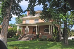
Block
From the record
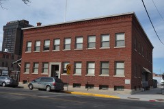
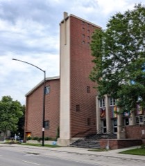
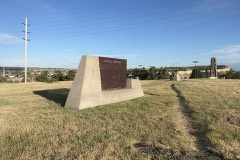
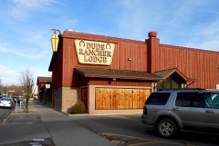
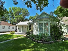
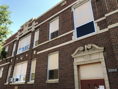
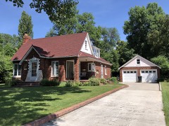
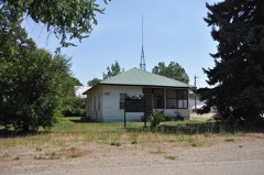
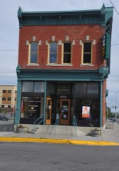
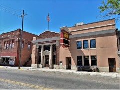
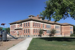
48 National Register listings published here, 2 of them National Historic Landmarks.
Sources: the National Register database, National Park Service
84 topographic sheets cover 33 settlements here, and 48 properties are on the National Register of Historic Places.
48 National Register listings published here, 2 of them National Historic Landmarks.
Sources: the National Register database, National Park Service
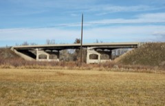
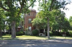
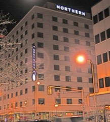
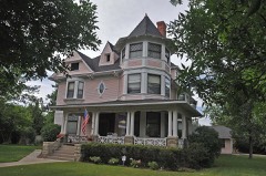
Every property in this county listed on the National Register of Historic Places, with the year it was listed and the federal nomination document.
Every wildfire the federal occurrence database records inside this county: 1,037 of them, burning about 272,938 acres. 196 started naturally and 17 were recorded as arson. Each settlement page carries the fires within five miles of it.
| Reported cause | Fires |
|---|---|
| Missing data/not specified/undetermined | 554 |
| Natural | 196 |
| Equipment and vehicle use | 70 |
| Debris and open burning | 52 |
| Fireworks | 41 |
| Recreation and ceremony | 32 |
| Firearms and explosives use | 23 |
| Power generation/transmission/distribution | 22 |
| Arson/incendiarism | 17 |
| Smoking | 12 |
| Misuse of fire by a minor | 7 |
| Other causes | 6 |
| Railroad operations and maintenance | 5 |
The five largest, by the area the report gives. None of them was recorded as arson.
| Date | Cause | Size | Reported by | Name on the report |
|---|---|---|---|---|
| 22 August 2008 | Natural | 102,380 acres | Southern Land Office | DUNN MOUNTAIN ASSIST |
| 12 July 2006 | Natural | 91,897 acres | Billings Field Office | BUNDY RAILROAD |
| 26 August 2000 | Debris and open burning | 5,000 acres | Crow Agency | PEASE |
| 18 August 1996 | Natural | 4,500 acres | Southern Land Office | DOVER RANCH |
| 20 August 1999 | Natural | 3,900 acres | Southern Land Office | PINE RIDGE |
| 22 August 2006 | Misuse of fire by a minor | 3,863 acres | Southern Land Office | EMERALD HILLS |
| 2 August 1996 | Smoking | 2,948 acres | Crow Agency | TOLLUCA |
| 16 July 2002 | Power generation/transmission/distribution | 2,921 acres | Miles City Field Office | STEAMBOAT |
Every settlement page carries the fires within five miles of it - see the settlement index below.
The NOAA Storm Events Database holds 946 reports for this county, causing 4 deaths, 8 injuries and about $54,474,500 in recorded property damage. Each settlement page carries the reports that name it.
| Kind of event | Reports |
|---|---|
| Hail | 506 |
| Thunderstorm Wind | 356 |
| Flash Flood | 24 |
| Tornado | 21 |
| Funnel Cloud | 15 |
| Flood | 13 |
| Heavy Rain | 5 |
| Lightning | 4 |
| Wildfire | 1 |
| Dust Devil | 1 |
The most serious of them, by death, then injury, then recorded damage. The accounts are quoted exactly as the forecast office filed them.
| When | Event | Place named | Harm | What the report says |
|---|---|---|---|---|
| August 1985 | Thunderstorm Wind | not stated | 2 killed | no account filed |
| May 2011 | Flood | Mossmain | 1 killed, $300,000 | Widespread rainfall of 2 to 3 inches with locally higher amounts fell across the Yellowstone County area during a two day period. Billings had its all-time daily rainfall record broke on May 24th with 3.12 inches. This was just a part of a record setting precipitation month for Billings which totaled 9.54 inches. This rainfall on top of an already wet month resulted in some streams and creeks over Southern Yellowstone County to overflow their banks. Flooding occurred on Blue Creek in the Briarwood area. Several homes and structures were surrounded by water on Aviemore Court where some voluntary evacuations occurred. In addition, the Briarwood Golf Course was inundated with water.||Pryor Creek was out of its banks resulting in water spilling over a dike in a low lying area of Huntley. Fly Creek near Pompey was out of its banks and flooded a roadway leading to town. Flooding occurred along most of Pryor Creek between the towns of Pryor and Huntley. In addition, county officials reported that Pryor Creek Road Bridge between Interstates 90 and 94 was washed out.||Blue Creek Subdivision at Jene Helene Avenue flooded many homes and the Briarwood Golf Club May 20th-22nd. This resulted in the Billings Fire Department issuing voluntary evacuation orders. In addition, flash flooding occurred in Billings on May 24th forcing many road closures downtown and causing large boulders to fall off the Rimrocks. Flooding from Pryor Creek inundated a Huntley neighborhood and destroyed Pryor Creek Road on May 22nd. ||The Yellowstone River at Billings went above flood stage on May 25th through May 26th. The river crested at 13.92 feet on May 26th. ||In addition, a man operating a backhoe trying to save his house, drowned near Pryor Creek. The roadway had washed out from underneath the backhoe.||Damage estimates based on FEMA reviews and Individual Assistance approvals. |
| July 2009 | Lightning | Billings Hgts | 1 killed | A line of strong thunderstorms moved into the area west of Billings around 730pm MDT. A lightning strike occurred around 800pm MDT at Castlerock Park where the Celebrate Freedom community gathering was occuring. A visitor (26 year old male resident of Billings) at the celebration was struck in the forehead and died. |
| July 1958 | Tornado (F2) | not stated | 2 hurt, $2,500,000 | no account filed |
| August 2020 | Thunderstorm Wind | Billings | 2 hurt | A microburst hit the Montana Fair at the Billings Fairgrounds. Three tents were blown over with two employees receiving minor injuries. In addition, numerous tree limbs were blown down along with some minor damage to vehicles. |
| October 1998 | Lightning | Billings | 1 hurt, $10,000 | Lightning nearly struck a man East of Billings and knocked out power for several minutes in Billings Heights and in the South side of Billings. |
| August 1958 | Tornado | not stated | 1 hurt, $2,500 | no account filed |
| July 2006 | Lightning | Billings | 1 hurt | A complex of thunderstorms moved into the Billings area shortly after 7 PM MST on Sunday July 23rd.A Billings woman and her friend were out for a walk along Black Otter Trail on the Rimrocks as the storm moved into the area. The woman was struck by lightning and killed as they were seeking shelter. |
| July 1998 | Thunderstorm Wind | Billings Logan Arpt | 1 hurt | A 60 mph wind gust was reported by the ASOS at Logan International Airport. The storm also knocked down several branches. One of which injured a 16 year old girl. Some power outages were reported in Billings as well. |
| June 2010 | Tornado (EF2) | Billings | $30,000,000 | Based on the observed damage, the tornado was classified as an EF-2 on the Enhanced Fujita Scale. Wind speeds within an EF-2 tornado range from 111-135 mph, and the associated damage observed at the Billings MetraPark and nearby businesses was consistent with this classification. The damage path was 120 yards wide with a length of about a half mile and on the ground an estimated 12 minutes.||The damage assessment and eyewitness accounts indicate that the tornado developed near the intersection of Lake Elmo Drive and Main Street in the Billings Heights at approximately 4:24 pm, with significant EF-2 damage to several nearby businesses. Damage included rooftops being blown off of three structures, windows blown out, power poles downed, business signs and billboards blown down along with several trees uprooted. The tornado appeared to weaken slightly as it progressed southeast across Alkali Creek. Limbs were broken off numerous trees in the vicinity of the creek. The tornadic circulation then appeared to have strengthened once again as it moved south over the Rimrock Auto Arena at Metrapark. EF-2 damage was again observed to the arena with much of the roof blown off along with other damage to the exterior of the building. Debris from the arena impacted other nearby businesses creating additional damage, mainly in the form of broken windows. Debris from the arena was reported landing as far away as a mile from the tornado touchdown. The tornado then dissipated over the arena around 4:36 pm.||The associated thunderstorm then moved northeast away from Billings. Numerous sightings of funnel clouds were reported as this storm moved east-northeast of Billings, however no additional tornado touchdowns were reported. |
| July 1998 | Hail | Billings | $8,000,000 | Numerous observations of large hail were reported by spotters, amateur radio operators and National Weather Service personnel. The hail damaged several vehicles in the Billings area, and also caused heavy damage to crops. |
| July 1998 | Hail | Billings | $4,000,000 | Several reports of hail up to 1.75 inches in diameter were reported in and around Billings from spotters, amateur radio operators and law enforcement. The hail severely damaged several cars and roofs. The hail also caused heavy damage to crops in the Billings area. |
| June 2010 | Flash Flood | (Bil)Logan Arpt Bill | $2,700,000 | Flood waters from a thunderstorm turned downtown streets into rivers, parking lots into lakes and basements into swamps. So much rain fell so fast on Billings that storm drains wide enough to hold a small car were filled for hours. Streets turned into rushing rivers, basements filled with muddy water and some residents went swimming with shovels and sticks to clear clogged storm drains. More than an inch of water seeped into the Billings Clinic hospital corridors and the basement near the buildings north entrances. Mud and water flooded the atrium area of Billings Clinic. In the hospital's north parking lot, storm water rose above the tires of passenger cars. Flooding was also reported in the underground parking garage of the hospital. Flash flooding was also reported on Alkali Creek as the creek flooded in several places. There were numerous calls of flooding in the basements of residential homes and businesses and water being over roads in some places. In addition, manhole covers were blown off by the pressure of water flooding the city's storm sewer system. The heavy rain caused a significant amount of water damage throughout the main part of the city. |
| August 2019 | Thunderstorm Wind | Shepherd | $2,500,000 | Significant damage was done to Shepherd schools. There was roof damage and extensive damage to the bus barn. In addition, all the west side windows were broken out from combined hail and wind. |
| July 1998 | Hail | Huntley | $2,000,000 | Numerous reports of tennis ball sized hail causing numerous damages to vehicles and homes in and around Huntley. |
| June 2023 | Flash Flood | Billings Logan Arpt | $1,600,000 | Many roads on the west side of Billings were flooded and closed. Gable Road was particularly hit hard. Birely Drain and Big Ditch overflowed their banks washing out a portion of Gable Road. The cost to repair Gable Road will be about 600K. Total flood damage costs to the city will be around $1M. |
| July 1994 | Thunderstorm Wind | Laurel | $500,000 | At Laurel hanger damaged at airport and trees down around town. At Billings Airport plane was turned over. Lots of roof and tree damage around town. |
| July 1994 | Thunderstorm Wind | Billings | $50,000 | A roof was blown off a home in the Billings Heights area. |
| July 1994 | Thunderstorm Wind | Billings Arpt | $50,000 | At Laurel hanger damaged at airport and trees down around town. At Billings Airport plane was turned over. Lots of roof and tree damage around town. |
| June 1994 | Thunderstorm Wind | Billings | $50,000 | Several homes were damaged in South Billings. |
| July 1994 | Hail | Billings Heights | $50,000 | Minor hail damage around town. Hail plugged storm sewers causing some local flooding. |
| June 1994 | Thunderstorm Wind | Laurel | $50,000 | no account filed |
| June 1971 | Tornado (F0) | not stated | $25,000 | no account filed |
| June 1965 | Tornado | not stated | $25,000 | no account filed |
| July 1955 | Tornado | not stated | $25,000 | no account filed |
| June 1999 | Thunderstorm Wind | Worden | $5,000 | Wind gusts from a thunderstorm destroyed a 20 by 24 foot shed. The wind also twisted a round bale feeder and tore a chicken house door off. |
| July 1994 | Hail | Huntley | $5,000 | Minor hail damage around town. Hail plugged storm sewers causing some local flooding. |
| July 1994 | Hail | not stated | $5,000 | Minor hail damage around town. Hail plugged storm sewers causing some local flooding. |
| June 1994 | Hail | Laurel | $5,000 | no account filed |
| August 1993 | Hail | Pompeys Pillar | $5,000 | no account filed |
| August 1993 | Hail | Ballantine | $5,000 | no account filed |
| March 2011 | Thunderstorm Wind | Billings Hgts | $3,000 | A microburst resulted in damage to numerous vinyl fences, some roof shingles and house siding along El Rancho Drive in Billings Heights. |
| June 1991 | Tornado (F0) | not stated | $2,500 | no account filed |
| July 1998 | Thunderstorm Wind | Billings | $1,000 | An eight inch tree limb fell across the southbound lane on main street in Billings. |
| July 1994 | Hail | Toledo | $500 | Lightning struck a house and set it on fire in Billings Heights. |
| August 2025 | Thunderstorm Wind | Lockwood | - | Mesonet weather station sdam8 Soda Springs. |
| August 2025 | Hail | Laurel Muni Arpt | - | Hail report by local spotter. |
| August 2025 | Hail | Laurel Muni Arpt | - | Hail report by local spotter. |
| August 2025 | Hail | Laurel Muni Arpt | - | Corrects previous hail report from 8 ESE Molt. Came from facebook comment. |
| August 2025 | Hail | Billings Logan Arpt | - | Also received 0.12 in rain. |
| August 2025 | Hail | Laurel Muni Arpt | - | From facebook comment. |
| August 2025 | Hail | Billings Logan Arpt | - | Corrects previous hail report from 4 W Billings. Some hail drifts were also reported. |
| August 2025 | Hail | Billings Logan Arpt | - | Corrects previous hail report from 1 wnw of Billings. |
| August 2025 | Hail | Shepherd | - | From facebook comment. |
| August 2025 | Hail | Billings Logan Arpt | - | From fcebook comment. |
| August 2025 | Hail | Laurel Muni Arpt | - | Corrects previous hail report from location at 8 nnw Laurel. |
| August 2025 | Hail | Billings Logan Arpt | - | Reported via phone call from the public. |
| August 2025 | Hail | Laurel Muni Arpt | - | Report given by local spotter. |
| August 2025 | Hail | Billings Logan Arpt | - | Hail drifts also reported. |
| August 2025 | Hail | Billings Logan Arpt | - | Reported via phone call from the public. |
| August 2025 | Hail | Billings Logan Arpt | - | Report from mping. |
| August 2025 | Hail | Billings | - | Corrects previous hail report from 2 ene of Billings. |
| August 2025 | Hail | Billings Logan Arpt | - | Corrects previous hail report from 6 W Billings. From Facebook comment. |
| August 2025 | Hail | Shepherd | - | Corrects previous hail report from Shepherd. From facebook comment. |
| June 2025 | Thunderstorm Wind | Worden | - | Tree limbs down and small objects thrown around. |
| June 2025 | Thunderstorm Wind | Worden | - | Fifty knt wind reported. |
| June 2025 | Thunderstorm Wind | Lockwood | - | Time estimated from radar . |
| June 2025 | Thunderstorm Wind | Lockwood | - | Mesonet station Soda Springs. |
| July 2025 | Hail | Broadview | - | Quarter size hail reported between 130 pm and 2pm. |
| July 2025 | Flood | Billings Logan Arpt | - | Image shows Grand Ave. flooded. Public also stated they saw construction cones floating down the street. Localized flooding of low-lying areas. |
The Survey's mineral resources record lists 26 workings inside this county. 11 still produce and 15 are closed or unrecorded. Each settlement page carries the workings within five miles of it.
| Commodity | Workings |
|---|---|
| Sand and Gravel, Construction | 12 |
| Clay | 8 |
| Bentonite | 2 |
| Stone, Dimension | 2 |
| Pumice | 1 |
| Limestone, Dimension | 1 |
The least common of them first, because a county's hundredth gravel pit says nothing its first ten did not.
| Where | Site | Commodity | Status | Recorded |
|---|---|---|---|---|
| Limestone Occurrence | Limestone, Dimension | Occurrence | ||
| Unnamed Pumicite | Pumice | Prospect | ||
| Concrete Products Co.Shale | Bentonite | Producer | ||
| Lockwood Flats Pit | Stone, Dimension | Past Producer | ||
| Mackey Bentonite Deposit | Bentonite | Occurrence | ||
| Montana Shale Pit | Stone, Dimension | Past Producer | ||
| Bent Clay Pit | Clay | Past Producer | ||
| Buff Clay Pit | Clay | Past Producer | ||
| Lovell Clay Pit | Clay | Producer | ||
| Lovell Clay Products | Clay | Occurrence | ||
| Lovell Clay Products | Clay | Producer | ||
| Plainfeather | Clay | Producer | ||
| Tenny Bentonite | Clay | Occurrence | ||
| Unnamed Bentonite Location | Clay | Occurrence | ||
| Base Crusher | Sand and Gravel, Construction | Producer | ||
| Billings Sand and Gravel | Sand and Gravel, Construction | Past Producer | ||
| Empire Sand and Gravel | Sand and Gravel, Construction | Producer | ||
| Gabel Pit | Sand and Gravel, Construction | Past Producer | ||
| Krug Sand and Gravel Pit | Sand and Gravel, Construction | Producer | ||
| Lovell Sand Pit | Sand and Gravel, Construction | Producer | ||
| Meyer Construction Crusher #1 | Sand and Gravel, Construction | Past Producer | ||
| Midland Materials Co. Pit | Sand and Gravel, Construction | Producer | ||
| Mossmain Sand and Gravel Pit | Sand and Gravel, Construction | Producer | ||
| Plant Mix Crusher | Sand and Gravel, Construction | Producer | ||
| Unnamed Gravel Pit | Sand and Gravel, Construction | Unknown | ||
| Unnamed Gravel Pit | Sand and Gravel, Construction | Unknown |
Named settlements recorded in the Geographic Names Information System, each with the topographic sheets covering it. Villages, hamlets and abandoned places alike. Each is shown with the nearest named watercourse or landform and the survey quadrangle it falls on.
Huntley Project census division · 59006 · On Deer Creek · Nibbe quadrangle
16 sheets, 1893 to 1989
Northwest Yellowstone census division · 59106 · On Little Cove Creek · Rimrock quadrangle
11 sheets, 1954 to 1989
Billings census division · 59101 · By Skeleton Cliff · Billings West quadrangle
11 sheets, 1954 to 1989
Billings census division · 59105 · Near Cherry Island · Billings East quadrangle
19 sheets, 1893 to 1989
Northwest Yellowstone census division · 59015 · Broadview West quadrangle
6 sheets, 1954 to 1980
Huntley Project census division · 59064 · Near Randalls Island · Bull Mountain quadrangle
10 sheets, 1954 to 1983
Billings census division · 59102 · By Rimrocks · Billings West quadrangle
11 sheets, 1954 to 1989
Shepherd census division · 59105 · On Sevenmile Creek · Rattlesnake Butte quadrangle
16 sheets, 1893 to 1989
Northwest Yellowstone census division · 59015 · Comanche quadrangle
10 sheets, 1954 to 1989
Huntley Project census division · 59024 · Near Big Coulee · Custer quadrangle
10 sheets, 1954 to 1983
Huntley Project census division · 59024 · Near Thurmond Coulee · Waco quadrangle
9 sheets, 1954 to 1983
Billings census division · 59101 · On Dry Creek · Billings East quadrangle
19 sheets, 1893 to 1989
Huntley Project census division · 59037 · On Twelve Mile Creek · Huntley quadrangle
17 sheets, 1893 to 1989
Huntley Project census division · 59037 · Indian Arrow quadrangle
16 sheets, 1893 to 1989
Billings census division · 59101 · On Dry Creek · Billings East quadrangle
19 sheets, 1893 to 1989
Huntley Project census division · 59006 · Near Gravel Pit Coulee · Nibbe quadrangle
16 sheets, 1893 to 1989
Northwest Yellowstone census division · 59015 · Hay Basin South quadrangle
6 sheets, 1954 to 1980
Huntley Project census division · 59006 · On Arrow Creek · Nibbe quadrangle
16 sheets, 1893 to 1989
Huntley Project census division · 59088 · On Pompeys Pillar Creek · Nibbe quadrangle
16 sheets, 1893 to 1989
Huntley Project census division · 59064 · On Lost Boy Creek · Pompeys Pillar quadrangle
11 sheets, 1894 to 1981
Northwest Yellowstone census division · 59106 · On Little Cove Creek · Rimrock quadrangle
11 sheets, 1954 to 1989
South Yellowstone census division · 59101 · Soda Springs quadrangle
15 sheets, 1893 to 1989
Huntley Project census division · 59024 · On Hibbard Creek · Waco quadrangle
9 sheets, 1954 to 1983