 Block
Billings, Montana
11 topographic sheets cover this place, the earliest surveyed in 1954 and the latest in 1989. It stands in the Billings census division. It lies in ZIP code area 59101. It sits by Skeleton Cliff. The Survey maps it on the Billings West quadrangle. 117,116 people lived here at the 2020 count. It stands 3,123 feet above sea level.
Research this city
On record in Billings
Buildings and businesses the archive holds for this place. Each opens its own page, with the source record it came from.
On the National Register 12 of 40 shown
 Pictograph CaveNational Historic Landmark · listed 1966
 Acme Buildinglisted 2005
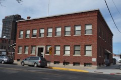 Armour Cold Storagelisted 2004
 Babcock Theatre Buildinglisted 2013
 Billings Chamber of Commerce Buildinglisted 1972
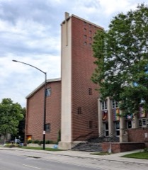 Billings First Congregational Churchlisted 2025
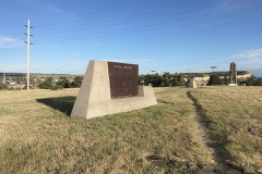 Boothill Cemeterylisted 1979
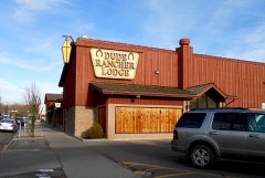 Dude Rancher Lodgelisted 2010
 Electric Buildinglisted 2002
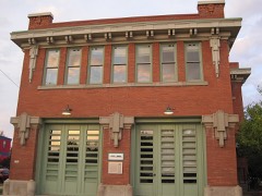 Fire House No. 2listed 1980
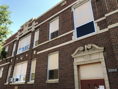 Garfield Schoollisted 2012
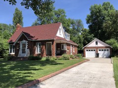 Arnold Graf Houselisted 2015
Population over time
2 figuresBillings grew from 104,170 to 117,116 between 2010 and 2020. These are the recorded population figures Wikidata holds for this place, reached through the Geographic Names Information System number this page is keyed on rather than by name, so they belong to this place and not to another of the same name. Most are census counts, but not all are: an early figure may be a founding or settlement estimate, and an estimate published within five years of a census is left out. The change column is computed, and is left blank where more than 20 years separate a figure from the one before it, because a gap that long is not a change between two counts.
| Year | People | Change |
|---|---|---|
| 2010 | 104,170 | |
| 2020 | 117,116 | +12,946 (+12%) |
Topographic sheets covering this place
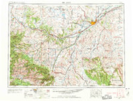
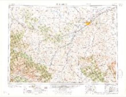
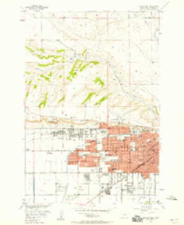
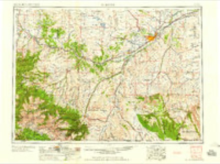
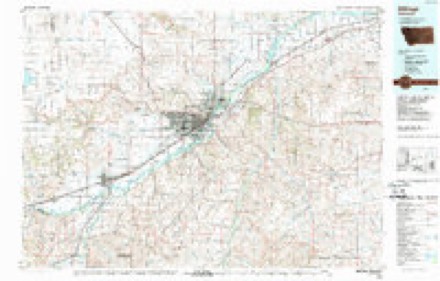
5 surveys from 11 printed sheetsMatched by testing this settlement's coordinate against the published boundary of every sheet in the United States Geological Survey's historical collection. Each opens the scanned sheet at the Survey.
- 1954 USGS Billings quadrangle1:250000, 4 printings
- 1957 USGS Billings quadrangle1:250000
- 1957 USGS Billings West quadrangle1:24000, 3 printings
- 1958 USGS Billings quadrangle1:250000, 2 printings
- 1989 USGS Billings quadrangle1:100000
Fires near this place
184 since 1999Regional context, not property-specific evidence. The federal wildfire occurrence database lists 184 fires within 5 miles of Billings between 1999 and 2020, burning about 426 acres in total. 6 started naturally. 2 were recorded as arson. Distance is straight-line from the map coordinates, so a fire counted here may appear on a neighbouring settlement's page as well.
| Reported cause | Fires |
|---|---|
| Missing data/not specified/undetermined | 142 |
| Equipment and vehicle use | 9 |
| Recreation and ceremony | 9 |
| Fireworks | 7 |
| Natural | 6 |
| Debris and open burning | 5 |
| Arson/incendiarism | 2 |
| Power generation/transmission/distribution | 2 |
| Railroad operations and maintenance | 1 |
| Misuse of fire by a minor | 1 |
The most recent of them, most recent first, with the day each was reported and the service that recorded it.
| Date | Cause | Size | Reported by | Name on the report |
|---|---|---|---|---|
| 9 September 2017 | Missing data/not specified/undetermined | under an acre | Southern Land Office | PICCOLO LN & HWY 87E |
| 9 September 2017 | Equipment and vehicle use | under an acre | Southern Land Office | MAIN STREET FIRE |
| 7 September 2020 | Missing data/not specified/undetermined | under an acre | Yellowstone County | 2908 LAMPMAN DR. |
| 5 September 2020 | Missing data/not specified/undetermined | under an acre | Yellowstone County | 1235 W. WICKS LN |
| 5 September 2020 | Missing data/not specified/undetermined | 1.0 acres | Yellowstone County | FANTAN ST AND GRANDA BLVD |
| 4 September 2017 | Missing data/not specified/undetermined | under an acre | Southern Land Office | APPLE |
| 4 September 2017 | Missing data/not specified/undetermined | under an acre | Southern Land Office | HEMLOCK |
| 3 September 2017 | Missing data/not specified/undetermined | under an acre | Southern Land Office | 28TH |
Settlements close enough to share some of these fires:
Mines and quarries near this place
10 of 14 shownRegional context, not property-specific evidence. The federal mineral resources record lists 14 workings within 5 miles of Billings: 7 producers, 5 past producers, 2 occurrences. 7 still produce. What was taken out: Sand and Gravel, Construction, Clay, Bentonite. Distance is straight-line from the map coordinates, so a quarry counted here may appear on a neighbouring settlement's page as well.
| Where | Site | Commodity | Status | Recorded |
|---|---|---|---|---|
| Concrete Products Co.Shale | Bentonite | Producer | ||
| Bent Clay Pit | Clay | Past Producer | ||
| Buff Clay Pit | Clay | Past Producer | ||
| Lovell Clay Products | Clay | Producer | ||
| Lovell Clay Products | Clay | Occurrence | ||
| Plainfeather | Clay | Producer | ||
| Tenny Bentonite | Clay | Occurrence | ||
| Base Crusher | Sand and Gravel, Construction | Producer | ||
| Billings Sand and Gravel | Sand and Gravel, Construction | Past Producer | ||
| Empire Sand and Gravel | Sand and Gravel, Construction | Producer |
Storms near this place
60 of 161 shownRegional context, not property-specific evidence. The National Weather Service names Billings in 161 storm reports between 1994 and 2025: 80 hail, 59 thunderstorm wind, 8 flash flood, 4 funnel cloud. The reports record 4 injuries. Each account below is quoted exactly as the forecast office filed it, from the NOAA Storm Events Database, and each date opens the federal record of that event.
| When | Event | Place named | Harm | What the report says |
|---|---|---|---|---|
| August 2020 | Thunderstorm Wind | Billings | 2 hurt | A microburst hit the Montana Fair at the Billings Fairgrounds. Three tents were blown over with two employees receiving minor injuries. In addition, numerous tree limbs were blown down along with some minor damage to vehicles. |
| October 1998 | Lightning | Billings | 1 hurt, $10,000 | Lightning nearly struck a man East of Billings and knocked out power for several minutes in Billings Heights and in the South side of Billings. |
| July 2006 | Lightning | Billings | 1 hurt | A complex of thunderstorms moved into the Billings area shortly after 7 PM MST on Sunday July 23rd.A Billings woman and her friend were out for a walk along Black Otter Trail on the Rimrocks as the storm moved into the area. The woman was struck by lightning and killed as they were seeking shelter. |
| June 2010 | Tornado (EF2) | Billings | $30,000,000 | Based on the observed damage, the tornado was classified as an EF-2 on the Enhanced Fujita Scale. Wind speeds within an EF-2 tornado range from 111-135 mph, and the associated damage observed at the Billings MetraPark and nearby businesses was consistent with this classification. The damage path was 120 yards wide with a length of about a half mile and on the ground an estimated 12 minutes.||The damage assessment and eyewitness accounts indicate that the tornado developed near the intersection of Lake Elmo Drive and Main Street in the Billings Heights at approximately 4:24 pm, with significant EF-2 damage to several nearby businesses. Damage included rooftops being blown off of three structures, windows blown out, power poles downed, business signs and billboards blown down along with several trees uprooted. The tornado appeared to weaken slightly as it progressed southeast across Alkali Creek. Limbs were broken off numerous trees in the vicinity of the creek. The tornadic circulation then appeared to have strengthened once again as it moved south over the Rimrock Auto Arena at Metrapark. EF-2 damage was again observed to the arena with much of the roof blown off along with other damage to the exterior of the building. Debris from the arena impacted other nearby businesses creating additional damage, mainly in the form of broken windows. Debris from the arena was reported landing as far away as a mile from the tornado touchdown. The tornado then dissipated over the arena around 4:36 pm.||The associated thunderstorm then moved northeast away from Billings. Numerous sightings of funnel clouds were reported as this storm moved east-northeast of Billings, however no additional tornado touchdowns were reported. |
| July 1998 | Hail | Billings | $8,000,000 | Numerous observations of large hail were reported by spotters, amateur radio operators and National Weather Service personnel. The hail damaged several vehicles in the Billings area, and also caused heavy damage to crops. |
| July 1998 | Hail | Billings | $4,000,000 | Several reports of hail up to 1.75 inches in diameter were reported in and around Billings from spotters, amateur radio operators and law enforcement. The hail severely damaged several cars and roofs. The hail also caused heavy damage to crops in the Billings area. |
| July 1994 | Thunderstorm Wind | Billings | $50,000 | A roof was blown off a home in the Billings Heights area. |
| June 1994 | Thunderstorm Wind | Billings | $50,000 | Several homes were damaged in South Billings. |
| July 1998 | Thunderstorm Wind | Billings | $1,000 | An eight inch tree limb fell across the southbound lane on main street in Billings. |
| August 2025 | Hail | Billings | - | Corrects previous hail report from 2 ene of Billings. |
| June 2025 | Thunderstorm Wind | Billings | - | Mesonet station 3.1 SW Lockwood. |
| June 2024 | Thunderstorm Wind | Billings | - | One-inch tree limbs were reported broken. |
| July 2022 | Thunderstorm Wind | Billings | - | A 7 inch tree branch was snapped. |
| July 2022 | Thunderstorm Wind | Billings | - | A 1.5 foot diameter tree was downed. |
| July 2022 | Flash Flood | Billings | - | Multiple streets in downtown Billings flooded. |
| July 2021 | Thunderstorm Wind | Billings | - | A 6 inch tree limb fell onto the road. |
| August 2021 | Thunderstorm Wind | Billings | - | An outbuilding was displaced by the wind. |
| August 2020 | Thunderstorm Wind | Billings | - | A large power pole snapped. |
| August 2020 | Thunderstorm Wind | Billings | - | It was reported that 13 vehicles at a FedEx building received broken windows as nearby gravel blew into them. Many other vehicles sustained damage in a nearby car auction facility. |
| August 2019 | Hail | Billings | - | Some broken windows were reported. |
| August 2018 | Thunderstorm Wind | Billings | - | Some wind damage occurred on Bench Boulevard. A large cottonwood tree split in half and fell on a fence causing damage to the fence. A dead pine also fell with the root ball being exposed. The strong winds occurred from convection aloft but no lightning was detected. |
| September 2013 | Thunderstorm Wind | Billings | - | A wind gust of 60 mph was estimated just southeast of Billings. |
| May 2007 | Thunderstorm Wind | Billings | - | Many tree branches were knocked down. |
| June 2007 | Heavy Rain | Billings | - | Seven tenths of an inch of rain was reported. |
| July 2007 | Thunderstorm Wind | Billings | - | Winds gusted to 67 mph just south of Billings. |
| July 2007 | Flash Flood | Billings | - | Numerous streets, underpasses and parking lots were reported flooded. |
| July 2006 | Thunderstorm Wind | Billings | - | 6 to 8 inch tree limb damaged house roof in Billings Heights. Patio table broken by the wind and 4x6 foot sheets of plywood blown by the wind. |
| July 2006 | Thunderstorm Wind | Billings | - | Billings ASOS also measured a peak sustained wind of 58 mph at 543 PM MST. |
| June 2005 | Hail | Billings | - | Mostly ping pong ball sized hail, but a few as large as hen eggs |
| June 2005 | Thunderstorm Wind | Billings | - | 12-18 inch limb down in residential area |
| June 2005 | Hail | Billings | - | NWS employee reported penny size hail around 27th street in downtown Billings. |
| June 2005 | Hail | Billings | - | Inch to inch and half diameter hail seen laying next to the road 30 minutes after the storm had moved through. Time estimate based on radar. |
| July 2005 | Heavy Rain | Billings | - | Various street flooding reported in downtown Billings after a thunderstorm produced a period of very heavy rain. 1.16 inches of rain fell at the Billings Airport between 7pm and 745pm. |
| July 2005 | Hail | Billings | - | Hail broke a window at a residence. |
| August 2005 | Thunderstorm Wind | Billings | - | Power poles knocked down near 3800 Pierce Parkway on the westend of Billings. |
| August 2005 | Thunderstorm Wind | Billings | - | Billings Airport ASOS |
| July 2005 | Thunderstorm Wind | Billings | - | Billings West End 29th and Monad |
| July 2005 | Thunderstorm Wind | Billings | - | NWS Office Billings West End |
| July 2005 | Thunderstorm Wind | Billings | - | 61 mph wind gust recorded by ASOS at the Billings Airport |
| July 2005 | Thunderstorm Wind | Billings | - | Soda Springs RAWS |
| June 2003 | Hail | Billings | - | .88 inch hail near Ballantine |
| July 2003 | Tornado (F0) | Billings | - | Damage survey determined tornado destroyed 1 mobile home and badly damage another. Several steel grain bins destroyed by straight line winds along with large cottonwood trees snapped in half along with trees having leaves stripped off. Mobile home was not occupied at the time. |
| May 2002 | Thunderstorm Wind | Billings | - | 61 mph wind gust at the Billings National Weather Service |
| July 2002 | Thunderstorm Wind | Billings | - | 86 mph wind gust recoreded at Q2 News Station |
| July 2002 | Thunderstorm Wind | Billings | - | 75 mph wind gust recorded by Billings ASOS |
| July 2002 | Thunderstorm Wind | Billings | - | Wind damage. Numerous reports of trees and fences blown over. Large billboard on 6th Ave. Northblown over. |
| April 2001 | Thunderstorm Wind | Billings | - | 69 mph thunderstorm wind gust at the Billings Airport |
| June 2001 | Hail | Billings | - | Golf ball size hail |
| July 2001 | Thunderstorm Wind | Billings | - | 60 mph thunderstorm wind gust estimated by spotter. |
| July 2001 | Flash Flood | Billings | - | Street flooding on the south side of Billings |
| June 2001 | Flash Flood | Billings | - | Water over the road at 4th and 24th St. North |
| June 2001 | Flash Flood | Billings | - | 6th Avenue flooded and closed |
| June 2001 | Flash Flood | Billings | - | Montana and 1st Avenue South...water covering hoods of cars |
| June 2001 | Flash Flood | Billings | - | 1-2 miles north of K-Mart |
| July 2001 | Hail | Billings | - | Nickel size hail lasted from 655pm to 720pm MDT. |
| April 2001 | Thunderstorm Wind | Billings | - | 85 mph thunderstorm wind gust at KTVQ TV weather station |
| July 2000 | Thunderstorm Wind | Billings | - | Wind damage with 55-60 mile per hour winds. |
| August 1999 | Funnel Cloud | Billings | - | A funnel cloud was spotted in southwest Billings by an off-duty National Weather Service employee. |
| August 1999 | Funnel Cloud | Billings | - | Several funnel clouds were spotted southeast of Billings. |
| April 1999 | Hail | Billings | - | Hail as large as golf ball size fell southeast of Billings and in Billings Heights. The KTVQ television transmitter facility near Emerald Hill was damaged by hail. |
Nearest settlements
The eight closest, with where each one stands in the county. Distances are straight-line, computed from the Geographic Names Information System coordinates.
| Map | Place | Distance | Sheets |
|---|---|---|---|
| Billings Heights | 4.1 miles | 19 | |
| Cameron Park | 4.4 miles | 11 | |
| Lockwood | 5.2 miles | 19 | |
| Hirsch | 5.2 miles | 19 | |
| Yegen | 7.7 miles | 12 | |
| Cline | 8.4 miles | 16 | |
| Baseline | 10.7 miles | 11 | |
| Rimrock | 10.8 miles | 11 |
Elsewhere
Matched on this settlement's Geographic Names Information System number rather than its name, so it cannot be a different place of the same name in another state.
| Wikipedia article on Billings | An encyclopaedic summary. Its text is share-alike, so it is linked here rather than copied. |
| Wikidata item Q166304 | The structured record the population and elevation above come from. Public domain (CC0). |
Provenance
This settlement is recorded in the Geographic Names Information System as feature 802034. The sheet list is computed by point-in-boundary test against the United States Geological Survey's historical topographic inventory. Both are works of the United States government and carry no copyright under 17 U.S.C. 105.
Wildfire. Short, Karen C. 2022. Spatial wildfire occurrence data for the United States, 1992-2020 [FPA_FOD_20221014]. 6th Edition. Fort Collins, CO: Forest Service Research Data Archive. https://doi.org/10.2737/RDS-2013-0009.6 Collected with United States Government funding and usable without additional permissions or fees.
Mines and quarries. USGS Mineral Resources Data System (MRDS) https://mrdata.usgs.gov/mrds/ A work of the United States government, no copyright under 17 U.S.C. 105.
Storms. NOAA National Centers for Environmental Information, Storm Events Database https://www.ncei.noaa.gov/stormevents/ A work of the United States government, no copyright under 17 U.S.C. 105. Narratives are quoted verbatim from the National Weather Service report and are not edited or summarised.