 Block
Brockway, Montana
6 topographic sheets cover this place, the earliest surveyed in 1954 and the latest in 1983. It stands in the Circle census division. It lies in ZIP code area 59214. It stands on Cotter Creek. The Survey maps it on the Brockway quadrangle. 14 people lived here at the 2020 count. It stands 2,579 feet above sea level.
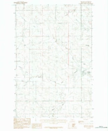
Topographic sheets covering this place
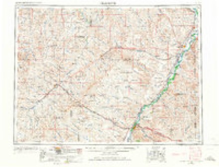
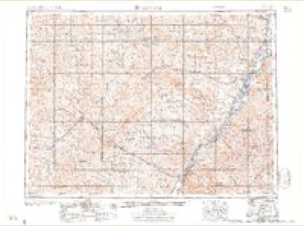
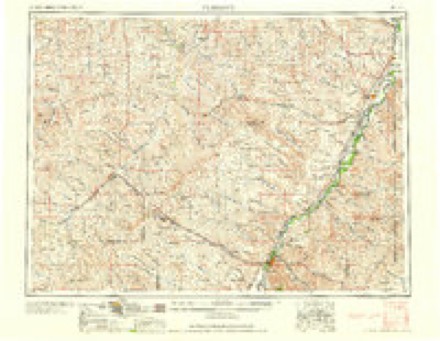
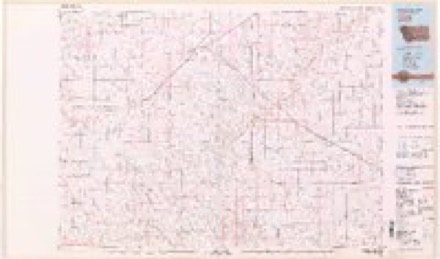
5 surveys from 6 printed sheetsMatched by testing this settlement's coordinate against the published boundary of every sheet in the United States Geological Survey's historical collection. Each opens the scanned sheet at the Survey.
- 1954 USGS Glendive quadrangle1:250000, 2 printings
- 1957 USGS Glendive quadrangle1:250000
- 1958 USGS Glendive quadrangle1:250000
- 1982 USGS Circle quadrangle1:100000
- 1983 USGS Brockway quadrangle1:24000
Fires near this place
3 since 2017Regional context, not property-specific evidence. The federal wildfire occurrence database lists 3 fires within 5 miles of Brockway between 2017 and 2020, burning about 12 acres in total. None started naturally. None was recorded as arson. Distance is straight-line from the map coordinates, so a fire counted here may appear on a neighbouring settlement's page as well.
| Reported cause | Fires |
|---|---|
| Equipment and vehicle use | 3 |
The most recent of them, most recent first, with the day each was reported and the service that recorded it.
| Date | Cause | Size | Reported by | Name on the report |
|---|---|---|---|---|
| 27 July 2017 | Equipment and vehicle use | 10 acres | Eastern Land Office | DUCK CREEK |
| 17 July 2020 | Equipment and vehicle use | 1.0 acres | McCone County | DIRTY CREEK - MCCONE |
| 4 February 2017 | Equipment and vehicle use | 1.0 acres | Eastern Land Office | DIRTY |
Settlements close enough to share some of these fires:
Storms near this place
60 of 86 shownRegional context, not property-specific evidence. The National Weather Service names Brockway in 86 storm reports between 1996 and 2025: 50 hail, 25 thunderstorm wind, 5 flash flood, 2 funnel cloud. No death or injury is recorded in these reports. Each account below is quoted exactly as the forecast office filed it, from the NOAA Storm Events Database, and each date opens the federal record of that event.
| When | Event | Place named | Harm | What the report says |
|---|---|---|---|---|
| May 2020 | Thunderstorm Wind | Brockway | $350,000 | Public reported wind damage just west of Brockway and just south of US Highway 200. Former emergency manager's roof was blown half off, and part of his garage was collapsed. Event time is estimated. House was totaled by insurance. |
| June 2016 | Thunderstorm Wind | Brockway | $280,000 | Significant damage to 30 power transmission poles and 30-40 power distribution poles along Highway 200 between Van Norman and Brockway. A large camper was rolled in the Timber Creek area along Highway 24. |
| May 2020 | Thunderstorm Wind | Brockway | $187,000 | Utility company reported more than 100 power poles and 16 distribution towers down along MT-Highway 200. Started about 2 miles west of Brockway, then northeastward toward the town of Circle. |
| July 2013 | Hail | Brockway | $20,000 | Trained spotter reported hail up to the size of golf balls broke windows, damaged siding, damaged a camper, and destroyed a pea crop. |
| July 1998 | Thunderstorm Wind | Brockway | $8,000 | Roof damage done to businesses in Brockway. |
| July 2013 | Hail | Brockway | $5,000 | Trained spotter reported that hail up to the size of baseballs fell for over 10 minutes, breaking windows and stripping most of the leaves from a tree. |
| July 2008 | Thunderstorm Wind | Brockway | $100 | The wind removed a window screen and blew it across the yard. |
| July 2025 | Hail | Brockway | - | Trained spotter reported that their vehicle windshield was cracked by hen egg size hail. |
| July 2025 | Hail | Brockway | - | Public reported hen egg size hail. |
| July 2025 | Thunderstorm Wind | Brockway | - | Public reported difficulty controlling their vehicle and estimated wind gusts of 60 mph. |
| July 2025 | Funnel Cloud | Brockway | - | Video of a funnel cloud was recorded by a storm chaser and posted on social media. |
| July 2025 | Hail | Brockway | - | Trained spotter reported their truck window was broken by ping pong ball size hail. |
| June 2024 | Thunderstorm Wind | Brockway | - | Public estimated a 58 mph thunderstorm wind gust. |
| July 2023 | Hail | Brockway | - | A trained spotter reported hail up to the size of quarters. |
| August 2023 | Heavy Rain | Brockway | - | The public reported an estimated 2.0 inches of rainfall occurred within 2 hours. |
| May 2020 | Thunderstorm Wind | Brockway | - | NWS employees conducted a damage survey in the Brockway area. Damage to buildings and sheared power poles indicated wind speeds of 105 to 110 mph. Other power poles both east and west of this area were also damaged. |
| July 2020 | Hail | Brockway | - | Trained spotter reported plentiful hail up to the size of quarters. |
| March 2019 | Flood | Brockway | - | McCone County Sheriff's Office reported that some area back roads are impassible due to recent snow melt causing rising creek levels along the smaller tributaries feeding into the Redwater River. Most impacts were along and near the Brockway East Road and and the Dry Ash Creek Road due to culverts washing out along the Tusler Creek. Flood start and end times are estimated. |
| July 2019 | Hail | Brockway | - | Public reported, via social media, quarter size hail. |
| July 2019 | Flash Flood | Brockway | - | McCone County Sheriff's Office reported a large washout on Ash Creek Road. |
| July 2019 | Flash Flood | Brockway | - | McCone County Sheriff's Office reported several county roads washed out and closed. |
| July 2018 | Thunderstorm Wind | Brockway | - | Fire crew from Badger Creek Wildfire measured sustained winds of 40 mph and a gust of 62 mph while providing standby support for a fireworks show in the town of Brockway. |
| May 2018 | Hail | Brockway | - | NWS employee reported hail up to the size of ping pong balls. |
| August 2016 | Hail | Brockway | - | Trained spotter reported quarter sized hail. |
| July 2015 | Thunderstorm Wind | Brockway | - | Trained spotter reported 60 mph winds with rain. |
| July 2014 | Thunderstorm Wind | Brockway | - | Trained spotter reported dime-sized hail covering the ground to a depth of four inches, and wind gusts of 50 to 60 mph. |
| May 2014 | Hail | Brockway | - | Trained spotter reported quarter-sized hail with heavy rain. |
| June 2014 | Hail | Brockway | - | Trained spotter reported hail up the size of half dollars covered the ground. |
| June 2014 | Hail | Brockway | - | Trained spotter reported quarter-sized hail. |
| July 2014 | Hail | Brockway | - | Trained spotter reported quarter-sized hail covering the ground. |
| May 2013 | Flood | Brockway | - | McCone county dispatch reported that part of Beauty Valley Road (a gravel road) was washed out due to run off from the heavy rainfall. Location is about 16 miles WSW of the town of Circle. |
| July 2013 | Thunderstorm Wind | Brockway | - | Trained spotter estimated wind gusts up to 58 mph. |
| July 2013 | Hail | Brockway | - | Trained spotter reported walnut-sized hail. |
| July 2013 | Hail | Brockway | - | Trained spotter reported golf ball sized hail. |
| July 2013 | Hail | Brockway | - | Trained spotter reported golf ball sized hail. |
| July 2013 | Hail | Brockway | - | Trained spotter reported hail up the size of quarters lasting 10 minutes. |
| August 2013 | Thunderstorm Wind | Brockway | - | Public reported wind gusts of 60 mph. |
| May 2013 | Flash Flood | Brockway | - | Heavy rainfall of up to 4 inches left up to a foot of water 100 yards across on Highway 253 near mile marker 42, causing the road to be closed down for several hours. The road was closed by the Sheriff's Department for several hours. An area farmer reported his fields were a large lake with water running across them. |
| May 2013 | Hail | Brockway | - | Trained spotter reported hail up to the size of quarters. |
| July 2013 | Hail | Brockway | - | NWS Employee reported walnut-sized hail. |
| July 2013 | Hail | Brockway | - | Trained spotter reported pea-sized and quarter-sized hail with heavy rain and 35-45 mph wind gusts. |
| July 2013 | Hail | Brockway | - | Trained spotter reported quarter-sized hail - duration of 5 minutes, with winds of 58 mph estimated just before the hail began to fall. |
| June 2012 | Thunderstorm Wind | Brockway | - | A trained spotter reported a 60 MPH wind gust, and also pea to dime sized hail 8 miles west of Brockway in McCone County. |
| June 2012 | Thunderstorm Wind | Brockway | - | Storm hit with strong gusts to 60 mph. After the winds hit, then hail from pea to dime size fell. |
| July 2011 | Hail | Brockway | - | Estimated quarter-sized hail and measured 0.40 inches of rain. |
| July 2011 | Thunderstorm Wind | Brockway | - | Spotter estimated a 60 mph wind gust. |
| July 2011 | Thunderstorm Wind | Brockway | - | Local 911 call center reported 60 mph winds. |
| July 2011 | Hail | Brockway | - | Estimated quarter-sized hail. |
| May 2010 | Hail | Brockway | - | A resident reported hail about the size of quarters. |
| July 2010 | Flash Flood | Brockway | - | Neighbor of a trained spotter reported two feet of water flowing over Highway 200 between Circle and Flowing Wells Rest Area. |
| May 2010 | Hail | Brockway | - | At 2000 MST eleven miles south-southwest of Brockway tennis ball size hail (2.5 inch diameter) was reported for 5 minutes. Smaller reports of hail included: 0.75 inch stones at 2010 MST 14 miles west of Circle; 0.75 inch stones at 2035 MST 10 miles south of Circle; and 0.75 inch stones at 2053 MST 7 miles ESE Circle. |
| May 2010 | Tornado (EF0) | Brockway | - | Two sets of storm chasers reported a rope tornado that touched down sometime between 854 and 859 pm MDT. There were some conflicts between reports on timing and exact location. One report had the tornado on the ground for 15 seconds. |
| July 2010 | Thunderstorm Wind | Brockway | - | Spotter (located 1 mile north of the Flowing Wells Rest Area) reported 58 mph wind gust. |
| June 2010 | Hail | Brockway | - | Trained spotter reported nickel size hail. |
| June 2009 | Funnel Cloud | Brockway | - | A farmer reported a long rope-like rotating funnel that he could see from his farm four miles southwest of Brockway. The funnel was about five to ten miles southwest of him. It did not touch the ground and he saw it for about 30 seconds. |
| August 2009 | Hail | Brockway | - | A few hailstones were quarter-size. Heavy rain also accompanied the storm. |
| July 2008 | Hail | Brockway | - | Rainfall was measured at 0.70 inches. |
| May 2007 | Hail | Brockway | - | Hail of 3/4 in diameter covered the ground. |
| April 2006 | Thunderstorm Wind | Brockway | - | Accompanied by pea sized hail |
| May 2006 | Flash Flood | Brockway | - | Water running over Beauty Valley Road. 1.6 inches of rain fell in about an hour. |
Nearest settlements
The eight closest, with where each one stands in the county. Distances are straight-line, computed from the Geographic Names Information System coordinates.
| Map | Place | Distance | Sheets |
|---|---|---|---|
| Watkins | 7.0 miles | 6 | |
| Circle | 12.2 miles | 6 | |
| Lower Summit | 13.6 miles | 7 | |
| White (historical) | 14.4 miles | 7 | |
| Lost Creek (historical) | 17.8 miles | 5 | |
| Paris (historical) | 21.0 miles | 7 | |
| Coal Creek (historical) | 21.6 miles | 8 | |
| Weldon | 22.8 miles | 5 |
Elsewhere
Matched on this settlement's Geographic Names Information System number rather than its name, so it cannot be a different place of the same name in another state.
| Wikipedia article on Brockway | An encyclopaedic summary. Its text is share-alike, so it is linked here rather than copied. |
| Wikidata item Q4972894 | The structured record the population and elevation above come from. Public domain (CC0). |
Provenance
This settlement is recorded in the Geographic Names Information System as feature 802061. The sheet list is computed by point-in-boundary test against the United States Geological Survey's historical topographic inventory. Both are works of the United States government and carry no copyright under 17 U.S.C. 105.
Wildfire. Short, Karen C. 2022. Spatial wildfire occurrence data for the United States, 1992-2020 [FPA_FOD_20221014]. 6th Edition. Fort Collins, CO: Forest Service Research Data Archive. https://doi.org/10.2737/RDS-2013-0009.6 Collected with United States Government funding and usable without additional permissions or fees.
Storms. NOAA National Centers for Environmental Information, Storm Events Database https://www.ncei.noaa.gov/stormevents/ A work of the United States government, no copyright under 17 U.S.C. 105. Narratives are quoted verbatim from the National Weather Service report and are not edited or summarised.