 Block
From the record
12 National Register listings published here, 1 of them a National Historic Landmark.
Sources: the National Register database, National Park Service
83 topographic sheets cover 31 settlements here, and 12 properties are on the National Register of Historic Places.
12 National Register listings published here, 1 of them a National Historic Landmark.
Sources: the National Register database, National Park Service
Every property in this county listed on the National Register of Historic Places, with the year it was listed and the federal nomination document.
| Photograph | Property | Type | Listed | Reference |
|---|---|---|---|---|
 | Adams-Fairview Bonanza Farm | building | 1990 | 90001838 |
 | Frederick A. and Sophia Bagg Bonanza Farm | district | 1985 | 85002832 |
 | Fort Abercrombie | site | 2009 | 08001367 |
 | Leach Public Library | building | 1990 | 89002303 |
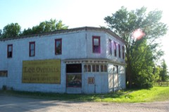 | Nelson's Grocery | building | 1977 | 77001027 |
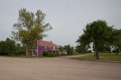 | Post Office | building | 1977 | 77001028 |
 | Red River Valley University | building | 1984 | 84002770 |
 | Richland County Courthouse | building | 1980 | 80002926 |
 | South Wild Rice Church | building | 1982 | 82001345 |
| St. Alban's Episcopal Church | building | 1992 | 92001607 | |
 | US Post Office-Wahpeton | building | 1989 | 89001759 |
 | Wahpeton Hospital | building | 1983 | 83001940 |
Every wildfire the federal occurrence database records inside this county: 102 of them, burning about 3,783 acres. 3 started naturally and 8 were recorded as arson. Each settlement page carries the fires within five miles of it.
| Reported cause | Fires |
|---|---|
| Debris and open burning | 30 |
| Missing data/not specified/undetermined | 30 |
| Arson/incendiarism | 8 |
| Recreation and ceremony | 8 |
| Equipment and vehicle use | 7 |
| Railroad operations and maintenance | 7 |
| Fireworks | 6 |
| Natural | 3 |
| Power generation/transmission/distribution | 2 |
| Smoking | 1 |
The five largest, by the area the report gives. Two of them were set deliberately.
| Date | Cause | Size | Reported by | Name on the report |
|---|---|---|---|---|
| 3 April 2012 | Debris and open burning | 678 acres | Dakota Prairie National Grasslands | VIKING PRAIRIE |
| 28 November 2017 | Missing data/not specified/undetermined | 600 acres | North Dakota State Forest Service | GRASS LAND FIRE |
| 29 November 2017 | Arson/incendiarism | 480 acres | Tewaukon Wetland Management District | GUNNESS |
| 3 April 2016 | Arson/incendiarism | 474 acres | Tewaukon National Wildlife Refuge | BIGGS |
| 25 April 2003 | Missing data/not specified/undetermined | 300 acres | Tewaukon National Wildlife Refuge | AASER |
| 7 May 2013 | Debris and open burning | 204 acres | Dakota Prairie National Grasslands | SHEEP FENCE GATE |
| 30 November 2012 | Missing data/not specified/undetermined | 102 acres | Tewaukon Wetland Management District | PHEASANT HART WF |
| 9 May 2017 | Missing data/not specified/undetermined | 100 acres | North Dakota State Forest Service | HAPPY VALLEY FIRE |
Every settlement page carries the fires within five miles of it - see the settlement index below.
The NOAA Storm Events Database holds 708 reports for this county, causing 2 deaths, 32 injuries and about $6,537,750 in recorded property damage. Each settlement page carries the reports that name it.
| Kind of event | Reports |
|---|---|
| Hail | 296 |
| Thunderstorm Wind | 244 |
| Tornado | 62 |
| Flash Flood | 44 |
| Funnel Cloud | 34 |
| Flood | 20 |
| Lightning | 4 |
| Heavy Rain | 4 |
The most serious of them, by death, then injury, then recorded damage. The accounts are quoted exactly as the forecast office filed them.
| When | Event | Place named | Harm | What the report says |
|---|---|---|---|---|
| July 1955 | Tornado (F4) | not stated | 2 killed, 19 hurt, $250,000 | no account filed |
| May 1964 | Tornado (F3) | not stated | 11 hurt | no account filed |
| June 1999 | Thunderstorm Wind | Wahpeton | 1 hurt, $75,000 | A 5 year-old boy was injured when parts of a neighbors roof came through a window in his house. He received 10 to 12 stitches on his neck and head from glass cuts. Nearby a garage was blown off its foundation and a boat was lifted into some trees. Another neighbor had a shed destroyed and a fish house, boat, and grain bins were damaged. |
| April 2002 | Thunderstorm Wind | Great Bend | 1 hurt, $20,000 | Outflow from a thunderstorm knocked 2 semi trucks off Interstate 29 west of Wahpeton. |
| April 2006 | Flood | Countywide | $1,140,000 | The Red River at Wahpeton/Breckenridge rose above flood stage around 2 AM CST on March 30th and remained above flood stage until around 8 PM CST on April 9th. The river peaked at roughly 15.95 feet around 3 AM CST on April 1st. Unofficially, 15.95 feet would be the sixth highest modern-day river stage recorded. The fifth highest modern-day river stage of 25.10 feet (unofficial) was recorded on the Wild Rice River at Abercrombie on April 2nd. Overland flooding also occurred in addition to the river flooding. At one point, approximately 35 bridges along the Wild Rice River and around 30 roads were closed due to flooding. Near Lidgerwood, overland flooding from a slough threatened a retirement center on the southwest edge of town. The Governor of North Dakota authorized the National Guard to assist in the construction of a 3 foot high temporary dike to hold off floodwaters. National Guard troops were also deployed to the Wahpeton area to assist in constructing/monitoring temporary dikes. The widening Wild Rice River in the Great Bend area surrounded several homes. At Dwight, the city lift station was sandbagged to protect it from the floodwaters. The Red River bridge from Abercrombie to Kent was also closed for a time. After the spring flood of 1997, many communities along the Red River looked at ways to mitigate flood effects. For Wahpeton, a higher permanent levee system was in the process of being constructed, which would protect the city to a level of 19.5 feet. A majority of the dike work had been completed, which helped minimize the effects of the 2006 spring flood. Richland County received a Presidential Disaster Declaration for damages caused by spring flooding.In summary, the total public and private flood losses experienced within the Red River of the North basin through late March and April 2006 were likely in excess of $20 million. This includes the following amounts. For Minnesota state and local infrastructure (this total includes the damages listed for each county), $8.5 million. For North Dakota state and local infrastructure (this total includes the damages listed for each county), $8 million. For Federal agencies (USACE, USGS, and USCG), $1.5 million. For the transportation industry costs due to traffic diversions caused by prolonged road and bridge closures, $1.5 million. For personal property losses due to floodwaters surrounding more than 500 individual farmsteads and rural homesteads, $1.0 million. |
| July 2011 | Thunderstorm Wind | La Mars | $500,000 | Several grain bins were dented in and numerous large tree limbs were broken down at a farmstead. Numerous tree branches were broken down in shelterbelts throughout Devillo and Lemars townships. Some corn fields were flattened. |
| May 2011 | Tornado (EF2) | Walcott | $500,000 | This tornado tracked north northeastward for roughly two miles before crossing into Cass County. The tornado was likely enshrouded in downburst winds and heavy rain. The tornado and accompanying winds knocked down numerous wooden power poles along its path and four steel t-bar high voltage towers. Peak winds were estimated at 120 mph. |
| July 2020 | Thunderstorm Wind | Fairmount | $300,000 | A squall with embedded microburst moved across the Fairmount area, snapping large branches and smaller trees at numerous rural properties and in the town itself. The overhead doors were blown in on a few garages and an industrial building. A fertilizer plant had a large north-facing overhead door blown in and a section of its northeast side wall blown out. |
| May 2011 | Thunderstorm Wind | Walcott | $250,000 | There were reports of damage to many cars and buildings in Walcott. The firehall and city administration building lost sections of roofing and falling tree limbs crushed vehicles and roofs of several homes. |
| July 1973 | Tornado (F3) | not stated | $250,000 | no account filed |
| June 1964 | Tornado (F2) | not stated | $250,000 | no account filed |
| June 2005 | Thunderstorm Wind | Mooreton | $225,000 | A mule barn under construction was blown down at the Bagg bonanza farm. |
| June 2017 | Thunderstorm Wind | La Mars | $200,000 | Vehicle windows were broken by wind driven gravel. Several trees were also blown down in the area. |
| June 2017 | Thunderstorm Wind | Fairmount | $200,000 | Trees and buildings were damaged by the strong wind. |
| June 2017 | Thunderstorm Wind | Tyler | $200,000 | A grain bin and building were damaged. |
| July 2011 | Thunderstorm Wind | Wyndmere | $200,000 | The wind gust was measured by a NDSU NDAWN mesonet site. Numerous large tree limbs were broken down around the town of Wyndmere along with four wooden power poles. Wind damage was widespread throughout Wyndmere and Danton townships suggestive of peak winds from 55 to 65 mph, with isolated peak winds to 80 mph. |
| April 2023 | Flood | Wahpeton | $194,000 | Wahpeton - First crest of 12.29 ft occurred on 4/15, with a secondary crest of 12.51 ft occurring on 4/19.|NOTE: Damages dollar amount is for the entire county. Not separated by specific river basin or damage type. |
| April 2023 | Flood | Enloe | $194,000 | Abercrombie - Wild Rice River - Crest of 18.41 feet occurred on 4/19. A second crest of 10.03 feet occurred on May 1 (Included with May storm data).||NOTE: Damages dollar amount is for the entire county. Not separated by specific river basin or damage type. |
| August 2008 | Flash Flood | Wahpeton | $150,000 | Water was reported to be 2 to 3 feet deep in the streets of Wahpeton with water up on front lawns. 2.75 inches of rain fell in two hours. No travel was advised by city officials. |
| July 2011 | Thunderstorm Wind | Mooreton | $100,000 | Numerous large tree limbs were broken down and some shingles were torn off homes in Mooreton. Widespread wind damage was evident throughout Barney and Mooreton townships. |
| July 2007 | Thunderstorm Wind | Wyndmere | $100,000 | At a location two miles east of McLeod, siding was peeled off a house and a trampoline was wrapped around a tree. Other large tree branches were also blown down. |
| July 2001 | Tornado (F1) | Barney | $100,000 | 70 trees were uprooted and twisted in different directions. The awnings of a home and a barn were destroyed by the tornado. Several radio towers were toppled. At a nearby farm, a large grain bin, house, and several other buildings were damaged. |
| June 1999 | Thunderstorm Wind | Wahpeton | $100,000 | A business on Highway 13 reported substantial damage to its machinery and buildings as the high winds came through. A semi truck also was blown over close by. |
| July 1998 | Thunderstorm Wind | Hankinson | $75,000 | Strong straightline winds crumpled several large metal grain bins at the town elevator. Hundreds of trees were blown down, one landing on a house. Power was knocked out and phone service was disrupted. |
| May 2012 | Thunderstorm Wind | Great Bend | $50,000 | About one-half mile of power poles were snapped near the intersection of county roads 16 and 1. A barn and silo at a farmstead were heavily damaged. Peak winds were estimated at 80 to 90 mph. |
| May 1993 | Thunderstorm Wind | Lidgerwood | $50,000 | Strong winds uprooted trees 30 inches in diameter and 40 feet tall. The winds also flattened garages, and demolished barns and sheds. |
| May 1998 | Flood | Wahpeton | $50,000 | no account filed |
| May 1996 | Tornado (F1) | Hankinson | $50,000 | no account filed |
| July 1998 | Thunderstorm Wind | Fairmount | $35,000 | Strong winds completely demolished a 50x100 foot pole shed, and scattered debris for a half mile. Many trees were blown down, windows were broken, and a propane tank was blown over. Another barn at a neighboring farm was also destroyed. |
| July 2011 | Tornado (EF1) | Stiles | $30,000 | The tornado became enshrouded in heavy rains and downburst winds. Several trees were snapped or uprooted in farm shelterbelts. Peak winds were estimated at 95 mph. |
| August 2008 | Flash Flood | Abercrombie | $30,000 | Several fields and farm access roads were flooded due to runoff from heavy rains in northeast Richland County. The water slowly subsided through the morning of the 12th as runoff moved into the larger river system. |
| June 1999 | Thunderstorm Wind | Lidgerwood | $30,000 | A 108x50 foot storage shed was picked up by the wind and thrown into a grove of trees. Some debris was thrown 1000 feet away. |
| June 1997 | Lightning | Galchutt | $30,000 | Lightning struck the steeple of a church, igniting a fire in the bell house. |
| May 1989 | Tornado (F0) | not stated | $25,000 | no account filed |
| May 1989 | Tornado (F0) | not stated | $25,000 | no account filed |
| July 1988 | Tornado (F0) | not stated | $25,000 | no account filed |
| July 1986 | Tornado (F0) | not stated | $25,000 | no account filed |
| August 1977 | Tornado | not stated | $25,000 | no account filed |
| July 1974 | Tornado (F1) | not stated | $25,000 | no account filed |
| July 1966 | Tornado | not stated | $25,000 | no account filed |
| August 1960 | Tornado (F2) | not stated | $25,000 | no account filed |
| July 1959 | Tornado | not stated | $25,000 | no account filed |
| July 1952 | Tornado (F3) | not stated | $25,000 | no account filed |
| July 2016 | Flash Flood | Wahpeton | $20,000 | Knee deep water was reported over Sixth Street South, along with basement flooding and power outages. |
| July 2011 | Thunderstorm Wind | Lidgerwood | $20,000 | A large tree was blown onto a house. Other trees were uprooted. |
| June 2008 | Thunderstorm Wind | Walcott | $20,000 | Several large cottonwood tree limbs were knocked down in a shelter belt along the Cass County line. |
| June 2008 | Thunderstorm Wind | Walcott | $20,000 | Several large four to six inch branches were knocked down by the wind. |
| July 2001 | Thunderstorm Wind | Walcott | $20,000 | Half of the metal roof on the fire station was blown off and deposited a block away. Many trees were uprooted by the strong wind. |
| July 2008 | Hail | Hankinson | $20,000 | no account filed |
| May 2012 | Thunderstorm Wind | Wahpeton Arpt | $15,000 | The 2315 CST observation from the Wahpeton airport AWOS came in with a gust to 65 knots. The time was estimated by radar. The 83 mph wind gust was measured by a personal weather station located just south of the airport. A private hanger door was caved in by the wind which caused some damage to an airplane parked just inside the door. |
| August 2011 | Flash Flood | Hankinson | $15,000 | Reports of 4.00 to 6.50 inches of rain were received from Hankinson. This filled ditches and quickly covered some roads and streets in town. |
| July 2009 | Heavy Rain | Hankinson | $15,000 | Roughly three inches of rain fell in about two hours, causing some drainage problems around the city of Hankinson. Main Street was closed, as the storm sewers could not keep up with the runoff. Several businesses in low spots had minor water damage. |
| May 2015 | Flash Flood | Wyndmere | $10,000 | Three to four inches of rain fell in a short duration, flooding ditches, fields, and farm access roads across portions of Westend and Homestead townships. |
| June 2013 | Flood | Christine | $10,000 | Overland flooding developed over portions of rural Eagle Township. Four to eight inches of very heavy rainfall from the preceding evening collected in farm fields, ditches, and small streams through the early morning then steadily drained towards the Red River during the day. County and township roads were overtopped and partially washed out at several locations. |
| June 2009 | Flash Flood | Walcott | $10,000 | Fields and farm access roads were flooded near Abercrombie. Portions of southern Eagle and northeastern Abercrombie townships received from 4 to 7 inches of rain from the late afternoon of the 16th through the overnight hours of the 17th. |
| June 2008 | Hail | Lidgerwood | $10,000 | The hail occurred for a few minutes from 10:57 AM to 11:00 AM CDT. |
| July 2008 | Tornado (EF0) | Wahpeton | $10,000 | A brief touchdown occurred in southern Wahpeton. A large tree was snapped and fell on a house. Other minor shingle and tree branch damage occurred nearby. Peak winds were estimated at 80 mph. |
| July 2002 | Lightning | Wahpeton | $10,000 | 35 to 40 homes were evacuated after lightning ruptured a gas line. The residents were allowed to return two hours later. |
| July 2001 | Thunderstorm Wind | Wyndmere | $10,000 | A grain bin was lifted off its foundation and demolished. Numerous trees were blown down. |
| June 1998 | Thunderstorm Wind | Walcott | $10,000 | A barn roof was blown off and trees were downed in the strong wind. |
The Survey's mineral resources record lists 5 workings inside this county. 3 still produce and 2 are closed or unrecorded. Each settlement page carries the workings within five miles of it.
| Commodity | Workings |
|---|---|
| Sand and Gravel, Construction | 5 |
The least common of them first, because a county's hundredth gravel pit says nothing its first ten did not.
| Where | Site | Commodity | Status | Recorded |
|---|---|---|---|---|
| Fishers Wipperman Pit & Plant | Sand and Gravel, Construction | Past Producer | ||
| Richland Pit | Sand and Gravel, Construction | Past Producer | ||
| Scheffler Pit | Sand and Gravel, Construction | Producer | ||
| Scheffler Plant | Sand and Gravel, Construction | Producer | ||
| Wipperman Pit and Plant | Sand and Gravel, Construction | Producer |
Named settlements recorded in the Geographic Names Information System, each with the topographic sheets covering it. Villages, hamlets and abandoned places alike. Each is shown with the nearest named watercourse or landform and the survey quadrangle it falls on.