 Block
Ansley, Nebraska
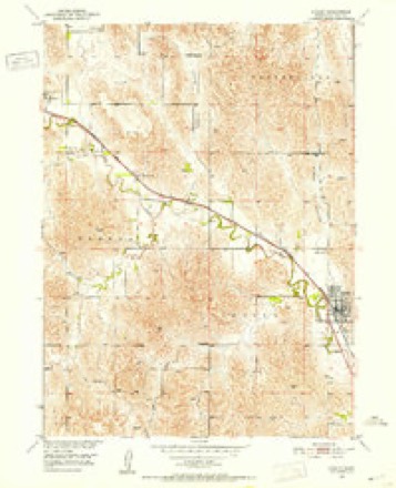
11 topographic sheets cover this place, the earliest surveyed in 1951 and the latest in 1985. It stands in Ansley Township. It lies in ZIP code area 68814. It lies near Comer Canyon. The Survey maps it on the Ansley quadrangle. 459 people lived here at the 2020 count. It stands 2,306 feet above sea level.
On record in Ansley
Buildings and businesses the archive holds for this place. Each opens its own page, with the source record it came from.
On the National Register 1 record
 First National Bank-Steinmeier Buildinglisted 2011
Population over time
2 figuresAnsley grew from 441 to 459 between 2010 and 2020. These are the recorded population figures Wikidata holds for this place, reached through the Geographic Names Information System number this page is keyed on rather than by name, so they belong to this place and not to another of the same name. Most are census counts, but not all are: an early figure may be a founding or settlement estimate, and an estimate published within five years of a census is left out. The change column is computed, and is left blank where more than 20 years separate a figure from the one before it, because a gap that long is not a change between two counts.
| Year | People | Change |
|---|---|---|
| 2010 | 441 | |
| 2020 | 459 | +18 (+4%) |
Topographic sheets covering this place
4 surveys from 11 printed sheetsMatched by testing this settlement's coordinate against the published boundary of every sheet in the United States Geological Survey's historical collection. Each opens the scanned sheet at the Survey.
- 1951 USGS Ansley quadrangle1:24000, 3 printings
- 1955 USGS Broken Bow quadrangle1:250000, 5 printings
- 1956 USGS Broken Bow quadrangle1:250000
- 1985 USGS Broken Bow quadrangle1:100000, 2 printings
In the county-history sources
1,574 words on this townshipHistory of Custer County, Nebraska; a Narrative of the Past, with Special Emphasis Upon the Pioneer Period of the County's History, Its Social, Commercial, Educational, Religous, and Civic Developement from the Early Days to the Present Time, published 1919 names this settlement in its chapter on Ansley Township. These are the passages that mention it, exactly as the scans read.
The Christian church of Ansley was organized in Alarch 1889, following a meeting held in a hall over C. J. Stevens" store, by the state evangelist, R. C. Barrow. The charter members were Dan Hagin, Mrs. Dovia Hagin, Frank Hagin, John Sargent, Laura A. Sargent, Simon Rigby, Alice Rigby, Mary Hagin, George Rich, Marie Rich, Fanny Gaines, ^Irs. Anthony, and Jeanette Stevenson (now Mrs. Frank Housel). The officiary consisted of two elders, John Sargent and George Rich, and two deacons, Dan Hagin and Simon Rigby. In 1892 the present house of worship was erected, at a cost of $3,000. and it was dedicated in Augvist of that year, by Dr. W. P. Aylsworth. dean of the sacred-literature department of Cotner L'niversity. The succes- sion of pastors is here recorded: W. H. Hedges, Fred Hagin, J. Sherman Hill. J. \\'. Walker. George Bailey, Jesse R. Teagarden, C. \'. Allison, T. C. :McIntyre. D. G. \\'agner. F. D. Hobson, P. G. Dennis, and the present pastor, Charles A. Shook. The church now has an active membership of 153 and an outlying membership of about thirty-five in th? church organized at the Banner schoolhouse in December, 1917, by the pastor, Charles A. Shook. It has a Bible school enrollment of about 150, with an average attendance of seventy-one. C. W. Hawk is the present superintendent. The Chi'istian Endeavor Society has thirteen members and Miss Eva S'tuckey is president. There is a strong woman's missionary society, known as the Christian Woman's Board of Missions .-Xuxiliarv, with
Passage source: History of Custer County, Nebraska; a Narrative of the Past, with Special Emphasis Upon the Pioneer Period of the County's History, Its Social, Commercial, Educational, Religous, and Civic Developement from the Early Days to the Present Time, published 1919.
This church has sent out one preacher, Fred Hagin, son of Dan and Mrs. Dovia Hagin, and he has been for some years a missionary in the foreign field, at Tokio, Japan. This has been one of the strong churches of the Disciples of Christ in this county. It has maintained its vitality and has a prominent place in the village of Ansley and the community round about.
Passage source: History of Custer County, Nebraska; a Narrative of the Past, with Special Emphasis Upon the Pioneer Period of the County's History, Its Social, Commercial, Educational, Religous, and Civic Developement from the Early Days to the Present Time, published 1919.
In October, 1906, O. A. Adams, pastor of the church at Ansley, with Louis Epler as singing evangelist, held a meeting in the opera hall at Mason City resulting in an organization with the following officers : Elders, Sherman Knox, Oren Dolen ; deacons, George Chipps, Vannie Reed, William Davis, Ross Rhodes; church clerk, Oren Dolen.
Passage source: History of Custer County, Nebraska; a Narrative of the Past, with Special Emphasis Upon the Pioneer Period of the County's History, Its Social, Commercial, Educational, Religous, and Civic Developement from the Early Days to the Present Time, published 1919.
Machine-read from a century-old scan, so expect the errors a machine makes: misspelled names, dropped words, stray characters.
Read the whole chapter on Ansley Township - it names this place 1 more 1 time.
Fires near this place
15 since 2008Regional context, not property-specific evidence. The federal wildfire occurrence database lists 15 fires within 5 miles of Ansley between 2008 and 2017, burning about 74 acres in total. None started naturally. None was recorded as arson. Distance is straight-line from the map coordinates, so a fire counted here may appear on a neighbouring settlement's page as well.
| Reported cause | Fires |
|---|---|
| Debris and open burning | 6 |
| Equipment and vehicle use | 3 |
| Missing data/not specified/undetermined | 3 |
| Smoking | 1 |
| Railroad operations and maintenance | 1 |
| Power generation/transmission/distribution | 1 |
The most recent of them, most recent first, with the day each was reported and the service that recorded it.
| Date | Cause | Size | Reported by | Name on the report |
|---|---|---|---|---|
| 10 July 2012 | Missing data/not specified/undetermined | 1.0 acres | Nebraska Forest Service | not named |
| 26 June 2010 | Equipment and vehicle use | under an acre | Nebraska Forest Service | not named |
| 12 June 2010 | Equipment and vehicle use | under an acre | Nebraska Forest Service | not named |
| 30 April 2008 | Power generation/transmission/distribution | under an acre | Nebraska Forest Service | not named |
| 7 March 2015 | Debris and open burning | 1.0 acres | Nebraska Forest Service | not named |
| 3 March 2013 | Debris and open burning | 15 acres | Nebraska Forest Service | not named |
| 28 March 2008 | Debris and open burning | under an acre | Nebraska Forest Service | not named |
| 19 March 2017 | Debris and open burning | 1.0 acres | Nebraska Forest Service | not named |
Settlements close enough to share some of these fires:
Storms near this place
60 of 61 shownRegional context, not property-specific evidence. The National Weather Service names Ansley in 61 storm reports between 1999 and 2025: 43 hail, 13 thunderstorm wind, 4 tornado, 1 heavy rain. No death or injury is recorded in these reports. Each account below is quoted exactly as the forecast office filed it, from the NOAA Storm Events Database, and each date opens the federal record of that event.
| When | Event | Place named | Harm | What the report says |
|---|---|---|---|---|
| April 2003 | Tornado (F0) | Ansley | $20,000 | A tornado tossed irrigation pipe as it crossed a field and then broke off numerous trees and destroyed a metal machine shed as it moved over a farmstead. Metal from the machine shed was twisted around trees and also thrown across the road into an open field. Then as it moved through another open field, it overturned a center pivot irrigation system. |
| April 2003 | Tornado (F0) | Ansley | $20,000 | As the tornado encountered a farmstead, it pushed a detached garage from its foundation, overturned a four-wheel all-terrain vehicle, and threw a metal cattle feeder 100 feet to the other side of the road. It also tore numerous shingles off a roof and broke two windows in the farmhouse. Power poles were also broken. |
| May 2011 | Thunderstorm Wind | Ansley | $15,000 | Emergency manager reported several empty grain bins blown down. Also, irrigation pipes were strewn about. |
| May 2002 | Hail | Ansley | $10,000 | no account filed |
| July 2008 | Thunderstorm Wind | Ansley | $5,000 | The Emergency Manager reported downed power lines and power outages in and around Ansley. |
| April 2003 | Hail | Ansley | $4,000 | no account filed |
| June 2003 | Hail | Ansley | $4,000 | no account filed |
| July 2015 | Hail | Ansley | $2,000 | A window was broken out by golf ball sized hail. |
| April 2003 | Hail | Ansley | $2,000 | no account filed |
| April 2024 | Thunderstorm Wind | Ansley | $1,000 | Thunderstorm wind gusts, estimated at near 70 MPH led to roof damage with some shingles lifted and blown away. Report was from social media. |
| June 2024 | Thunderstorm Wind | Ansley | - | A 60 MPH wind gust measured by a home weather station. |
| June 2024 | Thunderstorm Wind | Ansley | - | Mesonet measured a 66 MPH wind gust at this location. |
| July 2022 | Thunderstorm Wind | Ansley | - | A trained weather spotter estimated 60 mph wind gusts in Ansley. |
| July 2022 | Thunderstorm Wind | Ansley | - | A trained weather spotter reported 70 mph wind gusts and pea size hail in Ansley. |
| July 2022 | Hail | Ansley | - | A trained weather spotter reported quarter size hail in Ansley. |
| June 2022 | Thunderstorm Wind | Ansley | - | Power poles down. |
| July 2020 | Hail | Ansley | - | Golf ball size hail caused crop damage near Ansley. |
| July 2020 | Hail | Ansley | - | Hail estimated up to golf ball size resulted in significant crop damage between Ansley and Mason City. |
| May 2018 | Thunderstorm Wind | Ansley | - | No damage reported. |
| August 2017 | Thunderstorm Wind | Ansley | - | Thunderstorm wind gust estimated at 70 MPH at this location. |
| August 2016 | Thunderstorm Wind | Ansley | - | Estimated wind gust of 60 mph. |
| July 2015 | Hail | Ansley | - | Severe hail damage to crops reported at this location. |
| July 2015 | Thunderstorm Wind | Ansley | - | In addition to strong winds, hail of unknown size stripped garden plants at this location. |
| July 2013 | Hail | Ansley | - | Ground was covered with hen egg sized hail. |
| June 2011 | Hail | Ansley | - | Public reported quarter to golf ball sized hail. |
| June 2011 | Hail | Ansley | - | The ground was almost covered white with hail pea to half dollar sized. |
| June 2011 | Hail | Ansley | - | Custer county emergency manager reported numerous home windows broken in Ansley from large jagged hail, along with trees stripped of foliage. |
| August 2010 | Heavy Rain | Ansley | - | Heavy rainfall in Mason City was measured to 3.60 inches. |
| May 2004 | Tornado (F0) | Ansley | - | The tornado touched down in an open field. |
| May 2004 | Tornado (F0) | Ansley | - | The tornado touched down in an open pasture. |
| June 2025 | Hail | Ansley | - | no account filed |
| May 2022 | Hail | Ansley | - | no account filed |
| June 2022 | Hail | Ansley | - | no account filed |
| May 2022 | Hail | Ansley | - | no account filed |
| April 2021 | Hail | Ansley | - | no account filed |
| September 2019 | Hail | Ansley | - | no account filed |
| July 2018 | Hail | Ansley | - | no account filed |
| April 2017 | Hail | Ansley | - | no account filed |
| July 2015 | Hail | Ansley | - | no account filed |
| June 2014 | Hail | Ansley | - | no account filed |
| June 2014 | Hail | Ansley | - | no account filed |
| June 2014 | Hail | Ansley | - | no account filed |
| July 2013 | Hail | Ansley | - | no account filed |
| July 2013 | Hail | Ansley | - | no account filed |
| July 2013 | Hail | Ansley | - | no account filed |
| July 2013 | Hail | Ansley | - | no account filed |
| June 2010 | Hail | Ansley | - | no account filed |
| June 2010 | Hail | Ansley | - | no account filed |
| June 2010 | Hail | Ansley | - | no account filed |
| July 2010 | Hail | Ansley | - | no account filed |
| June 2008 | Thunderstorm Wind | Ansley | - | no account filed |
| June 2008 | Hail | Ansley | - | no account filed |
| June 2008 | Hail | Ansley | - | no account filed |
| May 2005 | Hail | Ansley | - | no account filed |
| June 2005 | Hail | Ansley | - | no account filed |
| March 2004 | Hail | Ansley | - | no account filed |
| March 2004 | Hail | Ansley | - | no account filed |
| May 2002 | Hail | Ansley | - | no account filed |
| May 2002 | Hail | Ansley | - | no account filed |
| May 1999 | Hail | Ansley | - | no account filed |
Nearest settlements
The eight closest, with where each one stands in the county. Distances are straight-line, computed from the Geographic Names Information System coordinates.
| Map | Place | Distance | Sheets |
|---|---|---|---|
| Mason City | 6.2 miles | 12 | |
| Westerville | 7.5 miles | 11 | |
| Berwyn | 7.6 miles | 11 | |
| Buckeye | 12.0 miles | 11 | |
| Weissert | 12.8 miles | 11 | |
| Cumro | 13.9 miles | 11 | |
| Burr Oak | 14.6 miles | 11 | |
| Elton (historical) | 15.6 miles | 11 |
Elsewhere
Matched on this settlement's Geographic Names Information System number rather than its name, so it cannot be a different place of the same name in another state.
| Wikipedia article on Ansley | An encyclopaedic summary. Its text is share-alike, so it is linked here rather than copied. |
| Wikidata item Q957708 | The structured record the population and elevation above come from. Public domain (CC0). |
Provenance
This settlement is recorded in the Geographic Names Information System as feature 827004. The sheet list is computed by point-in-boundary test against the United States Geological Survey's historical topographic inventory. Both are works of the United States government and carry no copyright under 17 U.S.C. 105.
Wildfire. Short, Karen C. 2022. Spatial wildfire occurrence data for the United States, 1992-2020 [FPA_FOD_20221014]. 6th Edition. Fort Collins, CO: Forest Service Research Data Archive. https://doi.org/10.2737/RDS-2013-0009.6 Collected with United States Government funding and usable without additional permissions or fees.
Storms. NOAA National Centers for Environmental Information, Storm Events Database https://www.ncei.noaa.gov/stormevents/ A work of the United States government, no copyright under 17 U.S.C. 105. Narratives are quoted verbatim from the National Weather Service report and are not edited or summarised.