 Block
Berwyn, Nebraska
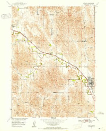
11 topographic sheets cover this place, the earliest surveyed in 1951 and the latest in 1985. It stands in Berwyn Township. It lies in ZIP code area 68814. It lies near Dutchman Valley. The Survey maps it on the Ansley quadrangle. 75 people lived here at the 2020 count. It stands 2,379 feet above sea level.
Population over time
2 figuresBerwyn fell from 83 to 75 between 2010 and 2020. These are the recorded population figures Wikidata holds for this place, reached through the Geographic Names Information System number this page is keyed on rather than by name, so they belong to this place and not to another of the same name. Most are census counts, but not all are: an early figure may be a founding or settlement estimate, and an estimate published within five years of a census is left out. The change column is computed, and is left blank where more than 20 years separate a figure from the one before it, because a gap that long is not a change between two counts.
| Year | People | Change |
|---|---|---|
| 2010 | 83 | |
| 2020 | 75 | -8 (-10%) |
Topographic sheets covering this place
4 surveys from 11 printed sheetsMatched by testing this settlement's coordinate against the published boundary of every sheet in the United States Geological Survey's historical collection. Each opens the scanned sheet at the Survey.
- 1951 USGS Ansley quadrangle1:24000, 3 printings
- 1955 USGS Broken Bow quadrangle1:250000, 5 printings
- 1956 USGS Broken Bow quadrangle1:250000
- 1985 USGS Broken Bow quadrangle1:100000, 2 printings
In the county-history sources
4,173 words on this townshipHistory of Custer County, Nebraska; a Narrative of the Past, with Special Emphasis Upon the Pioneer Period of the County's History, Its Social, Commercial, Educational, Religous, and Civic Developement from the Early Days to the Present Time, published 1919 names this settlement in its chapter on Berwyn Township. These are the passages that mention it, exactly as the scans read.
At the time of this writing the village of Berwyn is thirty-two years old, and if it is small for its age, let it be understood that the size in no way reflects on the enterprising spirit of the citizens. It is a convenient trading point and community center for the people on the adjacent farms and makes no pretensions to being anything else.
Passage source: History of Custer County, Nebraska; a Narrative of the Past, with Special Emphasis Upon the Pioneer Period of the County's History, Its Social, Commercial, Educational, Religous, and Civic Developement from the Early Days to the Present Time, published 1919.
It was laid out in 1886, by the Lincoln Townsite Company, on the north side of the railroad grade that was then being extended up the Muddy valley. The location centers on the section line which runs east and west between sections 16 and 21, township 16 north, range 19 west. The half-section line running north and south through these sections divides the town east and west and forms the principal business street. In the same summer, J. O. Taylor, a substantial pioneer farmer, erected on the new townsite the first store and put in a stock of dry goods and groceries. About the same time R. P. McKnight put up another store building and used it jointly for a store and restaurant. Later, McKnight made application for a postoffice and was himself commissioned the first postmaster of Berwyn. The following winter the Dierks Lumber Company established a branch office and put in a fine stock of lumber and such other accessories as generally pertain to the lumber business. A little later the West elevator was erected and a blacksmith here located early the next spring. About this time W. H. Mauk and H. S. Wayse put in a general hardware store, and the town was well started if not full fledged. It is today a prosperous vilage of modest proportions, with a population of about 300.
Passage source: History of Custer County, Nebraska; a Narrative of the Past, with Special Emphasis Upon the Pioneer Period of the County's History, Its Social, Commercial, Educational, Religous, and Civic Developement from the Early Days to the Present Time, published 1919.
Machine-read from a century-old scan, so expect the errors a machine makes: misspelled names, dropped words, stray characters.
Fires near this place
16 since 2008Regional context, not property-specific evidence. The federal wildfire occurrence database lists 16 fires within 5 miles of Berwyn between 2008 and 2020, burning about 1,644 acres in total. 1 started naturally. None was recorded as arson. Distance is straight-line from the map coordinates, so a fire counted here may appear on a neighbouring settlement's page as well.
| Reported cause | Fires |
|---|---|
| Debris and open burning | 6 |
| Railroad operations and maintenance | 4 |
| Smoking | 1 |
| Natural | 1 |
| Recreation and ceremony | 1 |
| Power generation/transmission/distribution | 1 |
| Equipment and vehicle use | 1 |
| Missing data/not specified/undetermined | 1 |
The most recent of them, most recent first, with the day each was reported and the service that recorded it.
| Date | Cause | Size | Reported by | Name on the report |
|---|---|---|---|---|
| 8 August 2012 | Missing data/not specified/undetermined | 2.0 acres | Nebraska Forest Service | not named |
| 9 June 2013 | Railroad operations and maintenance | under an acre | Nebraska Forest Service | not named |
| 28 June 2008 | Natural | 1.0 acres | Nebraska Forest Service | not named |
| 8 April 2019 | Debris and open burning | 11 acres | Nebraska Forest Service | not named |
| 18 April 2009 | Railroad operations and maintenance | 5.0 acres | Nebraska Forest Service | not named |
| 8 March 2020 | Debris and open burning | 3.0 acres | Nebraska Forest Service | not named |
| 7 March 2013 | Railroad operations and maintenance | under an acre | Nebraska Forest Service | not named |
| 26 March 2012 | Debris and open burning | 1.0 acres | Nebraska Forest Service | not named |
Settlements close enough to share some of these fires:
Storms near this place
37 since 1996Regional context, not property-specific evidence. The National Weather Service names Berwyn in 37 storm reports between 1996 and 2024: 26 hail, 4 thunderstorm wind, 2 tornado, 2 flash flood. No death or injury is recorded in these reports. Each account below is quoted exactly as the forecast office filed it, from the NOAA Storm Events Database, and each date opens the federal record of that event.
| When | Event | Place named | Harm | What the report says |
|---|---|---|---|---|
| April 2001 | Tornado (F1) | Berwyn | $100,000 | An F1 tornado developed just west of Berwyn in southeast Custer County. In the minute and a half that it was on the ground, it picked up a van on Highway 2, turned it around, and shattered the windows. The occupants of the van were uninjured. Numerous trees were uprooted or snapped off, and the roof was torn off a farm house. Another farmstead suffered damage to the house and barn. There were also irrigation pipes tossed around and bent. |
| July 2000 | Hail | Berwyn | $50,000 | no account filed |
| May 2013 | Flash Flood | Berwyn | $40,000 | Thunderstorms trained to produced 3 to 5 inches of heavy rainfall where emergency management reported flooding with water over some roads in Broken Bow, a bridge was washed out on the Callaway Road and flooding over the road 4 miles west of Broken Bow. |
| March 2019 | Flood | Berwyn | $25,000 | Road flooded 1 mile west of Berwyn. |
| July 2013 | Thunderstorm Wind | Berwyn | $1,000 | Thunderstorm wind gusts were estimated at 60 MPH and downed numerous 4 inch diameter tree limbs. |
| July 2013 | Hail | Berwyn | - | Ping pong sized hail reported at Mile Marker 291 on Highway 2. |
| June 2010 | Tornado (EF0) | Berwyn | - | A brief tornado touched down and crossed the road west of town. The storm chaser's car was hit with debris as the tornado crossed the road. |
| July 2010 | Thunderstorm Wind | Berwyn | - | The emergency manager reported three to four foot diameter trees snapped in half. |
| May 2007 | Flash Flood | Berwyn | - | Law enforcement reported water flowing over State Highways 2 and 92. |
| June 2024 | Thunderstorm Wind | Berwyn | - | no account filed |
| July 2024 | Hail | Berwyn | - | no account filed |
| June 2022 | Hail | Berwyn | - | no account filed |
| May 2019 | Hail | Berwyn | - | no account filed |
| June 2018 | Hail | Berwyn | - | no account filed |
| August 2017 | Hail | Berwyn | - | no account filed |
| August 2017 | Thunderstorm Wind | Berwyn | - | no account filed |
| June 2014 | Hail | Berwyn | - | no account filed |
| August 2014 | Hail | Berwyn | - | no account filed |
| June 2014 | Hail | Berwyn | - | no account filed |
| August 2013 | Hail | Berwyn | - | no account filed |
| May 2013 | Hail | Berwyn | - | no account filed |
| May 2013 | Hail | Berwyn | - | no account filed |
| May 2013 | Hail | Berwyn | - | no account filed |
| August 2011 | Hail | Berwyn | - | no account filed |
| June 2010 | Funnel Cloud | Berwyn | - | no account filed |
| July 2010 | Hail | Berwyn | - | no account filed |
| September 2010 | Funnel Cloud | Berwyn | - | no account filed |
| June 2008 | Hail | Berwyn | - | no account filed |
| April 2007 | Hail | Berwyn | - | no account filed |
| June 2005 | Hail | Berwyn | - | no account filed |
| June 2001 | Hail | Berwyn | - | no account filed |
| May 2000 | Hail | Berwyn | - | no account filed |
| June 1999 | Hail | Berwyn | - | no account filed |
| June 1999 | Hail | Berwyn | - | no account filed |
| June 1998 | Hail | Berwyn | - | no account filed |
| October 1998 | Hail | Berwyn | - | no account filed |
| July 1996 | Hail | Berwyn | - | no account filed |
Nearest settlements
The eight closest, with where each one stands in the county. Distances are straight-line, computed from the Geographic Names Information System coordinates.
| Map | Place | Distance | Sheets |
|---|---|---|---|
| Westerville | 7.0 miles | 11 | |
| Ansley | 7.6 miles | 11 | |
| Broken Bow | 8.2 miles | 12 | |
| Weissert | 8.6 miles | 11 | |
| Elton (historical) | 10.6 miles | 11 | |
| Buckeye | 11.7 miles | 11 | |
| Mason City | 13.8 miles | 12 | |
| Round Valley | 15.0 miles | 11 |
Elsewhere
Matched on this settlement's Geographic Names Information System number rather than its name, so it cannot be a different place of the same name in another state.
| Wikipedia article on Berwyn | An encyclopaedic summary. Its text is share-alike, so it is linked here rather than copied. |
| Wikidata item Q971120 | The structured record the population and elevation above come from. Public domain (CC0). |
Provenance
This settlement is recorded in the Geographic Names Information System as feature 827355. The sheet list is computed by point-in-boundary test against the United States Geological Survey's historical topographic inventory. Both are works of the United States government and carry no copyright under 17 U.S.C. 105.
Wildfire. Short, Karen C. 2022. Spatial wildfire occurrence data for the United States, 1992-2020 [FPA_FOD_20221014]. 6th Edition. Fort Collins, CO: Forest Service Research Data Archive. https://doi.org/10.2737/RDS-2013-0009.6 Collected with United States Government funding and usable without additional permissions or fees.
Storms. NOAA National Centers for Environmental Information, Storm Events Database https://www.ncei.noaa.gov/stormevents/ A work of the United States government, no copyright under 17 U.S.C. 105. Narratives are quoted verbatim from the National Weather Service report and are not edited or summarised.