 Block
Arnold, Nebraska
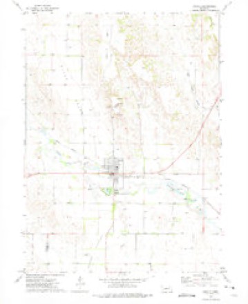
9 topographic sheets cover this place, the earliest surveyed in 1954 and the latest in 1985. It stands in Arnold Township. It lies in ZIP code area 69120. It lies near Mills Valley. The Survey maps it on the Arnold quadrangle. 592 people lived here at the 2020 count. It stands 2,703 feet above sea level.
Research this city
On record in Arnold
Buildings and businesses the archive holds for this place. Each opens its own page, with the source record it came from.
On the National Register 1 record
 Finch Memorial Librarylisted 2015
Population over time
2 figuresArnold fell from 597 to 592 between 2010 and 2020. These are the recorded population figures Wikidata holds for this place, reached through the Geographic Names Information System number this page is keyed on rather than by name, so they belong to this place and not to another of the same name. Most are census counts, but not all are: an early figure may be a founding or settlement estimate, and an estimate published within five years of a census is left out. The change column is computed, and is left blank where more than 20 years separate a figure from the one before it, because a gap that long is not a change between two counts.
| Year | People | Change |
|---|---|---|
| 2010 | 597 | |
| 2020 | 592 | -5 (-1%) |
Topographic sheets covering this place
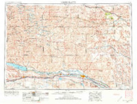
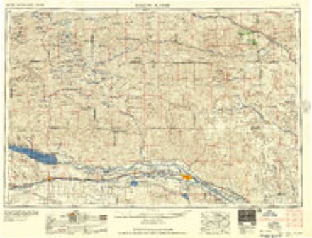
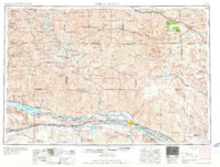
6 surveys from 9 printed sheetsMatched by testing this settlement's coordinate against the published boundary of every sheet in the United States Geological Survey's historical collection. Each opens the scanned sheet at the Survey.
- 1954 USGS North Platte quadrangle1:250000, 3 printings
- 1956 USGS North Platte quadrangle1:250000
- 1957 USGS North Platte quadrangle1:250000
- 1967 USGS North Platte quadrangle1:250000
- 1972 USGS Arnold quadrangle1:24000
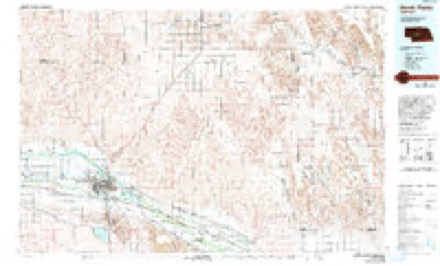
- 1985 USGS North Platte quadrangle1:100000, 2 printings
In the county-history sources
1,981 words on this townshipHistory of Custer County, Nebraska; a Narrative of the Past, with Special Emphasis Upon the Pioneer Period of the County's History, Its Social, Commercial, Educational, Religous, and Civic Developement from the Early Days to the Present Time, published 1919 names this settlement in its chapter on Arnold Township. These are the passages that mention it, exactly as the scans read.
Arnold was named in honor of George Arnold, who located in this vicinity in 1875, and who was a member of the ranch firm of Arnold & Ritchie. The original village site was located in section 28, township 17, range 25, in the famous S'outh Loup valley, near the west line of Custer county. Nebraska, the land having been homesteaded by R. E. Allen, who mile from the present site of the village, but in 1881 it was moved to the residence of R. E. Allen. Dr. J. H. Murray located here in 1884 and here he practiced his profession until 1890. In the year 1886 John Finch and A'irgil Cannon opened a drug store, Alex Robertson a bank, and Miss Mary Robertson a millinery store. A large hotel and various other business enterprises soon followed. In 1891 Arnold boasted of a population of about 150, and the following lines of business were represented: A. G. & M. E. HofTman, general merchandise ; Allen & Son, hardware, implements, and livery; Frank Anson, hotel; C.
Passage source: History of Custer County, Nebraska; a Narrative of the Past, with Special Emphasis Upon the Pioneer Period of the County's History, Its Social, Commercial, Educational, Religous, and Civic Developement from the Early Days to the Present Time, published 1919.
On the 9th day of February, 1909, the county board of Cu.ster county passed favorably upon a petition praying that the following described tract of land be incorporated as a village, to be known as the village of Arnold : "Beginning at a ])oint on the half-section line sixty rods east of the center of section 21, township 17 north, range 25 west; thence running east along said half-section line to a point sixty rods west of the center of section 22. township 17. range 25; thence south to a point on the half-section line si.Kty rods west fessor E. C. Pickett at the head as principal, J. \". Reader as intermediate teacher, and Miss Eeora Hardin as primary teacher. The tworoom school building, which afforded ample accommodation for several years, was much too small for the rapidly increasing school population during the present school year, necessitating the use of another room for the lower grades. A large and modern school building will be erected this year and, possibly, another grade added. Three churches. Christian. Methodist, and Baptist, all supporting resident pastors, are ministering to the spiritual needs of the comnuinity. .\t this writing, (some time ago), the following lines of business are represented: Ben Hardin, general merchandise and hardware ; B. E. Robinson, physician : W. H. Judkins. hardware and furniture ; the Farmers State Banl<, D. S. Bohrer, cashier; F. H. Gilcrest & Company, lumber, coal, and implements ; Dierks Lumber Company, lumber and coal ; John Finch & Son, druggists ; Arnold Mercantile Company, dry goods and groceries ; Parons Brothers, harness shop ; John Manara, barber; Ray & Reed, meat market; F. D. Reynolds, dentist; IMrs. J. Elsie Logan, physician ; Morrow & Backes. contractors and builders; H. J. Bedford, publisher Arnold Sentinel; Charles Beardsley, jeweler and optometrist; Mrs. Charles Beardsley, restaurant and bakery ; Duckett & Maddox, hardware and furniture: Helton & Roberts, general merchandise ; the Peoples State Bank, W. H. Jennings, Jr.. cashier ; Knox & Logan, real estate and insurance ; Mrs. H. R. Black, shoes and notions ; S. McCants, dry goods and groceries ; iSlcCants & Sauter, meat market; John P. Long, farm implements ; Confal Brothers, garage; S. Leland, roller mills; Grooms & Stewart, blacksmith shop; Phifer & Son, livery, feed, and dray ; Nansel & Lohr, livery, feed, and dray; N. E. Paine, blacksmith shop; H. E. Bishop, cement-block factory and builder; Arthur Down, lather; Mrs. Gertrude Parsons, hotel ; Charles McGuire, postmaster ; John Samuelson, well-maker and plumber; Gus Morrow, painter; G. G. Gunter, plasterer and bricklayer: William Collins, restaurant; Wood & Smith, hotel ; Finch, Robinson & Meads, real estate; P. G. Houghton, real estate; Dr. M. A. Rown, chiropractic; T. S. Wood, contractor and builder; R. S. Wood, painter; F. J. Smith, cement-block maker and plasterer; Stevens & George, barbers; Mark S. Tapley, plumber; C. V. Rutner, auto livery. The Beatrice Creamery Company, David Cole Creamery Company, and the Farmers Co-operative Creamery Company have stations here.
Passage source: History of Custer County, Nebraska; a Narrative of the Past, with Special Emphasis Upon the Pioneer Period of the County's History, Its Social, Commercial, Educational, Religous, and Civic Developement from the Early Days to the Present Time, published 1919.
"Tt seems hardly possible that a town of less than 1.000 inhabitants could entertain within its gates 6,000 guests at one time and do it in such a perfect and satisfactory manner that out of the vast throng not a single complaint was heard. And yet this is the record Arnold placed to its everlasting credit on Friday of last week, when it celebrated "Railroad Day.' It was a great occasion and a great gathering, the crowd being one of the largest that has ever assembled in any town in the county.
Passage source: History of Custer County, Nebraska; a Narrative of the Past, with Special Emphasis Upon the Pioneer Period of the County's History, Its Social, Commercial, Educational, Religous, and Civic Developement from the Early Days to the Present Time, published 1919.
Machine-read from a century-old scan, so expect the errors a machine makes: misspelled names, dropped words, stray characters.
Read the whole chapter on Arnold Township - it names this place 5 more 5 times.
Fires near this place
10 since 2007Regional context, not property-specific evidence. The federal wildfire occurrence database lists 10 fires within 5 miles of Arnold between 2007 and 2015, burning about 251 acres in total. 2 started naturally. None was recorded as arson. Distance is straight-line from the map coordinates, so a fire counted here may appear on a neighbouring settlement's page as well.
| Reported cause | Fires |
|---|---|
| Equipment and vehicle use | 5 |
| Debris and open burning | 2 |
| Natural | 2 |
| Missing data/not specified/undetermined | 1 |
The most recent of them, most recent first, with the day each was reported and the service that recorded it.
| Date | Cause | Size | Reported by | Name on the report |
|---|---|---|---|---|
| 1 August 2012 | Natural | 20 acres | Nebraska Forest Service | not named |
| 9 July 2012 | Equipment and vehicle use | 15 acres | Nebraska Forest Service | not named |
| 3 July 2010 | Missing data/not specified/undetermined | 1.0 acres | Nebraska Forest Service | not named |
| 15 July 2007 | Natural | under an acre | Nebraska Forest Service | not named |
| 5 May 2008 | Equipment and vehicle use | 10 acres | Nebraska Forest Service | not named |
| 31 March 2015 | Equipment and vehicle use | 160 acres | Nebraska Forest Service | not named |
| 18 March 2011 | Equipment and vehicle use | 40 acres | Nebraska Forest Service | not named |
| 24 February 2015 | Equipment and vehicle use | 1.0 acres | Nebraska Forest Service | not named |
Settlements close enough to share some of these fires:
Storms near this place
60 of 116 shownRegional context, not property-specific evidence. The National Weather Service names Arnold in 116 storm reports between 1994 and 2025: 69 hail, 23 thunderstorm wind, 17 tornado, 4 flash flood. No death or injury is recorded in these reports. Each account below is quoted exactly as the forecast office filed it, from the NOAA Storm Events Database, and each date opens the federal record of that event.
| When | Event | Place named | Harm | What the report says |
|---|---|---|---|---|
| May 2007 | Flash Flood | Arnold | $250,000 | Thunderstorms produced very heavy rainfall of 2 to 6 inches across southern Custer County. Water going over Highway 92 between Arnold and Merna washed out the shoulders in several locations. Small mudslides onto the railroad tracks occurred at the Ansley overpass. Highway 21 south of Broken Bow was also under water. Numerous secondary roads were severely damaged due to water over the roads. |
| May 1999 | Thunderstorm Wind | Arnold | $220,000 | no account filed |
| June 2024 | Tornado (EF2) | Arnold | $80,000 | Tornado touched down in the vicinity of Eureka Valley road and 15 road and traveled to the southeast for approximately 2 miles. Where the initial touchdown occurred, numerous power poles were snapped and a twisted a center pivot irrigation system occurred. Several large pieces of aluminum irrigation pipe were lofted and deposited. The tornado tracked east southeast, uprooting and damaging large trees near Dry Creek and Road 420. |
| June 2017 | Thunderstorm Wind | Arnold | $80,000 | Pivot overturned, numerous trees down, and a 100 x 80 foot building partially destroyed. |
| June 2009 | Flash Flood | Arnold | $75,000 | Emergency Management reported numerous roads washed out from heavy rain. Road lengths of up to 150 feet were washed out. |
| June 2006 | Tornado (F1) | Arnold | $70,000 | A tornado from a supercell thunderstorm touched down briefly overturning two center pivot irrigation systems and destroying alfalfa and wheat fields. |
| June 2006 | Thunderstorm Wind | Arnold | $50,000 | A supercell thunderstorm that had produced a tornado 1 mile northwest of Arnold collapsed with strong outflow winds breaking off numerous large trees, snapping off power poles, and producing roof damage on some homes. |
| June 2003 | Tornado (F0) | Arnold | $50,000 | A long lived supercell that moved from south central Lincoln County to northeast Lincoln County produced a tornado in Lincoln County near the Lincoln and Custer County line which then moved into Custer County. After entering Custer County, storm chasers and ranchers watched the tornado as it moved through corn fields and destroyed 2 center pivot irrigation systems. |
| May 2007 | Flash Flood | Arnold | $25,000 | Heavy rain from thunderstorms caused a bridge and culvert to wash out in Old Mill Park in Arnold. The ground was already saturated from heavy rain overnight. |
| May 2007 | Tornado (EF1) | Arnold | $20,000 | The tornado touched down 8 miles northeast of Arnold and traveled northward destroying a barn and windmills, breaking fences, snapping trees, and breaking windows in an old sod home. The average path width of the tornado was 220 yards. After traveling for approximately 17 miles in Custer County, the tornado crossed into Blaine County approximately 12 miles northwest of Anselmo and then into Brown County before finally lifting. The total track length of the tornado was 55 miles. |
| July 1999 | Tornado (F0) | Arnold | $20,000 | A tornado was reported to touch down south of Arnold and lifted before it reached Arnold. Damage in its path included one center pivot irrigation system, flattened crops in a field just south of town, and several trees uprooted or broken down. |
| September 2023 | Hail | Arnold | $10,000 | Vehicle damage reported in a parking lot at this location. Time estimated from radar. |
| May 2007 | Hail | Arnold | $10,000 | The hail damaged numerous cars. |
| July 2004 | Hail | Arnold | $10,000 | Hail broke windows in homes and vehicles and destroyed corn and wheat fields. |
| October 1994 | Tornado (F0) | Arnold | $10,000 | A small tornado moved southwest to northeast and caused damage over a two mile path to two farmsteads. The tornado tore metal roofing off of outbuildings, picked up a chicken house, and turned it around at the first farmstead. It destroyed large cane stacks enroute to the second farmstead. Four windows were sucked out of the home, uprooted trees in a windbreak destroyed three hog sheds, a grain bin, a metal shed, and fences. |
| July 2007 | Hail | Arnold | $8,000 | no account filed |
| May 2002 | Hail | Arnold | $8,000 | no account filed |
| June 2017 | Thunderstorm Wind | Arnold | $5,000 | Roof and decking peeled back on a well built home. |
| July 2007 | Hail | Arnold | $5,000 | no account filed |
| June 2000 | Hail | Arnold | $5,000 | no account filed |
| June 2003 | Hail | Arnold | $4,000 | no account filed |
| June 2000 | Hail | Arnold | $2,000 | Tree damage. |
| May 2005 | Hail | Arnold | $2,000 | no account filed |
| August 2002 | Thunderstorm Wind | Arnold | $1,000 | Five inch diameter limbs were broken off of trees. |
| June 2004 | Hail | Arnold | $1,000 | no account filed |
| July 2024 | Tornado (EFU) | Arnold | - | Weak tornado briefly touched down. No damage reported. |
| May 2024 | Tornado (EFU) | Arnold | - | Video and photographic evidence of a weak tornado. Location is estimated based off of verbal accounts. There was very little WSR-88d reflectivity to go off of. |
| May 2023 | Tornado (EFU) | Arnold | - | This tornado touched down in an open field. No damage was observed. |
| May 2023 | Tornado (EFU) | Arnold | - | The tornado touched down in an open field. No damage was observed. |
| July 2023 | Thunderstorm Wind | Arnold | - | A mesonet station near Arnold measured a 68 mph wind gust. |
| July 2023 | Thunderstorm Wind | Arnold | - | A trained spotter reported 60 mph winds east of Arnold. |
| May 2023 | Tornado (EFU) | Arnold | - | This tornado touched down in an open field. No damage was observed. |
| July 2021 | Thunderstorm Wind | Arnold | - | Public reported fertilizer tanks blown over, a giant corn silo caved in, and large tree branches downed. Winds were estimated around 80 mph. |
| June 2020 | Flash Flood | Arnold | - | One foot of water over the road. |
| June 2020 | Tornado (EF0) | Arnold | - | A weak tornado observed. |
| June 2020 | Tornado (EF0) | Arnold | - | A brief tornado was observed. No damage was reported. |
| March 2019 | Flood | Arnold | - | The NDOR web site reported flooding on Highway 92, 10 miles east of Arnold. |
| August 2018 | Thunderstorm Wind | Arnold | - | Tree branches up to 5 inches in diameter were downed. |
| June 2017 | Thunderstorm Wind | Arnold | - | Several large 10 to 12 inch in diameter tree limbs down. One dented a horse trailer and one fell on a power line. |
| June 2017 | Thunderstorm Wind | Arnold | - | Several large softwood trees uprooted or snapped at the trunk. |
| June 2017 | Thunderstorm Wind | Arnold | - | Reported by emergency management. |
| June 2017 | Thunderstorm Wind | Arnold | - | Building damaged and power poles down. |
| June 2017 | Thunderstorm Wind | Arnold | - | Several 10 inch limbs down from softwood trees. |
| June 2017 | Thunderstorm Wind | Arnold | - | Large healthy cottonwood tree snapped at the base. |
| October 2017 | Thunderstorm Wind | Arnold | - | No major damage reported. |
| July 2016 | Thunderstorm Wind | Arnold | - | Public estimated a 60 mph wind gust south of Arnold. |
| July 2014 | Thunderstorm Wind | Arnold | - | Hail to nickel size with high winds stripped crops of green snap and corn. |
| August 2014 | Hail | Arnold | - | Hail lasted 20 minutes and did extensive damage to corn crops north of Arnold. |
| June 2014 | Flood | Arnold | - | Weather spotter reported local flooding between North Platte northeast to the Arnold area. |
| June 2013 | Thunderstorm Wind | Arnold | - | Winds estimated at 60 mph. |
| September 2012 | Tornado (EF0) | Arnold | - | At 1605 CST, a non-supercell tornado developed about 3 miles northwest of Arnold. The tornado moved slowly south over rangeland before dissipating at 1615 CST. No damage was discernable. Average path width was 90 yards. |
| July 2011 | Thunderstorm Wind | Arnold | - | Tree damage reported at this location. |
| July 2011 | Hail | Arnold | - | Hail was jagged in nature. |
| June 2010 | Thunderstorm Wind | Arnold | - | Emergency manager reported light pole blown over in town. |
| August 2010 | Thunderstorm Wind | Arnold | - | Severe criteria winds gusts were reported from a thunderstorm south of the Arnold area. |
| June 2009 | Thunderstorm Wind | Arnold | - | Very strong winds from a bowing line of thunderstorms uprooted trees and snapped off several full size trees and large tree limbs. The majority of tree damage was on the northwest side of town. |
| June 2009 | Tornado (EF0) | Arnold | - | The brief tornado touched down over open land with no damage reported. |
| June 2007 | Tornado (EF0) | Arnold | - | Brief touchdown with no damage or injuries reported. |
| July 2004 | Hail | Arnold | - | Hail combined with strong winds damaged about 200 acres of corn and wheat crops. |
| June 2000 | Tornado (F0) | Arnold | - | Brief touchdown over open country just north of Arnold. |
Nearest settlements
The eight closest, with where each one stands in the county. Distances are straight-line, computed from the Geographic Names Information System coordinates.
| Map | Place | Distance | Sheets |
|---|---|---|---|
| Finchville | 6.8 miles | 9 | |
| Pleasant Hill | 7.3 miles | 9 | |
| Callaway | 16.9 miles | 11 | |
| Etna | 19.5 miles | 9 | |
| Dale (historical) | 20.7 miles | 11 | |
| Anselmo | 22.0 miles | 11 | |
| Lodi | 23.0 miles | 11 | |
| Merna | 23.4 miles | 11 |
Elsewhere
Matched on this settlement's Geographic Names Information System number rather than its name, so it cannot be a different place of the same name in another state.
| Wikipedia article on Arnold | An encyclopaedic summary. Its text is share-alike, so it is linked here rather than copied. |
| Wikidata item Q2879387 | The structured record the population and elevation above come from. Public domain (CC0). |
Provenance
This settlement is recorded in the Geographic Names Information System as feature 827055. The sheet list is computed by point-in-boundary test against the United States Geological Survey's historical topographic inventory. Both are works of the United States government and carry no copyright under 17 U.S.C. 105.
Wildfire. Short, Karen C. 2022. Spatial wildfire occurrence data for the United States, 1992-2020 [FPA_FOD_20221014]. 6th Edition. Fort Collins, CO: Forest Service Research Data Archive. https://doi.org/10.2737/RDS-2013-0009.6 Collected with United States Government funding and usable without additional permissions or fees.
Storms. NOAA National Centers for Environmental Information, Storm Events Database https://www.ncei.noaa.gov/stormevents/ A work of the United States government, no copyright under 17 U.S.C. 105. Narratives are quoted verbatim from the National Weather Service report and are not edited or summarised.