 Block
Broken Bow, Nebraska
12 topographic sheets cover this place, the earliest surveyed in 1951 and the latest in 1985. It stands in Broken Bow City. It lies in ZIP code area 68822. It stands on South Branch Mud Creek. The Survey maps it on the Broken Bow quadrangle. 3,506 people lived here at the 2020 count. It stands 2,477 feet above sea level.
On record in Broken Bow
Buildings and businesses the archive holds for this place. Each opens its own page, with the source record it came from.
On the National Register 6 records
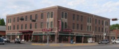 Arrow Hotellisted 1985
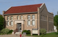 Broken Bow Carnegie Librarylisted 1998
 Custer County Courthouse and Jaillisted 1979
 Stillman P. Groat Houselisted 2015
 Security State Bank Buildinglisted 1987
- Broken Bow Commercial Square Historic Districtlisted 2006
Population over time
2 figuresBroken Bow fell from 3,559 to 3,506 between 2010 and 2020. These are the recorded population figures Wikidata holds for this place, reached through the Geographic Names Information System number this page is keyed on rather than by name, so they belong to this place and not to another of the same name. Most are census counts, but not all are: an early figure may be a founding or settlement estimate, and an estimate published within five years of a census is left out. The change column is computed, and is left blank where more than 20 years separate a figure from the one before it, because a gap that long is not a change between two counts.
| Year | People | Change |
|---|---|---|
| 2010 | 3,559 | |
| 2020 | 3,506 | -53 (-1%) |
Topographic sheets covering this place
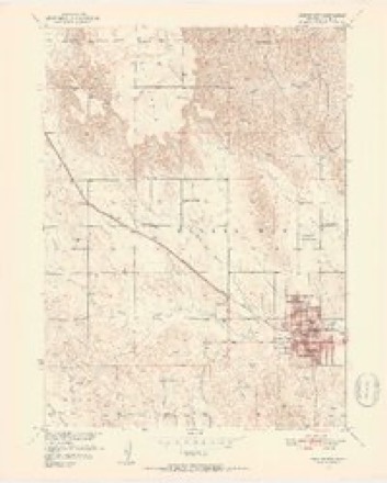
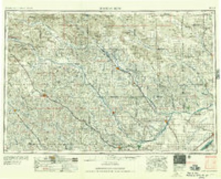
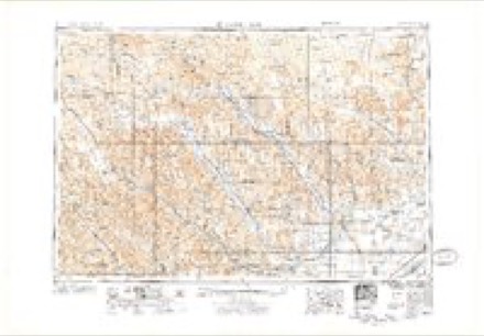
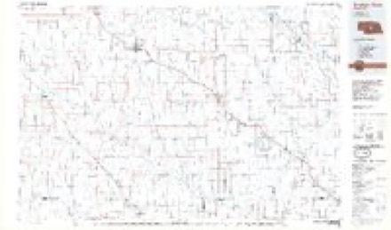
4 surveys from 12 printed sheetsMatched by testing this settlement's coordinate against the published boundary of every sheet in the United States Geological Survey's historical collection. Each opens the scanned sheet at the Survey.
- 1951 USGS Broken Bow quadrangle1:24000, 4 printings
- 1955 USGS Broken Bow quadrangle1:250000, 5 printings
- 1956 USGS Broken Bow quadrangle1:250000
- 1985 USGS Broken Bow quadrangle1:100000, 2 printings
In the county-history sources
8,212 words on this townshipHistory of Custer County, Nebraska; a Narrative of the Past, with Special Emphasis Upon the Pioneer Period of the County's History, Its Social, Commercial, Educational, Religous, and Civic Developement from the Early Days to the Present Time, published 1919 names this settlement in its chapter on Broken Bow City. These are the passages that mention it, exactly as the scans read.
Streeter for the first time wintered cattle in the territory now comprising Custer county. On Ash creek, a short distance soiitli of Broken Bow, lie turned out in the fall 821 cattle, of which 385 were yearlings. They were all Texas cattle ; the following spring he rounded up 819, a loss of only two head.
Passage source: History of Custer County, Nebraska; a Narrative of the Past, with Special Emphasis Upon the Pioneer Period of the County's History, Its Social, Commercial, Educational, Religous, and Civic Developement from the Early Days to the Present Time, published 1919.
Early in the fall of 1884 a few settlers located homesteads in the northeast corner of the Brighton Ranch Company's pasture, on Ash creek. This pasture was about fifteen miles square and extended several miles south of the Loup river almost to Broken Bow, and was inclosed with a wire fence. The land being government land, and subject to entry, these settlers served notice on the ranch company to remove their fences from about their claims within thirty days. The company paid no attention to this request, and at the expiration of the time the settlers made a raid on the fence and appropriated the posts to make roofs for their sod houses. Roofs in those days were made by laying a large log, called a ridge log, lengthwise of the building at the top. The fence posts were then laid up to form the rafters, to which brush was fastened, the whole being covered with one or two layers of prairie sod, coated with several inches of yellow clay, procured from the canyons, which turned water very eft'ectually.
Passage source: History of Custer County, Nebraska; a Narrative of the Past, with Special Emphasis Upon the Pioneer Period of the County's History, Its Social, Commercial, Educational, Religous, and Civic Developement from the Early Days to the Present Time, published 1919.
In the meantime a boy of the settlement had been despatched to Broken Bow, on the fastest pony that could be procured, to secure help, and quite a posse of men from the town started for the scene of action. The foreman of the ran;h, who was in Broken Bow at the time as complaining witness against the settlers, heard of this and sent one of his cowboys in haste to warn the second foreman of the impending invasion. The messenger arrived at the settlement in advance of the citizens and gave the alarm. The housewreckers were thoroughly scared, and. turning the heads of their mule teams toward the South Loup, a]3plied the whij) freely. As the mules began to run over the rough prairie the posts began to fall off the wagons, and as the teams began to show signs of weariness the cowboys began to heave off more posts to lighten the load as they bumped along, leaving a trail behind them like that of a railroad construction gang. Arriving at the ranch, they turned out their mules, secured their ^^'inchesters and made a break for tlie hills on the south side of the river, to await developments. When the posse of rescuers arrived at the little settlement and found the invaders gone, they did not follow them, but returned to Broken Bow. The cowboys remained in the hills two days, waiting for the approach of the enemy in vain.
Passage source: History of Custer County, Nebraska; a Narrative of the Past, with Special Emphasis Upon the Pioneer Period of the County's History, Its Social, Commercial, Educational, Religous, and Civic Developement from the Early Days to the Present Time, published 1919.
Machine-read from a century-old scan, so expect the errors a machine makes: misspelled names, dropped words, stray characters.
Read the whole chapter on Broken Bow City - it names this place 8 more 8 times.
Fires near this place
40 since 2002Regional context, not property-specific evidence. The federal wildfire occurrence database lists 40 fires within 5 miles of Broken Bow between 2002 and 2020, burning about 609 acres in total. 1 started naturally. None was recorded as arson. Distance is straight-line from the map coordinates, so a fire counted here may appear on a neighbouring settlement's page as well.
| Reported cause | Fires |
|---|---|
| Missing data/not specified/undetermined | 10 |
| Railroad operations and maintenance | 9 |
| Debris and open burning | 7 |
| Equipment and vehicle use | 6 |
| Power generation/transmission/distribution | 3 |
| Fireworks | 2 |
| Smoking | 1 |
| Misuse of fire by a minor | 1 |
| Natural | 1 |
The most recent of them, most recent first, with the day each was reported and the service that recorded it.
| Date | Cause | Size | Reported by | Name on the report |
|---|---|---|---|---|
| 5 September 2010 | Fireworks | 10 acres | Nebraska Forest Service | not named |
| 22 September 2012 | Equipment and vehicle use | 4.0 acres | Nebraska Forest Service | not named |
| 21 September 2008 | Misuse of fire by a minor | under an acre | Nebraska Forest Service | not named |
| 15 September 2012 | Railroad operations and maintenance | 7.0 acres | Nebraska Forest Service | not named |
| 8 August 2012 | Missing data/not specified/undetermined | 2.0 acres | Nebraska Forest Service | not named |
| 3 August 2018 | Railroad operations and maintenance | 14 acres | Nebraska Forest Service | not named |
| 2 August 2018 | Railroad operations and maintenance | under an acre | Nebraska Forest Service | not named |
| 17 August 2020 | Equipment and vehicle use | under an acre | Nebraska Forest Service | not named |
Settlements close enough to share some of these fires:
Storms near this place
60 of 119 shownRegional context, not property-specific evidence. The National Weather Service names Broken Bow in 119 storm reports between 1993 and 2025: 59 hail, 46 thunderstorm wind, 9 flash flood, 4 tornado. No death or injury is recorded in these reports. Each account below is quoted exactly as the forecast office filed it, from the NOAA Storm Events Database, and each date opens the federal record of that event.
| When | Event | Place named | Harm | What the report says |
|---|---|---|---|---|
| October 2000 | Tornado (F2) | Broken Bow | $1,000,000 | The tornado touched down 7 miles southeast of Broken Bow and traveled 12 miles north northeast across farm and rangeland. Initial damage occurred at touchdown with a modular home destroyed. Then over the next 2 miles 3 farmsteads were struck. The first suffered heavy damage to all buildings including the house. At the second farmstead a modular home and several buildings were completely destroyed. The third farmstead suffered extensive damage to the outbuildings and minor damage to the house. The tornado then moved across highway 2 and destroyed several farm building 4 miles east of Broken Bow. Then as the tornado moved across highway 70 another farmstead was struck with several outbuildings destroyed and the house damaged. The tornado remained on the the ground and destroyed a barn 5 miles northeast of Broken Bow, then did extensive damage to a farmstead 7 miles northeast of Broken Bow where several outbuildings were destroyed or damaged and damaged the house. Tree damage was extensive along the entire path and several center pivot irrigation systems were destroyed. The tornado lifted 7 miles northeast of Broken Bow. |
| October 2023 | Flash Flood | Broken Bow | $500,000 | Public reports flooding with buildings inundated at the Custer County Fairgrounds. |
| June 2013 | Thunderstorm Wind | Broken Bow | $200,000 | Strong winds downed power lines and produced extensive tree damage in Broken Bow. Additional damage included overturned center pivots east of town and in Callaway. Visible wind damage covered a 40 mile path from Callaway to Comstock. |
| June 2012 | Thunderstorm Wind | Broken Bow | $150,000 | Downburst winds up to 70 mph caused extensive tree damage and loss of power to half the city of Broken Bow. Reports of wind damage extended through west central Custer County to include Callaway and Arnold, where fallen tree limbs caused damage to homes, parks and power lines. |
| June 2013 | Thunderstorm Wind | Broken Bow | $100,000 | Strong winds downed large trees and power lines. Roofs were blown off buildings with one roof estimated 30 to 40 yards away from a house. |
| August 1996 | Thunderstorm Wind | Broken Bow | $50,000 | no account filed |
| September 2010 | Thunderstorm Wind | Broken Bow | $40,000 | A 40 X 60 Wick steel storage building was damaged when lifted by strong winds. The building had several trusses splintered and shifted before approximately 20 feet of the peak panels broke with the structure slammed back to the foundation. A 26 foot horse trailer was also moved two to three feet. In addition, southwest of Broken Bow a lean-to congregated steel roof on a large barn was damaged as the winds lifted and peeled panels off. A center irrigation pivot was also overturned. |
| October 1997 | Thunderstorm Wind | Broken Bow | $40,000 | 75 to 90 mph thunderstorm winds broke down power lines causing power outages in and around Broken Bow. Wind blown tree limbs damaged roofs and broke out windows. |
| June 2012 | Thunderstorm Wind | Broken Bow | $35,000 | Strong winds down numerous 3 to 4 inch diameter tree branches that covered Highway 2 from Ansley to Broken Bow. The road was temporarily closed for tree limb removal. |
| July 2009 | Thunderstorm Wind | Broken Bow | $35,000 | The strong thunderstorm winds snapped a traffic light pole and broke off 10 to 15 inch diameter tree limbs. Some of the tree limbs fell on homes and power lines. A large part of Broken Bow was without power for a period of time. |
| June 2013 | Thunderstorm Wind | Broken Bow | $25,000 | A large garage was destroyed. |
| June 2004 | Thunderstorm Wind | Broken Bow | $25,000 | Strong thunderstorm winds up to 60 knots knocked down power lines and numerous trees around Broken Bow. Property damage included windows broken out of cars, business signs broken or knocked down, and a metal shed overturned. |
| August 2017 | Thunderstorm Wind | Broken Bow | $20,000 | Emergency manager reports numerous damaged trees in Broken Bow. |
| September 2010 | Thunderstorm Wind | Broken Bow | $20,000 | The strong winds destroyed a 20 X 30 open faced garage and 8 X 10 garden shed 3 miles south of Broken Bow on highway 21. |
| July 2000 | Hail | Broken Bow | $20,000 | no account filed |
| June 1998 | Thunderstorm Wind | Broken Bow | $15,000 | Thunderstorm downburst wind damaged building and fence at fairgrounds. |
| July 2000 | Hail | Broken Bow | $15,000 | no account filed |
| July 2024 | Tornado (EF1) | Broken Bow | $10,000 | Tornado briefly touched down just northwest of the intersection of Ryno Road and Highway 2, west of Broken Bow. Surveillance video showed a brief tornado that picked up an 800 pound trailer and tossed it into a car. A large SUV was also lifted and moved 3 inches. |
| July 2020 | Flash Flood | Broken Bow | $10,000 | Torrential rainfall caused flooding at a golf course near Broken Bow. |
| July 2020 | Flash Flood | Broken Bow | $10,000 | Custer County Fairgrounds is under water. Water is standing or flowing all across town. |
| August 2002 | Hail | Broken Bow | $8,000 | no account filed |
| May 1998 | Thunderstorm Wind | Broken Bow | $5,000 | Thunderstorm winds at 60 mph damaged farm equipment 6 miles west of Broken Bow. |
| June 2014 | Hail | Broken Bow | $5,000 | no account filed |
| August 2000 | Hail | Broken Bow | $5,000 | no account filed |
| June 2003 | Hail | Broken Bow | $3,000 | no account filed |
| August 2002 | Hail | Broken Bow | $2,000 | no account filed |
| June 2008 | Hail | Broken Bow | $1,500 | no account filed |
| July 2011 | Hail | Broken Bow | $1,000 | Tennis ball sized hail damaged trees at this location. |
| June 2003 | Hail | Broken Bow | $1,000 | no account filed |
| June 2025 | Thunderstorm Wind | Broken Bow | - | Gust measured at the Broken Bow Airport. |
| May 2023 | Thunderstorm Wind | Broken Bow | - | A 58 MPH thunderstorm wind gust was reported at the Broken Bow Airport. |
| May 2023 | Thunderstorm Wind | Broken Bow | - | A measured thunderstorm wind gust of 70 MPH was reported at the Broken Bow Airport. |
| May 2023 | Thunderstorm Wind | Broken Bow | - | A 59 MPH wind gust was reported at the Broken Bow Airport. |
| July 2023 | Thunderstorm Wind | Broken Bow | - | Broken Bow Airport ASOS measured a 51 kt wind gust. |
| October 2023 | Flash Flood | Broken Bow | - | Extensive overland flooding is noted in the vicinity of highway 21 and road 797. |
| October 2023 | Flash Flood | Broken Bow | - | Swift water being reported over Highway 70 in the vicinity of Highway 2 just east of Broken Bow. |
| July 2022 | Thunderstorm Wind | Broken Bow | - | Broken Bow Airport ASOS measured a 90 mph wind gust. |
| July 2022 | Thunderstorm Wind | Broken Bow | - | Emergency management reported multiple trees downed or uprooted, gas lines broken, corn crop stripped, and other damage in and around Broken Bow. Report coincides with a 90 mph gust from the nearby ASOS. |
| July 2020 | Thunderstorm Wind | Broken Bow | - | Large trees were downed in Broken Bow. |
| July 2020 | Thunderstorm Wind | Broken Bow | - | Large trees were downed, blocking a road in Broken Bow. |
| May 2019 | Thunderstorm Wind | Broken Bow | - | Wind gust of 62 MPH measured at the Broken Bow Airport. |
| May 2019 | Thunderstorm Wind | Broken Bow | - | Gust measured at the Broken Bow Airport. |
| June 2018 | Thunderstorm Wind | Broken Bow | - | Wind gust measured at the Broken Bow Airport. |
| May 2018 | Thunderstorm Wind | Broken Bow | - | No damage reported. |
| June 2017 | Thunderstorm Wind | Broken Bow | - | Official gust. |
| August 2017 | Flash Flood | Broken Bow | - | Emergency manager reports several roads in Broken Bow covered with 6+ inches of water. |
| August 2017 | Thunderstorm Wind | Broken Bow | - | Trained spotter estimated 80 MPH wind gusts at this location. |
| August 2017 | Flash Flood | Broken Bow | - | Trained spotter reports numerous roads covered with water up to the top of curbs. |
| July 2016 | Thunderstorm Wind | Broken Bow | - | Broken Bow Airport measured a 60 mph wind gust. |
| July 2014 | Thunderstorm Wind | Broken Bow | - | Wind gusts to 70 mph estimated on the north side of Broken Bow. |
| June 2014 | Hail | Broken Bow | - | Golf ball size hail had fallen for 5 minutes at time of report. |
| August 2013 | Hail | Broken Bow | - | Strongs winds bending tree trunks with strength unknown. |
| June 2013 | Thunderstorm Wind | Broken Bow | - | Numerous trees down with estimated wind gust in excess of 70 MPH. |
| July 2013 | Thunderstorm Wind | Broken Bow | - | A trained spotter estimated thunderstorm wind gusts of 55 to 60 MPH. |
| July 2013 | Thunderstorm Wind | Broken Bow | - | Thunderstorm wind gust to 74 MPH, measured at the Broken Bow Airport. |
| August 2013 | Flash Flood | Broken Bow | - | Flood waters up to law enforcement vehicle bumpers downtown or around a foot deep. |
| February 2012 | Hail | Broken Bow | - | Half inch size hail covered the ground. |
| July 2010 | Thunderstorm Wind | Broken Bow | - | Strong winds damaged an eight foot diameter tree that was blown over in Broken Bow. |
| July 2010 | Funnel Cloud | Broken Bow | - | Trained weather spotter observed a well defined funnel cloud. |
| September 2010 | Thunderstorm Wind | Broken Bow | - | The strong winds were accompanied by quarter size hail. |
Nearest settlements
The eight closest, with where each one stands in the county. Distances are straight-line, computed from the Geographic Names Information System coordinates.
| Map | Place | Distance | Sheets |
|---|---|---|---|
| Berwyn | 8.2 miles | 11 | |
| Merna | 8.5 miles | 11 | |
| Elton (historical) | 11.2 miles | 11 | |
| Weissert | 11.3 miles | 11 | |
| Lillian | 13.0 miles | 11 | |
| Dale (historical) | 13.0 miles | 11 | |
| Round Valley | 13.1 miles | 11 | |
| Westerville | 13.7 miles | 11 |
Elsewhere
Matched on this settlement's Geographic Names Information System number rather than its name, so it cannot be a different place of the same name in another state.
| Wikipedia article on Broken Bow | An encyclopaedic summary. Its text is share-alike, so it is linked here rather than copied. |
| Wikidata item Q925730 | The structured record the population and elevation above come from. Public domain (CC0). |
Provenance
This settlement is recorded in the Geographic Names Information System as feature 827664. The sheet list is computed by point-in-boundary test against the United States Geological Survey's historical topographic inventory. Both are works of the United States government and carry no copyright under 17 U.S.C. 105.
Wildfire. Short, Karen C. 2022. Spatial wildfire occurrence data for the United States, 1992-2020 [FPA_FOD_20221014]. 6th Edition. Fort Collins, CO: Forest Service Research Data Archive. https://doi.org/10.2737/RDS-2013-0009.6 Collected with United States Government funding and usable without additional permissions or fees.
Storms. NOAA National Centers for Environmental Information, Storm Events Database https://www.ncei.noaa.gov/stormevents/ A work of the United States government, no copyright under 17 U.S.C. 105. Narratives are quoted verbatim from the National Weather Service report and are not edited or summarised.