 Block
Chapman, Nebraska
13 topographic sheets cover this place, the earliest surveyed in 1899 and the latest in 1985. It stands in Chapman Township. It lies in ZIP code area 68827. The Survey maps it on the Chapman quadrangle. 260 people lived here at the 2020 count. It stands 1,765 feet above sea level.
Research this city
On record in Chapman
Buildings and businesses the archive holds for this place. Each opens its own page, with the source record it came from.
On the National Register 1 record
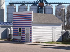 Cahow Barber Shoplisted 1984
Population over time
2 figuresChapman fell from 287 to 260 between 2010 and 2020. These are the recorded population figures Wikidata holds for this place, reached through the Geographic Names Information System number this page is keyed on rather than by name, so they belong to this place and not to another of the same name. Most are census counts, but not all are: an early figure may be a founding or settlement estimate, and an estimate published within five years of a census is left out. The change column is computed, and is left blank where more than 20 years separate a figure from the one before it, because a gap that long is not a change between two counts.
| Year | People | Change |
|---|---|---|
| 2010 | 287 | |
| 2020 | 260 | -27 (-9%) |
Topographic sheets covering this place
5 surveys from 13 printed sheetsMatched by testing this settlement's coordinate against the published boundary of every sheet in the United States Geological Survey's historical collection. Each opens the scanned sheet at the Survey.
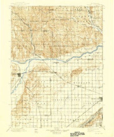
- 1899 USGS St. Paul quadrangle1:125000, 4 printings
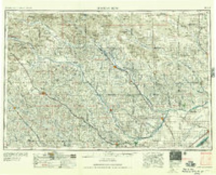
- 1955 USGS Broken Bow quadrangle1:250000, 5 printings
- 1956 USGS Broken Bow quadrangle1:250000
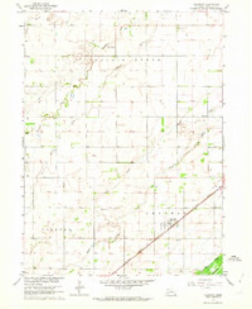
- 1962 USGS Chapman quadrangle1:24000
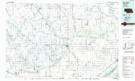
- 1985 USGS St. Paul quadrangle1:100000, 2 printings
In the county-history sources
1,425 words on this townshipA History of Merrick County, Nebraska: From "the Beginning" to 1895, published 1898 names this settlement in its chapter on Chapman Township. These are the passages that mention it, exactly as the scans read.
When the Union Pacific, in 1866, staked out its towns eleven miles apart along its road, the future station of Chapman had least reason of all the stations along th.e road to claim for itself the name of "town." Shoemaker's Point was abandoned, and yet the truth is hardly told when we say that it was abandoned that the village of Chapman might come into existence. From Central City to Grand Island was practically a townless tract, and even the need of a town between them was at that time unfelt.
Passage source: A History of Merrick County, Nebraska: From "the Beginning" to 1895, published 1898.
But the deciee of the railroad, that there should be a station here, could not long be disobeyed, and in 1871 the first business building of Chapman was erected by Messrs. L. Reed and C. A. Leake and occu¬ pied by them for a general trading store. The first real store was opened in 1873 by Mr. J. I. Walker and sold by him to Mr. W. H. Morris in 1877. The real importance of the town dates from 1878, when the Chapman bridge across the Platte was completed, opening up the trade of the northern part of Hamilton County for the benefit of the new town. During this year the town attained to almost its present size, and would probably be today a fair rival of tb#* county seat had not the coming of the Burlington branch into Hamilton County a short time after taken away a large portion of the new territory after which it was reaching.
Passage source: A History of Merrick County, Nebraska: From "the Beginning" to 1895, published 1898.
Aside from t^e educational line, Chapman has comparatively little history. Two or three diminutive newspapers have flourished for a month or two, but have not found nourishment enough to continue their existence. Religiously, Chapman has grown from no church accommodation to a representation by two denomination - Methodist and Baptist. The educational history of Chapman began with a school taught by Mrs. Aurand at her residence in 1871. I11 1872 a school building was erected, and progress since then has been steady and rapid. Of the four earliest Merrick County towns - Lone Tree, ClaTks, Silver Creek and Chapman - the latter two, at opposite ends of the county, have most nearly retained their old-time dimensions and com¬ mercial importance, although their existence is by no means to be denominated an useless one.
Passage source: A History of Merrick County, Nebraska: From "the Beginning" to 1895, published 1898.
Machine-read from a century-old scan, so expect the errors a machine makes: misspelled names, dropped words, stray characters.
Read the whole chapter on Chapman Township - it names this place 2 more 2 times.
Fires near this place
32 since 2001Regional context, not property-specific evidence. The federal wildfire occurrence database lists 32 fires within 5 miles of Chapman between 2001 and 2018, burning about 52 acres in total. 1 started naturally. 1 was recorded as arson. Distance is straight-line from the map coordinates, so a fire counted here may appear on a neighbouring settlement's page as well.
| Reported cause | Fires |
|---|---|
| Railroad operations and maintenance | 11 |
| Debris and open burning | 8 |
| Equipment and vehicle use | 5 |
| Missing data/not specified/undetermined | 5 |
| Arson/incendiarism | 1 |
| Smoking | 1 |
| Natural | 1 |
The most recent of them, most recent first, with the day each was reported and the service that recorded it.
| Date | Cause | Size | Reported by | Name on the report |
|---|---|---|---|---|
| 8 September 2007 | Railroad operations and maintenance | under an acre | Nebraska Forest Service | not named |
| 8 September 2007 | Railroad operations and maintenance | under an acre | Nebraska Forest Service | not named |
| 22 September 2014 | Arson/incendiarism | 1.0 acres | Nebraska Forest Service | not named |
| 3 August 2011 | Missing data/not specified/undetermined | under an acre | Nebraska Forest Service | not named |
| 18 June 2018 | Debris and open burning | under an acre | Nebraska Forest Service | not named |
| 11 June 2011 | Missing data/not specified/undetermined | 1.0 acres | Nebraska Forest Service | not named |
| 8 May 2010 | Debris and open burning | under an acre | Nebraska Forest Service | not named |
| 1 May 2001 | Railroad operations and maintenance | under an acre | Nebraska Forest Service | not named |
Settlements close enough to share some of these fires:
Storms near this place
60 of 64 shownRegional context, not property-specific evidence. The National Weather Service names Chapman in 64 storm reports between 1994 and 2022: 42 hail, 17 thunderstorm wind, 2 tornado, 2 flood. No death or injury is recorded in these reports. Each account below is quoted exactly as the forecast office filed it, from the NOAA Storm Events Database, and each date opens the federal record of that event.
| When | Event | Place named | Harm | What the report says |
|---|---|---|---|---|
| June 2020 | Thunderstorm Wind | Chapman | $500,000 | Emergency management reported several pivots were flipped over and mangled north of Chapman. At a convenience store in Chapman, a metal light pole was blown down, and a large metal ice chest was moved away from the main building into the parking lot. |
| July 2022 | Tornado (EF1) | Chapman | $250,000 | This EF1 tornado tracked nearly 10 miles through rural portions of far east central Hall and far southwestern Merrick counties during the very early morning hours of Monday, July 4th. The maximum wind speed was estimated to be 110 MPH, based on the combination of damage to trees, some buildings and homes, and power poles. The tornado was estimated to be 200 yards wide at its widest point.||This tornado first touched down in a rural area four miles south of downtown Grand Island and quickly gained strength. It entered Merrick County around 12:56 a.m. CDT near the intersection of Gunbarrel and Stolley Park Roads, persisting for nearly six more miles before lifting at 1:10 a.m. CDT approximately five miles southwest of Chapman (near the intersection of 5th and D Roads). Along its total path, it damaged over a half-dozen homes, including blown out windows, shingle and siding damage, and at least one home had part of its roof decking torn off (fortunately no injuries were reported). Other outbuildings and grain bins were damaged or destroyed, including a barn in Merrick County that was over 100 years old. Several power poles were snapped, along with trees and damage to crops. The damage pattern evident in corn fields had a distinct herringbone pattern...consistent with a tornadic wind field. ||This tornado formed in a trailing area of stratiform rainfall not usually conducive for tornadic development. The combination of a very moist, unstable airmass and very favorable wind shear for the time of day were key in the formation of the low-topped supercell which spawned the tornado. |
| May 2016 | Thunderstorm Wind | Chapman | $250,000 | Wind gusts estimated to be near 70 MPH resulted in some irrigation pivot damage in the area. Wind was accompanied by half dollar size hail. |
| May 2003 | Hail | Chapman | $150,000 | no account filed |
| August 2020 | Hail | Chapman | $125,000 | no account filed |
| June 2008 | Flash Flood | Chapman | $100,000 | A pickup was swept off of worms road in western Merrick County. Most of the residents in Archer woke to significant flooding around 0300CST June 8th and began sandbagging. Cars were floating in Archer. Numerous roads were washed out across western Merrick County. |
| April 2005 | Hail | Chapman | $100,000 | no account filed |
| June 2022 | Hail | Chapman | $50,000 | no account filed |
| July 2014 | Hail | Chapman | $50,000 | no account filed |
| June 2014 | Hail | Chapman | $50,000 | no account filed |
| June 2008 | Hail | Chapman | $30,000 | no account filed |
| September 1997 | Hail | Chapman | $30,000 | no account filed |
| July 2015 | Thunderstorm Wind | Chapman | $25,000 | Wind gusts estimated to be near 60 MPH resulted in some tree damage and a flag pole being snapped. |
| October 2001 | Tornado (F1) | Chapman | $25,000 | Tornado entered Merrick County from Hamilton County. |
| May 2019 | Hail | Chapman | $25,000 | no account filed |
| May 2005 | Hail | Chapman | $25,000 | no account filed |
| July 2004 | Thunderstorm Wind | Chapman | $25,000 | no account filed |
| July 2003 | Hail | Chapman | $25,000 | no account filed |
| June 2003 | Hail | Chapman | $25,000 | no account filed |
| September 2006 | Hail | Chapman | $20,000 | no account filed |
| May 1998 | Hail | Chapman | $20,000 | no account filed |
| July 2012 | Hail | Chapman | $15,000 | no account filed |
| May 2001 | Hail | Chapman | $10,000 | no account filed |
| May 2009 | Hail | Chapman | $5,000 | no account filed |
| July 1996 | Hail | Chapman | $5,000 | no account filed |
| July 2021 | Thunderstorm Wind | Chapman | - | A wind gust of 66 MPH was recorded by a mesonet station located two miles southwest of Chapman. |
| May 2016 | Hail | Chapman | - | Hail was accompanied by 60 MPH wind gusts. |
| July 2016 | Hail | Chapman | - | Penny to quarter size hail was reported on the Hall and Merrick County line. |
| June 2015 | Flood | Chapman | - | Water covered parts of Bismarck Road, near the Hall county line. |
| April 2013 | Hail | Chapman | - | Quarter size hail covered the ground. |
| June 2011 | Thunderstorm Wind | Chapman | - | Wind gusts were estimated at 65 MPH. |
| June 2008 | Hail | Chapman | - | Pea to nickel size hail and heavy rain was reported. |
| May 1994 | Hail | Chapman | - | Thunderstorm winds knocked down trees south of Chapman. Golf ball-size hail was also reported. |
| May 1994 | Thunderstorm Wind | Chapman | - | Thunderstorm winds knocked down trees south of Chapman. Golf ball-size hail was also reported. |
| June 2020 | Hail | Chapman | - | no account filed |
| September 2019 | Hail | Chapman | - | no account filed |
| March 2017 | Thunderstorm Wind | Chapman | - | no account filed |
| May 2017 | Thunderstorm Wind | Chapman | - | no account filed |
| July 2016 | Hail | Chapman | - | no account filed |
| July 2015 | Hail | Chapman | - | no account filed |
| July 2014 | Hail | Chapman | - | no account filed |
| April 2014 | Hail | Chapman | - | no account filed |
| September 2013 | Flood | Chapman | - | no account filed |
| May 2011 | Hail | Chapman | - | no account filed |
| August 2011 | Hail | Chapman | - | no account filed |
| July 2011 | Hail | Chapman | - | no account filed |
| June 2010 | Hail | Chapman | - | no account filed |
| June 2009 | Hail | Chapman | - | no account filed |
| June 2009 | Hail | Chapman | - | no account filed |
| June 2008 | Hail | Chapman | - | no account filed |
| April 2007 | Thunderstorm Wind | Chapman | - | no account filed |
| June 2006 | Thunderstorm Wind | Chapman | - | no account filed |
| May 2005 | Thunderstorm Wind | Chapman | - | no account filed |
| August 2005 | Hail | Chapman | - | no account filed |
| May 2004 | Hail | Chapman | - | no account filed |
| June 2003 | Hail | Chapman | - | no account filed |
| May 2003 | Hail | Chapman | - | no account filed |
| May 2003 | Hail | Chapman | - | no account filed |
| May 2002 | Thunderstorm Wind | Chapman | - | no account filed |
| August 1999 | Thunderstorm Wind | Chapman | - | no account filed |
Nearest settlements
The eight closest, with where each one stands in the county. Distances are straight-line, computed from the Geographic Names Information System coordinates.
| Map | Place | Distance | Sheets |
|---|---|---|---|
| Lockwood | 5.9 miles | 12 | |
| Paddock | 6.6 miles | 14 | |
| Worms | 7.7 miles | 13 | |
| Archer | 9.8 miles | 13 | |
| Hord | 10.0 miles | 14 | |
| Central City | 10.5 miles | 14 | |
| Riverside Park | 11.1 miles | 14 | |
| Heber | 11.5 miles | 14 |
Elsewhere
Matched on this settlement's Geographic Names Information System number rather than its name, so it cannot be a different place of the same name in another state.
| Wikipedia article on Chapman | An encyclopaedic summary. Its text is share-alike, so it is linked here rather than copied. |
| Wikidata item Q3287927 | The structured record the population and elevation above come from. Public domain (CC0). |
Provenance
This settlement is recorded in the Geographic Names Information System as feature 828096. The sheet list is computed by point-in-boundary test against the United States Geological Survey's historical topographic inventory. Both are works of the United States government and carry no copyright under 17 U.S.C. 105.
Wildfire. Short, Karen C. 2022. Spatial wildfire occurrence data for the United States, 1992-2020 [FPA_FOD_20221014]. 6th Edition. Fort Collins, CO: Forest Service Research Data Archive. https://doi.org/10.2737/RDS-2013-0009.6 Collected with United States Government funding and usable without additional permissions or fees.
Storms. NOAA National Centers for Environmental Information, Storm Events Database https://www.ncei.noaa.gov/stormevents/ A work of the United States government, no copyright under 17 U.S.C. 105. Narratives are quoted verbatim from the National Weather Service report and are not edited or summarised.