 Block
Concord, Nebraska
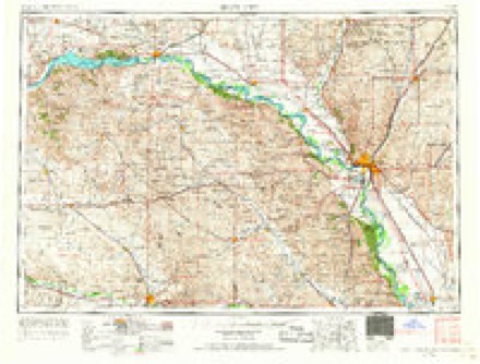
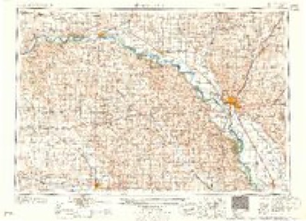
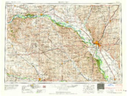
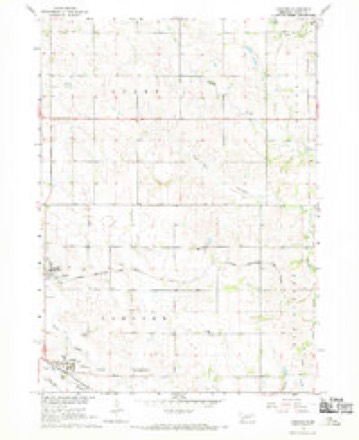
9 topographic sheets cover this place, the earliest surveyed in 1955 and the latest in 1986. It stands in Concord Township. It lies in ZIP code area 68728. The Survey maps it on the Concord quadrangle. 126 people lived here at the 2020 count. It stands 1,457 feet above sea level.
Population over time
2 figuresConcord fell from 166 to 126 between 2010 and 2020. These are the recorded population figures Wikidata holds for this place, reached through the Geographic Names Information System number this page is keyed on rather than by name, so they belong to this place and not to another of the same name. Most are census counts, but not all are: an early figure may be a founding or settlement estimate, and an estimate published within five years of a census is left out. The change column is computed, and is left blank where more than 20 years separate a figure from the one before it, because a gap that long is not a change between two counts.
| Year | People | Change |
|---|---|---|
| 2010 | 166 | |
| 2020 | 126 | -40 (-24%) |
Topographic sheets covering this place
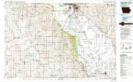
5 surveys from 9 printed sheetsMatched by testing this settlement's coordinate against the published boundary of every sheet in the United States Geological Survey's historical collection. Each opens the scanned sheet at the Survey.
- 1955 USGS Sioux City quadrangle1:250000, 4 printings
- 1958 USGS Sioux City quadrangle1:250000
- 1959 USGS Sioux City quadrangle1:250000
- 1967 USGS Concord quadrangle1:24000
- 1986 USGS Sioux City South quadrangle1:100000, 2 printings
What happened here
An account from the chapter on Concord township. The inset identifies its exact source book and publication year.
Indian Scare And Massacre
| The following story - written by one of our family -was published several years ago in an Omaha paper. The story is founded on the great scare of 1862, and the murder of the Wiseman family, both of which have already been described in these pages, and which took place about a year apart, but for the purposes of this story are represented as occurring at the same time.
In the county-history sources
30,710 words on this townshipHistory of Dixon County, Nebraska. Its Pioneers, Settlement, Growth and Development, and Its Present Condition--its Villages, Townships, Enterprises and Leading Citizens, Together with Portraits and Biographical Sketches of Some of Its Prominent Men, Incidents of Pioneer Life, Etc, published 1896 names this settlement in its chapter on Concord Township. These are the passages that mention it, exactly as the scans read.
One of the leading residents of Concord township is Willis Jenkins, who was horn in New York; went to Illinois when 21 years old and the next year to Iowa, and from Iowa in 78 came here. He was married in Iowa and has a son and da ughter. He has half a section and first-rate improvements. He was the supervisor of Concord in 'SI), heing the first member from that town after township organization vvas adopted. When Mr. Jenkins came to the township there were not over half a dozen settlers there before him.
Passage source: History of Dixon County, Nebraska. Its Pioneers, Settlement, Growth and Development, and Its Present Condition--its Villages, Townships, Enterprises and Leading Citizens, Together with Portraits and Biographical Sketches of Some of Its Prominent Men, Incidents of Pioneer Life, Etc, published 1896.
J. W. Thompson was supervisor for Concord in '93, '94 and '95. His portrait appears elsewhere. He is an intelligent and successful farmer and stock raiser, and was an excellent supervisor. In mentioning Mr. Thompson in the list of supervisors on page 136 we have written his name as William Thompson. It should have been J. W. Thompson, as appears by his signature below his portrait.
Passage source: History of Dixon County, Nebraska. Its Pioneers, Settlement, Growth and Development, and Its Present Condition--its Villages, Townships, Enterprises and Leading Citizens, Together with Portraits and Biographical Sketches of Some of Its Prominent Men, Incidents of Pioneer Life, Etc, published 1896.
Ceo. 0. Acres, a leading citizen of Concord village, built the first house in that vicinity and ferried all the lumber across the river at Sioux City with which to build it. Mr. Acres was born in '55 at Manchester, Iowa, and came to Nebraska in '78 and settled on a homestead in what is now Concord township, where he lived until the fall of '89, when he bought out the lumber and coal business of Shumway & Everett at Concord village. He sold lumber, bought live stock and grain until 1893. and was interested in all improvements in Concord. In '90. when the Concord State Bank was instituted, he was elected a director and was an active worker, helping to make it one of the best banks in northeastern Nebraska, In '93 he became cashier, which position he now holds.
Passage source: History of Dixon County, Nebraska. Its Pioneers, Settlement, Growth and Development, and Its Present Condition--its Villages, Townships, Enterprises and Leading Citizens, Together with Portraits and Biographical Sketches of Some of Its Prominent Men, Incidents of Pioneer Life, Etc, published 1896.
Machine-read from a century-old scan, so expect the errors a machine makes: misspelled names, dropped words, stray characters.
Read the whole chapter on Concord Township - it names this place 4 more 4 times.
Fires near this place
12 since 2001Regional context, not property-specific evidence. The federal wildfire occurrence database lists 12 fires within 5 miles of Concord between 2001 and 2018, burning about 30 acres in total. None started naturally. None was recorded as arson. Distance is straight-line from the map coordinates, so a fire counted here may appear on a neighbouring settlement's page as well.
| Reported cause | Fires |
|---|---|
| Missing data/not specified/undetermined | 6 |
| Debris and open burning | 5 |
| Railroad operations and maintenance | 1 |
The most recent of them, most recent first, with the day each was reported and the service that recorded it.
| Date | Cause | Size | Reported by | Name on the report |
|---|---|---|---|---|
| 6 July 2006 | Debris and open burning | under an acre | Nebraska Forest Service | not named |
| 2 June 2017 | Debris and open burning | 2.0 acres | Nebraska Forest Service | not named |
| 15 May 2009 | Debris and open burning | under an acre | Nebraska Forest Service | not named |
| 18 April 2005 | Missing data/not specified/undetermined | 10 acres | Nebraska Forest Service | not named |
| 31 March 2018 | Missing data/not specified/undetermined | 2.0 acres | Nebraska Forest Service | not named |
| 31 March 2018 | Missing data/not specified/undetermined | under an acre | Nebraska Forest Service | not named |
| 10 March 2015 | Missing data/not specified/undetermined | 2.0 acres | Nebraska Forest Service | not named |
| 20 December 2001 | Railroad operations and maintenance | 2.0 acres | Nebraska Forest Service | not named |
Settlements close enough to share some of these fires:
Storms near this place
20 since 1997Regional context, not property-specific evidence. The National Weather Service names Concord in 20 storm reports between 1997 and 2023: 11 hail, 5 thunderstorm wind, 3 flood, 1 heavy rain. No death or injury is recorded in these reports. Each account below is quoted exactly as the forecast office filed it, from the NOAA Storm Events Database, and each date opens the federal record of that event.
| When | Event | Place named | Harm | What the report says |
|---|---|---|---|---|
| July 2023 | Hail | Concord | - | In addition to dime to penny size hail, wind gusts of 50 to 55 mph stripped leaves from trees and broke a few smaller branches. |
| July 2023 | Thunderstorm Wind | Concord | - | Small tree limbs of 1 to 3 inches in diameter were broken off by thunderstorm wind gusts. |
| March 2019 | Flood | Concord | - | Nebraska Highway 26B was closed due to ponding of water. |
| March 2019 | Flood | Concord | - | Snow melt and heavy rainfall (measured 2.55 inches at Concord) resulted in significant flooding of agricultural lands and flooded Nebraska Highway 35 north of Wakefield.|Logan Creek near Wakefield (gage site LCWN1) crested at the highest on record, 4.54 feet above flood stage, on March 13. |
| June 2018 | Flood | Concord | - | A week of periodic heavy rainfall ending June 26 resulted in a widespread 4 to 9 inches of rainfall, much of which occurred on June 24 and 25. Specific weekly totals included 7.58 inches at Concord and 8.08 inches at Wakefield. Minor flooding occurred with significant amounts of crop and pasture land inundated as Logan Creek at Wakefield (gage site LCWN1) crested 2.5 feet above flood stage on June 26. The river fell below flood stage on June 26. |
| June 2015 | Heavy Rain | Concord | - | Rainfall of 3.80 inches was measured. |
| August 2014 | Hail | Concord | - | Large hail dented a few vehicles. |
| August 2014 | Hail | Concord | - | no account filed |
| May 2012 | Hail | Concord | - | no account filed |
| March 2011 | Hail | Concord | - | no account filed |
| June 2005 | Hail | Concord | - | no account filed |
| August 2005 | Hail | Concord | - | no account filed |
| July 2004 | Thunderstorm Wind | Concord | - | no account filed |
| July 2004 | Thunderstorm Wind | Concord | - | no account filed |
| May 2003 | Hail | Concord | - | no account filed |
| July 2001 | Thunderstorm Wind | Concord | - | no account filed |
| June 1998 | Hail | Concord | - | no account filed |
| June 1998 | Hail | Concord | - | no account filed |
| September 1997 | Hail | Concord | - | no account filed |
| September 1997 | Thunderstorm Wind | Concord | - | no account filed |
Nearest settlements
The eight closest, with where each one stands in the county. Distances are straight-line, computed from the Geographic Names Information System coordinates.
| Map | Place | Distance | Sheets |
|---|---|---|---|
| Dixon | 2.3 miles | 9 | |
| Allen | 7.9 miles | 9 | |
| Wakefield | 10.3 miles | 9 | |
| Martinsburg | 12.0 miles | 18 | |
| Waterbury | 14.4 miles | 9 | |
| Emerson | 15.6 miles | 10 | |
| Lime Grove | 19.3 miles | 19 | |
| Ponca | 19.4 miles | 20 |
Elsewhere
Matched on this settlement's Geographic Names Information System number rather than its name, so it cannot be a different place of the same name in another state.
| Wikipedia article on Concord | An encyclopaedic summary. Its text is share-alike, so it is linked here rather than copied. |
| Wikidata item Q1820535 | The structured record the population and elevation above come from. Public domain (CC0). |
Provenance
This settlement is recorded in the Geographic Names Information System as feature 828291. The sheet list is computed by point-in-boundary test against the United States Geological Survey's historical topographic inventory. Both are works of the United States government and carry no copyright under 17 U.S.C. 105.
Wildfire. Short, Karen C. 2022. Spatial wildfire occurrence data for the United States, 1992-2020 [FPA_FOD_20221014]. 6th Edition. Fort Collins, CO: Forest Service Research Data Archive. https://doi.org/10.2737/RDS-2013-0009.6 Collected with United States Government funding and usable without additional permissions or fees.
Storms. NOAA National Centers for Environmental Information, Storm Events Database https://www.ncei.noaa.gov/stormevents/ A work of the United States government, no copyright under 17 U.S.C. 105. Narratives are quoted verbatim from the National Weather Service report and are not edited or summarised.