 Block
Wakefield, Nebraska
9 topographic sheets cover this place, the earliest surveyed in 1955 and the latest in 1986. It stands in Wakefield Township. It lies in ZIP code area 68784. The Survey maps it on the Wakefield quadrangle. 1,522 people lived here at the 2020 count. It stands 1,404 feet above sea level.
On record in Wakefield
Buildings and businesses the archive holds for this place. Each opens its own page, with the source record it came from.
On the National Register 1 record
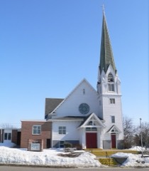 Swedish Evangelical Lutheran Salem Churchlisted 1983
Population over time
2 figuresWakefield grew from 1,451 to 1,522 between 2010 and 2020. These are the recorded population figures Wikidata holds for this place, reached through the Geographic Names Information System number this page is keyed on rather than by name, so they belong to this place and not to another of the same name. Most are census counts, but not all are: an early figure may be a founding or settlement estimate, and an estimate published within five years of a census is left out. The change column is computed, and is left blank where more than 20 years separate a figure from the one before it, because a gap that long is not a change between two counts.
| Year | People | Change |
|---|---|---|
| 2010 | 1,451 | |
| 2020 | 1,522 | +71 (+5%) |
Topographic sheets covering this place
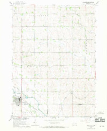
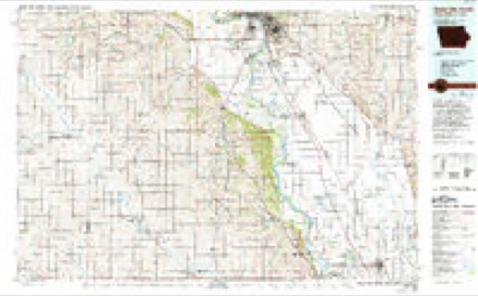
5 surveys from 9 printed sheetsMatched by testing this settlement's coordinate against the published boundary of every sheet in the United States Geological Survey's historical collection. Each opens the scanned sheet at the Survey.
- 1955 USGS Sioux City quadrangle1:250000, 4 printings
- 1958 USGS Sioux City quadrangle1:250000
- 1959 USGS Sioux City quadrangle1:250000
- 1967 USGS Wakefield quadrangle1:24000
- 1986 USGS Sioux City South quadrangle1:100000, 2 printings
In the county-history sources
1,914 words on this townshipHistory of Dixon County, Nebraska. Its Pioneers, Settlement, Growth and Development, and Its Present Condition--its Villages, Townships, Enterprises and Leading Citizens, Together with Portraits and Biographical Sketches of Some of Its Prominent Men, Incidents of Pioneer Life, Etc, published 1896 names this settlement in its chapter on Wakefield Township. These are the passages that mention it, exactly as the scans read.
Is bounded on the north by Springbank, east by Emerson, south by Wayne county and west by Logan. The justly celebrated Logan river, and valley from two to three miles wide, passes through the southwestern part of the township, furnishing the excellent water power facilities which have been utilized by the flouring mills at Wakefield village.
Passage source: History of Dixon County, Nebraska. Its Pioneers, Settlement, Growth and Development, and Its Present Condition--its Villages, Townships, Enterprises and Leading Citizens, Together with Portraits and Biographical Sketches of Some of Its Prominent Men, Incidents of Pioneer Life, Etc, published 1896.
One of the first settlers in this part of the county was C. T. Barto, whose frontier experiences here form an interesting part of the history of Wakefield. C. T. Barto was born in Bradford county. Penn., February 8th. 1837. His father. N. H. Barto, who was born at Bainbridge. N. Y., 1812, and still living, removed to Chemung county, N. Y.. near Elmira in 1843. C. T. Barto married Estella Cooley, January 3rd, L861, and removed to Illinois in April. 1861. There they rented a farm in DeKalb county, which they afterwards bought. In 1868 they sold their farm and started on their pilgrimage west and located in what is now Wakefield township on May 3rd. 1869. At that time the nearest settler on the road to Sioux City was Boedkey, twelve miles east of Wakefield, and the next Jesse Wigle, twenty-one miles east of Barto's place on Wigle creek, two miles south of the present town of Homer. South there was no settlement short of the Elkhorn river. West, no settlement short of Norfolk, at that time called Yellowbanks. The nearest postoffice was twenty-four miles east in Dakota county and Major C. H. Potter was postmaster, and there also was located the nearest flouring mill run by a man named David and now operated by Sam Coombs. North there was practically no settlement nearer than South Creek, the Pomeroys settling in Springbank in '70 or '71, and the Herfels and George 0. Lampher about the same time.
Passage source: History of Dixon County, Nebraska. Its Pioneers, Settlement, Growth and Development, and Its Present Condition--its Villages, Townships, Enterprises and Leading Citizens, Together with Portraits and Biographical Sketches of Some of Its Prominent Men, Incidents of Pioneer Life, Etc, published 1896.
Philo Graves was also one of the early residents of this township. His father, Willard Graves of Illinois, in the spring of 1868, located 4(1 sections of land (25,600 acres) in Cedar and Wayne counties and in the southern part of Dixon county, and in the following year brought here his family and a colony of people, a large share of whom bought farms in Wayne county. A few, however, became residents of the present townships of Wakefield and Logan.
Passage source: History of Dixon County, Nebraska. Its Pioneers, Settlement, Growth and Development, and Its Present Condition--its Villages, Townships, Enterprises and Leading Citizens, Together with Portraits and Biographical Sketches of Some of Its Prominent Men, Incidents of Pioneer Life, Etc, published 1896.
Machine-read from a century-old scan, so expect the errors a machine makes: misspelled names, dropped words, stray characters.
Read the whole chapter on Wakefield Township - it names this place 11 more 11 times.
Fires near this place
3 since 2013Regional context, not property-specific evidence. The federal wildfire occurrence database lists 3 fires within 5 miles of Wakefield between 2013 and 2017, burning about 91 acres in total. None started naturally. None was recorded as arson. Distance is straight-line from the map coordinates, so a fire counted here may appear on a neighbouring settlement's page as well.
| Reported cause | Fires |
|---|---|
| Misuse of fire by a minor | 1 |
| Recreation and ceremony | 1 |
| Debris and open burning | 1 |
The most recent of them, most recent first, with the day each was reported and the service that recorded it.
| Date | Cause | Size | Reported by | Name on the report |
|---|---|---|---|---|
| 5 April 2013 | Misuse of fire by a minor | 1.0 acres | Winnebago Agency | BIA #424 |
| 8 March 2015 | Debris and open burning | under an acre | Nebraska Forest Service | not named |
| 19 March 2017 | Recreation and ceremony | 90 acres | Nebraska Forest Service | not named |
Settlements close enough to share some of these fires:
Storms near this place
28 since 1997Regional context, not property-specific evidence. The National Weather Service names Wakefield in 28 storm reports between 1997 and 2025: 15 hail, 9 thunderstorm wind, 2 tornado, 2 flood. No death or injury is recorded in these reports. Each account below is quoted exactly as the forecast office filed it, from the NOAA Storm Events Database, and each date opens the federal record of that event.
| When | Event | Place named | Harm | What the report says |
|---|---|---|---|---|
| March 2019 | Flood | Wakefield | $3,500,000 | Water was over Highway 20 between 583 Avenue and 5835 Avenue. In addition, flooding resulted in extensive damage to public infrastructure including numerous county and township roads, culverts, and some bridges. |
| October 2013 | Tornado (EF2) | Wakefield | $500,000 | A tornado, crossing into Dixon County from Wayne County, severely damaged the roofs of two houses, one of which was a manufactured house, and caused damage to the siding and windows of the houses. Windows of at least one other house were blown out. The tornado also overturned a camper, destroyed or severely damaged a grain bin, numerous farm outbuildings, farm storage buildings, several pieces of farm equipment, and flattened corn crops in several areas. The tornado caused tree damage along its path, including trees uprooted and snapped off at the trunks, and blew down power poles and power lines. |
| June 2014 | Tornado (EF1) | Wakefield | $50,000 | A tornado, crossing into Dixon County from the south, severely damaged the roof and garage of a farm home. The tornado also blew down power poles and lines, and caused tree and crop damage. |
| September 1997 | Hail | Wakefield | $5,000 | Large hail damaged a camper and trees. |
| August 2016 | Thunderstorm Wind | Wakefield | $2,000 | Thunderstorm winds damaged farm outbuildings and caused tree damage, including at least one tree blown down. |
| April 2025 | Hail | Wakefield | - | Observed hail varied from pea to penny size. |
| July 2025 | Thunderstorm Wind | Wakefield | - | A large section of a 50-60 foot tree was blown down at the cemetery, along with other spotty thunderstorm wind damage around town to tree limbs. |
| May 2022 | Thunderstorm Wind | Wakefield | - | Thunderstorm winds downed several large trees. Crop damage is an estimate from insured losses. Information provided by the United States Department of Agriculture. |
| June 2019 | Flood | Wakefield | - | During crop planting season, prolonged flooding led to the loss of or inability to plant crops across the area. Crop loss estimates provided by the United States Department of Agriculture. |
| June 2014 | Thunderstorm Wind | Wakefield | - | Thunderstorm winds caused tree damage, including large limbs blown down. |
| June 2014 | Thunderstorm Wind | Wakefield | - | Thunderstorm winds caused tree damage, including trees snapped in half, and large branches blown down. |
| May 2013 | Thunderstorm Wind | Wakefield | - | Thunderstorm winds blew down several 6 to 8 inch diameter branches. |
| August 2012 | Thunderstorm Wind | Wakefield | - | Thunderstorm winds caused tree damage, including up to 6 inch diameter limbs broken. |
| June 2011 | Thunderstorm Wind | Wakefield | - | Thunderstorm winds caused tree damage, including large branches blown down. |
| August 2007 | Thunderstorm Wind | Wakefield | - | Thunderstorm winds caused tree damage, including several branches blown down. |
| July 2024 | Hail | Wakefield | - | no account filed |
| July 2023 | Hail | Wakefield | - | no account filed |
| July 2023 | Hail | Wakefield | - | no account filed |
| April 2013 | Hail | Wakefield | - | no account filed |
| May 2013 | Hail | Wakefield | - | no account filed |
| March 2011 | Hail | Wakefield | - | no account filed |
| May 2004 | Hail | Wakefield | - | no account filed |
| May 2004 | Hail | Wakefield | - | no account filed |
| June 2003 | Hail | Wakefield | - | no account filed |
| June 2001 | Hail | Wakefield | - | no account filed |
| June 2001 | Hail | Wakefield | - | no account filed |
| May 2000 | Hail | Wakefield | - | no account filed |
| June 1998 | Hail | Wakefield | - | no account filed |
Nearest settlements
The eight closest, with where each one stands in the county. Distances are straight-line, computed from the Geographic Names Information System coordinates.
Elsewhere
Matched on this settlement's Geographic Names Information System number rather than its name, so it cannot be a different place of the same name in another state.
| Wikipedia article on Wakefield | An encyclopaedic summary. Its text is share-alike, so it is linked here rather than copied. |
| Wikidata item Q963155 | The structured record the population and elevation above come from. Public domain (CC0). |
Provenance
This settlement is recorded in the Geographic Names Information System as feature 834424. The sheet list is computed by point-in-boundary test against the United States Geological Survey's historical topographic inventory. Both are works of the United States government and carry no copyright under 17 U.S.C. 105.
Wildfire. Short, Karen C. 2022. Spatial wildfire occurrence data for the United States, 1992-2020 [FPA_FOD_20221014]. 6th Edition. Fort Collins, CO: Forest Service Research Data Archive. https://doi.org/10.2737/RDS-2013-0009.6 Collected with United States Government funding and usable without additional permissions or fees.
Storms. NOAA National Centers for Environmental Information, Storm Events Database https://www.ncei.noaa.gov/stormevents/ A work of the United States government, no copyright under 17 U.S.C. 105. Narratives are quoted verbatim from the National Weather Service report and are not edited or summarised.