 Block
Doniphan, Nebraska
16 topographic sheets cover this place, the earliest surveyed in 1892 and the latest in 1985. It stands in Doniphan Township. It lies in ZIP code area 68832. The Survey maps it on the Doniphan quadrangle. 809 people lived here at the 2020 count. It stands 1,942 feet above sea level.
Research this city
On record in Doniphan
Buildings and businesses the archive holds for this place. Each opens its own page, with the source record it came from.
On the National Register 1 record
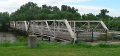 Nine Bridges Bridgelisted 1992
Population over time
2 figuresDoniphan fell from 829 to 809 between 2010 and 2020. These are the recorded population figures Wikidata holds for this place, reached through the Geographic Names Information System number this page is keyed on rather than by name, so they belong to this place and not to another of the same name. Most are census counts, but not all are: an early figure may be a founding or settlement estimate, and an estimate published within five years of a census is left out. The change column is computed, and is left blank where more than 20 years separate a figure from the one before it, because a gap that long is not a change between two counts.
| Year | People | Change |
|---|---|---|
| 2010 | 829 | |
| 2020 | 809 | -20 (-2%) |
Topographic sheets covering this place
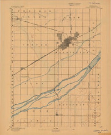
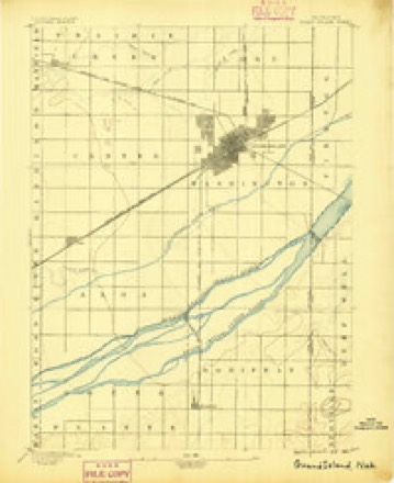
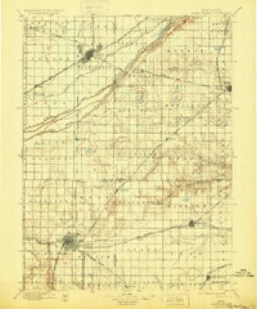
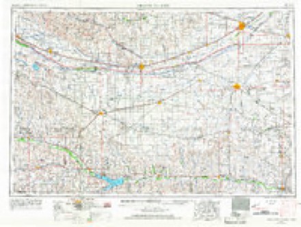
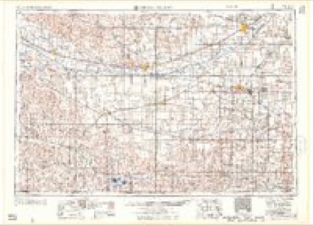
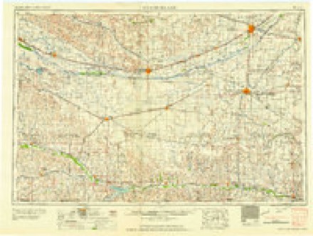
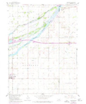
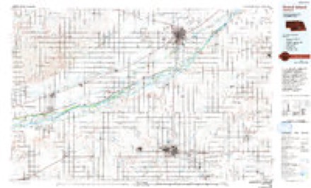
8 surveys from 16 printed sheetsMatched by testing this settlement's coordinate against the published boundary of every sheet in the United States Geological Survey's historical collection. Each opens the scanned sheet at the Survey.
- 1892 USGS Grand Island quadrangle1:62500
- 1895 USGS Grand Island quadrangle1:62500
- 1898 USGS Grand Island quadrangle1:125000, 4 printings
- 1955 USGS Grand Island quadrangle1:250000, 3 printings
- 1957 USGS Grand Island quadrangle1:250000
- 1958 USGS Grand Island quadrangle1:250000
- 1962 USGS Doniphan quadrangle1:24000, 3 printings
- 1985 USGS Grand Island quadrangle1:100000, 2 printings
In the county-history sources
6,119 words on this townshipHistory of Hall County, Nebraska; a Narrative of the Past with Special Emphasis Upon the Pioneer Period of the County's History, and Chronological Presentation of Its Social, Commercial, Educational, Religious, and Civic Development from the Early Days to the Present Time, and Special Analysis of Its Military and Civil Participation in the Late World War, published 1920 names this settlement in its chapter on Doniphan Township. These are the passages that mention it, exactly as the scans read.
After the St. Joseph and Grand Island railroad was in operation it was inevitable that a town should grow up between Grand Island and Hastings. So in 1879 Mr. Burger, who owned the land where the town of Doniphan was built, platted a town site, laid out the first lots, sold a number of lots and started the town, which was named Doniphan, in honor of Colonel Doniphan, who was attorney for the St. Joseph & Grand Island railway.
Samuel Biedelman lived a half-mile west of the town and later moved down after the town was started. H. C. Denman had a farm that joined the new townsite, and while he did not live in the town he became a leading citizen of the new community. Charles Dufford, a farmer in that vicinity, moved down a short time after the new town got started. S. H. Lakins moved in after the town had been going for something like three years. Upson Brothers came right in, during the first few months, and started a store in August, 1879. W. H. Gideon lived at the edge of the town and helped lay out the new town. Samuel Gibson came in rather early and worked for Mr. Burger in the blacksmith job. Dr. Caswell T. Poe came the year after the establishment of the town. He had located in South Platte precint and farmed there for five years, and also practiced medicine. He had then gone to Grand Island, but after the new town started he relocated in the southern part of the county and began practicing from the new village. These who have just been named were among the first settlers of the new town, whose early arrival contributed materially to establishing the town that was to be in that part of the county, Doniphan.
The first girl born on the new townsite was Jennie M. Stout, on February 9, 1880, but she lived only a short time. The first boy born in the new town was Mr. Burger's son, Albert Doniphan Burger, in 1879. The first marriage in the town took place October 30, 1881, and the contracting parties were L- M. Brewer and Miss Anna M. Wharry, performed at the hotel.
Machine-read from a century-old scan, so expect the errors a machine makes: misspelled names, dropped words, stray characters.
Read the whole chapter on Doniphan Township - it names this place 16 more 16 times.
Fires near this place
2 since 2001Regional context, not property-specific evidence. The federal wildfire occurrence database lists 2 fires within 5 miles of Doniphan between 2001 and 2014, burning under an acre in total. None started naturally. None was recorded as arson. Distance is straight-line from the map coordinates, so a fire counted here may appear on a neighbouring settlement's page as well.
| Reported cause | Fires |
|---|---|
| Power generation/transmission/distribution | 1 |
| Debris and open burning | 1 |
The most recent of them, most recent first, with the day each was reported and the service that recorded it.
| Date | Cause | Size | Reported by | Name on the report |
|---|---|---|---|---|
| 27 April 2001 | Debris and open burning | under an acre | Nebraska Forest Service | not named |
| 2 December 2014 | Power generation/transmission/distribution | under an acre | Nebraska Forest Service | not named |
Mines and quarries near this place
1 within 5 milesRegional context, not property-specific evidence. The federal mineral resources record lists 1 working within 5 miles of Doniphan: 1 producer. All of them still produce. What was taken out: Sand and Gravel, Construction. Distance is straight-line from the map coordinates, so a quarry counted here may appear on a neighbouring settlement's page as well.
| Where | Site | Commodity | Status | Recorded |
|---|---|---|---|---|
| Amick Pit | Sand and Gravel, Construction | Producer |
Storms near this place
59 since 1996Regional context, not property-specific evidence. The National Weather Service names Doniphan in 59 storm reports between 1996 and 2024: 24 hail, 20 thunderstorm wind, 6 heavy rain, 3 tornado. No death or injury is recorded in these reports. Each account below is quoted exactly as the forecast office filed it, from the NOAA Storm Events Database, and each date opens the federal record of that event.
| When | Event | Place named | Harm | What the report says |
|---|---|---|---|---|
| May 2002 | Hail | Doniphan | $1,000,000 | no account filed |
| August 2019 | Flood | Doniphan | $500,000 | Several homes experienced flooded basements and flooding from overflowing small lakes at the Amick Acres neighborhood west of Doniphan. With additional bouts of heavy rain, flooding persisted for over a week there. A CoCoRaHS observer near Doniphan measured an incredible 11.91 of rain between Aug. 21-26, and 16.76 for the entire month. |
| August 2019 | Flash Flood | Doniphan | $500,000 | Several homes experienced flooded basements and flooding from overflowing small lakes at the Amick Acres neighborhood west of Doniphan. With additional bouts of heavy rain, flooding persisted for over a week there. A CoCoRaHS observer near Doniphan measured an incredible 11.91 of rain between Aug. 21-26, and 16.76 for the entire month. Also, shorter-term, 24-hour rain totals from around Hall County on the 22nd (via CoCoRaHS) included 5.98 inches 4 miles south southwest of Alda, 4.54 inches 3 miles west of Doniphan, and 3.67 inches 6 miles west northwest of Hansen. |
| August 1999 | Thunderstorm Wind | Doniphan | $125,000 | no account filed |
| May 2022 | Hail | Doniphan | $100,000 | Hail up to the size of golf balls was reported on Highway 281 north of Hansen. |
| June 2020 | Thunderstorm Wind | Doniphan | $100,000 | Wind gusts were estimated to be near 70 MPH, downing tree limbs approximately 4 to 5 inches in diameter. |
| April 2006 | Thunderstorm Wind | Doniphan | $75,000 | no account filed |
| June 2008 | Hail | Doniphan | $50,000 | no account filed |
| May 2018 | Tornado (EF0) | Doniphan | $30,000 | This tornado touched down approximately 2 miles south of Doniphan and moved north before lifting on the south edge of Doniphan. The tornado was rated an EF-0 with a maximum wind speed estimated to be 75 MPH. This rating was based on damage to an outbuilding and nearby home. The damage to the home was caused by flying debris from the outbuilding. Other structures in the area sustained minor damage, such as broken windows, damage to soffits and garage doors. ||The path was determined from a combination of storm survey information, video, radar data, and other reports. Several reports indicate the possibility of other small circulations near the parent tornado, but the most reliable path information is related to the main parent circulation as given. |
| December 2021 | Thunderstorm Wind | Doniphan | $25,000 | A wind gust of 71 MPH was measured by a mesonet station located two miles south of Doniphan. An NWS employee estimated wind gusts to be near 65 MPH on the southeast side of Doniphan, resulting in damage to a wood fence. |
| December 2021 | Thunderstorm Wind | Doniphan | $25,000 | Wind gusts estimated to be near 80 MPH resulted in a pick-up and trailer being blown over on Interstate 80 just east of the Locust Street exit. |
| May 2017 | Thunderstorm Wind | Doniphan | $25,000 | A semi truck was blown over on Interstate 80, blocking both lanes of traffic near mile marker 316. |
| June 2008 | Hail | Doniphan | $10,000 | Penny to quarter size hail was reported. Some tree damage in Doniphan with branches down. |
| September 2018 | Thunderstorm Wind | Doniphan | $5,000 | A gust of 64 MPH was measured by the employee's anemometer. |
| February 2017 | Flood | Doniphan | $5,000 | Ice jam flooding occurred for a few days along the middle channels of the Platte River, primarily from near the Interstate 80/Highway 281 interchange, downstream to around Locust Street. On the western edge of the flooding area, waters covered fields near the intersection of Interstate 80 and U.S. Highway 281, and reached the parking lot and access road of a nearby a restaurant and hotel. Slightly downstream, additional flooding occurred near Locust St. north of Interstate 80, where the road leading to Camp Augustine was water-covered from Feb. 3rd-4th. |
| July 2016 | Thunderstorm Wind | Doniphan | $5,000 | Wind gusts were estimated to be near 60 MPH. |
| July 2016 | Thunderstorm Wind | Doniphan | $5,000 | Wind gusts were estimated to be 60 MPH. Spotter was pulled over on the side of Highway 281 due to blinding rain, and also reported that vehicle was rocking due to the strong winds. |
| June 2009 | Hail | Doniphan | $5,000 | no account filed |
| May 1998 | Hail | Doniphan | $5,000 | no account filed |
| June 1996 | Hail | Doniphan | $5,000 | no account filed |
| June 2014 | Hail | Doniphan | $3,000 | no account filed |
| June 2015 | Flash Flood | Doniphan | $1,000 | Flooding occurred on the southbound lane of Highway 281 near Rosedale Road, and caused a few traffic accidents. |
| May 1996 | Thunderstorm Wind | Doniphan | $500 | no account filed |
| May 2024 | Thunderstorm Wind | Doniphan | - | Wind gusts were estimated to be 60 to 65 MPH. |
| October 2023 | Tornado (EFU) | Doniphan | - | This rope-like tornado was reported by the public to the NWS via a picture from a storm chaser in the area. No rating nor wind speed was assigned due to the lack of quality damage indicators in the area. The location is estimated. |
| May 2022 | Thunderstorm Wind | Doniphan | - | A wind gust of 60 MPH was measured by a mesonet station located two miles south of Doniphan and a wind gust 58 MPH was measured by a mesonet station located one mile east-southeast of Doniphan. |
| July 2021 | Thunderstorm Wind | Doniphan | - | Wind gusts recorded by a mesonet station located on the east-southeast side of Doniphan included 71 MPH at 10:43 PM CDT and 61 MPH at 10:35 PM CDT. |
| July 2020 | Thunderstorm Wind | Doniphan | - | Wind gusts were estimated to be near 70 MPH. |
| July 2020 | Thunderstorm Wind | Doniphan | - | A wind gust of 70 MPH was recorded by a mesonet station located 1 mile east-southeast of Doniphan. |
| August 2019 | Thunderstorm Wind | Doniphan | - | A 75 MPH wind gust was measured by a mesonet station located 1 mile east-southeast of Doniphan at 2:54 AM CDT, with a 79 MPH wind gust measured at 3:01 AM CDT. A 67 MPH wind gust was measured by a mesonet station located 2 miles south of Doniphan at 3 AM CDT. |
| August 2017 | Heavy Rain | Doniphan | - | A 24-hour precipitation amount of 4.46 inches was recorded 2 miles west of Doniphan. |
| August 2017 | Heavy Rain | Doniphan | - | A 24-hour precipitation amount of 4.94 inches was recorded 4 miles east-northeast of Doniphan. |
| April 2015 | Hail | Doniphan | - | Quarter size hail was reported seven miles south of Grand Island on Interstate 80 near mile marker 316. |
| June 2015 | Hail | Doniphan | - | Penny size hail was falling at the Quality Inn at the Interchange of Interstate 80 and Highway 281. |
| June 2015 | Heavy Rain | Doniphan | - | A 24-hour rainfall total of 3.30...most of which fell during the evening of the 4th into the early morning of the 5th. Two-day rainfall totals of 3-7 were common within much of Adams, Clay, Fillmore, Nuckolls, Thayer, southern Hall, southern Hamilton and southern York counties, resulting in significant flooding across parts of the area. |
| June 2014 | Heavy Rain | Doniphan | - | A storm total rainfall amount of 4.06 inches was reported by NeRAIN observer. |
| August 2014 | Thunderstorm Wind | Doniphan | - | Wind gusts were estimated to be near 60 MPH. Tree branches were blown down across Highway 281. |
| April 2014 | Hail | Doniphan | - | Dime to penny size hail occurred in Doniphan. |
| April 2014 | Heavy Rain | Doniphan | - | A 24 hour rainfall total of 4.15 inches occurred about 2 miles west of Doniphan. This report is from an NERAIN observer. |
| June 2011 | Heavy Rain | Doniphan | - | Storm total rainfall amount of 3.06 inches was reported by a NeRAIN observer. |
| June 2010 | Thunderstorm Wind | Doniphan | - | Wind gusts estimated at 60 mph. |
| April 2022 | Hail | Doniphan | - | no account filed |
| June 2022 | Hail | Doniphan | - | no account filed |
| April 2021 | Hail | Doniphan | - | no account filed |
| June 2020 | Hail | Doniphan | - | no account filed |
| May 2018 | Thunderstorm Wind | Doniphan | - | no account filed |
| July 2016 | Hail | Doniphan | - | no account filed |
| September 2015 | Hail | Doniphan | - | no account filed |
| May 2012 | Hail | Doniphan | - | no account filed |
| December 2010 | Flood | Doniphan | - | no account filed |
| July 2008 | Hail | Doniphan | - | no account filed |
| March 2006 | Thunderstorm Wind | Doniphan | - | no account filed |
| May 2006 | Hail | Doniphan | - | no account filed |
| June 2002 | Hail | Doniphan | - | no account filed |
| June 2002 | Hail | Doniphan | - | no account filed |
| May 2000 | Hail | Doniphan | - | no account filed |
| October 2000 | Funnel Cloud | Doniphan | - | no account filed |
| June 1997 | Tornado (F0) | Doniphan | - | no account filed |
| May 1996 | Hail | Doniphan | - | no account filed |
Nearest settlements
The eight closest, with where each one stands in the county. Distances are straight-line, computed from the Geographic Names Information System coordinates.
| Map | Place | Distance | Sheets |
|---|---|---|---|
| Rosedale | 6.8 miles | 13 | |
| Alda | 8.6 miles | 16 | |
| Kingwood Estates | 8.9 miles | 17 | |
| Parkview | 9.1 miles | 17 | |
| Grand Island | 10.7 miles | 17 | |
| Kuesters Lake | 11.1 miles | 17 | |
| Pioneer Estates | 12.4 miles | 17 | |
| Wood River | 12.7 miles | 15 |
Elsewhere
Matched on this settlement's Geographic Names Information System number rather than its name, so it cannot be a different place of the same name in another state.
| Wikipedia article on Doniphan | An encyclopaedic summary. Its text is share-alike, so it is linked here rather than copied. |
| Wikidata item Q2791749 | The structured record the population and elevation above come from. Public domain (CC0). |
Provenance
This settlement is recorded in the Geographic Names Information System as feature 828756. The sheet list is computed by point-in-boundary test against the United States Geological Survey's historical topographic inventory. Both are works of the United States government and carry no copyright under 17 U.S.C. 105.
Wildfire. Short, Karen C. 2022. Spatial wildfire occurrence data for the United States, 1992-2020 [FPA_FOD_20221014]. 6th Edition. Fort Collins, CO: Forest Service Research Data Archive. https://doi.org/10.2737/RDS-2013-0009.6 Collected with United States Government funding and usable without additional permissions or fees.
Mines and quarries. USGS Mineral Resources Data System (MRDS) https://mrdata.usgs.gov/mrds/ A work of the United States government, no copyright under 17 U.S.C. 105.
Storms. NOAA National Centers for Environmental Information, Storm Events Database https://www.ncei.noaa.gov/stormevents/ A work of the United States government, no copyright under 17 U.S.C. 105. Narratives are quoted verbatim from the National Weather Service report and are not edited or summarised.