 Block
Holmesville, Nebraska
10 topographic sheets cover this place, the earliest surveyed in 1955 and the latest in 1986. It stands in Rockford Township. It lies in ZIP code area 68310. The Survey maps it on the Blue Springs quadrangle. 60 people lived here at the 2020 count. It stands 1,265 feet above sea level.
Population over time
2 figuresHolmesville grew from 51 to 60 between 2010 and 2020. These are the recorded population figures Wikidata holds for this place, reached through the Geographic Names Information System number this page is keyed on rather than by name, so they belong to this place and not to another of the same name. Most are census counts, but not all are: an early figure may be a founding or settlement estimate, and an estimate published within five years of a census is left out. The change column is computed, and is left blank where more than 20 years separate a figure from the one before it, because a gap that long is not a change between two counts.
| Year | People | Change |
|---|---|---|
| 2010 | 51 | |
| 2020 | 60 | +9 (+18%) |
Topographic sheets covering this place
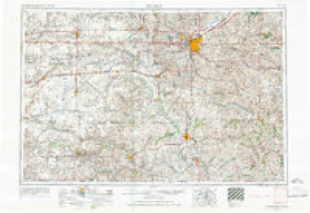
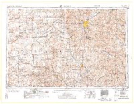
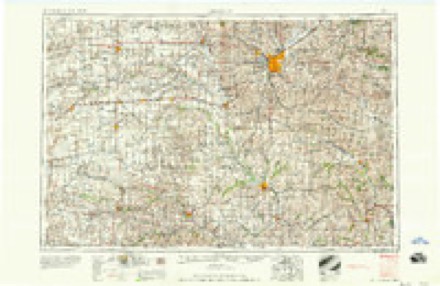
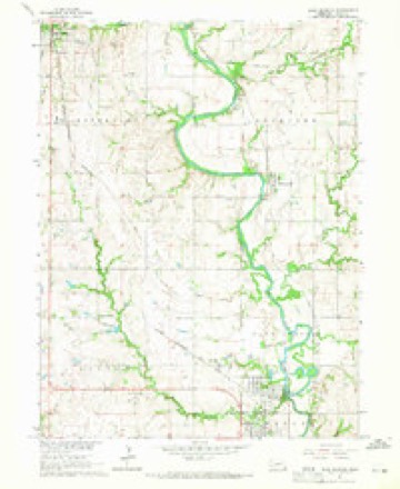
5 surveys from 10 printed sheetsMatched by testing this settlement's coordinate against the published boundary of every sheet in the United States Geological Survey's historical collection. Each opens the scanned sheet at the Survey.
- 1955 USGS Lincoln quadrangle1:250000, 5 printings
- 1957 USGS Lincoln quadrangle1:250000
- 1958 USGS Lincoln quadrangle1:250000
- 1964 USGS Blue Springs quadrangle1:24000
- 1986 USGS Beatrice quadrangle1:100000, 2 printings
In the county-history sources
1,520 words on this townshipHistory of Gage County, Nebraska; a Narrative of the Past, with Special Emphasis Upon the Pioneer Period of the County's History, Its Social, Commercial, Educational, Religious, and Civic Development from the Early Days to the Present Time, published 1918 names this settlement in its chapter on Rockford Township. These are the passages that mention it, exactly as the scans read.
Holmesville is not only the largest but is easily the most important of the unincorporated villages of Gage county. .It has a population of 175, according to the federal census of 1910. It is located in Rockford township, on the east bank of the Big Blue river. It is nine miles southeast of Beatrice and is the first station on the Union Pacific Railroad. It was marked by the early settlers as the location for a townsite and Whitesville, the first legal county seat of Gage county, was within half a mile of the townsite of Holmesville, on a tract of land afterward taken as a homestead by James Kings ford, namely: the southwest quarter of section 29, Rockford township. In a very early day, A. L. Hurd and W. S. Guffey opened a stone quarry at or near the site of Holmesville, and most of the stone used in building the first state capitol at Lincoln was hauled across country, by ox, mule and horse teams, from this quarry, in 1868.
Passage source: History of Gage County, Nebraska; a Narrative of the Past, with Special Emphasis Upon the Pioneer Period of the County's History, Its Social, Commercial, Educational, Religious, and Civic Development from the Early Days to the Present Time, published 1918.
The village was founded by Morgan L. Holmes, in 1880, the surveyed plat being filed for record in the office of the register of deeds on March 8th of thai year. The founding of the village immediately followed the construction of the present line of the Union Pacific Railroad from Marysville, Kansas, to Beatrice. The first store in Holmesville was a general store opened by Thomas Patz. James Gleason, a brother-in-law of the founder of the village, James H. Davis, Abraham Petro, Eli Miller and James H. Fuller also were among its earliest business men and residents. Fuller ran a general merchandise store for many years, and up to the time of his death, a few years ago, was a well known and substantial citizen of Holmesville.
Passage source: History of Gage County, Nebraska; a Narrative of the Past, with Special Emphasis Upon the Pioneer Period of the County's History, Its Social, Commercial, Educational, Religious, and Civic Development from the Early Days to the Present Time, published 1918.
Amongst the business concerns now found in Holmesville are two general stores, hardware store and lumber yard, elevator, hotel, restaurant and meat market. But what distinguishes Holmesville from all the other villages in the county is the investment made there by J. H. Steinmeyer and his sons George W. and Robert Steinmeyer. About 1908 these public-spirited citizens of the county estab- lished the State Bank of Holmesville, with a capital of $10,000. Under the very able management of the owners this banking institution has grown to the point where it does a large volume of business in the course of a year and has deposits of over $100,000.
Passage source: History of Gage County, Nebraska; a Narrative of the Past, with Special Emphasis Upon the Pioneer Period of the County's History, Its Social, Commercial, Educational, Religious, and Civic Development from the Early Days to the Present Time, published 1918.
Machine-read from a century-old scan, so expect the errors a machine makes: misspelled names, dropped words, stray characters.
Read the whole chapter on Rockford Township - it names this place 3 more 3 times.
Fires near this place
40 since 2007Regional context, not property-specific evidence. The federal wildfire occurrence database lists 40 fires within 5 miles of Holmesville between 2007 and 2020, burning about 484 acres in total. None started naturally. None was recorded as arson. Distance is straight-line from the map coordinates, so a fire counted here may appear on a neighbouring settlement's page as well.
| Reported cause | Fires |
|---|---|
| Debris and open burning | 21 |
| Missing data/not specified/undetermined | 10 |
| Power generation/transmission/distribution | 3 |
| Equipment and vehicle use | 3 |
| Recreation and ceremony | 2 |
| Fireworks | 1 |
The most recent of them, most recent first, with the day each was reported and the service that recorded it.
| Date | Cause | Size | Reported by | Name on the report |
|---|---|---|---|---|
| 27 August 2011 | Power generation/transmission/distribution | under an acre | Nebraska Forest Service | not named |
| 7 July 2012 | Equipment and vehicle use | 2.0 acres | Nebraska Forest Service | not named |
| 4 July 2012 | Fireworks | under an acre | Nebraska Forest Service | not named |
| 28 July 2012 | Recreation and ceremony | 1.0 acres | Nebraska Forest Service | not named |
| 30 June 2012 | Missing data/not specified/undetermined | 43 acres | Nebraska Forest Service | not named |
| 13 June 2012 | Recreation and ceremony | 1.0 acres | Nebraska Forest Service | not named |
| 26 May 2009 | Debris and open burning | under an acre | Nebraska Forest Service | not named |
| 2 May 2017 | Power generation/transmission/distribution | 2.0 acres | Nebraska Forest Service | not named |
Settlements close enough to share some of these fires:
Mines and quarries near this place
1 within 5 milesRegional context, not property-specific evidence. The federal mineral resources record lists 1 working within 5 miles of Holmesville: 1 producer. All of them still produce. What was taken out: Stone, Crushed/Broken. Distance is straight-line from the map coordinates, so a quarry counted here may appear on a neighbouring settlement's page as well.
| Where | Site | Commodity | Status | Recorded |
|---|---|---|---|---|
| Behrens Quarry and Mill | Stone, Crushed/Broken | Producer |
Storms near this place
11 since 2003Regional context, not property-specific evidence. The National Weather Service names Holmesville in 11 storm reports between 2003 and 2025: 4 thunderstorm wind, 3 hail, 1 tornado, 1 flood. No death or injury is recorded in these reports. Each account below is quoted exactly as the forecast office filed it, from the NOAA Storm Events Database, and each date opens the federal record of that event.
| When | Event | Place named | Harm | What the report says |
|---|---|---|---|---|
| June 2015 | Flood | Holmesville | $100,000 | Repeated episodes of heavy rainfall resulted in a long duration flood along the Big Blue River near Beatrice with multiple crests observed. The initial crest on the 6th of June was the most significant, with a second significant crest on the 17th. Besides significant agricultural flooding along both banks of the river, several rural roads were closed near the river as well as State Highway 136. |
| March 2025 | Thunderstorm Wind | Holmesville | - | Public reported measured wind gust of 58 mph. |
| July 2025 | Heavy Rain | Holmesville | - | Personal weather station report of 2.53 inches of rain. |
| July 2023 | Thunderstorm Wind | Holmesville | - | A personal weather station measured a peak wind gust of 66 mph. |
| August 2023 | Hail | Holmesville | - | Public reported lots of hail up to quarter size. |
| June 2019 | Thunderstorm Wind | Holmesville | - | Law enforcement reported a tree blown down in Holmesville. |
| August 2019 | Flash Flood | Holmesville | - | Water was reported over the road at S 36 Road and Belvidere Drive. |
| May 2013 | Thunderstorm Wind | Holmesville | - | Thunderstorm wind gusts estimated at around 60 mph took the roof off of a shed along Highway 77 south of Beatrice. |
| June 2008 | Hail | Holmesville | - | Hail up to nickel-size fell from 8 miles south of Beatrice into Beatrice. |
| July 2006 | Hail | Holmesville | - | Hailstones, some as large as 3 inches in diameter, caused considerable vehicle and siding damage to homes in the Holmesville area, which is several miles southeast of Beatrice. The hail lasted for at least 15 minutes. |
| May 2003 | Tornado (F1) | Holmesville | - | A tornado initially touched down around 2 miles west of Holmesville causing structual damage to a farmstead near there. The tornado then tracked to Filley causing some minor tree and farm building damage along the way. In Filley the tornado tore a 30 by 50 foot section off of a roof of a 35 foot building in town. |
Nearest settlements
The eight closest, with where each one stands in the county. Distances are straight-line, computed from the Geographic Names Information System coordinates.
Elsewhere
Matched on this settlement's Geographic Names Information System number rather than its name, so it cannot be a different place of the same name in another state.
| Wikipedia article on Holmesville | An encyclopaedic summary. Its text is share-alike, so it is linked here rather than copied. |
| Wikidata item Q5901056 | The structured record the population and elevation above come from. Public domain (CC0). |
Provenance
This settlement is recorded in the Geographic Names Information System as feature 830063. The sheet list is computed by point-in-boundary test against the United States Geological Survey's historical topographic inventory. Both are works of the United States government and carry no copyright under 17 U.S.C. 105.
Wildfire. Short, Karen C. 2022. Spatial wildfire occurrence data for the United States, 1992-2020 [FPA_FOD_20221014]. 6th Edition. Fort Collins, CO: Forest Service Research Data Archive. https://doi.org/10.2737/RDS-2013-0009.6 Collected with United States Government funding and usable without additional permissions or fees.
Mines and quarries. USGS Mineral Resources Data System (MRDS) https://mrdata.usgs.gov/mrds/ A work of the United States government, no copyright under 17 U.S.C. 105.
Storms. NOAA National Centers for Environmental Information, Storm Events Database https://www.ncei.noaa.gov/stormevents/ A work of the United States government, no copyright under 17 U.S.C. 105. Narratives are quoted verbatim from the National Weather Service report and are not edited or summarised.