| April 2006 | Lightning | Beatrice | 1 killed, 3 hurt | Lightning struck and killed a 14 year-old female during a pick-up soccer game. Three others were injured, one seriously. |
| May 1996 | Tornado (F2) | Beatrice | 15 hurt, $12,000,000 | no account filed |
| September 1973 | Tornado (F3) | not stated | 8 hurt, $2,500,000 | no account filed |
| April 2001 | Tornado (F2) | Virginia | 2 hurt, $400,000 | A tornado caused extensive damage in Virginia with most of the damage occurring along a 4 block long and 1 block wide stretch through the center of town. One house was almost completely destroyed causing minor injuries to 2 people living there. Six other homes and businesses sustained extensive damage, and trees and other debris were scattered all over the community. |
| June 1967 | Tornado (F2) | not stated | 2 hurt, $250,000 | no account filed |
| July 1958 | Tornado (F2) | not stated | 1 hurt, $250,000 | no account filed |
| May 2004 | Tornado (F4) | Clatonia | $20,000,000 | See description below. |
| July 1994 | Tornado (F0) | Liberty | $5,000,000 | A tornado touched down on the north side of Liberty, then proceeded to lift and touch down through the east side of town. It caused extensive structural damage to outbuildings and mobile homes. Some trees were also uprooted. |
| April 2006 | Tornado (F2) | Wymore | $4,500,000 | This tornado formed about 6 miles west of Wymore at 433 pm CDT (1533 CST), tracked northeast to around 4 miles east of Beatrice where it caused f2 damage, then tracked just south of Adams and crossed into Johnson county 2 miles southeast of Adams around 515 pm CDT. In Johnson county the tornado tracked another 5 miles before dissipating or lifting 3 miles north of Sterling. This tornado formed from a supercell which then became rain-wrapped and took on a heavy rain (hp) supercell characteristics.In Gage county, the average width of the damage path of the tornado was around 150 yards, but it did reach around 1/2 mile in a 3 mile stretch from 4 miles east of Beatrice to 6 miles east northeast of Beatrice. The total path length in Gage and Johnson counties was 34 miles. Seventy-three homes were affected by the tornado, one house was basically destroyed and two others received major damage. One farmstead had 10 trees uprooted. The tornado also destroyed two large chicken houses that when full could house up to 86,000 broilers. In Gage county the damage was estimated at $4.5 million. |
| July 1978 | Tornado (F2) | not stated | $2,500,000 | no account filed |
| May 2015 | Flood | Clatonia | $750,000 | Moderate flooding occurred along the Big Blue River through northern and central Gage County. The flooding was extensive over the western and southern side of the city of Beatrice leading to many local streets to be closed, in addition to U.S. Highway 77 and U.S. 136. The Big Blue River at Beatrice crested at 30.11 feet, or 12.11 feet above flood stage late in the evening on the 7th. |
| May 2008 | Tornado (EF2) | Pickrell | $750,000 | A bow echo that moved across the Beatrice area spun up an EF2 tornado just north of town while south through east of town a narrow path of straight line wind damage occurred. The tornado touched down around 2 miles east of Highway 77 near Hackberry Road where it severely damaged two houses. Farm outbuildings were also severely damaged or destroyed. The tornado was rated an EF2 at that location. From there the tornado damaged a church on Elm Road with trees also snapped or uprooted in both areas as well. The tornado continued east northeast causing substantial tree and outbuilding damage to 10 more farmsteads, along with some house damage. Most of the damage occurred along Hackberry Road with the damage path around 1/4 mile wide. As the tornado worked its way east northeast toward Johnson county...the damage gradually weakened and the path narrowed. The tornado was estimated to have lifted a little northeast of Filley. Emergency management estimated that the tornado and the wind damage south through east of town caused at least a million dollars worth of damage. |
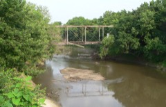
| May 2007 | Flood | Beatrice | $650,000 | Rainfall of 4 to 5 inches fell over much of the Big Blue River basin in Gage county from Friday May 4th through Sunday May 6th, with 4.26 inches reported in Beatrice. The heavy rain caused the Big Blue River to flood with both the gage in Beatrice and near Barneston reporting above flood stage readings for a few days. In Beatrice the Big Blue River reached a 23.9 foot crest around 230 pm CDT on May 7th, flood stage 16 feet. The river first crossed flood stage in Beatrice around 815 am on May 6th and didn't drop below flood stage until 730 am on the 9th.|At Barneston the Big Blue River reached a 24.5 foot crest around 345 pm CDT on May 7th, flood stage is 20 feet. The river near Barneston was above flood stage from around 1000 pm CDT May 6th until 315 am on the 9th.|The river flooded agricultural farmland and county roads in the region. Seven county roads were flooded from Beatrice toward Blue Springs and Wymore. Highway 136 was also closed late May 6th through May 7th around the Beatrice area because of high water that also flooded a park and some streets in town causing around $135,000 worth of damage to the park and ballfields. Two businesses had to be evacuated in Beatrice. The flood waters also prompted 5000 sandbags to be placed around a historical museum to keep flood waters from damaging historic items. Also a grain elevator near Holmesville, several miles southeast of Beatrice, was also sandbagged to protect from the rising waters. Total damage from the storms that hit Gage county on May 5th and 6th amounted to around $650,000, most of which was due to flooding. |
| May 1996 | Hail | Wymore | $450,000 | no account filed |
| June 2008 | Flash Flood | (Bie)Beatrice Arpt | $250,000 | Heavy rain caused flash flooding across mainly northern Gage county. Numerous county roads were flooded causing damage to culverts, according to emergency management. Farm fields also sustained damage. |
| May 2008 | Thunderstorm Wind | Ellis | $250,000 | Thunderstorm winds estimated at over 70 mph caused widespread tree damage and farm outbuilding damage from south through east of the Beatrice area. The winds were associated with a bow echo that moved across the Beatrice area. A tornado spun up on the north end of the echo causing more significant damage north through northeast of Beatrice. Especially hard hit with damage from thunderstorm winds was the Rockford Lake State Recreation area, where 6 to 8 campers were blown over and cabin and tree damage was quite substantial. Emergency management estimated that the tornado and straight line winds caused at least a million dollars worth of damage. |
| April 1991 | Tornado (F3) | not stated | $250,000 | no account filed |
| April 1991 | Tornado (F2) | not stated | $250,000 | no account filed |
| July 1984 | Tornado (F1) | not stated | $250,000 | no account filed |
| July 1978 | Tornado | not stated | $250,000 | no account filed |
| June 1975 | Tornado (F2) | not stated | $250,000 | no account filed |
| June 1998 | Thunderstorm Wind | Pickrell | $200,000 | High winds caused damage to several buildings, irrigation systems, and trees. |
| April 2001 | Tornado (F1) | Wymore | $150,000 | A brief touchdown of a tornado caused extensive tree damage and some roof and structual damage in Wymore. Trees were downed across highway 77 in town causing its closure. One mobile home was pushed 10 feet off of it's foundation causing some structual damage. A roof was torn off of a garage and several grain bins were crumpled and moved 75 to 125 yards. This tornado was associated with the same thunderstorm complex that caused the tornado in Virginia. |
| June 2015 | Flood | Holmesville | $100,000 | Repeated episodes of heavy rainfall resulted in a long duration flood along the Big Blue River near Beatrice with multiple crests observed. The initial crest on the 6th of June was the most significant, with a second significant crest on the 17th. Besides significant agricultural flooding along both banks of the river, several rural roads were closed near the river as well as State Highway 136. |
| May 2015 | Flood | Barneston | $100,000 | Very heavy rainfall of 3 to 7 inches feel upstream of the river gauge and allowed for the river to rise into moderate flooding near Barneston. This resulted in significant low-land flooding along the river. In addition, small streams near Wymore and Blue Springs backed up causing local flood problems in these areas. The Big Blue River near Barneston crested at 28.93 feet or 8.93 feet above flood stage during the morning on the 8th. |
| March 2006 | Thunderstorm Wind | Clatonia | $100,000 | Thunderstorm winds estimated at 60 mph damaged a 70 foot machine shed. |
| May 1998 | Thunderstorm Wind | Rockford | $100,000 | Several silos knocked over. |
| September 2001 | Tornado (F1) | Odell | $60,000 | A tornado tracked from southwest of Odell to just east of town near highway 8. The tornado struck a farmstead heavily damaging 6 outbuildings and a cottonwood and cedar tree shelterbelt. The damage path was reported to a Beatrice newspaper by the Gage county Emergency Manager. |
| April 2006 | Tornado (F0) | Adams | $55,000 | A tornado, estimated at fo strength, touched down about 5 to 6 miles south of Adams. The tornado tore roofs off three hog barns, a chicken shed and blew out windows to several houses. One farmstead reported around $55,000 in damage. The tornado also caused tree damage along its 5 to 6 mile path, lifting about 1/2 mile southwest of Adams. The average damage path width was around 200 yards. |
| April 2008 | Flash Flood | Blue Spgs | $50,000 | Heavy rain caused flash flooding across River Drive south of Blue Springs. The flooding was the result of 2 to 4 inches of rain that fell from thunderstorms that night and produced some washed-out roads and damage to some culverts. A bridge in the area was closed for several hours. |
| June 2001 | Lightning | Wymore | $38,000 | A lightning strike caused a house fire in Wymore. |
| April 2008 | Flood | Barneston | $25,000 | Rainfall of 2 to 4 inches over a several hour period across a section of the lower Big Blue River basin in southeast Nebraska caused the Big Blue River near Barneston to flood. The river near Barneston reached 20.8 feet at 1115 am CDT on April 25th, flood stage is 20 feet. The river was above flood stage near Barneston from around 1015 am through 215 pm. The flooding caused some road and culvert damage in addition to flooding agricultural lowlands. |
| June 1978 | Tornado | not stated | $25,000 | no account filed |
| July 1978 | Tornado | not stated | $25,000 | no account filed |
| April 1976 | Tornado (F1) | not stated | $25,000 | no account filed |
| July 1970 | Tornado (F2) | not stated | $25,000 | no account filed |
| May 1959 | Tornado (F1) | not stated | $25,000 | no account filed |
| July 1959 | Tornado (F1) | not stated | $25,000 | no account filed |
| May 1956 | Tornado (F2) | not stated | $25,000 | no account filed |
| June 1997 | Thunderstorm Wind | Wymore | $23,000 | Two grain bins and a sheet metal shed badly damaged. A truck was also damaged when the grain bin went airborn and slammed into it. Numerous tree limbs as large as eight inches in diameter downed. |
| June 2015 | Flash Flood | Cortland | $20,000 | Emergency management reported that water was starting to flood United States Highway 77. |
| April 2001 | Hail | Beatrice | $20,000 | Hail up to 1 inch in diameter damaged some windows in Beatrice including the marquee at the Cinema Centre on Court St. in Beatrice. |
| July 2000 | Thunderstorm Wind | Filley | $10,000 | Thunderstorm winds destroyed a barn near Filley. |
| June 1997 | Thunderstorm Wind | Blue Spgs | $10,000 | Blue Springs cemetary severely damaged. Six large trees downed with many others damaged. Many headstones overturned. |
| July 1997 | Flash Flood | Beatrice | $8,000 | Heavy rains enveloped a grain elevator and washed out a section of railroad tracks next to it. |
| May 2007 | Flash Flood | Filley | $5,000 | Heavy rainfall of an inch or two produced flash flooding across county roads near Highway 136 between Filley and Crab Orchard. |
| May 2007 | Thunderstorm Wind | Beatrice | $5,000 | Thunderstorm winds estimated at 60 mph destroyed a machine shed south of Beatrice. |
| May 1995 | Tornado (F0) | Beatrice | $5,000 | An off duty police officer had truck thrown off the road into a ditch. The liner was ripped out of his vehicle. |
| April 1998 | Lightning | Beatrice | $4,000 | no account filed |
| June 1971 | Tornado (F0) | not stated | $2,500 | no account filed |
| August 1953 | Tornado (F2) | not stated | $2,500 | no account filed |
| May 1996 | Lightning | Beatrice | $1,000 | no account filed |
| March 2009 | Thunderstorm Wind | Clatonia | $500 | Thunderstorm wind gusts estimated at over 60 mph damaged a metal outbuilding south of Claytonia. |
| August 1989 | Tornado (F0) | not stated | $250 | no account filed |
| March 2026 | Hail | Clatonia | - | Trained spotter report of hail estimated at 1.75 inch in diameter. |
| April 2026 | Hail | Ellis | - | Trained spotter report of hail measured up to 1.50 inches in diameter near Harbine, NE. |
| April 2026 | Hail | Beatrice | - | Trained spotter report of hail measured up to 1 inch in diameter in Beatrice, NE. |
| April 2026 | Hail | Beatrice | - | Trained spotter report of hail measured up to 1.50 inches in diameter in Beatrice, NE. |
| April 2026 | Hail | Beatrice | - | Trained spotter report of hail measured up to 1.50 inch in diameter in Beatrice, NE. |
| March 2025 | Thunderstorm Wind | Holmesville | - | Public reported measured wind gust of 58 mph. |
 Block