 Block
Humboldt, Nebraska
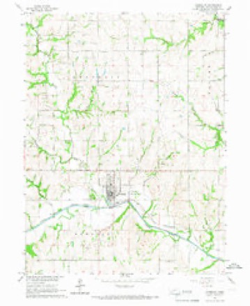
11 topographic sheets cover this place, the earliest surveyed in 1916 and the latest in 1986. It stands in Humboldt City. It lies in ZIP code area 68376. It stands on Long Branch. The Survey maps it on the Humboldt quadrangle. 800 people lived here at the 2020 count. It stands 1,024 feet above sea level.
On record in Humboldt
Buildings and businesses the archive holds for this place. Each opens its own page, with the source record it came from.
On the National Register 2 records
 John Holman Houselisted 1972
- Humboldt Commercial Historic Districtlisted 2005
Population over time
2 figuresHumboldt fell from 877 to 800 between 2010 and 2020. These are the recorded population figures Wikidata holds for this place, reached through the Geographic Names Information System number this page is keyed on rather than by name, so they belong to this place and not to another of the same name. Most are census counts, but not all are: an early figure may be a founding or settlement estimate, and an estimate published within five years of a census is left out. The change column is computed, and is left blank where more than 20 years separate a figure from the one before it, because a gap that long is not a change between two counts.
| Year | People | Change |
|---|---|---|
| 2010 | 877 | |
| 2020 | 800 | -77 (-9%) |
Topographic sheets covering this place
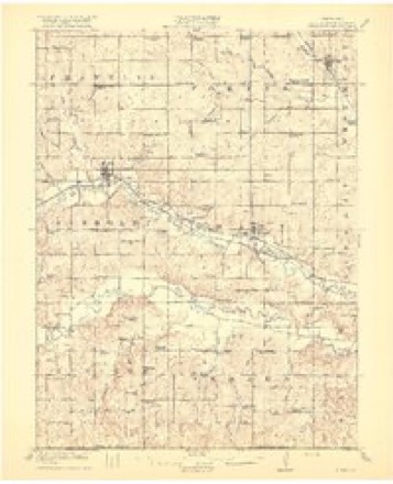
6 surveys from 11 printed sheetsMatched by testing this settlement's coordinate against the published boundary of every sheet in the United States Geological Survey's historical collection. Each opens the scanned sheet at the Survey.
- 1916 USGS Humboldt quadrangle1:62500, 3 printings
- 1955 USGS Nebraska City quadrangle1:250000, 3 printings
- 1957 USGS Nebraska City quadrangle1:250000
- 1958 USGS Nebraska City quadrangle1:250000
- 1965 USGS Humboldt quadrangle1:24000
- 1986 USGS Falls City quadrangle1:100000, 2 printings
In the county-history sources
11,575 words on this townshipHistory of Richardson County, Nebraska : Its People, Industries and Institutions, published 1917 names this settlement in its chapter on Humboldt City. These are the passages that mention it, exactly as the scans read.
Later, when the homestead law was put into effect, a number of liohemians came to Xeliniska. I'"irst among them was b'rank Skaiak. who was also tlie first to take a homestead on the prairie. Skalal< left Bohemia in iS(>5, coming- West by way of Chicago, where there was a flourishing Bohemian settement. At St. Joseph, Missouri, Frank Skalak with his farnily took a Ijoat for Arago, where they accidentally became acquainted with Zulek. On that day Zulek had come to Arago to secure, if possiljle, a loan to pa\- off an obligation he was owing a party in Missouri. Being a countryman he immediately secured the loan from Skalak, although they had never met before. Thereupon, Skalak with his family returned with Zulek to locate in this section of the country. Wenzel Skalak, then a boy, now one of the prominent Ijusiness men of Humboldt, declares that the loan then made was a most fortunate one indeed, as it was the means of causing- them to locate here. However, he does not advise so hazardous a method of curbstone banking as that was.
Passage source: History of Richardson County, Nebraska : Its People, Industries and Institutions, published 1917.
In recounting- those early clays he related that he hired out to Zulek for the munificent sum of forty dollars per year, Ijreaking sod barefooted in grass, waist high, using a twenty- four-inch plow and driving from four to six yoke of oxen. He had to walk to Arago or \eliraska Cit)- to have his plow sharpened. Their provisions were also secured at those places. In 1867 Ruel Nims & Company opened the first store in Humboldt, occupying the old stone store facing the old bed of the Long Branch, a short distance south of the present business section of Humboldt. Young Wenzel at once secured a position as a clerk with this firm, receiving five dollars per month salary. Being an efficient clerk his salary was soon increased to ten dollars per month, the following year. He afterwards was in the employment of various firms in the city until he engaged in business for himself, n(3w owning- the large hardware and implement business on the west side of the public square in the city. John Wohoun, another pioneer, setlleil on the prairie with the Skalaks and in\ited their friends (Bohemians) and soon had a nucleus, from which grew one of the largest settlements of foreigners in the county. Those who secured homesteads at this time were : Anton Eis, M. Nemechek, Ferdinand I'idermutz, John Petrashek. \'acia\ Prachal, Vaclav Holechek, Jan Janata, Ferd Blecha, Fr. Xemecliek, Jos. Musil, Jno. Cizner, and X'aclav Hlavaty. All of these men who braved tlie hardships of the early pioneer are n(jw dead, save one, b'rank Xeniechek, Sr.. who still resides on the place he chose when coming to the state. The Bohemian settlement at Hunijjoldt is without doubt the oldest of that peoi)Ie in the state. One of the chief factors in holding the settlement together was the organization of a fraternal society known as the C. S. V. S. (Bohemian
Passage source: History of Richardson County, Nebraska : Its People, Industries and Institutions, published 1917.
Inasmuch as the chief industry of the Bohemian in his native land was that of agriculture, so it has been here, and they are today numbered among the most industrious and successful of the farming community here. Vet all along the Bohemian has been well represented in the business circles of Humboldt. All are prosperous and well-to-do and more than ordinarily successful in the various occupations in which they may he found engaged. All along they have taken a keen interest in the upbuilding of the community to which they gave a large impetus for settlement. Although at first, many of the customs and traditions of the old world were adhered tn, yet they have now been discarded and even the most typical Bohemian immigrant has been transformed into a patriotic, peaceful, contented American. Although they still cling to their mother tongue, even that is giving wa\ to the language of the new world. It will be, too, only a matter of time when even this pioneer settlement will lose its Bohemian characteristics altogether and become thoroughly Americanized. Only the old Bohemian cemetery in the west end of the county will bear testimony to the fact that here the Bohemian settler had once found that haven which he sought and in return gave birth to a newer, happier posterity.
Passage source: History of Richardson County, Nebraska : Its People, Industries and Institutions, published 1917.
Machine-read from a century-old scan, so expect the errors a machine makes: misspelled names, dropped words, stray characters.
Read the whole chapter on Humboldt City - it names this place 1 more 1 time.
Fires near this place
30 since 2006Regional context, not property-specific evidence. The federal wildfire occurrence database lists 30 fires within 5 miles of Humboldt between 2006 and 2020, burning about 826 acres in total. None started naturally. None was recorded as arson. Distance is straight-line from the map coordinates, so a fire counted here may appear on a neighbouring settlement's page as well.
| Reported cause | Fires |
|---|---|
| Debris and open burning | 30 |
The most recent of them, most recent first, with the day each was reported and the service that recorded it.
| Date | Cause | Size | Reported by | Name on the report |
|---|---|---|---|---|
| 6 April 2016 | Debris and open burning | 1.0 acres | Nebraska Forest Service | not named |
| 4 April 2016 | Debris and open burning | 70 acres | Nebraska Forest Service | not named |
| 4 April 2016 | Debris and open burning | 6.0 acres | Nebraska Forest Service | not named |
| 3 April 2016 | Debris and open burning | 12 acres | Nebraska Forest Service | not named |
| 17 April 2019 | Debris and open burning | 110 acres | Nebraska Forest Service | not named |
| 13 April 2016 | Debris and open burning | 20 acres | Nebraska Forest Service | not named |
| 7 March 2020 | Debris and open burning | 80 acres | Nebraska Forest Service | not named |
| 7 March 2015 | Debris and open burning | 2.0 acres | Nebraska Forest Service | not named |
Settlements close enough to share some of these fires:
Storms near this place
44 since 1996Regional context, not property-specific evidence. The National Weather Service names Humboldt in 44 storm reports between 1996 and 2026: 22 hail, 16 thunderstorm wind, 2 heavy rain, 2 tornado. No death or injury is recorded in these reports. Each account below is quoted exactly as the forecast office filed it, from the NOAA Storm Events Database, and each date opens the federal record of that event.
| When | Event | Place named | Harm | What the report says |
|---|---|---|---|---|
| May 1996 | Hail | Humboldt | $30,000 | no account filed |
| June 1997 | Thunderstorm Wind | Humboldt | $10,000 | Trees downed. Few outbuildings on a farm just west of cemetary damaged. |
| September 1998 | Thunderstorm Wind | Humboldt | $8,000 | Thunderstorm winds took the roof off of a 150 ft machine shed. |
| April 2026 | Hail | Humboldt | - | Public report of hail estimated up to 1 inch in diameter near Humboldt, NE. |
| March 2025 | Hail | Humboldt | - | Public report of mostly smaller hail, but a couple of soft hail stones up to the size of a quarter. |
| March 2025 | Thunderstorm Wind | Humboldt | - | Mesonet measured wind gust of 58 mph. |
| May 2025 | Tornado (EFU) | Humboldt | - | Storm chaser videos indicate that an intermittent weak tornado tracked just south of Highway 8, beginning in an open field east of Highway 50, and continuing with an intermittent ground-level circulation and dust until ending prior to reaching 631 road. The ground level dust circulation did appear to be connected to a cloud base circulation, although without a fully visible condensation funnel. No damage was noted with this tornado. |
| May 2024 | Thunderstorm Wind | Humboldt | - | A trained spotter recorded a wind gust of 71 miles per hour. |
| May 2023 | Hail | Humboldt | - | The public submitted a picture via Twitter of 4-inch hail. |
| May 2023 | Hail | Humboldt | - | A storm chaser reported 2-inch hail. |
| July 2020 | Thunderstorm Wind | Humboldt | - | Utility company reported a few large limbs down in town. |
| October 2017 | Heavy Rain | Humboldt | - | This is a 24 hour heavy rainfall report. |
| August 2015 | Tornado (EF1) | Humboldt | - | The tornado continued into Richardson County from Pawnee County. The tornado continue to produce little damage in Richardson County as there were little structures for the tornado to impact. Some tree damage was noted along the path in Richardson County as well as continued crop damage. As the tornado dissipated it made a loop near 632nd Ave and move southwest for a short time before finally dissipating. |
| May 2013 | Hail | Humboldt | - | The hail fell along with thunderstorm wind gusts estimated at 60 mph. |
| May 2013 | Thunderstorm Wind | Humboldt | - | Thunderstorm winds estimated at around 60 mph were accompanied by hail around quarter-size. |
| April 2013 | Hail | Humboldt | - | Hail up to golf ball-size fell from west of Humboldt into Humboldt. The hail was accompanied by winds estimated at around 60 mph. |
| April 2013 | Thunderstorm Wind | Humboldt | - | Thunderstorm winds estimated at around 60 mph were accompanied by hail up to golf ball-size. The winds and hail broke out the window of a police car. |
| March 2012 | Hail | Humboldt | - | Hail up to around baseball-size fell for several minutes near Humboldt and locations just to the south and east. |
| June 2011 | Hail | Humboldt | - | Hail up to quarter-size fell in the Humboldt area. |
| June 2010 | Thunderstorm Wind | Humboldt | - | A spotter estimated thunderstorm wind gusts of around 60 mph south of Humboldt. |
| June 2010 | Hail | Humboldt | - | Thunderstorm winds estimated at 60 to 70 mph were accompanied by hail up to 1 inch in diameter. This caused considerable crop damage along with some vehicle and house damage from near Humboldt to just southwest of Falls City. The damage was visible on satellite pictures and stretched from north of Beatrice in Gage county southeast to near Falls City. In Richardson county the damage path width narrowed from 5 to 8 miles in the northwest to a mile or two near Falls City. |
| June 2010 | Thunderstorm Wind | Humboldt | - | Thunderstorm winds estimated at 60 to 70 mph were accompanied by hail up to 1 inch in diameter. This caused considerable crop damage along with some vehicle and house damage from near Humboldt to just southwest of Falls City. The damage was visible on satellite pictures and stretched from north of Beatrice in Gage county southeast to near Falls City. In Richardson county the damage path width narrowed from 5 to 8 miles in the northwest to a mile or two near Falls City. |
| June 2010 | Hail | Humboldt | - | Considerable crop damage occurred just to the south of Humboldt. |
| June 2009 | Heavy Rain | Humboldt | - | Heavy rain was reported across sections of Richardson county during the evening of June 1 with a little over 6 inches reported 6 miles south of Humboldt. Law enforcement reported the rain caused minimal flooding or damage but 1 to 2 inches of water covered Highway 8 near mile marker 129, about 1/2 mile east of the Junction of Highways 105 and 8 for a while. |
| August 2009 | Thunderstorm Wind | Humboldt | - | Thunderstorm wind gusts estimated at over 60 mph split or downed a significant number of large trees in the Humboldt area. The fallen trees caused scattered structural damage in the area, especially at the local cemetery where 20 to 30 trees were lost. |
| July 2008 | Thunderstorm Wind | Humboldt | - | Thunderstorm wind gusts estimated at over 60 mph blew a refrigerator from the yard into the side of a house. |
| April 2008 | Hail | Humboldt | - | The time was estimated. |
| August 2007 | Flash Flood | Humboldt | - | Heavy rain caused flash flooding across Highway 75 northeast of Humboldt near the Nemaha county line. |
| August 2007 | Thunderstorm Wind | Humboldt | - | Numerous tree limbs were downed, including one 12 inches in diameter, due to thunderstorm wind gusts in Humboldt. |
| April 2007 | Thunderstorm Wind | Humboldt | - | Thunderstorm wind gusts estimated at 60 mph downed branches 4 inches in diameter near town. |
| May 2007 | Flood | Humboldt | - | Rainfall of 2 to 3 inches fell over the lower reaches of the Big Nemaha River and adjacent sections of southwest Iowa. Falls city reported a 24 hour total of 3.01 inches ending at 7 am CDT Thursday May 24th. The heavy rain caused the Big Nemaha River and the Missouri River to flood in Richardson county. The Big Nemaha near Falls City reached a crest of 25.8 feet at 315 pm CDT on 5/24, flood stage is 23 feet. The river at Falls City was above flood stage from noon on the 24th until 4 am on the 25th. The flooding covered about 300 feet of a gravel road that links the town of Preston to US Highway 159 for a few hours.|At Rulo the Missouri River reached around 18 feet at 300 am CDT on May 25th, flood stage is 17 feet. The Missouri River at Rulo was above flood stage from 5 pm May 24th until a little after noon on the 25th. |A few county roads and lowland farms near the rivers were flooded. |
| May 2007 | Thunderstorm Wind | Humboldt | - | Thunderstorm wind gusts estimated at around 80 mph destroyed a hay barn and cattle shed west of Humboldt along with causing some tree damage. |
| June 2003 | Thunderstorm Wind | Humboldt | - | A thunderstorm wind gust estimated at around 60 mph caused some tree damage in town. |
| August 2003 | Thunderstorm Wind | Humboldt | - | Thunderstorm winds estimated at 60 mph by a trained spotter blew the window out of a house and caused some tree damage near Humboldt. |
| June 2018 | Hail | Humboldt | - | no account filed |
| April 2014 | Hail | Humboldt | - | no account filed |
| May 2013 | Hail | Humboldt | - | no account filed |
| August 2011 | Hail | Humboldt | - | no account filed |
| May 2011 | Hail | Humboldt | - | no account filed |
| June 2009 | Hail | Humboldt | - | no account filed |
| June 2009 | Hail | Humboldt | - | no account filed |
| May 2004 | Hail | Humboldt | - | no account filed |
| June 1999 | Hail | Humboldt | - | no account filed |
| September 1998 | Hail | Humboldt | - | no account filed |
Nearest settlements
The eight closest, with where each one stands in the county. Distances are straight-line, computed from the Geographic Names Information System coordinates.
| Map | Place | Distance | Sheets |
|---|---|---|---|
| Dawson | 6.5 miles | 11 | |
| Athens (historical) | 8.5 miles | 12 | |
| Nim City | 9.2 miles | 11 | |
| Stella | 10.3 miles | 11 | |
| Verdon | 12.4 miles | 11 | |
| Salem | 13.4 miles | 11 | |
| Shubert | 14.8 miles | 11 | |
| Straussville | 16.9 miles | 11 |
Elsewhere
Matched on this settlement's Geographic Names Information System number rather than its name, so it cannot be a different place of the same name in another state.
| Wikipedia article on Humboldt | An encyclopaedic summary. Its text is share-alike, so it is linked here rather than copied. |
| Wikidata item Q963170 | The structured record the population and elevation above come from. Public domain (CC0). |
Provenance
This settlement is recorded in the Geographic Names Information System as feature 830195. The sheet list is computed by point-in-boundary test against the United States Geological Survey's historical topographic inventory. Both are works of the United States government and carry no copyright under 17 U.S.C. 105.
Wildfire. Short, Karen C. 2022. Spatial wildfire occurrence data for the United States, 1992-2020 [FPA_FOD_20221014]. 6th Edition. Fort Collins, CO: Forest Service Research Data Archive. https://doi.org/10.2737/RDS-2013-0009.6 Collected with United States Government funding and usable without additional permissions or fees.
Storms. NOAA National Centers for Environmental Information, Storm Events Database https://www.ncei.noaa.gov/stormevents/ A work of the United States government, no copyright under 17 U.S.C. 105. Narratives are quoted verbatim from the National Weather Service report and are not edited or summarised.