 Block
Valley, Nebraska
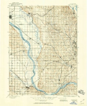
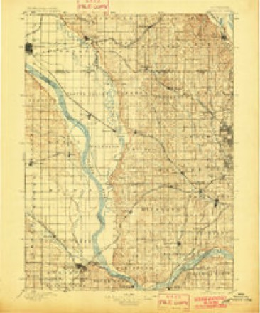
16 topographic sheets cover this place, the earliest surveyed in 1893 and the latest in 1982. It stands in Platte Valley precinct. It lies in ZIP code area 68064. The Survey maps it on the Valley quadrangle. 3,037 people lived here at the 2020 count. It stands 1,142 feet above sea level.
Population over time
2 figuresValley grew from 1,875 to 3,037 between 2010 and 2020. These are the recorded population figures Wikidata holds for this place, reached through the Geographic Names Information System number this page is keyed on rather than by name, so they belong to this place and not to another of the same name. Most are census counts, but not all are: an early figure may be a founding or settlement estimate, and an estimate published within five years of a census is left out. The change column is computed, and is left blank where more than 20 years separate a figure from the one before it, because a gap that long is not a change between two counts.
| Year | People | Change |
|---|---|---|
| 2010 | 1,875 | |
| 2020 | 3,037 | +1,162 (+62%) |
Topographic sheets covering this place
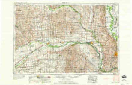
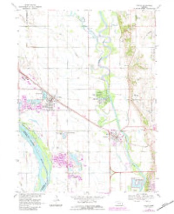
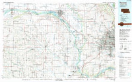
7 surveys from 16 printed sheetsMatched by testing this settlement's coordinate against the published boundary of every sheet in the United States Geological Survey's historical collection. Each opens the scanned sheet at the Survey.
- 1893 USGS Fremont quadrangle1:125000
- 1896 USGS Fremont quadrangle1:125000, 5 printings
- 1955 USGS Fremont quadrangle1:250000, 3 printings
- 1957 USGS Fremont quadrangle1:250000
- 1958 USGS Fremont quadrangle1:250000
- 1968 USGS Valley quadrangle1:24000, 3 printings
- 1982 USGS Fremont quadrangle1:100000, 2 printings
Fires near this place
22 since 2001Regional context, not property-specific evidence. The federal wildfire occurrence database lists 22 fires within 5 miles of Valley between 2001 and 2019, burning about 59 acres in total. None started naturally. None was recorded as arson. Distance is straight-line from the map coordinates, so a fire counted here may appear on a neighbouring settlement's page as well.
| Reported cause | Fires |
|---|---|
| Debris and open burning | 13 |
| Missing data/not specified/undetermined | 4 |
| Railroad operations and maintenance | 2 |
| Smoking | 1 |
| Fireworks | 1 |
| Equipment and vehicle use | 1 |
The most recent of them, most recent first, with the day each was reported and the service that recorded it.
| Date | Cause | Size | Reported by | Name on the report |
|---|---|---|---|---|
| 5 July 2008 | Fireworks | under an acre | Nebraska Forest Service | not named |
| 24 July 2016 | Equipment and vehicle use | 1.0 acres | Nebraska Forest Service | not named |
| 9 June 2007 | Missing data/not specified/undetermined | 1.0 acres | Nebraska Forest Service | not named |
| 30 June 2001 | Debris and open burning | 15 acres | Nebraska Forest Service | not named |
| 6 May 2018 | Missing data/not specified/undetermined | 5.0 acres | Nebraska Forest Service | not named |
| 6 May 2018 | Missing data/not specified/undetermined | 3.0 acres | Nebraska Forest Service | not named |
| 16 May 2013 | Debris and open burning | under an acre | Nebraska Forest Service | not named |
| 9 April 2011 | Debris and open burning | under an acre | Nebraska Forest Service | not named |
Settlements close enough to share some of these fires:
Mines and quarries near this place
2 within 5 milesRegional context, not property-specific evidence. The federal mineral resources record lists 2 workings within 5 miles of Valley: 2 producers. All of them still produce. What was taken out: Sand and Gravel, Construction. Distance is straight-line from the map coordinates, so a quarry counted here may appear on a neighbouring settlement's page as well.
| Where | Site | Commodity | Status | Recorded |
|---|---|---|---|---|
| Hartford Sand & Gravel Pits 1a & 1b | Sand and Gravel, Construction | Producer | ||
| Lyman-Richey Sand & Gravel Corp. | Sand and Gravel, Construction | Producer |
Storms near this place
60 of 88 shownRegional context, not property-specific evidence. The National Weather Service names Valley in 88 storm reports between 1994 and 2025: 40 hail, 37 thunderstorm wind, 4 flood, 3 flash flood. No death or injury is recorded in these reports. Each account below is quoted exactly as the forecast office filed it, from the NOAA Storm Events Database, and each date opens the federal record of that event.
| When | Event | Place named | Harm | What the report says |
|---|---|---|---|---|
| May 2007 | Heavy Rain | Valley | $1,000,000 | Record heavy rain fell over most of Douglas county from Friday May 4th through late Sunday night May 6th. Eppley airfield measured 7.46 inches while 4.39 inches was recorded at the NWS office in Valley. The heavy rain caused widespread ponding of water throughout Douglas county and caused some sewers to backup across the Omaha area. Most of the streets that were flooded because of the backed up sewers were in the older eastern sections of the city. Many basements were also flooded throughout town. In addition, 100 vehicles were flooded at the Eppley Airport north long-term parking lot due to backed up storm drains. |
| March 2011 | Hail | Valley | $250,000 | Hail up to golf ball-size fell for around 5 minutes in the Valley area including at the NWS office near town. The hail was driven by winds estimated at least at 50 mph and caused extensive vehicle and property damage at the NWS office and to homes around a golf course near town. The damage to the Vehicles alone at the NWS was over $100,000. Damage to property and vehicles near the golf course and to homes in Valley was probably well in excess of $100,000. |
| June 1996 | Thunderstorm Wind | Valley | $80,000 | no account filed |
| April 2025 | Hail | Valley | - | NWS employee measured 1.5 hail, noting that the shape was somewhat flat, disk-shaped. The larger hailstone were shaped similar to cauliflower, a congealed hailstone made up of many very small hailstones. |
| July 2025 | Flash Flood | Valley | - | On the morning of July 31st, 2025, a storm brought heavy, intense rainfall to the Omaha metropolitan area, causing flash flooding in both Douglas and Sarpy counties. Between 4:00 AM and 7:30 AM CST, the West Papillion Creek at Elkhorn experienced a rapid rise in water levels. The creek crested at 11.20 feet around 4:30 AM CST, which is above the flood stage. This surge was due to an intense downpour, with rainfall rates estimated at 1.50 to 3.00 inches per hour, and total accumulations reaching 3.15 to 4.03 inches in some areas. A National Weather Service (NWS) employee corroborated the impact of this flooding, reporting that floodwaters had covered the eastbound lane of West Maple Road east of the creek, with a stalled car visible in the high water. |
| July 2025 | Thunderstorm Wind | Valley | - | Official NWS observation with a measured wind gust of 61 mph, associated with the outflow boundary of a thunderstorm. |
| April 2024 | Hail | Valley | - | Quarter sized hail fell at the Omaha-Valley National Weather Service. |
| April 2024 | Hail | Valley | - | For the second time this day, quarter sized hail fell at the Omaha-Valley National Weather Service. |
| May 2024 | Flash Flood | Valley | - | Law Enforcement closed 276th Street north of Valley between Highway 275 and Highway 36 due to flowing water over the roadway. |
| June 2024 | Flood | Valley | - | Training thunderstorms brought a swath of heavy rain to portions of southern Nebraska, beginning in Dawson County, and expanding into portions of northeast and east-central Nebraska. Areas upstream the Platte River, primarily in Merrick, Howard and Nance counties saw over 5 inches of rain with these storms. As such, this heavy upstream rain in addition to one to two inches of additional rain that fell across Dodge and Saunders county resulted in the Platte River reaching flood stage. The Platte near the intersection of Dodge, Douglas and Saunders counties crested at 1:15 CDT at 11.89 feet. Flood stage at this portion of the river is 11.0 feet. Flooding was also observed at the Lashara and Venice river gauges, both cresting at 8.6 feet and 15.64 feet respectively. Their respective flood stages are 8.0 feet and 15.5 feet. |
| June 2024 | Hail | Valley | - | Hail up to half-dollar sized was observed at the Omaha/Valley National Weather Service. |
| July 2023 | Hail | Valley | - | Public reported ping pong size hail via social media. |
| July 2023 | Flood | Valley | - | Fire department reported street flooding in the Valley. |
| July 2023 | Thunderstorm Wind | Valley | - | NWS Omaha measured a peak wind gust of 71 mph. |
| May 2022 | Thunderstorm Wind | Valley | - | Peak wind gust of 68 mph was measured at the WFO Omaha office. |
| May 2022 | Hail | Valley | - | NWS Employee reported 1 inch hail. |
| May 2022 | Hail | Valley | - | Trained spotter reported 1 inch hail. |
| August 2021 | Thunderstorm Wind | Valley | - | Peak wind gust of 58 mph was measured at NWS Omaha. |
| August 2021 | Hail | Valley | - | Broadcast media relayed report of 2.5-inch hail. |
| August 2021 | Hail | Valley | - | Public reported 2-inch hail. |
| August 2021 | Thunderstorm Wind | Valley | - | Peak wind gust of 60 mph was measured at NWS Omaha. |
| August 2021 | Hail | Valley | - | Ping pong size hail was observed at NWS Omaha. |
| June 2021 | Thunderstorm Wind | Valley | - | Personal weather station measured a peak wind gust of 60 mph. |
| May 2020 | Thunderstorm Wind | Valley | - | Wind measured at OAX office was 71 MPH. |
| March 2019 | Flash Flood | Valley | - | NWS Omaha/Valley is being evacuated due to flood waters. Valmont industries evacuated their plant and mandatory evacuation orders occurred in the town of Valley. A levee breech in the Platte River along the Union Dike caused flood waters to overtake the entire town. Numerous homes and businesses were flooded. |
| June 2018 | Thunderstorm Wind | Valley | - | Eight inch diameter tree limb was snapped from a tree in Valley. |
| June 2017 | Hail | Valley | - | One and a half inch hail was measured at the NWS Omaha/Valley office. Most of the hail was up to 0.5 inch size. |
| May 2017 | Thunderstorm Wind | Valley | - | A 74 Knot wind gust was measured at the Omaha/Valley National Weather Service Office. |
| May 2017 | Thunderstorm Wind | Valley | - | Several power poles were blown down in Valley. |
| September 2017 | Thunderstorm Wind | Valley | - | There was shingle damage to a home in the Valley Shores subdivision in Valley. In addition, outdoor furniture was blown around as well. The event was isolated as there was no damage to other homes in the same housing subdivision. |
| June 2017 | Thunderstorm Wind | Valley | - | An 87 mph thunderstorm wind gust was measured at the NWS Omaha/Valley Office. |
| June 2017 | Thunderstorm Wind | Valley | - | A 63 mph wind gust was measured at the NWS Omaha/Valley office. |
| June 2017 | Thunderstorm Wind | Valley | - | An 87 mph wind gust was recorded at the NWS Omaha/Valley Office. |
| July 2017 | Hail | Valley | - | Ping pong ball size hail reported reported at Loves gas station in Valley,NE. |
| April 2016 | Hail | Valley | - | Hail fell at the National Weather Service office. |
| June 2016 | Thunderstorm Wind | Valley | - | A downburst occurred as the line of thunderstorms moved toward Valley, NE. This led to some damage including trees and silos. This damage was along State Street and Reichmuth Road from 288th to 294th. The strong winds extended south to the National Weather Service in Valley were a wind gusts was measured at 59 mph. |
| June 2014 | Thunderstorm Wind | Valley | - | Measured at the NWS office near Valley. |
| June 2013 | Hail | Valley | - | Hail up to the size of quarters fell at the National Weather Service Office in Valley. |
| May 2012 | Thunderstorm Wind | Valley | - | Thunderstorm wind gusts were measured at 60 mph at the NWS office just northwest of Valley. The winds were accompanied by hail that reached up to golf ball-size. |
| May 2012 | Hail | Valley | - | From the same storm that hit the NWS office a few minutes earlier. |
| May 2012 | Hail | Valley | - | Hail up to dime-size fell at the NWS office. |
| May 2012 | Hail | Valley | - | Hail up to golf ball-size fell at the NWS office just northwest of Valley. The hail was accompanied by thunderstorm wind gusts that were measured at 60 mph. Although most hailstones were an inch to an inch and half in diameter, the wind-driven hail caused vehicle damage at the office and likely at surrounding sites as well. |
| May 2011 | Hail | Valley | - | A few pieces of very transparent hail around dime-size fell at the NWS office near Valley. |
| June 2011 | Thunderstorm Wind | Valley | - | A thunderstorm wind gust was measured at 72 mph at the NWS office near Valley. The winds knocked down power poles along Meigs Street west of Highway 275 in Valley. |
| August 2011 | Thunderstorm Wind | Valley | - | Thunderstorm wind gusts were measured at 66 mph at the NWS office near Valley at 957 pm CDT, this followed earlier gusts of 61 mph at 947 pm and 64 mph at 954 pm. The strong winds extended into southwest Omaha where tree limbs downed power lines and knocked out power to at least 10,000 customers, mainly in the Millard area. |
| April 2010 | Hail | Valley | - | Hail at the NWS office fell for almost 20 minutes, although there was a brief break. The hail reached 1 inch in diameter toward the end of the second episode and was accompanied by very heavy rain, with nearly 2 inches measured from the storm, and 35 mph winds. |
| July 2010 | Thunderstorm Wind | Valley | - | Thunderstorm wind gusts of up to 67 mph were measured at the NWS office near Valley. The winds snapped power poles along the road leading into the office. The winds also uprooted and split trees and large limbs causing scattered vehicle, house and fence damage in Valley. |
| August 2010 | Hail | Valley | - | Hail up to 1.5 inches in diameter was measured at the NWS office just northwest of Valley. The hailstones were mostly 1/2 inch or smaller. |
| September 2010 | Hail | Valley | - | Reported on Highway 275 a little north of Valley. |
| May 2008 | Flood | Valley | - | Heavy rain produced flash flooding that closed a few county roads and partially flooded four homes, mostly along Rawhide Creek, north of Valley. |
| July 2008 | Heavy Rain | Valley | - | Rainfall of 2.22 inches was measured at the NWS office in Valley between 7 and 10pm CDT. |
| July 2008 | Thunderstorm Wind | Valley | - | Thunderstorm wind gusts estimated at close to 60 mph blew a shed onto the road near 264th and Rainwood. |
| July 2008 | Thunderstorm Wind | Valley | - | A thunderstorm wind gust of 60 mph was measured at the NWS office. The strong winds caused some tree damage in Valley and knocked the power out across much of the town for a few hours. |
| June 2008 | Hail | Valley | - | At the NWS Valley office. |
| July 2008 | Hail | Valley | - | Hail up to golfball-size fell for about 15 minutes in and north through east of the Valley area. The hail broke some windows out of a house east of town and caused scattered other house and vehicle damage in the area. |
| February 2007 | Flood | Valley | - | Ice jams and rising water due to snow melt on the Platte River caused water to flood and very large chunks of ice to be thrown up on the banks along the Platte River from west of Valley to southwest of Waterloo. The water flooded around some cabins and onto county roads near the river. |
| March 2006 | Funnel Cloud | Valley | - | A funnel cloud was observed by NWS personnel a few miles southwest of the office. |
| April 2006 | Funnel Cloud | Valley | - | A cold-air, or non-thunderstorm funnel cloud was observed at the NWS near Valley. The very narrow funnel did not touch the ground, and was not even associated with precipitation. There were numerous reports of funnels on both sides of the Missouri River from south of Omaha toward the Onawa and Mapleton areas. The funnel clouds made the local news reports. |
| July 2006 | Thunderstorm Wind | Valley | - | A supercell thunderstorm moved across the Omaha metro area and produced damaging winds. The winds were measured at 59 mph at the NWS office in Valley, about 10 miles west of western Omaha, at 322 pm cdt. The winds uprooted a large tree in Valley and a large branch from it crashed into a house causing substantial roof damage. These strong winds then spread both east across town and southeast into adjacent counties. At 335 pm cdt tree limbs were downed by winds estimated at 60 mph a mile or two north of the northern sections of Omaha north of I-680, while around 340 pm a turn signal near 83rd and Maple Streets was snapped off and large trees were downed at 52nd and Seward streets. In total 20 traffic signals were damaged across town and there were also reports of scattered tree and fence damage. Five-thousand OPPD customers lost power during the storm. This storm was the same one that dropped large hail and produced strong winds from around Columbus east through Mead and Wahoo. |
| May 2005 | Hail | Valley | - | One inch hail was measured at the NWS office near Valley. |
Nearest settlements
The eight closest, with where each one stands in the county. Distances are straight-line, computed from the Geographic Names Information System coordinates.
| Map | Place | Distance | Sheets |
|---|---|---|---|
| King Lake | 2.4 miles | 16 | |
| Waterloo | 3.7 miles | 16 | |
| Lake Platte View | 4.7 miles | 15 | |
| Rellers Park | 5.4 miles | 15 | |
| Venice | 5.5 miles | 15 | |
| Elk City | 5.8 miles | 16 | |
| Mercer | 6.0 miles | 15 | |
| Elkhorn | 6.2 miles | 17 |
Elsewhere
Matched on this settlement's Geographic Names Information System number rather than its name, so it cannot be a different place of the same name in another state.
| Wikipedia article on Valley | An encyclopaedic summary. Its text is share-alike, so it is linked here rather than copied. |
| Wikidata item Q964005 | The structured record the population and elevation above come from. Public domain (CC0). |
Provenance
This settlement is recorded in the Geographic Names Information System as feature 834325. The sheet list is computed by point-in-boundary test against the United States Geological Survey's historical topographic inventory. Both are works of the United States government and carry no copyright under 17 U.S.C. 105.
Wildfire. Short, Karen C. 2022. Spatial wildfire occurrence data for the United States, 1992-2020 [FPA_FOD_20221014]. 6th Edition. Fort Collins, CO: Forest Service Research Data Archive. https://doi.org/10.2737/RDS-2013-0009.6 Collected with United States Government funding and usable without additional permissions or fees.
Mines and quarries. USGS Mineral Resources Data System (MRDS) https://mrdata.usgs.gov/mrds/ A work of the United States government, no copyright under 17 U.S.C. 105.
Storms. NOAA National Centers for Environmental Information, Storm Events Database https://www.ncei.noaa.gov/stormevents/ A work of the United States government, no copyright under 17 U.S.C. 105. Narratives are quoted verbatim from the National Weather Service report and are not edited or summarised.