 Block
Floyd, New Mexico
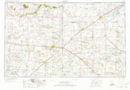
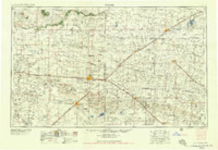
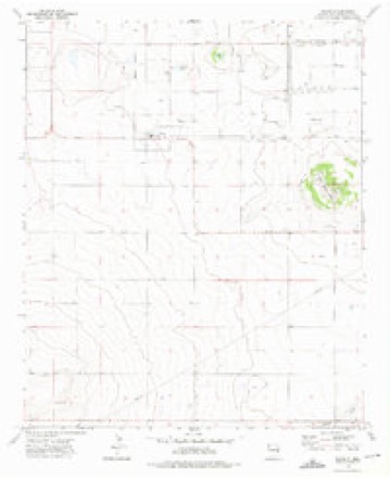
7 topographic sheets cover this place, the earliest surveyed in 1954 and the latest in 1973. It stands in the Elida census division. It lies in ZIP code area 88118. The Survey maps it on the Floyd quadrangle. 86 people lived here at the 2020 count. It stands 4,154 feet above sea level.
Population over time
2 figuresFloyd fell from 133 to 86 between 2010 and 2020. These are the recorded population figures Wikidata holds for this place, reached through the Geographic Names Information System number this page is keyed on rather than by name, so they belong to this place and not to another of the same name. Most are census counts, but not all are: an early figure may be a founding or settlement estimate, and an estimate published within five years of a census is left out. The change column is computed, and is left blank where more than 20 years separate a figure from the one before it, because a gap that long is not a change between two counts.
| Year | People | Change |
|---|---|---|
| 2010 | 133 | |
| 2020 | 86 | -47 (-35%) |
Topographic sheets covering this place
3 surveys from 7 printed sheetsMatched by testing this settlement's coordinate against the published boundary of every sheet in the United States Geological Survey's historical collection. Each opens the scanned sheet at the Survey.
- 1954 USGS Clovis quadrangle1:250000, 4 printings
- 1958 USGS Clovis quadrangle1:250000
- 1973 USGS Floyd quadrangle1:24000, 2 printings
Fires near this place
32 since 1993Regional context, not property-specific evidence. The federal wildfire occurrence database lists 32 fires within 5 miles of Floyd between 1993 and 2019, burning about 2,717 acres in total. 6 started naturally. None was recorded as arson. Distance is straight-line from the map coordinates, so a fire counted here may appear on a neighbouring settlement's page as well.
| Reported cause | Fires |
|---|---|
| Missing data/not specified/undetermined | 12 |
| Equipment and vehicle use | 10 |
| Natural | 6 |
| Debris and open burning | 1 |
| Smoking | 1 |
| Fireworks | 1 |
| Other causes | 1 |
The most recent of them, most recent first, with the day each was reported and the service that recorded it.
| Date | Cause | Size | Reported by | Name on the report |
|---|---|---|---|---|
| 25 August 2011 | Equipment and vehicle use | 65 acres | New Mexico State Forestry Division | KRONE |
| 10 August 2011 | Equipment and vehicle use | 29 acres | New Mexico State Forestry Division | HESSTON |
| 6 July 2006 | Natural | 60 acres | New Mexico State Forestry Division | not named |
| 5 July 2011 | Fireworks | 10 acres | New Mexico State Forestry Division | THE HIDEOUT |
| 27 July 2015 | Natural | 1.0 acres | New Mexico State Forestry Division | FLOYD |
| 26 July 1997 | Missing data/not specified/undetermined | 30 acres | New Mexico State Forestry Division | DEAVER |
| 6 June 1994 | Missing data/not specified/undetermined | 60 acres | New Mexico State Forestry Division | BUZARD |
| 26 June 2019 | Natural | 130 acres | Capitan District | 19-51380524X |
Settlements close enough to share some of these fires:
Mines and quarries near this place
2 within 5 milesRegional context, not property-specific evidence. The federal mineral resources record lists 2 workings within 5 miles of Floyd: 2 unknowns. None of them still produces. What was taken out: Sand and Gravel, Construction. Distance is straight-line from the map coordinates, so a quarry counted here may appear on a neighbouring settlement's page as well.
| Where | Site | Commodity | Status | Recorded |
|---|---|---|---|---|
| Materials Pit | Sand and Gravel, Construction | Unknown | ||
| Materials Pit | Sand and Gravel, Construction | Unknown |
Storms near this place
34 since 1994Regional context, not property-specific evidence. The National Weather Service names Floyd in 34 storm reports between 1994 and 2025: 13 thunderstorm wind, 12 hail, 4 flash flood, 2 tornado. No death or injury is recorded in these reports. Each account below is quoted exactly as the forecast office filed it, from the NOAA Storm Events Database, and each date opens the federal record of that event.
| When | Event | Place named | Harm | What the report says |
|---|---|---|---|---|
| June 2017 | Thunderstorm Wind | Floyd | $250,000 | A large storage trailer with agricultural goods was blown over and contents destroyed. Several farmers in the area experienced total crop loss from large hail and high winds. Damage was also reported to many homes. One home saw hail punctured through the roof and damaged the interior of the residence. |
| October 2019 | Flash Flood | Floyd | $100,000 | A CoCoRaHS observer near Causey reported a whopping 6.87 of rain in just 24 hours. State Road 267 was closed due to flash flooding between mile markers 11 and 15 west of Portales. |
| June 2017 | Hail | Floyd | $100,000 | Hail up to the size of baseballs. Damage sustained to crops, homes, and vehicles. |
| May 2025 | Tornado (EF1) | Floyd | $50,000 | Overall rating is EF-1 with 90 mph windspeeds based on what damage indicators there were from power pole damage as no structures were impacted. Damage survey found tree damage at the start of the tornado about 3 miles SW of Floyd before tracking northeast over open fields and crossing road NM-267 about 1.5 miles SE of Floyd. The tornado snapped 10 to 15 power poles near the bases of the poles as it continued to move northeast. Another 20 power poles were snapped on Roosevelt Road 3. This stretch of the tornado track includes its peak intensity and width with low end EF-1 damage (winds speeds near 90 mph). The tornado weakened as it tracked NE towards Roosevelt Road 2 and a dairy plant. There was a mangled farm sprinkler system to the SW of the dairy and minor damage to fences and metal roofing at the dairy plant. |
| July 2012 | Thunderstorm Wind | Floyd | $20,000 | Powerful thunderstorm winds downed two power poles, overturned one center pivot irrigation unit, blew over a feed trailer, and downed at least one large tree. |
| August 2008 | Thunderstorm Wind | Floyd | $5,000 | Thunderstorm winds blew over a crop sprinkler near Floyd and tiles off roofs in Portales. |
| July 2021 | Thunderstorm Wind | Floyd | $2,000 | A trained spotter reported small tree limbs that were generally less than 1 inch in diameter were knocked down from estimated 50 to 55 mph winds from a thunderstorm near Floyd. Damages are estimated for the downed tree limbs. |
| August 2010 | Flash Flood | Floyd | $2,000 | Multiple roads were flooded across northern Roosevelt County, particularly around Floyd and Portales. One citizen attempted to drive through a low water crossing filled with three to four feet of water along Highway 267 near Floyd. The car stalled, but was recovered. 18th Street in Portales was a particularly hard hit area. Streets along 18th were impassible between Avenue D and Globe. The intersection of Avenue I and 18th Street was impassible as well. The cooperative observer in Portales measured 1.75 inches of rain. |
| June 2013 | Thunderstorm Wind | Floyd | $500 | Several sections of a fence made of telephone pole wood blown down 1 mile east of Floyd. |
| June 2012 | Hail | Floyd | $500 | Baseball size hail broke out the windshield of a pick up truck. |
| June 2025 | Thunderstorm Wind | Floyd | - | The Melrose Range Mesonet station observed a 70 mph wind gust from nearby thunderstorms. |
| September 2025 | Thunderstorm Wind | Floyd | - | The RAWS station at Melrose Range observed a 69 mph wind gust on the leading edge of a line of severe thunderstorms. |
| May 2024 | Flash Flood | Floyd | - | Road closure from standing water over roadway along NM 267 from mile marker 10 to 13. |
| May 2024 | Hail | Floyd | - | A severe thunderstorm produced penny to quarter size hail a few miles south of Floyd. |
| June 2017 | Thunderstorm Wind | Floyd | - | Local weather station several miles west-northwest of Floyd reported a peak wind gust to 67 mph. |
| May 2017 | Funnel Cloud | Floyd | - | The first funnel cloud in a series spotted west-northwest of Portales. |
| July 2017 | Flood | Floyd | - | Numerous vehicles were stranded along U.S. Highway 70. State police characterized the area as a large lake. State road 267 was also washed out between Floyd and Portales. Over a foot of water was reported on roadways in downtown Portales. |
| May 2013 | Hail | Floyd | - | Nickel size hail reported near Floyd. |
| June 2013 | Thunderstorm Wind | Floyd | - | Peak thunderstorm wind of 69 mph 4 miles southwest of Floyd. |
| June 2012 | Tornado (EF1) | Floyd | - | A long track tornadic supercell thunderstorm that developed over far western portions of the Caprock in extreme southeast Guadalupe county produced significant and widespread damage along a path that stretched from over 100 miles from approximately 15 miles north of Fort Sumner to near the New Mexico / Texas state line south of Causey. This was the first of two relatively short tornado damage paths that were surveyed. |
| May 2011 | Hail | Floyd | - | Hail was reported along Highway 236 near Bethel. |
| August 2008 | Flash Flood | Floyd | - | Thunderstorms produced heavy rain which flooded State Road 267 between Floyd and Portales. |
| July 2005 | Thunderstorm Wind | Floyd | - | Staff at the tower of the Melrose Bombing Range reported extreme winds as a small bow echo type storm moved west to east over the range complex. Trees were twisted and several large cargo containers were rolled across country for about 1000 feet, but no other damage was observed. |
| May 1999 | Hail | Floyd | - | Hail accumulated knee-deep in several places wiping out cotton and vegetable plants during a 35 minute period that also produced 3 inches of rain. |
| May 2010 | Hail | Floyd | - | no account filed |
| August 2008 | Thunderstorm Wind | Floyd | - | no account filed |
| May 2008 | Hail | Floyd | - | no account filed |
| May 2008 | Hail | Floyd | - | no account filed |
| June 2007 | Thunderstorm Wind | Floyd | - | no account filed |
| June 2004 | Hail | Floyd | - | no account filed |
| August 2002 | Heavy Rain | Floyd | - | no account filed |
| May 1999 | Hail | Floyd | - | no account filed |
| July 1997 | Thunderstorm Wind | Floyd | - | no account filed |
| June 1994 | Hail | Floyd | - | no account filed |
Nearest settlements
The eight closest, with where each one stands in the county. Distances are straight-line, computed from the Geographic Names Information System coordinates.
| Map | Place | Distance | Sheets |
|---|---|---|---|
| Upton | 5.6 miles | 6 | |
| Bethel | 5.7 miles | 8 | |
| Tinsley Crossing | 10.4 miles | 8 | |
| Delphos | 10.7 miles | 8 | |
| Benson (historical) | 11.2 miles | 7 | |
| Yerba | 11.4 miles | 8 | |
| Ingram (historical) | 12.0 miles | 6 | |
| Portales | 13.2 miles | 8 |
Elsewhere
Matched on this settlement's Geographic Names Information System number rather than its name, so it cannot be a different place of the same name in another state.
| Wikipedia article on Floyd | An encyclopaedic summary. Its text is share-alike, so it is linked here rather than copied. |
| Wikidata item Q2537378 | The structured record the population and elevation above come from. Public domain (CC0). |
Provenance
This settlement is recorded in the Geographic Names Information System as feature 902248. The sheet list is computed by point-in-boundary test against the United States Geological Survey's historical topographic inventory. Both are works of the United States government and carry no copyright under 17 U.S.C. 105.
Wildfire. Short, Karen C. 2022. Spatial wildfire occurrence data for the United States, 1992-2020 [FPA_FOD_20221014]. 6th Edition. Fort Collins, CO: Forest Service Research Data Archive. https://doi.org/10.2737/RDS-2013-0009.6 Collected with United States Government funding and usable without additional permissions or fees.
Mines and quarries. USGS Mineral Resources Data System (MRDS) https://mrdata.usgs.gov/mrds/ A work of the United States government, no copyright under 17 U.S.C. 105.
Storms. NOAA National Centers for Environmental Information, Storm Events Database https://www.ncei.noaa.gov/stormevents/ A work of the United States government, no copyright under 17 U.S.C. 105. Narratives are quoted verbatim from the National Weather Service report and are not edited or summarised.