 Block
Otis, New Mexico
11 topographic sheets cover this place, the earliest surveyed in 1939 and the latest in 1985. It stands in the Carlsbad census division. It lies in ZIP code area 88220. The Survey maps it on the Otis quadrangle.
On record in Otis
Buildings and businesses the archive holds for this place. Each opens its own page, with the source record it came from.
On the National Register within a mile 1 record
The National Register names another town for these. They stand within one mile of this settlement's coordinate.
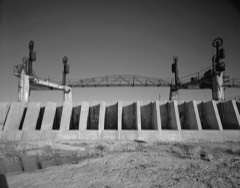 Carlsbad Irrigation DistrictNational Historic Landmark · listed 1966 · 0.0 miles away
Topographic sheets covering this place
6 surveys from 11 printed sheetsMatched by testing this settlement's coordinate against the published boundary of every sheet in the United States Geological Survey's historical collection. Each opens the scanned sheet at the Survey.
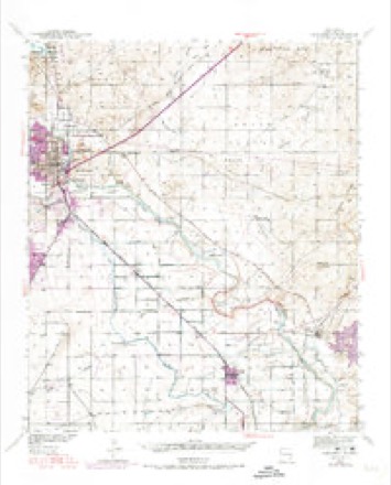
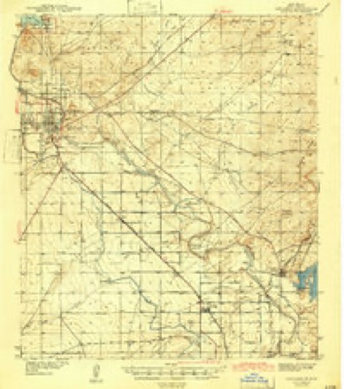
- 1939 USGS Carlsbad quadrangle1:62500, 2 printings
- 1943 USGS Carlsbad quadrangle1:62500
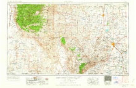
- 1954 USGS Carlsbad quadrangle1:250000, 3 printings
- 1958 USGS Carlsbad quadrangle1:250000, 2 printings
- 1979 USGS Carlsbad quadrangle1:100000, 2 printings
- 1985 USGS Otis quadrangle1:24000
Fires near this place
75 since 1992Regional context, not property-specific evidence. The federal wildfire occurrence database lists 75 fires within 5 miles of Otis between 1992 and 2020, burning about 1,312 acres in total. None started naturally. None was recorded as arson. Distance is straight-line from the map coordinates, so a fire counted here may appear on a neighbouring settlement's page as well.
| Reported cause | Fires |
|---|---|
| Missing data/not specified/undetermined | 51 |
| Debris and open burning | 12 |
| Recreation and ceremony | 4 |
| Fireworks | 3 |
| Smoking | 2 |
| Equipment and vehicle use | 2 |
| Railroad operations and maintenance | 1 |
The most recent of them, most recent first, with the day each was reported and the service that recorded it.
| Date | Cause | Size | Reported by | Name on the report |
|---|---|---|---|---|
| 24 September 1999 | Equipment and vehicle use | under an acre | Roswell Field Office | TORNADO2 |
| 2 August 1993 | Missing data/not specified/undetermined | 15 acres | New Mexico State Forestry Division | TOWNSEND |
| 9 July 2020 | Debris and open burning | under an acre | Capitan District | KELLY |
| 9 July 2020 | Fireworks | under an acre | Capitan District | 21-50130053X |
| 9 July 2013 | Fireworks | under an acre | Carlsbad Field Office | SIX MILE |
| 7 July 1998 | Missing data/not specified/undetermined | 10 acres | New Mexico State Forestry Division | ROBERSON |
| 4 July 2014 | Fireworks | 1.0 acres | New Mexico State Forestry Division | HOWARD |
| 3 July 2005 | Missing data/not specified/undetermined | 2.0 acres | Carlsbad Field Office | WALKER |
Settlements close enough to share some of these fires:
Storms near this place
16 since 1997Regional context, not property-specific evidence. The National Weather Service names Otis in 16 storm reports between 1997 and 2024: 7 hail, 5 thunderstorm wind, 3 flash flood, 1 tornado. No death or injury is recorded in these reports. Each account below is quoted exactly as the forecast office filed it, from the NOAA Storm Events Database, and each date opens the federal record of that event.
| When | Event | Place named | Harm | What the report says |
|---|---|---|---|---|
| July 2005 | Thunderstorm Wind | Otis | $40,000 | Power outages were reported throughout Otis as a result of downed power lines from thunderstorm winds. |
| October 1997 | Thunderstorm Wind | Otis | $35,000 | A fast moving storm with downbursting winds caused damage that started south of the Otis community and moved northward into Otis. The storm moved from about 200 degrees at 30 knots with all of the debris from the damage being blown in this direction. The storm first hit two trailers about 4 miles south of Otis. Tie-down straps held one trailer in place but sustained a few broken windows and a warped door. The other (unstrapped) trailer was blown over and rolled by the strong winds resulting in its destruction. The trailer rolled two times with the floor sitting upright displaced 35 yards to the north in a field. Most of the roof was torn off and was crumpled about 100 yards farther north in the field.The next area to suffer damage was 2-3 miles to the NNW of the trailers where a row of 30 foot trees along a property line were uprooted. Next, the winds hit a 3 year old house and ripped off about half of its tin roof. As the storm moved into Otis, the strong winds snapped a string of telephone poles along U.S. Highway 285.A damage survey of the area determined an affected area 4 miles long and 1.5 miles wide. Several houses within the damage area sustained no visible damage. All debris was blown from about 190-195 degrees and was only very slightly divergent. |
| May 2018 | Hail | Otis | $23,000 | A thunderstorm moved across Eddy County and produced two inch hail in Otis. Several homes had damage to windows and siding. The cost of damage is a very rough estimate. |
| September 2024 | Thunderstorm Wind | Otis | $15,000 | Several power lines were reported down at the junction of US Hwy 285 and Helper Rd. The estimated wind gust was approximately 80 mph. Property damage cost is an estimation. |
| July 1998 | Thunderstorm Wind | Otis | $8,000 | Two barns and a carport were destroyed and three utility poles were downed near Otis. |
| July 1998 | Thunderstorm Wind | Otis | $2,500 | A wet microburst knocked down 3 utility poles along U.S. Highway 285 in Otis. |
| November 2024 | Hail | Otis | - | A trained spotter shared a photo of a golf ball to two-inch diameter hail in Otis near Derrick Rd and Kelly Rd. |
| June 2021 | Flash Flood | Otis | - | Heavy rain resulted in flash flooding in Eddy County. There was a photo of several inches of water around Preakness Gas Plant building about 20 miles northwest of Orla. No damage was reported. |
| June 2014 | Tornado (EF0) | Otis | - | A thunderstorm moved across Eddy County and produced a brief tornado near Otis. No damage was reported with this tornado so the path length and width are estimated. This tornado was rated an EF-0. |
| June 2009 | Flash Flood | Otis | - | The sheriff's office reported that they were barricading low water crossing near Otis due to 1 to 2 feet of flowing water through some intersections. Sandbags were also used to prevent flooding near homes. No damage was reported, however. |
| July 1997 | Flash Flood | Otis | - | Slow-moving thunderstorms dropped flooding rains in eastern Eddy County on State Highway 128. Water was running across the roadway near the 6 mile marker. |
| May 2019 | Hail | Otis | - | no account filed |
| October 2018 | Hail | Otis | - | no account filed |
| May 2010 | Hail | Otis | - | no account filed |
| June 2010 | Hail | Otis | - | no account filed |
| March 2006 | Hail | Otis | - | no account filed |
Nearest settlements
The eight closest, with where each one stands in the county. Distances are straight-line, computed from the Geographic Names Information System coordinates.
| Map | Place | Distance | Sheets |
|---|---|---|---|
| San Jose | 5.2 miles | 11 | |
| Hagerman Heights | 5.3 miles | 11 | |
| Carlsbad | 5.8 miles | 11 | |
| Loving | 5.9 miles | 11 | |
| West Carlsbad | 6.9 miles | 12 | |
| La Huerta | 6.9 miles | 11 | |
| Harkey Crossing | 8.1 miles | 10 | |
| Lookout (historical) | 8.7 miles | 10 |
Provenance
This settlement is recorded in the Geographic Names Information System as feature 892965. The sheet list is computed by point-in-boundary test against the United States Geological Survey's historical topographic inventory. Both are works of the United States government and carry no copyright under 17 U.S.C. 105.
Wildfire. Short, Karen C. 2022. Spatial wildfire occurrence data for the United States, 1992-2020 [FPA_FOD_20221014]. 6th Edition. Fort Collins, CO: Forest Service Research Data Archive. https://doi.org/10.2737/RDS-2013-0009.6 Collected with United States Government funding and usable without additional permissions or fees.
Storms. NOAA National Centers for Environmental Information, Storm Events Database https://www.ncei.noaa.gov/stormevents/ A work of the United States government, no copyright under 17 U.S.C. 105. Narratives are quoted verbatim from the National Weather Service report and are not edited or summarised.