 Block
Sedan, New Mexico
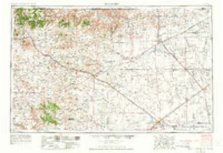
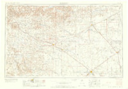
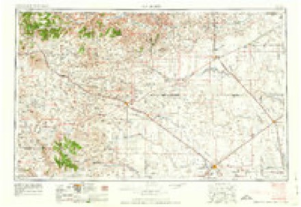
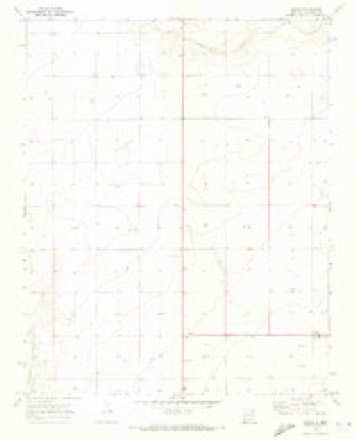
7 topographic sheets cover this place, the earliest surveyed in 1954 and the latest in 1982. It stands in the Clayton South census division. It lies in ZIP code area 88436. The Survey maps it on the Sedan quadrangle.
Topographic sheets covering this place
5 surveys from 7 printed sheetsMatched by testing this settlement's coordinate against the published boundary of every sheet in the United States Geological Survey's historical collection. Each opens the scanned sheet at the Survey.
- 1954 USGS Dalhart quadrangle1:250000, 2 printings
- 1958 USGS Dalhart quadrangle1:250000, 2 printings
- 1962 USGS Dalhart quadrangle1:250000
- 1970 USGS Sedan quadrangle1:24000
- 1982 USGS Clayton quadrangle1:100000
Fires near this place
8 since 1993Regional context, not property-specific evidence. The federal wildfire occurrence database lists 8 fires within 5 miles of Sedan between 1993 and 2020, burning about 1,086 acres in total. 2 started naturally. None was recorded as arson. Distance is straight-line from the map coordinates, so a fire counted here may appear on a neighbouring settlement's page as well.
| Reported cause | Fires |
|---|---|
| Missing data/not specified/undetermined | 3 |
| Natural | 2 |
| Equipment and vehicle use | 2 |
| Power generation/transmission/distribution | 1 |
The most recent of them, most recent first, with the day each was reported and the service that recorded it.
| Date | Cause | Size | Reported by | Name on the report |
|---|---|---|---|---|
| 21 July 2016 | Natural | 120 acres | Cimarron District | GIESBRECHT |
| 8 June 2016 | Natural | 25 acres | Cimarron District | HOLMAN |
| 28 May 2006 | Missing data/not specified/undetermined | 135 acres | New Mexico State Forestry Division | not named |
| 19 April 1997 | Missing data/not specified/undetermined | 250 acres | New Mexico State Forestry Division | VANVIER |
| 7 March 2018 | Equipment and vehicle use | 300 acres | Cimarron District | BEAMER |
| 9 November 1993 | Missing data/not specified/undetermined | 250 acres | New Mexico State Forestry Division | SEDAN |
| 6 January 2020 | Power generation/transmission/distribution | 5.0 acres | Cimarron District | COWAN |
| 6 January 2020 | Equipment and vehicle use | 1.0 acres | Cimarron District | VANDIVER |
Mines and quarries near this place
3 within 5 milesRegional context, not property-specific evidence. The federal mineral resources record lists 3 workings within 5 miles of Sedan: 3 unknowns. None of them still produces. What was taken out: Sand and Gravel, Construction. Distance is straight-line from the map coordinates, so a quarry counted here may appear on a neighbouring settlement's page as well.
| Where | Site | Commodity | Status | Recorded |
|---|---|---|---|---|
| Materials Pit | Sand and Gravel, Construction | Unknown | ||
| Materials Pit | Sand and Gravel, Construction | Unknown | ||
| Materials Pit | Sand and Gravel, Construction | Unknown |
Storms near this place
50 since 1994Regional context, not property-specific evidence. The National Weather Service names Sedan in 50 storm reports between 1994 and 2025: 35 hail, 7 thunderstorm wind, 4 tornado, 3 funnel cloud. No death or injury is recorded in these reports. Each account below is quoted exactly as the forecast office filed it, from the NOAA Storm Events Database, and each date opens the federal record of that event.
| When | Event | Place named | Harm | What the report says |
|---|---|---|---|---|
| May 2010 | Tornado (EF2) | Sedan | $325,000 | There was damage to agricultural equipment. A single wide mobile home that had tie down straps was completely destroyed and the undercarriage was carried approximately 40 yards. No injuries reported. |
| May 2010 | Tornado (EF1) | Sedan | $125,000 | Two tornadoes were reported from the same parent supercell thunderstorm. This is the second tornado with shorter track farther north. |
| July 2022 | Flash Flood | Sedan | $15,000 | Heavy rain of 3.5 to 4 inches caused flash flooding south of Clayton. A trained spotter reported that the heavy rain caused Carrizo Creek to overflow its banks. Standing water and debris was reported across area roadways and within fields. Damages are estimated. |
| May 1996 | Tornado (F0) | Sedan | $15,000 | no account filed |
| August 2017 | Hail | Sedan | $1,000 | Hail up to the size of golf balls with strong winds broke out windows at home in Sedan. |
| August 2017 | Hail | Sedan | $500 | The combination of strong winds and ping pong ball hail broke a window at a home in Sedan. |
| June 2025 | Hail | Sedan | - | A broadcast meteorologist reported half dollar to golf ball size hail along NM 402 near Sedan. |
| June 2025 | Hail | Sedan | - | Ping pong to golf ball size hail was observed along NM 402 southwest of Sedan from a severe thunderstorm. |
| June 2023 | Hail | Sedan | - | Ping pong ball sized hail fell with a supercell as it moved southeast through southern Union County. |
| May 2023 | Thunderstorm Wind | Sedan | - | A mesonet station near Sedan, NM in Union County measured a peak thunderstorm wind gust of 60 mph. |
| July 2021 | Thunderstorm Wind | Sedan | - | A trained spotter estimated a 60 mph wind gust from a severe thunderstorm near Sedan. |
| May 2020 | Hail | Sedan | - | A thunderstorm near Sedan produced pea to penny size hail, brief heavy rain, and gusty winds. |
| March 2019 | Hail | Sedan | - | Hail up to the size of nickels reported a few miles north-northwest of Sedan. |
| June 2018 | Hail | Sedan | - | Hail up to the size of nickels near Sedan. |
| May 2018 | Hail | Sedan | - | A very quick storm produced hail up to the size of nickels for less than one minute. |
| June 2017 | Thunderstorm Wind | Sedan | - | Thunderstorm outflow. |
| May 2017 | Thunderstorm Wind | Sedan | - | A weather station near Sedan reported a peak wind gust to 60 mph. |
| May 2015 | Hail | Sedan | - | Hen egg size hail for 10 minutes 1 mile east of Sedan. |
| May 2015 | Hail | Sedan | - | Hail stripped fruit off of trees on the property. |
| May 2015 | Thunderstorm Wind | Sedan | - | A personal weather station measured a thunderstorm wind gust of 69 mph. |
| June 2014 | Funnel Cloud | Sedan | - | Spotter observed funnel cloud near Sedan with significant rotation in thunderstorm structure. |
| July 2014 | Hail | Sedan | - | Quarter size hail. |
| September 2014 | Thunderstorm Wind | Sedan | - | Trained spotters' apricot tree was wrecked due to high winds. Most of the leaves were gone after thunderstorm came through. |
| August 2013 | Hail | Sedan | - | Nickel size hail in Sedan. |
| June 2013 | Hail | Sedan | - | Quarter hail in Sedan. |
| June 2011 | Thunderstorm Wind | Sedan | - | A spotter estimated a 60 mph wind gust in Sedan. |
| May 2010 | Hail | Sedan | - | Hail ranged from pea size to pennies. |
| May 2010 | Tornado (EF1) | Sedan | - | No reports of significant damage and no injuries. |
| April 2006 | Hail | Sedan | - | About two inches of hail covered the ground around Sedan. |
| July 1994 | Hail | Sedan | - | A severe thunderstorm over Union County produced strong winds and hail up to golf ball-size. The 52 knot winds was from the Clayton SAO. A local spotter reported the hail in Sedan with KLMX radio station providing the other reports. |
| May 2023 | Hail | Sedan | - | no account filed |
| May 2015 | Hail | Sedan | - | no account filed |
| May 2015 | Hail | Sedan | - | no account filed |
| May 2010 | Hail | Sedan | - | no account filed |
| May 2010 | Hail | Sedan | - | no account filed |
| May 2010 | Hail | Sedan | - | no account filed |
| May 2010 | Hail | Sedan | - | no account filed |
| May 2010 | Hail | Sedan | - | no account filed |
| May 2010 | Hail | Sedan | - | no account filed |
| May 2010 | Hail | Sedan | - | no account filed |
| July 2009 | Hail | Sedan | - | no account filed |
| July 2007 | Hail | Sedan | - | no account filed |
| April 2006 | Hail | Sedan | - | no account filed |
| September 2006 | Hail | Sedan | - | no account filed |
| May 2005 | Hail | Sedan | - | no account filed |
| August 2005 | Hail | Sedan | - | no account filed |
| August 2004 | Hail | Sedan | - | no account filed |
| June 2004 | Funnel Cloud | Sedan | - | no account filed |
| June 1998 | Hail | Sedan | - | no account filed |
| May 1996 | Funnel Cloud | Sedan | - | no account filed |
Nearest settlements
The eight closest, with where each one stands in the county. Distances are straight-line, computed from the Geographic Names Information System coordinates.
| Map | Place | Distance | Sheets |
|---|---|---|---|
| Thomas | 11.1 miles | 7 | |
| Bates | 11.1 miles | 8 | |
| Hayden | 14.3 miles | 4 | |
| Amistad | 15.6 miles | 4 | |
| Tate (historical) | 18.1 miles | 7 | |
| Garcia (historical) | 20.4 miles | 7 | |
| Clayton | 21.4 miles | 8 | |
| Miera | 22.7 miles | 7 |
Provenance
This settlement is recorded in the Geographic Names Information System as feature 910917. The sheet list is computed by point-in-boundary test against the United States Geological Survey's historical topographic inventory. Both are works of the United States government and carry no copyright under 17 U.S.C. 105.
Wildfire. Short, Karen C. 2022. Spatial wildfire occurrence data for the United States, 1992-2020 [FPA_FOD_20221014]. 6th Edition. Fort Collins, CO: Forest Service Research Data Archive. https://doi.org/10.2737/RDS-2013-0009.6 Collected with United States Government funding and usable without additional permissions or fees.
Mines and quarries. USGS Mineral Resources Data System (MRDS) https://mrdata.usgs.gov/mrds/ A work of the United States government, no copyright under 17 U.S.C. 105.
Storms. NOAA National Centers for Environmental Information, Storm Events Database https://www.ncei.noaa.gov/stormevents/ A work of the United States government, no copyright under 17 U.S.C. 105. Narratives are quoted verbatim from the National Weather Service report and are not edited or summarised.