MAJOR BIBLIOGRAPHICAL REFERENCES Galaida, Edward. Mill Creek Park. Cleveland, 194l. GEOGRAPHICAL DATA LATITUDE AND LONGITUDE COORDINATES DEFINING A RECTANGLE LOCATING THE PROPERTY DEFINING THE CENTER POINI OF A PHOPERTY OF LESS THAN TEN ACRES JUL 2 1974 FORM PREPARED BY Jeffrey Darbee, Historian, Historic Preservation Office May, 1974 Ohio 43211 (12. STATE LIAISON OFFICER CERTIFICATION As the designated State Liaison Officer for the Na- I hereby certify that this property is included in the tional Historic Preservation Act of 1966 (Public Law 89-665), I hereby nominate this property for inclusion in the National Register and certify that it has been evaluated according to the c-iteria and procedures set level of significance of this nomination is: Director, Office of Archeology and Historic Preservation * U.S.
GOVERNMENT PRINTING OFFICE : 1973-729-147/1442 3-l Degrees 039 Seconds DATE ORGANIZATION LATITUDE LONGITUDE STATE ATTEST: CORNER Name NATIONAL Columbus Minutes Title Degrees Minutes Seconds REGISTER CODE COUNTY Local Ohio Historical Society National Register. NATIONAL REGISTER VERIFICATION Society, 1970. NAME AND TITLE: CITY OR TOWN: Columbus: Ohio Historical STREET AND NUMBER Keeper of The National Register forth by the National Park Service. The recommended Gristmills and Milling.
RECEIVED 1982 Velma Avenue STATE Ohis CONTROL REVIEW ARCHITECTURAL HISTORIAN Send-back - Re-submit _ JUL 1 0 1974 INT: 1538-73 Entered PROPERTY PHOTOS National Register Write-up MAPS WORKING NUMBER BRANCH CHIEF TECH REVIEW HISTORIAN REVIEW UNIT CHIEF ARCHEOLOGIST TO 4AER Col KEEPER 1974 Federal Register entry WRITE-UP COMMENT PROPERTY : DATE AND INSTIGATOR (builder, architect, group, engineer, etc.): PRESENT CONDITION (altered, covered, ruins, deteriorated--archeological): SHEET DESCRIPTION: NAME: STYLE OR CULTURE: If there are comments or positive) which will affect SURVEY RECORDS form correct?): the write up, please indicate them below. COMMENTS: (leave attached to nomination) SIGNIFICANCE (specify Paragraph or line): NATIONAL PARK SERVICE NAME NEGATIVE FILED AT: DESCRIBE VIEW, DIRECTION, ETC.
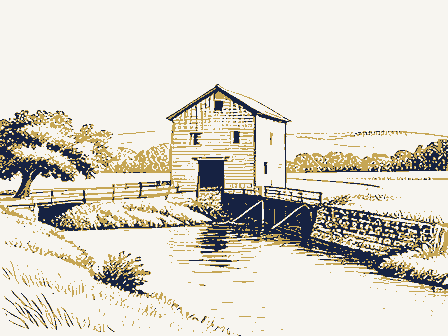
099 Mahoning COUNTY DATE IDENTIFICATION CODE STATE COMMON: Ohio ENTRY NUMBER Looking approximately southeast at the north and west sides of the Old Mill PHOTO REFERENCE PHOTO CREDIT: PROPERTY OF THE NATIONAL REGISTER PROPERTY PHOTOGRAPH FORM AND/OR HISTORIC: FOR NPS USE ONLY while standing on the Lanterman Falls Bridge 62).Lanterman NATIONAL REGISTER OF HISTORIC PLACES STREET AND NUMBER: (Type all entries -attach to or enclose with photograph) CITY OR TOWN: Canfield Road Route 62) in Mill Creek Park Falls is seen to the right of the Old Mill. UNITED STATES DEPARTMENT OF THE INTERIOR DATE OF PHOTO: THE OLD MILL October 14, 1971 LOCA TION Edward A. THE LANTERMAN MILL ASH PAID FOR GRAIN. DATE OF NAME LOCA TION JUL 2 October 14, 1971 DESCRIBE VIEW, DIRECTION, ETC.
039 Mahoning COUNTY CODE IDENTIFICATION STATE COMMON: PHOTO REFERENCE PROPERTY OF THE NATIONAL REGISTER ENTRY NUMBER The Lanterman Mill NATIONAL REGISTER OF HISTORIC PLACES Old Mill is original. (Type all entries -attach to or enclose with photograph) PROPERTY PHOTOGRAPH FORM Looking north at the south side of the Old Mill while standing at the FOR NPS USE ONLY AND/OR HISTORIC: picnic center just outside the building.The "Flour & Feed" sign on the NATIONAL PARK SERVICE NATIONAL099 UNITED STATES DEPARTMENT OF THE INTERIOR NEGATIVE FILED AT: CITY OR TOWN: Youngstowm l4511 The Old Mill 1974 PHOTO CREDIT: Ohio DATE OF PHOTO: CASHPAID Form No. 10-301a NATIONAL PARK SERVICE JUL 10 June, 1974 DESCRIBE VIEW, DIRECTION, ETC. JUL 2 099 039 NAME Mahoning DATE COUNTY STATE Ohio CODE Youngstown NATIONAL REGISTER Looking northwest at south and east sides of mill.
William Brenner PHOTO REFERENCE ENTRY NUMBER PHOTO CREDIT: STREET AND NUMBER: PROPERTY PHOTOGRAPH FORM UNITED STATES DEPARTMENT OF THE INTERIOR NATIONAL REGISTER OF HISTORIC PLACES (Type all entries -attach to or enclose with photograph) FOR NPS USE ONLY CITY OR TOWN: (7/72) Canfield Road (US Route 62) in Mill Creek Park PROPERTY OF THE NATIONAL REGISTER IDENTIFICATION COMMON: The Old Mill DATE OF PHOTO: NEGATIVE FILED AT: Eastgate Development and Transportation Agency * US. GOVERNMENT PRINTING OFFICE 1973- LOCA TION UNITED STATES DEPARTMENT OF THE INTERIOR (July 1969) NATIONAL PARK SERVICE FOR NPS USE ONLY JUL 10 1974 STREET AND NUM BER: TO BE INCLUDED ON ALL MAPS 1. Property broundaries where required. 2. North arrow. 3. Latitude and longitude reference.
039 099 JUL Mahoning DATE REGISTER COUNTY STATE 19681963 NAME Ohio COMMON: CODE SCALE: 1:24000 NATIONAL REGISTER OF HISTORIC PLACES ENTRY NUMBER REQUIREMENTS The Lanterman Mill SOURCE: (Type all entries-attach to or enclose with map) AND/OR HISTORIC: PROPERTY MAP FORM CITY OR TOWN: Canfield Road 62) in Mill Creek Park Form 10-301 U.S.G.S. 7.5'Youngstown Quadrangle NATIONAL Youngstown MAP REFERENCE 44511 RECEIVED The Old Mill YOUNGSTOWN, OHIO YOUNGSTOWN QUADRANGLE GEOLOGICAL SURVEY DEPARTMENT OF THE INTERIOR OHIO-MAHONING CO. 7.5 MINUTE SERIES (TOPOGRAPHIC) The Old Mill TIzatitude: 41° 1963 UNITED STATES N4100w8037.5/7.5 JUL 1 0 1974 Mx. Daniel R. Porter Columbus, Ohio 43211 Location 7/11/74 Mahoning County MMott/row Wayne County Name Director ENTRIES IN THE NATIONAL REGISTER Hon. Howard M. Metzenbaum Also Notified Regional Director, Midwest Region Interstate #7l at 17th Ave.
Date Entered The Ohio Historical Society State Ristorie Preservation Officer Hon. Ralph S. Regula Youngstown vicinity Hon. Charles J. Carney Bon. Robert Taft, Jr. Mil1brook vieinity STATE
 Block
Block