MAJOR BIBLIOGRAPHICAL REFERENCES 1970, pages 11 and 12. Press, 1970, page 53. GEOGRAPHICAL DATA LATITUDE AND LONGITUDE COORDINA TES DEFINING A RECTANGLE LOCATING THE PROPERTY DEFINING THE CENTER POINT OF A PHOPERTY W81 ° 50° MAR 2 11974 National O FORM PREPARED BY January 8, 1974 STREET AND NUMBER: 2.
STATE LIAISON OFFICER CERTIFICATION I hereby certify that this property is included in the tional Historic Preservation Act of 1966 (Public Law 89-665), I hereby nominate this property for inclusion in the National Register and certify that it has been evaluated according to the c-iteria and procedures set level of significance of this nomination is: Director, Office of Archeology and Historic Preservation 7 Keeper of The National Register GPO 931-894 Local Degrees LONGITUDE COUNTY DATE LATITUDE Seconds ATTEST: REGISTER Title Minutes ORGANIZATION STATE Name CORNER Degrees Minutes Seconds Muskingum County. Miriam Wood CODE 4427740 NATIONAL REGISTER VERIFICATION Ohio As the designated State Liaison Officer for the Na- Southern Ohio Covered Bridge Association's Record Books, Volumn 5, National Register.
NAME AND TITLE: Columbus CITY OR TOWN: 039 3155 Whitohead Road Ohio Covered Bridge Committee OF LESS THAN TEN ACRES 428300 Allen, Richard S.,"Covered Bridges of the South#, Stephan Greene Press, ILIST ALL STATES AND COUNTIES FOR PROPERTIES OVERLAPPING STATE OR COUNTY BOUNDARIES less than one 3, 21.74.454 CONTROL REVIEW HISTOR IAN ARCHITECTURAL HISTORIAN SEP 1 0 1974 INT: 1538-73 Entered KEEPER ARCHEOLOGIST PHOTOS National Register Write-up Send-back Re-submit MAPS WORKING NUMBER BRANCH CHIEF TECH REVIEW Federal Register entry REVIEW UNIT CHIEF MusKinum 5sep ty To HAER "/5/74 NPS Form 10-900-8 OMB No.
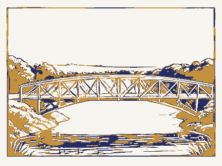
1024-0018 ADDITIONAL INFORMATION Attest Keeper Name State Page date entered National Park Service Continuation sheet Inventory-Nomination Form National Register of Historic Places Item number Nomination/Type of Review United States Department of the Interior Salt Creek Covered Bridge Date/Signature Muskingum County, OHIO For NPS use only Exp. 10-31-84 received 13-82) NPS Form 10-000-a OMB Approval No. 1024-0018 Salt Creek Covered Bridge, Norwich Vicinity, Muskingum County, Ohio. Wood, Historian, Southern Ohio Covered Bridge Association, August 1986.
Continuation sheet Inventory-Nomination Form Page National Register of Historic Places Information from research in county commissioners journal provided by Miriam Item number United States Department of the Interior National Park Service Abutments were by Jesse Romine for $2.65 per perch.In 1876,the name of this bridge was Johnson's Mill Bridge. Salt Creek Bridge built in 1876 by Thomas Fisher for $8.per lineal foot. SEP ADDITIONAL INFORMATION WASO Form - 177 UNITED STATES DEPARTMENT OF THE INTERIOR ("R" June 1984) NATIONAL PARK SERVICE NATIONAL REGISTER OF HISTORIC PLACES EVALUATION/RETURN SHEET Working No. - Fed. Reg. Date: Date Due: - nomination by person or local government owner objection Federal Agency: - -appeal J sample -request _ NR decision Reviewer Patuick sndlu Historian _see continuation sheet _ technical corrections cited below .substantive reasons discussed below 1.
Name 2. Location 3. Classification 4. Owner of Property 5. Location of Legal Description 7. Description Jexcellent -J unaltered - original site - moved summary paragraph yes ruins resubmission Category dates Condition alterations/integrity REJECT Status completeness Ownership deteriorated unexposed Action: Recom./Criteria clarity Substantive Review: good Accessible Public Acquisition Muskingum County boundary selection Salt Creek Covered Bridge Reviewer's comments: Has this property been determined eligible? Nomination returned for: Discipline Describe the present and original (if known)physical appearance RETURN 6. Representation in Existing Surveys Present Use fair Check one 4 1986 SEP ACCEPT 8. Significance Areas of Significance-Check and justify below relating significance to the resource justification of exception 9. Major Bibliographical References 10.
Geographical Data Acreage of nominated property 11. Form Prepared By _national _local - Date . - Phone: . GPO 918-450 Builder/Architect completeness Signed Period context title Photographs Specific dates applicable criteria relationship of integrity to significance 12. State Historic Preservation Officer Certification Maps UTM References Verbal boundary description and justification Questions concerning this nomination may be directed to summary paragraph justification of areas checked _state State Historic Preservation Officer signature Statement of Significance (in one paragraph) Comments for any item may be continued on an attached sheet Quadrangle name The evaluated significance of this property within the state is: clarity UNITED STATES DEPARTMENT OF THE INTERIOR Form No.
10-301a NATIONAL PARK SERVICE NATIONAL REGISTER OF HISTORIC PLACES ENTRY NUMBER (Type all entries -attach to or enclose with photograph) Salt Crook Corered Bridge AND/OR HISTORIC: LOCA TION CITY OR TOWN: 3 miles west aerth weat of Nowwich NEGATIVE FILED AT: DESCRIBE VIEW, DIRECTION, ETC. INT: 154-72 039 IDENTIFICATION 119 DATE NAME COUNTY STATE PHOTO REFERENCE CODE COMMON: PROPERTY PHOTOGRAPH FORM MAR 211974 STREET AND NUMBER: Muakingum PROPERTY OF TIE NATIONAL REGISTER Ohio REGISTER (7/72) FOR NPS USE ONLY 3155 Whitohcad Road DATE OF PHOTO: July 1973 NATION UNITED STATES DEPARTMENT OF THE INTERIOR Form No. 10-301a NATIONAL PARK SERVICE (Type all entries -attach toor enclose with photograph) SEP 10 1974 AND/OR HISTORIC: LOCA TION CITY OR TOWN: July 1973 NEGATIVE FILED AT: DESCRIBE VIEW, DIRECTION, ETC.
INT: 154-72 039 119 NAME IDENTIFICATION DATE COUNTY NATIONAL REGISTER STATE PHOTO REFERENCE CODE PROPERTY PHOTOGRAPH FORM NATIONAL REGISTER OF HISTORIC PLACES PROPERTY OF THE NATIONAL REGISTER ENTRY NUMBER FOR NPS USE ONLY (7/72) STREET AND NUMBER: 3155 Whitohoad Road DATE OF PHOTO: Muskingum Ohio PHOTO CREDIT: Miriam Wood UNITED STATES DEPARTMENT OF THE INTERIOR (July 1968) 1. NAME AND/OR HISTORIC 2. LOCATION 3. MAP REFERENCE 1:24000g REQUIREMENTS: PROPERTY BOUNDARIES, WHERE REQUIRED, AND NORTH ARROW: MAR 2 1 1974 GPO 932-010 1961 119 TOWN DATE COUNTY SOURCE REGISTER COMMON NATIONAL U.S.G.S.
SCALE STATE NATIONAL REGISTER OF HISTORIC PLACES PROPERTY MAP FORM Form 10-301 RECEIVED NATIONAL PARK SERVICE Nerwich Quadrangal STREET AND NUMBER (Type all entries -attach to or enclose with map) Muakingurn Salt Creek Corered Bridg- 3 miles west nerth west -f NUMERIC CODE (Assigned by NPS) Ohio NORWICH QUADRANGLE NORWICH, OHIO UNITED STATES 7.5 MINUTE SERIES (TOPOGRAPHIC) DEPARTMENT OF THE INTERIOR GEOLOGICAL SURVEY Salt Creek Covered Bridge STATE OF OHIO SEP 1 0 1374 Mr. Daniel R. Porter Hon. Clarence B.
Miller Coluabus, Ohio 43211 PR MMOTT: pl 9/12/74 Location STATE Stonelick Covered Bridge Director Name Also Notified Salt Creek Covered Bridge ENTRIES IN THE NATIONAL REGISTER Date Entered Lockville vicinity Muskingum County Parks Covered Bridge Martinsville vicinity Regional Director,Midwest Region Hartinsville Road Covered Bridge Chalfont vicinity Perry County Perintowm vicinity Norwdch vicinity Clinton County Lockville Canal Locks Fairfield County Interstate #7l at 17th Avenue Clermont County OEIO State Biatoric Preservation Off1eer The Ohio Hietorical Society 1985 Velma Avenue Columbus. Ohio 43211 August 28, 1986 P.O. Box 37127 Washington D.C. 20013-7127 Dear Ms. Shull: WRL/DAS : dwm 614/466-1500 Enclosures SOCIETY HISTORICAL recently conducted new research on these structures.
W.Ray Luce Ohio Historic Preservation Office Enclosed are updates on twelve covered bridges currently listed Please add these continuation sheets to the appropriate files, National Register of Historic Places Carol Shull State Historic Preservation Officer Department of the Interior the assistance of Miriam Wood, the original form preparer, who has SINCE 1885 Sincerely SEP 4 1986 on the National Register.The information has been provided with
 Block
Block