MAJOR BIBLIOGRAPHICAL REFERENCES Press, 1970, p- 21-23. Co., of Chicago & N.Y., Volume 1, p. 470 and 471. Printing Company, p. 137. GEOGRAPHICAL DATA LATITUDE AND LONGIT-IDE COORDINA TES DEFINING A RECTANGLE LOCATING THE PROPERTY DEFINING THE LENTER POINI OF A PROPERTY OF LESS THAN TEN ACRES N 39 ° DEC31 1974 FORM PREPARED BY Miriam F. Wood STREET AND NUMBER: CITY OR TOWN: 12. STATE LIAISON OFFICER CERTIFICATION As the designated State Liaison Officer for the Na- I hereby certify that this property is included in the tional Historic Preservation Act of 1966 (Public Law Nationa 1 Register. 89-665), I hereby nominate this property for inclusion in the National Register and certify that it has been evaluated according to the c-iteria and procedures set forth by the National Park Service.
The recommended Director, Office of Archeology and Historic Preservation level of significance of this nomination is: - * U.S.
GOVERNMENT PRINTING OFFICE : 1973-729-147/1442 3-l 039 Loca Seconds Degrees LATITUDE ORGANIZATION LONGITUDE COUNTY Name Minutes DATE CORNER RECEIVED STATE NATIONAL ATTEST: CODE Columbus 562 Ohio Covered Bridge Committee Ohio Degrees Minutes Seconds NATIONAL REGISTER VERIFICATION REGISTER Allen, Richard S., "Covered Bridges of the Middle West", Stephen Greene 3155 Whitehead Road April20,1974 NAME AND TITLE: 225.> Evane, Lyle S-, "A Standard History of Ross County, Ohio", Lewis Publishing Ketcham, Bryan E., "Covered Bridges on the Byways of Ohio", 1969, Oxford W 83° APPROXIMA TE ACREAGE OF NOMINATED PROPERTY: less than one Title "The Story of the Smith Truss", Covered Bridge Topics, 3005 Ref#75001530 , HISTORIAN ACCEPT 1-2-75 Inventory 8BA /o OTHER CONTROL ARCHEOLOGIST Maps Send-back Review Re-submit Photos BRANCH CHIEF Federal Register Entry State To HAER National Register Write-up REVIEW UNIT CHIEF United States Department of the Interior National Park Service WAso.No.7 LEBOVICH Colz I will call about 1-0-25 acyt KEEPER EnteredNAR 4 INT:2106- 74 Working Number 2.
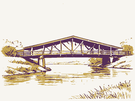
31. 74, 2277 TECHNICAL Ross Form No. 10-301a NATIONAL PARK SERVICE MAR 4 COMMON: South Salem Covered Bridge RECEIVED, DATE OF PHOTO: February 1974 NEGATIVE FILED AT: 3155 Whitehead Road Calumbus, Ohio 43204 DESCRIBE VIEW, DIRECTION, ETC. * U.S. GOVERNMENT PRINTING OFFICE: 1973-729-152/1446 III - 1 039 1975 COUNTY DATE PHOTO REFERENCE STATE IDENTIFICATION CODE REGISTER Lower Twin Road West portal, south side of bridge looking northeast. NATIONAL REGISTER OF HISTORIC PLACES Ohio (Type all entries-attach to or enclose with photograph) Just west of South Salem PROPERTY PHOTOGRAPH FORM ENTRY NUMBER (7/72) UNITED STATES DEPARTMENT OF THE INTERIOR FOR NPS USE ONLY STREET AND NUMBER: CITY OR TOWN: Ross AND/OR HISTORIC: Buckskin Covered Bridge DEC3 Jonathon Heierman NATIONAL LOCATION PHOTO CREDIT: SOUTH SALEM UNITED STATES DEPARTMENT OF THE INTERIOR Form No.
10-301a NATIONAL PARK SERVICE FOR NPS USE ONLY NAME COMMON:South Salem Covered Bridge AND/ OR HISTORIC: Buckskin Covered Bridge LOCA TION PHOTO CREDIT: Jonathon Heierman DATE OF PHOTO: NEGATIVE FILED AT: 3155 Whitehead Road Columbus, Ohio 43204 DESCRIBE VIEW, DIRECTION, ETC. South side of bridge, looking north INT: 154-72 039 141 DATE IDENTIFICATION COUNTY Lower Twin Road STATE PHOTO REFERENCE NATIONAL CODE Ohio ENTRY NUMBER REGISTER NATIONAL REGISTER OF HISTORIC PLACES February 1974 PROPERTY PHOTOGRAPH FORM Ross Just west of South Salem (Type all entries -attach to or enclose with photograph) CITY OR TOWN: PROPERTY OF THE NAT:ONAL REGISTER STREET AND NUMBER: (7/72) UNITED STATES DEPARTMENT OF THE INTERIOR Form No.
10-301a NATIONAL PARK SERVICE (Type all entries -attach to or enclose with photograph) ENTRY NUMBER COMMON: South Salem Covered Bridge AND/OR HISTORIC: Buckskin Covered Bridge LOCA TION STREET AND NUMBER: CITY OR TOWN: PHOTO CREDIT: NEGATIVE FILED AT: 3155 Whitehead Road Columbus, Ohio t3204 DESCRIBE VIEW, DIRECTION, ETC. INT: 154-72 PROPERTY OF THE NATIONAL REGISTER 039 141 NAME DATE COUNTY STATE Interior view of north trusses PHOTO REFERENCE IDENTIFICATION CODE Jonathon Heierman Just west of South Salem PROPERTY PHOTOGRAPH FORM Lower Twin Road NATIONAL REGISTER OF HISTORIC PLACES Ohio NATIONAL (7/72) FOR NPS USE ONLY Ross MAR 4 1975 Form No. 10-301 UNITED STATES DEPARTMENT OF THE INTERIOR Rev.
7-72 NATIONAL PARK SERVICE NATIONAL REGISTER OF HISTORIC PLACES PROPERTY MAP FORM FOR NPS USE ONLY (Type all entries -attach to or enclose with map) ENTRY NUMBER cOMMON: South Salem Covered Bridge AND/OR HISTORIC: Buckskin Covered Bridge STREET AND NUM BER: U.S.G.S. South Salem Quadrangle DEC3T 1974 TO BE INCLUDED ON ALL MAPS 1. Property broundaries where required. 2. North arrow. 3. Latitude and longitude reference. * U.S. GOVERNMENT PRINTING OFFICE : 1973-729-148/1441 3-1 039 141 NAME COUNTY REQUIREMENTS REGISTER LOCATION DATE RECEIVED CODE STATE NATIONAL SOURCE: MAP REFERENCE Lower Twin Road Just west of South Salem Ross CITY OR TOWN: Ohio 1961 1975 1:24000 SCALE: UNITED STATES SOUTH SALEM QUADRANGLE DEPARTMENT OF THE INTERIOR GEOLOGICAL SURVEY DECSI 1974 > ROAD CLASSIFICATION SOUTH SALEM, OHIO STATE OF OHIO 39 ° MAR 4 Hon. John H. Glenn, Jx. Mx. Charles C.
Pratt, Acting Director Hon. William H. Harsha Hon. Clarence E. Miller Hon. Charles E. Mosher Columbus, Ohio 43211 Regional Director, Midwest Region Hon. Donald D. Clancy Huron Location STATE Name Ross County Erie County MMott/cha Middleburg vicinity Noble County Rennert Mound Archaeological District ENTRIES IN THE NATIONAL REGISTER Date Entered Christ Episcopal Church Marysville vicinity The Ohio Historical Society Huffman Covered Bridge South Salem vicinity Hamilton County Elizabethtowm vicinity Reed Covered Bridge South Salem Covered Bridge State Historic Preservation Officer Hon. Robert Taft, Jr. Union County Also Notified Interstate 7l at l7th Avenue Hon. Clarence J.
Brown 3-6-75 Buckskin Covered Bridge sec, 'oldest - ART-5 - PHILOSOPHY - 20 I INVENTION -14 @ architectural style(s): (as) master builder: ) landscape architeot / garden designer: 3) interior decorator: artist 141 ASSOCIATION CONDITION ETHNIC 3-4-75 PERSONAL: INSTITUTIONAL: Midwest Dunexcavated EVENTS: NATIONAL REGISTER DATA SHEET Dexcellent Zgood Dunexposed on federal register: Bfunctions CNPS REGION South Salem Covered Bridge Rose Ross ACCESS O deteriorated 17) features LAW - 16 C RELIGION - 22 - LITERATURE- 17 - SCIENCE- 23 - AGRICULTURE-3 - HEALTH-27 C MILITARY- 18 - ARCHITECTURE-4 - ECONOMICS- 9 - INDUSTRY-13 - MUSIC- 19 - SOCIAL / CULTURAL-30 - EDUCATION-10] - TRANSPORTATION - 25 major alterations : Creconstructed @architeet: GROUP engineer: historic events: REGISTER WRITE-UP CURRENTLY: CONSERVATION-8 Unknown 1873 WHEN HISTORICALLY SIGNIFICANT NOT INTACT-O GINEERING-1 as it appe ARCHEOLOGY-historic- Zoriginal site Zunaltered Dfair Daltered SAVED?
YES Oruins 'only' bridge
 Block
Block