MAJOR BIBLIOGRAPHICAL REFERENCES Correspondance with Emmett Conway, Sr., Vinton County Historian. 10 GEOGRAPHICAL DATA UTM REFERENCES VERBAL BOUNDARY DESCRIPTION 11 FORM PREPARED BY NAME / TITLE Miriam F. Wood November 3, 1975 STREET & NUMBER CITY OR TOWN 12 STATE HISTORIC PRESERVATION OFFICER CERTIFICATION THE EVALUATED SIGNIFICANCE OF THIS PROPERTY WITHIN THE STATE IS: NATIONAL - LOCAL - hereby nominate this property for inclusion in the National Register and certify that it has been evaluated according to the criteria and procedures set forth by the National Park Service. STATE HISTORIC PRESERVATIGN OFFICER SIGNATURE FOR NPS USE ONLY CLUDED IN THE NATIONAL REGISTER KEEPER OF THE NATIONAL REGISTER GPO 888-445 CODE ORGANIZATION DATE NORTHING COUNTY TELEPHONE STATE Records Books of the Southern Ohio Covered Bridge Association, Vol.
8, Vinton County ATTEST Ketcham, Bryan E., Covered Bridges on the Byways of Ohio, Oxford Printing Company, Ohio 1969, page 147. 614-279-9576 Columbus, ZONE EASTING Atlas of Vinton County, Ohio,1876, Titus, Simmons and Titus, page 9. 3155 Whitehead Road Ohio Covered Bridge Cormitteo S.H. P.o. LIST ALL STATES AND COUNTIES FOR PROPERTIES OVERLAPPING STATE OR COUNTY BOUNDARIES As the designated State Historic Preservation Officer for the National Historic Preservation Act of 1966 (Public Law 89-665).I ACREAGE OF NOMINATED PROPERTY less than one I HEREBY CERTIF ZONE Mt. Olive Road Covered Bridge Photos - 5.
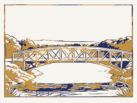
7,76 ARCHITECTURAL HISTORIAN To: HAER BRANCH CHIEF OCT 8 OTHER KEEPER Property Maps Entered CONTROL ARCHEOLOGIST Send-back Re-submit HISTORIAN Federal Register Entry State TECHNICAL Working Number 4.23.76.3222 National Register Write-up 6/23/76 Vinton DEFER To INT:2 1976 OHIO United States Department of the Interior National Park Service WAso No. 7 REVIEW UNIT Vinton Ca, ohio APR 2 3 1976 PROPERTY OF THE NATIONAL REGISTER East portal, south side, doo king northwest Form No. 10-301a (Rev. 10-74) UNITED STATES DEPARTMENT OF THE INTERIOR NATIONAL PARK SERVICE NATIONAL REGISTER OF HISTORIC PLACES APR 2 3 1976 PROPERTY PHOTOGRAPH FORM TYPE ALL ENTRIES -- ENCLOSE WITH PHOTOGRAPH CITY. TOWN X VICINITY OF DATE OF PHOTO August 14, 1975 NEGATIVE FILED AT Columbus, Ohio 43204 DESCRIBE VIEW. DIRECTION, ETC. IF DISTRICT, GIVE BUILDING NAME & STREET PHOTO NO.
1 GPO 892.454 IDENTIFICATION LOCATION Vinton COUNTY HISTORIC STATE RECIEVED Ohio One mile northeast of Allensville PHOTO REFERENCE DATE ENTERED Mt. Olive Road Covered Bridge NAME 3155 Whitehead Road East portal, south side, looking northwest SEE INSTRUCTIONS IN HOW TO COMPLETE NATIONAL REGISTER FORMS AND/OR COMMON FOR NPS USE ONLY Vinton Co., Ohio APR 2 3 1976 PROPERTY OF THE NATIONAL REGISTER Allensuille West portal, south side koo king east northeast. - Form No. 10-301a (Rev. 10-74) UNITED STATES DEPARTMENT OF THE INTERIOR APR 2 3 1976 NATIONAL REGISTER OF HISTORIC PLACES PROPERTY PHOTOGRAPH FORM OCT 8 TYPE ALL ENTRIES -- ENCLOSE WITH PHOTOGRAPH AND/OR COMMON CITY. TOWN X_ VICINITY OF one mile northeast of Allensville DATE OF PHOTO August 14, 1975 NEGATIVE FILED AT 3155 Whitehead Road Columbus, Ohio 43204 DESCRIBE VIEW. DIRECTION, ETC. IF DISTRICT, GIVE BUILDING NAME & STREET PHOTO NO.
2 West portal, south side, lo0king east, northeast. IDENTIFICATION COUNTY Vinton HISTORIC LOCATION STATE RECIEVED Ohio PHOTO REFERENCE NATIONAL PARK SERVICE Mt. Olive Road Covered Bridge SEE INSTRUCTIONS IN HOW TO COMPLETE NATIONAL REGISTER FORMS DATE ENTERED NAME FOR NPS USE ONLY GPO 892.454 PHOTO CREDIT Miriam F. Wood Form No. 10-301 UNITED STATES DEPARTMENT OF THE INTERIOR FOR NPS USE ONLY NATIONAL PARK SERVICE NATIONAL REGISTER OF HISTORIC PLACES PROPERTY MAP FORM DATE ENTERED SEE INSTRUCTIONS IN HOW TO COMPLETE NATIONAL REGISTER FORMS TYPE ALL ENTRIES - ENCLOSE WITH MAP AND/OR COMMON CITY. TOWN XVICINITY OF MAP REFERENCE SOURCE U.S.G.S. Allensville Quadrangle TO BE INCLUDED ON ALL MAPS 1. PROPERTY BOUNDARIES 2. NORTH ARROW 3. UTM REFERENCES INT: 3464 - 75 Vinton NAME LOCATION REQUIREMENTS COUNTY HISTORIC STATE Mt.
Olive Road Covered Bridge SCALE 1:21000 One mile northeast of Allensville 00T81976 DATE 1961 DEPARTMENT OF THE INTERIOR ALLENSVILLE, OHIO 15 MINUTE SERIES (TOPOGRAPHIC) UNITED STATES Covered Bridge ALLENSVILLE QUADRANGLE DEPARTMENT OF HIGHWAYS STATE OF OHIO NATIONAL DEPARTMENT OF NATURAL RESOURCES 17 362/930 4349/530 Mt. 0live Road U. S. DEPARTMENT OF THE INTERIOR (August 1971) NATIONAL PARK SERVICE TIME OF CALL 2. ADDRESS (Tel. No. if needed) in the area, GPO 897-848 OFFICE TELEPHONE REPORT 9:45 WASO-166 6/23/76 Miniam F. Wood 4. DETAILS OF DISCUSSION NAME OF PERSON PLACING/RECEIVING CALL mt. Olive Road Covered Bridge TITLE DATE Nat. Reg. dge Grant, Ulysses S., Boyhood Hone Brown County Barra Covered Bridge Hon. John H. Glenn, Jr. Hon. Robert Tatt, Jr. Dr. Thomas H. Smich Hon. James V. Stanton Hon. Tennyaon Guyer Ion. Clarence E.
Miller Regional Director, Midwest Region 880 1976 Location 10/15/76 STATE MMott/row Vinton County Washington County Name Marietta vicinity Rinard Covered Bridge Date Entered Also Notified Hizey Covered Bridge Wyandot County Cleveland Wyandot vicinity Pickerington vicinity Director Federal Reserve Bank of Cleveland Watertown vicinity Swartz Covered Bridge Lorain-Carnegie Bridge ENTRIES IN THE NATIONAL REGISTER Shinn Covered Bridge Cuyahoga County State Historic Preservation Officer Fairfield County Georgetowm Bartlett vicinity The Ohio Historical Society Allensvilie vicinity Interstate 7l at 17th Avenue Mt.
Olive Road Covered Bridge INT: 2950-75 Hon.William l.Harsha OTHER NAMES: ADMINISTRATOR (underline) FEDERAL (AGENCY NAME) : WEST PACIFIC NORTHWEST - Substantially intact-1 _ not applicable - 8 -Interior, exterior, environs not intact-o CONDITION - LORIGINAL SITE LRUINS - unknown -6 "only" YES IF YES, NAME: ADAPTIVE USE: FUNCTION (S): (use vocabulary words) _LANDSCAPE ARCH!TECTURE _entertainment -SOCIAL/HUMANITARIAN _urban & commun _OTHER (SPECIFY) INVENTION "first" YES Saved? Claims FEATURES: INTERIOR OTHER CONSERVATION DATE: COUNTY planning COMMUNICATIONS SIGNIFICANCE: historic district? LOCATION: MOVED ECONOMICS AGRICULTURE ENGINEERING ARCHITECTURE ARCHEOLOGY-PREHISTORIC -socio/cultural No access _POLITICS/GOVERNMENT _Reconstructed ARCHEOLOGY.HISTORIC WITHIN NATIONAL HISTORIC LANDMARK? WITHIN NATIONAL REGISTER HISTORIC DISTRICT?
EDUCATION _EXCELLENT COMMERCE -health Yes-unrestricted - DETERIORATED -settlement -recreation Reviewer _Unexcavated _EXPLORATION -MUSIC -PHILOSOPHY -MILITARY _LITERATURE NAME AS IT APPEARS IN FEDERAL REGISTER: mi.NE of Allensuille m STREET & NUMBER _LAW/Gov't/politics _SCIENCE V NR Data Sheet EXTERIOR MIDWEST TRANSPORTATION _UNEXPOSED ENVIRONS INITIALS: SKR LALTERED - UNALTERED ~ART OCT8.1976 .artist/artisan: (label role DATE (S) OF "MAJOR" ALTERATIONS: HISTORICALLY SIGNIFICANT DATE (S) : LOCAL GOV"T FEDERAL AGENCY : builder/contractor: personal architect/m.builder: DATES: NAMES: institutional events COUNTY OTHER MUNICIPAL landscape/garden designer: interior decorator: appropriate date) ETHNIC GROUP: PRIVATE ARCHITECTURAL STYLE: N.A. STATE ARCHITECTURAL STYLE: N.A.
.artist/artisan: (label role DATE (S) OF "MAJOR" ALTERATIONS : HISTORICALLY SIGNIFICANT DATE (S) : DATES: builder/contractor: personal events institutional NAMES: COUNTY MUNICIPAL landscape/garden designer: architect/m.builder: interior decorator: appropriate date) ETHNIC GROUP: FEDERAL AGENCY: LOCAL GOV"T PRIVATE (OF NOMINATION) OTHER STATE SOURCE:
 Block
Block