 Block
Block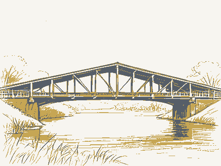
The nomination, in full
Bibliography, boundary description, and the people who prepared and reviewed the nomination.
Form No. 10-300 (Rev. 10-74) UNITED STATES DEPARTMENT OF THE INTERIOR NATIONAL PARK SERVICE NATIONAL REGISTER OF HISTORIC PLACES INVENTORY -- NOMINATION FORM SEE INSTRUCTIONS IN HOW TO COMPLETE NATIONAL REGISTER FORMS TYPE ALL ENTRIES -- COMPLETE APPLICABLE SECTIONS DATA SHEET FOR NPS USE ONLY RECEIVED NOV 1 1 1975 DATE ENTERED MAR 6 1976 1 NAME HISTORIC Eakin Mill Covered Bridge AND/OR COMMON Geer's Mill or McLaughlin Bridge 2 LOCATION STREET & NUMBER County road 38 Mound Hill Road NOT FOR PUBLICATION CITY, TOWN at Arbaugh VICINITY OF #10. Clarence E.
Miller STATE Ohio CODE 039 COUNTY Vinton CODE 163 3 CLASSIFICATION CATEGORY DISTRICT STRUCTURE OWNERSHIP PUBLIC ACQUISITION PROCESS CONSIDERED STATUS IN PROGRESS ACCESSIBLE RESTRICTED UNRESTRICTED PRESENT USE RESIDENCE OTHER: none 4 OWNER OF PROPERTY NAME Vinton County STREET & NUMBER CITY, TOWN McArthur VICINITY OF STATE Ohio 5 LOCATION OF LEGAL DESCRIPTION COURTHOUSE, REGISTRY OF DEEDS, ETC.
Court House STREET & NUMBER CITY, TOWN McArthur STATE Ohio 6 REPRESENTATION IN EXISTING SURVEYS TITLE DATE DEPOSITORY FOR SURVEY RECORDS CITY, TOWN STATE 7 DESCRIPTION CONDITION __EXCELLENT __DETERIORATED __GOOD __RUINS __FAIR __UNEXPOSED CHECK ONE __UNALTERED __ALTERED CHECK ONE _X_ORIGINAL SITE __MOVED DATE____ DESCRIBE THE PRESENT AND ORIGINAL (IF KNOWN) PHYSICAL APPEARANCE The structure under consideration is a one-span wooden truss covered bridge spanning the Big Raccoon Creek at Arbaugh, Vinton Township, in eastern Vinton County, Ohio on Mound Hill Road about one-half mile north of the Appalachian Highway. This old span has vertical, high-boarded siding finished with battens, a sheet metal roof, projected portals and cut-stone abutments. This bridge is known as the Eakin Mill, Geer's Mill or McLaughlin Bridge.
It was built in 1870/71 by Gilman and Ward Company of McArthur. They used a heavy, double multiple kingpost truss plan with a 7" x 4" plank brace (or arch) between the double trusses. The kingpost truss has been known since early times. It consists of a center or kingpost which is in ten- sion, and diagonals, which are in compression. This triangular form has been the basis of many more sophisticated truss types. Eakin Mill Bridge is a 14' panel double multiple kingpost with upper and lower chords in three sections. The truss uprights are all 6½" x 6½" except for the cen- ter kingpost which is 6½" x 8". The diagonals and end posts are also all 6½" x 6½". The hand-hewn trusses are bolted together with steel bolts. The floor is laid in two layers, the bottom layer is laid on the diagonal and the upper layer is laid lengthwise. These floor layers rest on the lower chords.
The over-all length of the structure is the overall length of the bridge is 122' with a floor length of 112'. The bridge is 18' wide overall with a roadway width of 14'4". A steel tension rod with turn- buckles has been added on each end of the bridge at the second truss- panel and these rods extend from upper to lower chord. Steel tension rods with turnbuckles also are suspended from steel gussets at the top of the end posts and extend down to the base of the center kingpost. Both upper and lower chords have been reinforced with steel channels. The base of the east abutment has been reinforced with concrete. The entire bridge has a pronounced camber giving it a Humpback appearance. Eakin Mill Covered Bridge presents much the same appearance today as it did one hundred years ago. The present sheet metal roof is undoubted- ly replaced one of shingles.
Cribbing has been placed under the bridge for added support. Heavy trucks used in the construction of the Appa- lachian Highway damaged the bridge and the county closed it about five years ago. It remains closed and there are no plans to repair or re- open it at this time. The roof is in good condition and most of the siding is still intact.
8 SIGNIFICANCE PERIOD AREAS OF SIGNIFICANCE -- CHECK AND JUSTIFY BELOW __PREHISTORIC --ARCHEOLOGY-PREHISTORIC __COMMUNITY PLANNING__LANDSCAPE ARCHITECTURE __RELIGION __1400-1499 --ARCHEOLOGY-HISTORIC __CONSERVATION __LAW __SCIENCE __1500-1599 __AGRICULTURE __ECONOMICS __LITERATURE __SCULPTURE __1600-1699 __ARCHITECTURE __EDUCATION __MILITARY __SOCIAL/HUMANITARIAN __1700-1799 __ART X_ENGINEERING __MUSIC __THEATER __1800-1899 __COMMERCE __EXPLORATION/SETTLEMENT__PHILOSOPHY X_TRANSPORTATION X_1900- __COMMUNICATIONS __INDUSTRY __POLITICS/GOVERNMENT __OTHER (SPECIFY) __INVENTION Historical SPECIFIC DATES 1870/71 BUILDER/ARCHITECT Gillman and Ward Company STATEMENT OF SIGNIFICANCE This covered bridge is known variously as the Eakin Mill, Geer's Mill or McLaughlin Bridge.
The name Eakin Mill is used by the county engineer's office and it comes from the name of the family who operated the mill here when the bridge was built. The name Geer's Mill comes from Henry Clay Geer who bought the mill from the Eakins and operated it for many years. His brother Jacob, ran the mill downstream at the famed Humpback Covered Bridge (now on the National Register). At the time when both mills were known as the Geer's Mill, it was decided to call the postoffice at this site Arbaugh, after a prominent family in the area and to avoid confusion with the other Geer's Mill. It is still called Arbaugh, but only a few families remain here. The McLaughlin Family, who later bought and operated the mill, still live in the house near the bridge. They tore the mill down in 1938.
Some of the foundation stones of the mill and part of the wooden foundation of the mill dam can still be seen below the bridge. The Eakin Mill Bridge is a fine example of a heavily-built multiple kingposttruss with added brace or arch. This is not a true Burr arch truss because the so-called arch is a segmented plank affair, whose ends rest on the lower chords and not into the abutments as is done with the true Burr truss. Most multiple kingpost trusses that were built here in Ohio were built using single timbers and only a few of the double multiple kingpost such as this bridge, remain today. There were many mills and covered bridges along the Raccoon in the 1800's. A sturdy bridge was a necessity to reach a mill as busy as Eakin Mill was!
Only two of these covered bridges remain over the Raccoon today and it is a coincidence that both were once known as the Geer's Mill Bridge after the brothers who both ran the mills beside them! Many people in the country still call both bridges the Geer's Mill Bridge! Eakin Mill Bridge at Arbaugh is a lovely old structure, arched up above the waters of the scenic Raccoon Creek, quiet and peaceful, yet only one-half mile from the busy Appalachian Highway. Gillman and Ward, well-known contractors from Marthru, built this bridge in 1870/71 for $2,200. Unfortunately, damage from overloaded trucks has retired this bridge from active service to the community. At one time, the trustees of Vinton Township hoped to set the bridge and build a rural park around it, but the county has so far refused to relinquish ownership and has no plans to repair and reopen the bridge.
Although it no longer carries any traffic, this fine old bridge still serves as an outstanding example of our pioneer forefathers' building skills! 9 MAJOR BIBLIOGRAPHICAL REFERENCES Allen, Richard S., Covered Bridges of the Northeast, Stephan Greene Press, 1957, pages 8 and 9. Ketoham, Bryan E., Covered Bridges on the Byways of Ohio; Oxford Printing Company, 1969, page 149. Vinton County Commissioners Journal, #2, pages 40, 48, 51 and 61, April 28, 1870 to March 10, 1871.
10 GEOGRAPHICAL DATA ACREAGE OF NOMINATED PROPERTY _less than one_ UTM REFERENCES A | 17 | 3 8 4 5 0 0 | 4 3 3 6 1 4 2 0 | ZONE EASTING NORTHING B | | | | | | | | | | | | ZONE EASTING NORTHING C | | | | | | | | | | | | D | | | | | | | | | | | | VERBAL BOUNDARY DESCRIPTION LIST ALL STATES AND COUNTIES FOR PROPERTIES OVERLAPPING STATE OR COUNTY BOUNDARIES STATE | CODE | COUNTY | CODE STATE | CODE | COUNTY | CODE 11 FORM PREPARED BY NAME / TITLE Miriam F.
Wood ORGANIZATION Ohio Covered Bridge Committee STREET & NUMBER 3155 Whitehead Road CITY OR TOWN Columbus, DATE June 17, 1975 TELEPHONE 614-279-9576 STATE Ohio 12 STATE HISTORIC PRESERVATION OFFICER CERTIFICATION THE EVALUATED SIGNIFICANCE OF THIS PROPERTY WITHIN THE STATE IS: NATIONAL _X_ STATE___ LOCAL___ As the designated State Historic Preservation Officer for the National Historic Preservation Act of 1966 (Public Law 89-665), I hereby nominate this property for inclusion in the National Register and certify that it has been evaluated according to the criteria and procedures set forth by the National Park Service.
STATE HISTORIC PRESERVATION OFFICER SIGNATURE TITLE SHPO DATE 1/14/75 FOR NPS USE ONLY I HEREBY CERTIFY THAT THIS PROPERTY IS INCLUDED IN THE NATIONAL REGISTER DATE 3/16/76 DIRECTOR, OFFICE OF ARCHEOLOGY AND HISTORIC PRESERVATION ATTEST: KEEPER OF THE NATIONAL REGISTER DATE 3-15-76 GPO 888-445 Property Lakin Mill Covered Bridge State OH Working Number 11.11.75.2018 Vinton TECHNICAL Photos 2 Maps 1 CONTROL PL OK 11.14.75 HISTORIAN Accept W.R. Case 12/16/75 ARCHITECTURAL HISTORIAN ACCEPT TH Garndle 12/18/75 ARCHEOLOGIST OTHER HAER Inventory BNB 1/2 Review Accept half How can they check "unaltered" when it has a metal roof + steel + concrete reinforcement? TMG REVIEW UNIT CHIEF Accept Cole 11/30/76 BRANCH CHIEF accept O.K.
Hump 3-4-76 KEEPER Accept Rettig (for Murtagh) 3-15-76 National Register Write-up Send-back Entered MAR 1 6 1976 Federal Register Entry 4-6-76 Re-submit United States Department of the Interior National Park Service WASO No. 7 INT-2106-74 10 FT. 4 IN. CLEARANCE Eakin Mill Bridge Vinton County, Ohio West portal, north side Looking southeast 2 #1 PROPERTY OF THE NATIONAL REGISTER NPS Number 3/16/76 Title: Eakin Mill Covered Bridge Vinton County, Ohio Loc. West portal, north side, looking southeast #1 Form No.
10-301a (Rev. 10-7J UNITED STATES DEPARTMENT OF THE INTERIOR NATIONAL PARK SERVICE NATIONAL REGISTER OF HISTORIC PLACES PROPERTY PHOTOGRAPH FORM FOR NPS USE ONLY RECEIVED NOV 1 1 1975 DATE ENTERED MAR 1 6 1976 SEE INSTRUCTIONS IN HOW TO COMPLETE NATIONAL REGISTER FORMS TYPE ALL ENTRIES ENCLOSE WITH PHOTOGRAPH 1 NAME HISTORIC Eakin Mill Covered Bridge AND/OR COMMON Geer's Mill or McLaughlin Bridge 2 LOCATION CITY, TOWN at Arbaugh VICINITY OF COUNTY Vinton STATE Ohio 3 PHOTO REFERENCE PHOTO CREDIT Miriam F; Wood DATE OF PHOTO May 18, 1975 NEGATIVE FILED AT 3155 Whitehead Road, Columbus, Ohio 43204 4 IDENTIFICATION DESCRIBE VIEW, DIRECTION, ETC. IF DISTRICT, GIVE BUILDING NAME & STREET West portal, north side, looking southeast PHOTO NO. 1 10 FT. 6 IN. CLEARANCE Eakin Mill Bridge, Vinton County, Ohio East portal, Looking west.
2 #2 PROPERTY OF THE NATIONAL REGISTER NPS Number 3/16/76 Title: Eakin Mill Covered Bridge Vinton County, Ohio Loc. East portal, looking west. 2 of 2 Form No. 10-301a (Pev. 10-7-1) UNITED STATES DEPARTMENT OF THE INTERIOR NATIONAL PARK SERVICE NATIONAL REGISTER OF HISTORIC PLACES PROPERTY PHOTOGRAPH FORM SEE INSTRUCTIONS IN HOW TO COMPLETE NATIONAL REGISTER FORMS TYPE ALL ENTRIES ENCLOSE WITH PHOTOGRAPH 1 NAME HISTORIC Eakin Mill Covered Bridge AND/OR COMMON Geer's Mill or McLaughlin Bridge 2 LOCATION CITY, TOWN at Arbaugh __VICINITY OF COUNTY Vinton STATE Ohio 3 PHOTO REFERENCE PHOTO CREDIT Miriam F. Wood DATE OF PHOTO May 18, 1975 NEGATIVE FILED AT 3155 Whitehead Road, Columbus, Ohio 43204 4 IDENTIFICATION DESCRIBE VIEW, DIRECTION, ETC.
IF DISTRICT, GIVE BUILDING NAME & STREET East portal, looking west: PHOTO NO. 2 FOR NPS USE ONLY RECEIVED NOV 1 1 1975 DATE ENTERED MAR 1 6 1976 UNITED STATES DEPARTMENT OF THE INTERIOR GEOLOGICAL SURVEY STATE OF OHIO DEPARTMENT OF NATURAL RESOURCES DIVISION OF GEOLOGICAL SURVEY VALES MILLS QUADRANGLE 7.5 MINUTE SERIES (TOPOGRAPHIC) RACCOON STATE FOREST Ew ing Mill Bridge BALTIMORE AND OHIO RAILROAD Baltic Mill Covered Bridge 1884-1966 NW 37 25'30 420 Mapped, edited, and published by the Geological Survey Control by USGS, USC&GS, and Ohio Dept. of Highways Topography by photogrammetric methods from aerial photographs taken 1963. Field checked 1965. Polyconic projection.
1927 North American datum 10,000-foot grid based on Ohio coordinate system, south zone 1000-meter Universal Transverse Mercator grid ticks, zone 17, shown in blue Fine red dashed lines indicate selected fence and field lines where generally visible on aerial photographs. This information is unchecked. * UTM GRID AND 1965 MAGNETIC NORTH DECLINATION AT CENTER OF SHEET SCALE 1:24000 1 0 1 2 3 4 5 6 7 8 9 10 10,000 FEET CONTOUR INTERVAL 20 FEET DOTTED LINES REPRESENT 10-FOOT CONTOURS DATUM IS MEAN SEA LEVEL FOR SALE BY U.S. GEOLOGICAL SURVEY, WASHINGTON, D.C. 20242 A FOLDER DESCRIBING TOPOGRAPHIC MAPS AND SYMBOLS IS AVAILABLE ON REQUEST ROAD CLASSIFICATION RECEIVED NOV 11 1975 NAT. REG.
HISTORIC PLACES VALES MILLS OHIO SOUTHEASTERN QUADRANGLE AMS 4456 III SE - SERIES V852 76001539 ENTRIES IN THE NATIONAL REGISTER STATE OHIO Date Entered MAR 1 6 1976 Name Location Immaculate Conception Church Grafton Lorain County Trinity Episcopal Church McArthur Vinton County Lynchburg Covered Bridge Lynchburg Clinton County Harshaville Covered Bridge Harshaville Adams County Eakin Mill Covered Bridge Arbaugh Vinton County Also Notified Hon. John H. Glenn, Jr. Hon. Robert Taft, Jr. Hon. Charles A. Mosher Hon. Clarence E. Miller Hon. William H. Harsha Regional Director, Midwest Region LPR MOTT:djb 3/22/76 State Historic Preservation Officer Dr. Thomas H.
Smith Director, The Ohio Historical Society Interstate 71 at 17th Avenue Columbus, Ohio 43211 INT: 2950-78 NATIONAL REGISTER DATA SHEET OWNER as it appears on federal register: Eakin Mill Covered Bridge LOCATION street & number Mound Hill Rd. OTHER NAMES: Bridge Geer's Mill; Mehanquin Bridge vicinity of city / town Aramaugh state OH county Vinton NPS REGION: Midwest code: 163 DATE of entry: 3-16-76 OWNER PRIVATE STATE MUNICIPAL COMMUNITY (MULTIPLE) FEDERAL (Agency) _______________________________ EXISTING SURVEYS CHAS CHAR LNHLD FUNDED? YES NO 10 SOURCE OF NOMINATION STATE FEDERAL ADMINISTRATOR: ________________________________________________________ WITHIN NATIONAL REGISTER HISTORIC DISTRICT?
NUMBER ____________________________________________________ IF YES, NAME: ____________________________ CONDITION excellent good fair deteriorated ruins unexposed unexcavated Altered unaltered moved reconstructed excavated SIGNIFICANCE: Substantially Intact-1 Not Intact-0 Substantially Intact-2 Not Intact-0 Substantially Intact-3 Not Intact-0 Unknown-4 Not Applicable-7 Unknown-4 Not Applicable-8 Not Applicable-9 ACCESS YES-Restricted YES-Unrestricted No Access Unknown ADAPTIVE USE YES NO IS PROPERTY A HISTORIC DISTRICT?
Yes No AREAS OF SIGNIFICANCE ARCHEOLOGY-historic-2 COMMERCE-6 ENGINEERING-11 LANDSCAPE ARCH.-15 ARCHEOLOGY-prehistoric-1 COMMUNICATIONS-7 EXPLORATION-12 LITERATURE-17 AGRICULTURE-3 CONSERVATION-8 HEALTH-9 MILITARY-18 ARCHITECTURE-4 ECONOMICS-9 INDUSTRY-13 MUSIC-19 ART-5 EDUCATION-10 INVENTION-14 PHILOSOPHY-20 POLITICS/GOVT.-21 RELIGION-22 SCIENCE-23 SCULPTURE-24 SOCIAL/HUMANITARIAN-28 SOCIAL/CULTURAL-30 TRANSPORTATION-25 RECREATION-28 SETTLEMENT-29 URBAN PLANNING-31 OTHER (SPECIFY) ___________ CLAIMS: explain 'first' oldest' 'only' functions WHEN HISTORICALLY SIGNIFICANT: Bridge CURRENTLY: as medium use dates dates of initial construction: 1870-5 1871 major alterations:____________________________ historic events:_____________________________ ETHNIC GROUP ASSOCIATION architectural style(s):_________________________ architect:_____________________________________ master builder:_______________________________ engineer:____________________________________ landscape architect / garden designer:_________ interior decorator:___________________________ artist:_______________________________________ artisan:_____________________________________ builder / contractor: Gillman & Ward Co.
NAMES give role & date PERSONAL: Geer, family name of 2 brothers who ran mills, causing the bridge beside the mills to also be called "Geer's Covered Bridge" EVENTS: __________________________________________________________________________ INSTITUTIONAL: ___________________________________________________________________ NA Frame, single span, multiple kingpost truss, 122' total bridge length, 14'4" wide roadway, 11'4" roadway width, projected portals, sheet metal gabled roof, cut-stone abutments; steel tension rods reinforce the second truss panel and join endposts at center kingposts. Part of wooden foundation of mill dam visible beneath bridge; one of two remaining covered bridges over Raccoon Creek. Review NATIONAL REGISTER DATA SHEET 1.
NAME(s) Eakin Mill Covered Bridge OTHER NAMES: Bridge Geer's Mill; McLaughlin Bridge 2. LOCATION street & number Mount Hill Rd. vicinity of city or town Arbaugh 3. OWNER PRIVATE STATE MUNICIPAL COUNTY MULTIPLE FEDERAL 4. EXISTING SURVEYS OHBS OHAMR NHL (BG) FUNDED BY____________ CONGRESS. DISTRICT 10 5. ADMINISTRATOR STATE FEDERAL 6. WITHIN NATIONAL REGISTER HISTORIC DISTRICT? YES NAME: ____________________ PRES. NAME_________ NO 7. WITHIN NATIONAL REGISTER HISTORIC LANDMARK? YES NAME: ____________________ 8. CONDITION Excellent Good Fair Deteriorated Ruins Unexposed altered unaltered reconstructed excavated original site moved unknown 9. ACCESS: YES- Restricted YES- Unrestricted NO 10.
AREAS OF SIGNIFICANCE: ARCHEOLOGY-prehist.-2 ARCHEOLOGY-historic-1 AGRICULTURE-4 ARCHITECTURE-4 ART-5 COMMERCE-6 COMMUNICATIONS-7 CONSERVATION-8 ECONOMICS-9 EDUCATION-10 ENGINEERING-11 ENTERTAINMENT-26 EXPLORATION-12 HEALTH-27 INDUSTRY-3 INVENTION-14 LANDSCAPE ARCH.-15 LAW-16 LITERATURE-17 MILITARY-18 MUSIC-19 PHILOSOPHY-20 POLITICS/GOVT.-21 RELIGION-22 SCIENCE-23 SOCIAL/HUMANITARIAN-24 THEATER-25 TRANSPORTATION-25 11. FUNCTIONS WHEN HISTORICALLY SIGNIFICANT: Bridge CURRENTLY: med. in use 12. DATES of initial construction: 1870-5? (1871) major alterations: historic events: 13. ETHNIC GROUP ASSOCIATION 14.
ARCHITECTURAL STYLE(S): _______________________ architect: _____________________________ master builder: _____________________________ engineer: _______________________________ landscape architect/garden designer: _________ interior decorator: __________________________ artist: ____________________ artisan: __________________ builder/contractor: Gilman & Ward Co. 15. NAMES give role & date PERSONAL: Geer, family name of a brother who ran mill, carried the bridge beside the mill to see be called "Geer's Covered Bridge" EVENTS: INSTITUTIONAL: 16.
NATIONAL REGISTER WRITE-UP Frame, one single-span, multiple king post truss; total bridge length, 124'; roadway width, projected portals, sheet metal gabled roof, cut-stone abutments; steel tension rods second truss panel and joining end posts to center King posts. Foundation of mill dam visible beneath bridge; one of 4 remaining covered Fort's wooden bridge on Toms Creek. 17. reviewers initials ___ date. 4/2 ADDITIONAL SPACE NEEDED. NUMBER & PUT ON REVERSE.