Listed on the National Register of Historic Places in
1976. A historic map-sheet match is not published yet. The record needs a coordinate-quality review before it can be joined to a sheet boundary.
From the record
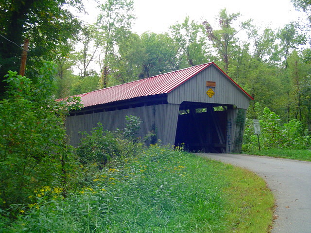
“The Eakin Mill Covered Bridge is a historic covered bridge in Vinton County, Ohio, United States. Located southeast of the county seat of McArthur, this bridge carries Mound Hill Road near the community of Arbaugh.”
Wikipedia article Eakin Mill Covered Bridge, CC BY-SA 4.0.
one of 6 National Register listings in Vinton County · listed in 1976 · category: Structure.
National Register reference number.76001539- the number the National Park Service assigned this property when it was listed, and the key its nomination file is catalogued under at the National Archives.
The ground it stands on
124,965 words
The chapter on Vinton Township in Geology of Vinton County, published 1927 names Arbaugh. This is what it says, exactly as the scans read.
Irregularities or inequalities of land surface, considered collectively, is known as the relief of a region. The chief features of Vinton County are long lines of rather rugged hills, and narrow valleys separating them. No pronounced difference between one area and another is evident, not enough at least to warrant dividing the county into subdivisions. The variations are minor and local. The most rugged hill lands are found in the eastern part of the county in Brown, Knox, Madison, and Vinton townships and in the western part in Eagle, Harrison, Jackson, and Richland townships. This is due to several causes, the chief of which are the character of the rock strata, immaturity of drainage, and positions of original water divides. Where the present streams have cut from one preglacial valley to another or where they have been deflected along minor tributaries of the original drainage, bordering hills are usually steep and bold. This is especially true where a large part of the strata dissected are massive sandstones. Examples of this rugged type of topography along constricted valleys are found along Raccoon Creek in the northwestern part of Brown Township, in northeastern Elk Township, and from Hope past Moonville, Knox, Bolin's Mills, and Arbaugh to Hawk or even to Minerton. Conditions are much the same also along Elk Fork from Vinton Furnace to its junction with Raccoon Creek, along Wheelabout Creek south of Zaleski, and along Pierce Run from Oreton to Radcliff. The rough hills along Sandy and Little Sandy runs in Brown Township, along Tedroe and Russell runs in Knox, along Alman and Zinns runs in Vinton, and along Rockcamp and Indiancamp runs in Wilkesville are due to deepening of the valleys caused by changes in drainage
The plains along Raccoon Creek in its entire passage of nearly 59 miles across Vinton County are exceptionally narrow for a stream of this size as they average less than .2 mile and seldom expand to as much as .4 mile. In many places the valley is very constricted, thus limiting the lowlands to narrow, ribbon-like belts bordering first one, then the other side of the stream. 'This is especially true of the Raccoon plains from Moonville past Knox, Bolin's Mills, Vales Mills, and Arbaugh to Radcliff. The soil on them is a sandy silt, which for the most part is quite fertile. Raccoon Valley is widest along the upper part of the course from New Plymouth to Hope where it averages about .3 mile. The increase here is due to the influence of preglacial streams which flowed southward toward Dundas and which left their imprints by high terraces at many places. The stream is generally sluggish and much of the lowland swampy. From Radcliff southward to the Vinton-Gallia county line, the plains along Raccoon Creek are narrow, averaging little more than .2 mile. The soil is a sandy silt of fair quality. Elk Fork is another stream whose plains are exceptionally narrow for its size. They are best developed and of most value along the upper part of the course in Elk Township.
Regional context, not property-specific
evidence. The
federal wildfire occurrence database
lists 14 fires within 5 miles of Eakin Mill Covered Bridge between
2012 and 2019, burning about 76 acres in total. None started naturally. None was recorded as arson.
Distance is straight-line from the map coordinates, so a fire counted
here may appear on a neighbouring settlement's page as well.
Reported cause
Fires
Missing data/not specified/undetermined
6
Debris and open burning
5
Equipment and vehicle use
1
Other causes
1
Power generation/transmission/distribution
1
The most recent of
them, most recent first, with the day each was reported and the service
that recorded it.
Regional context, not property-specific
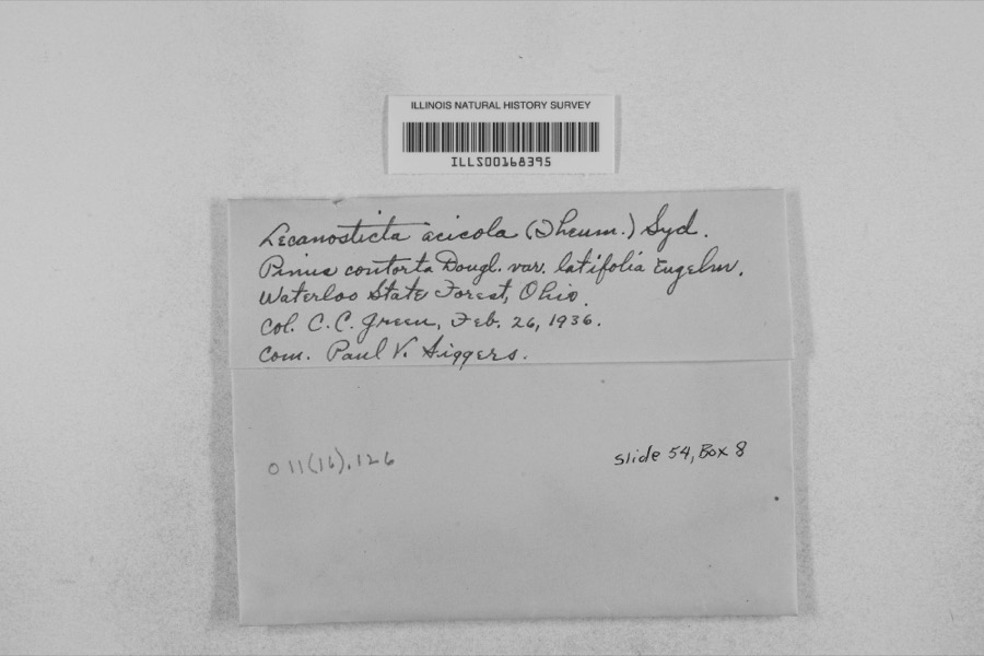
evidence. Museums hold 478 specimens
collected within 10 miles of Eakin Mill Covered Bridge between 1900 and
1975: 409 Animalia, 47 Plantae, 22 Fungi. 12 distinct Species records are shown.
Collected by 'Odell, D., Adams, K.; Bitner, E., Adams, W. and others. Each is a
physical object with a catalogue
number, and each entry opens the museum's record. This is what was
collected and kept, not a survey of what lives here - nothing can be
concluded from a species being absent.
No historic map-sheet match is published
for this property yet. That does not mean no map exists. This record needs
a coordinate-quality review before it can be joined to a sheet boundary.
Browse the county's mapped places while that work is
pending.
From the nomination file
2,856 words on record
When this property was proposed for the
National Register, someone wrote the case for it: what the building is,
and why it matters. That document is a federal record in the public domain.
It is quoted below word for word, never summarised. The text was read off the scanned case file by machine, so the
occasional stray character is the recogniser's and the 1970s
typewriter's.
Description of the property
s1ding fin1shed with battens, & sheet metal roof, projected portals and 1s a 14 panel double multiple kingpost with upper and lower chords in buckles has been added on each end of the bridge at the second truss DESCRIPTION CONDITION EXCELLENT UNALTERED rods with turnbuckles also are suspended from steel gussets at the top panel and these rods extend from upper to lower chord. steel tension sion, and diagonals, which are in compression. This triangular form has siding is still intact since early times.It consists of a center or kingpost which is in ten- Both upper and lower chords have been reinforced with steel channels.
CHECK ONE of the end posts and extend down to the base of the center kingpost -UNEXPOSED overall with a roadway width of 14i4w.A steel tension rod with turn- _GOOD joists, which in turn, rest on the lower chords. entire bridge has a pronounced camber giving it a Humpback appearance. 1y replaced one of shingles. DATE The overall length of Eakin Mill Covered Bridge presents much the same appearance today as The structure under consideration is a one-span wooden truss cwvered This bridge is known as the Eakin Mill, Geer's Mill or McLaughlin Bridge of the Appalachian Highway. This old span has vertical,high-boarded bridge spanning the Big Raccoon Creek at Arbaugh, Vinton Towmship, in 1t did one hundred years ago. The present sheet metal roof is undoubted- open it at this time.
lachian Highway damaged the bridge and the county closed it about five eastern Vinton County, Ohio on Mound Hill Road about one-half mile north The roof is in good condition and most of the for added support. Heavy trucks used in the constructiog of the Appa- three sections.
Iamed Humpback Covered Bridge (now on the National Register). At the call the postoffice at this site Arbaugh, after a prominent family in OI the foundation stones of the mill and part of the wooden foundation the double multiple kingpost such as this bridge, remain, todayd There around it, but the county has so far refused to relinquish ownership 1870/71 1400-1499 1700-1799 Historical RELIGION SIGNIFICANCE ART PERIOD BUILDER/ARCHITECT COMMERCE INVENTION THEATER AGRICULTURE ARCHITECTURE POLITICS/GOVERNMENT 1600-1699 INDUSTRY TRANSPORTATION SCULPTURE EXPLORATION/SETTLEMENT Gilman and Ward Company MILITARY people in the county still call both bridges the Geers Mill Bridget _COMMUNICATIONS neer's office and it comes from the name of the family who operated the with the true Burr truss.
Most multiple kingpost trusses that were built here in ohio were built using single timbers and only a few of _PREHISTORIC truss because the so-called arch is a segmented plank affair,,whose bridge from active service to the community. At one time, the trustees Henry Clay Geer who.bought the mill from the Eakins and operated it -SCIENCE the area and to avoid confusion with the other Geer's Mill. It is of the mill dam can still be seen below the bridge. $2,2o0.
Quoted from the National Register nomination
for reference 76001539, 13 pages, held by the National Archives in Record
Group 79. See the
catalogue record.
Listing record. National Park Service National Register of Historic Places, listed-properties dataset, current to 2026-05-22.
Map join. Address geocoded through the United States Census geocoder, then tested against the published boundary of every sheet in the USGS Historical Topographic Map Collection.
How this page is made. Listing fields come from federal records; map-sheet coverage is a labelled coordinate-to-boundary calculation, not a source-field claim.
Wildfire. Short, Karen C. 2022. Spatial wildfire occurrence data for the United States, 1992-2020 [FPA_FOD_20221014]. 6th Edition. Fort Collins, CO: Forest Service Research Data Archive. https://doi.org/10.2737/RDS-2013-0009.6 Collected with United States Government funding and usable without additional permissions or fees.
Specimens. Global Biodiversity Information Facility (GBIF), https://www.gbif.org/. Only records licensed CC0 or CC BY are used. Records licensed CC BY-NC are excluded because this site carries advertising. Images are checked individually and any whose licence is non-commercial, no-derivatives or unreadable is refused.
 Block
Block