 Block
Block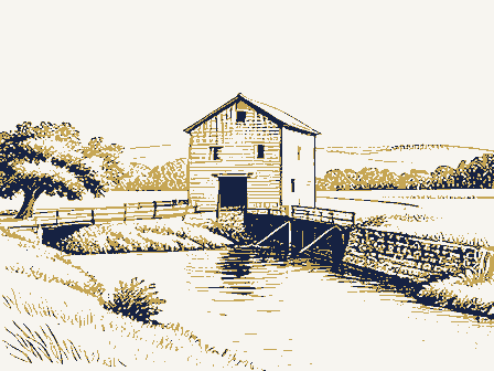
From the form
The catalogue entry the section above was filed under.
United States Department of the Interior received MAR 3 1982 date entered APR I7 1982 See instructions in How to Complete National Register Forms Type all entries-complete applicable sections and/or common street & number - not for publication city, town X vicinity of congressional district X state - county Present Use - district Xpublic _ unoccupied _ agriculture X building(s) - private - structure _ both _ work in progress private residence _ site _ in process X yes: restricted - yes: unrestricted -transportation - military - other: Mrs. Royal Grubb courthouse, registry of deeds, etc. Richland County Administration Building 50 Park Avenue East Ohio 44906 has this property been determined elegible? - yes - local depository for survey records The Ohio State University Mansfield Campus 039 museum Ownership code Category commercial date Accessible 6.
Representation in Existing Surveys government title Mansfield Ohio educational 2. Location entertainment 1. Name industrial Status Bellville park religious historic 5. Location of Legal Description object National Register of Historic Places scientific being considered Inventory-Nomination Form Public Acquisition August 1980 3. Classification For HCRS use only Heritage Conservation and Recreation Service Rummell Mill Ohio Historic Inventory 4. Owner of Property 174 West Durbin Avenue _federal X state Richland FHR-8-300 (11-78) _ excellent X unaltered - original site . ruins _moved date measuring about 33 by 42 feet, and is about 35 feet high at the eaves and about 50 feet has no openings on the first floor. On the top three floors are large doors in the middle to these doors. Erected on a sloping bank, the building appears taller from the river with space on the two upper levels.
It was added in the late nineteenth century when the original belts occupy much of the first floor, which has a lower ceiling height. Most of the equip- manufacturers, the equipment bears patent dates primarily from the 1870's and 1880's. The second and third floors have fifteen foot high ceilings and are supported by massive wood low at the sides, following the slope of the roof, and is lighted by narrow entablature and, like the other levels, is filled with machinery. A large, massive stairway connects Ciear Fork flows about ten feet south of the mill and is normally shallow and swift moving. About a thousand feet upstream the old mill race begins. It forms a mill pond northwest of the building. Another channel once led water into the turbine, through the basement and out the east end of the building.
About one hundred feet east of the mill is picturesque with shade trees and shrubbery and a hilly terrain. The building has deteriorated since its closing over thirty years ago. It is unpainted The mill race roughly parallels the river and has a deteriorated concrete guard lock at its mouth approximately 1000' upstream. Condition unexposed 7. Description covered with clapboard siding.The presence of wide corner boards and a simple massive Check one Window openings are long and rectangular with nine over six sash.The front and sides are all four levels. its sandstone basement exposed.Or the west end of the building is a rectangular lean-to in the northeast corner of the second floor and has weighing scales.The fourth floor is carpenters in 1974.
Located about one mile east of the village of Butler on the banks of the Clear Fork, tall at the peak.This wood frame structure rests ona foundation of cut sandstone and is .deteriorated Describe the present and original (if known) physical appearance