Listed on the National Register of Historic Places in
1982. A historic map-sheet match is not published yet. The record needs a coordinate-quality review before it can be joined to a sheet boundary.
From the record
one of 61 National Register listings in Richland County · listed in 1982 · category: Building.
National Register reference number.82003635- the number the National Park Service assigned this property when it was listed, and the key its nomination file is catalogued under at the National Archives.
What happened here
An account from the chapter on Worthington township, The inset identifies its exact
source book and publication year.
coarse features, high cheek-bones and large protruding lips, so much so, indeed. that. when ornamented with a miniature silver clevis and double-tree in each ear, and one in his nose. and smoking from the bow] and through the handle of his iron tomahawk, he presented rather a grotesque appearance. He was, in a word, regarded by the whites as extremely homely and repulsive.
Regional context, not property-specific
evidence. The
federal wildfire occurrence database
lists 16 fires within 5 miles of Rummell Mill between
2005 and 2019, burning about 15 acres in total. 1 started naturally. None was recorded as arson.
Distance is straight-line from the map coordinates, so a fire counted
here may appear on a neighbouring settlement's page as well.
Reported cause
Fires
Debris and open burning
11
Smoking
2
Natural
1
Missing data/not specified/undetermined
1
Recreation and ceremony
1
The most recent of
them, most recent first, with the day each was reported and the service
that recorded it.
Regional context, not property-specific
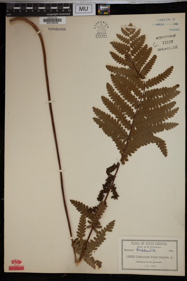
evidence. Museums hold 109 specimens
collected within 10 miles of Rummell Mill between 1879 and
1973: 100 Animalia, 8 Plantae, 1 Fungi. 12 distinct Species records are shown.
Collected by A.M.H., Aknown, Berra, T. M. (Tim M.) & Berra, T. M. (Tim M.) and others. Each is a
physical object with a catalogue
number, and each entry opens the museum's record. This is what was
collected and kept, not a survey of what lives here - nothing can be
concluded from a species being absent.
Regional context, not property-specific
evidence. The federal mineral resources record lists
2 workings within 5 miles of Rummell Mill: 1 past producer, 1 producer.
1 still produces. What was taken out: Sand and Gravel, Construction. Distance is straight-line from the
map coordinates, so a quarry counted here may appear on a neighbouring
settlement's page as well.
Regional context, not property-specific
evidence. The National Weather Service names
Butler, the town this property stands in, in 18 storm reports between 1993 and 2025: 14 thunderstorm wind, 3 hail, 1 tornado.
No death or injury is recorded in these reports. Each account below is quoted exactly as the forecast office
filed it, from the NOAA Storm Events Database, and each date
opens the federal record of that event.
A F1 tornado touched down southwest of Pleasant Hill Lake around 3:40 p.m. The tornado tracked east along Pleasant Hill Road and into southwest Ashland County. The tornado had a damage path approximately two miles long in Richland County. This damage path was intermittent and no more than fifty yards in width. A barn was leveled and a grain elevator was destroyed along Pleasant Hill Road. Numerous trees were also down.
Thunderstorm winds downed several trees and a couple utility poles in Worthington Township at the southeast end of Richland County. Scattered power outages were reported in the area.
No historic map-sheet match is published
for this property yet. That does not mean no map exists. This record needs
a coordinate-quality review before it can be joined to a sheet boundary.
Browse the county's mapped places while that work is
pending.
From the nomination file
1,969 words on record
When this property was proposed for the
National Register, someone wrote the case for it: what the building is,
and why it matters. That document is a federal record in the public domain.
It is quoted below word for word, never summarised. The text was read off the scanned case file by machine, so the
occasional stray character is the recogniser's and the 1970s
typewriter's.
Description of the property
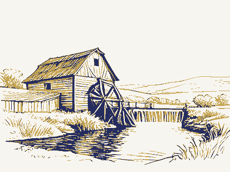
of each level. A large hoist anchored at the peak of the roof was used to transport material windows except at the ends. It slopes up to a height of about eighteen feet on the center waterwheel was replaced by this more efficient power source. columns joined together in a highly skilled mortise and tennon construction. An office is Inside, the building has only a partial basement toward the river end.The interior is filled with milling apparatus such as separators, purifiers, grinders and so forth.Chutes and trap doors extend throughout.Massive turning wheels connected to the turbine by large entablature with returns on the gable ends give this building its Greek Revival character.
the Rummell Mill isa large wood frame structure.The building is rectangular in shape, FHR-8-300 (11-78) date entered R Rummel Mill, Butler Vic. Item number 7 Page 2 Richland County, Ohio Wheels & belts 1-Cranson Scouring, Polishing and Separating Machine, Huntley Manufacturing Company, Stover Creek, N.Y. (Patent dates of 1885 and 1890) 4-w.D. Gray Roller Mill, E.P. Allis Company, Milwaukee, Wisconsin 1-Barrel Packer (patent dates of 1883, 1885 and 1888) 1-Huller, Engleberg Huller Company, Syracuse, N.Y.
(in one paragraph) Rummell Mill is one of the oldest and best preserved grist mills in North Central Ohio. It is the only mill in Richland County to survive with its machinery intact and and an interesting history as one of the early mills of this region that in its day was County's former role as the location of more water-powered mills then any other county Jacob Armentrout first recognized the potential of this site when he constructed a was one of three mills along the Clear Fork which ground corn for pioneer settlers. For was changed and the old water wheel was discarded in favor of more modern turbines. During its last years the building was known as the 0'Sharon Mill.
In 1840 Richland County, which was the largest county in the state, had 82 gristmills, in the county, which, added to the gristmills and two linseed oil mills made 190 operating included. No doubt the presence of the swiftly moving streams in this hilly yet very fertile area played a major role in this industry. In 1860, when Richland County had been reduced in size by the creation of additional counties, it still ranked ahead of as the largest and best preserved mill in the region. 1850 economics 1600-1699 communications 1500-1599 1700-1799 Builder/Architect 1400-1499 commerce education engineering transportation invention literature humanitarian 8.
Significance politics/government 1900- Specific dates _conservation was the last water-powered grist mill in this part of the state to cease operations, many years after Rummell sold it, the mill was known as the Butler Mill.The mill race - archeology-prehistoric - community planning _ art which occurred in the later 1940's. It has widespread recognition as a major landmark Ohio. saw mill here in the 1840's.
Quoted from the National Register nomination
for reference 82003635, 16 pages, held by the National Archives in Record
Group 79. See the
catalogue record.
Listed places nearby
5 within 8 miles
Other National Register properties close
enough to walk or drive between, ordered by distance from this one. Both
positions come from the same geocoding pass that matched these properties
to their map sheets.
Listing record. National Park Service National Register of Historic Places, listed-properties dataset, current to 2026-05-22.
Map join. Address geocoded through the United States Census geocoder, then tested against the published boundary of every sheet in the USGS Historical Topographic Map Collection.
How this page is made. Listing fields come from federal records; map-sheet coverage is a labelled coordinate-to-boundary calculation, not a source-field claim.
Wildfire. Short, Karen C. 2022. Spatial wildfire occurrence data for the United States, 1992-2020 [FPA_FOD_20221014]. 6th Edition. Fort Collins, CO: Forest Service Research Data Archive. https://doi.org/10.2737/RDS-2013-0009.6 Collected with United States Government funding and usable without additional permissions or fees.
Specimens. Global Biodiversity Information Facility (GBIF), https://www.gbif.org/. Only records licensed CC0 or CC BY are used. Records licensed CC BY-NC are excluded because this site carries advertising. Images are checked individually and any whose licence is non-commercial, no-derivatives or unreadable is refused.
Mines and quarries. USGS Mineral Resources Data System (MRDS) https://mrdata.usgs.gov/mrds/ A work of the United States government, no copyright under 17 U.S.C. 105.
Storms. NOAA National Centers for Environmental Information, Storm Events Database https://www.ncei.noaa.gov/stormevents/ A work of the United States government, no copyright under 17 U.S.C. 105. Narratives are quoted verbatim from the National Weather Service report and are not edited or summarised.
 Block
Block