Major Bibliographical References George Franklin Smythe, Kenyon College, Its First Century, Yale U. Press, 1924 Pp. 234-35; Smythe, A History of the Diocese of Ohio until the Year 1918, 1931, pp.358-414, esp. 378-79; J.D. Forbes, Victorian Architect: The Life and Work of William Tinsley, Indiana U. Press, PP. 91, 117. 10. Geographical Data Vernon Quadrangle 11. Form Prepared By street & number _ national . local As the designated State Historic Preservation Officer for the National Historic Preservation Act of 1966 (Public Law 89 665), I hereby nominate this property for inclusion in the National Register and certify that it has been evaluated according to the criteria and procedures set forth by the National Park Service.
code county date Easting Northing organization telephone Zone 1:24000 Attest: 1.4082 acres State Historic Preservation Officer signature Quadrangle scale name/title Verbal boundary description and justification Quadrangle name Chief of Registration List all states and counties for properties overlapping state or county boundaries UTM References 12. State Historic Preservation Officer Certification The evaluated significance of this property within the state is: See attached description from the mortgage deed. Acreage of nominated property Entered in tha city or town Astate National Register For NPs use only Galbraith M, Crump, owner NPS Form 10-900-a OMB No. 1024-0018 Exp. 10-31-84 United States Department of the Interior Item number 8 Page 2 visiting dignitaries, including the writer Robert Penn Warren, who wrote the film script College in 1971 by its present owners, Professor and Mrs.
Galbraith M. Crump. received Inventory-Nomination Form National Park Service date entered was finally put aside because of the distance of the house from the campus.Kokosing of All the King's Men while staying in the house.The house was purchased from the National Register of Historic Places For NPS use only to support the area's cultural fabric even down to the present day. Among those who have (3-82) lived in the house since 1935 have been a number of prominent members of the faculty and Significance WASO Form - 177 UNITED STATES DEPARTMENT OF THE INTERIOR ("R" June 1984) NATIONAL PARK SERVICE EVALUATION/RETURN SHEET JAN 29 1985 Fed. Reg. Date: Federal Agency: _ Lsample J request -appeal LNR decision Discipline _ _ technical corrections cited below -substantive reasons discussed below 1. Name 2. Location 3. Classification Public Acquisition 4. Owner of Property 5.
Location of Legal Description Has this property been determined eligible? 7. Description J excellent -unaltered - original site -moved boundary selection resubmission Category yes Date Ownership alterations/integrity Condition Status completeness REJECT Recom./Criteria Accessible deteriorated Reviewer fair unexposed RETURN ruins clarity Knox County Action: see continuation sheet Working No. 6. Representation in Existing Surveys Substantive Review: Describe the present and original (if known) physical appearance owner objection Nomination returned for: summary paragraph Present Use Reviewer's comments: Kokosing House nomination by person or local government NATIONAL REGISTER OF HISTORIC PLACES Check one Entered in tha National Register good ACCEPT 8. Significance summary paragraph Other 9. Major Bibliographical References 10. Geographical Data Acreage of nominated property 11.
Form Prepared By State Historic Preservation Officer signature Questions concerning this nomination may be directed to Signed Date Builder/Architect context completeness title national Maps applicable criteria Photographs clarity UTM References local relating significance to the resource _state justification of exception Specific dates 12. State Historic Preservation Officer Certification relationship of integrity to significance justification of areas checked Verbal boundary description and justification Quadrangle name Statement of Significance (in one paragraph) The evaluated significance of this property within the state is: Comments for any item may be continued on an attached sheet - Phone: - Gambier, Knox County, Ohio Kokosing House November 1984 Photographer: Barbara Powers 221 Kokosing Dr.
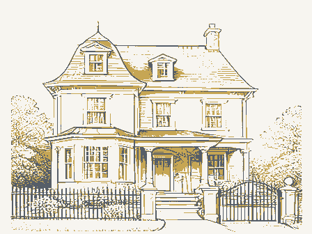
view: facade (east) facing west View 3: Interior detail, mantle Kokosing House Gambier, Knox County, Ohio 221 Kokosing Drive View 4: Window detail Kokosing House Gambier, Knox County, Ohio 221 Kokosing Drive view: NE corner, facing southwest Kokosing House November 1984 Gambier, Knox County, Ohio 221 Kokosing Dr. Gambier, Knox County, Ohio view: west elevation, facing east November 1984 Kokosing House 221 Kokosing Dr. view: south elevation, facing north Kokosing House 221 Kokosing Dr. November 1984 Gambier, Knox County, Ohio Gambier, Knox County, Ohio Kokosing House taken from Kenyon College archives Southern facade of Kokosing House as it appeared in the l880s. OHIO - KNOX CO UNITED STATES GEOLOGICAL SURVEY MT. VERNON QUADRANGLE MT.
VERNON, OHIO SESH DEPARTMENT OF THE INTERIOR 7.5 MINUTE SERIES (TOPOGRAPHIC) DEPARTMENT OF NATURAL RESOURCES Mapped, edited, and published by the Geological Survey N4022.5W8222.5/7.5 STATE OF OHIO SCALE 1:24 000 40-30-30 DCT 16 1984 13 October 1984 Columbus, Ohio 43211 If we are the sole owners and we object, our property will Gambier, Knox County, Ohio 43022 - Crump MARCELLA J. LAHMON Director date. Sincerely, listing and notify you that we request that our property We hereby waive our right to object to the proposed Joan Lee Crump listed in the National Register at the earliest possible 22l Kokosing Drive Dear Sir: be listed.
The Ohio Historical Society of listing a property in the National Register of Historic Kokosing House This will confirm that we are fully aware of the effects Preservation Act, we are entitled to object to the proposed not be listed.If there are multiple owmers of this property listing of our property by a notarized, written statement. Following is the address of our property: and a majority of the owners property will not Interstate 7l at l7th Avenue Gambier, Ohio 43022 Places. We recognize that, under the National Historic. Galbraith M.Crump 16 1984 VILLAGE OF GAMBIER GAMBIER, OHIO 43022 13 October 1984 Gambier, Knox County, Ohio 43022 Mayor Director Dear Sir: Sincerely, within my jurisdiction. Kokosing House Richard Baer The Ohio Historical Society Following is the proposed listing: listing a property in the National Register of Historic Places.
I hereby waive my right to comment on the proposed listing. I recognize that, under the National Historic Preservation Act, 22l Kokosing Drive Interstate 7l at l7th Avenue Iam entitled to comment on the proposed listing of property This will confirm that Iam fully aware of the effects of 1985 Velma Avenue Columbus, Ohio 43211 January 11, 1985 Ms. Carol Shull, Chief SINCE 1885 1100 L Street, N.W. Washington, D.C.
20240 Kenton Courthouse Square Historic District, Kenton, Hardin County, Ohio Kokosing House, Gambier, Knox County, Ohio includes letters from the property State Historic Preservation Officer JAN 29 1985 614/466-1500 Enclosures Crawford SOCIETY County Sincerely, Kokosing House New Submissions Smith-Davis House Hancock HISTORICAL Historic District Warren Knox Findlay Downtown National Park Service Ohio Historic Preservation Office Dear Carol: Bucyrus Commercial Historic Places National Register of Enclosed are two new National Register nominations and two resubmissions. followed for the new submissions.Please note that the nomination for the and do everything possible to expedite the nomination. WRL/BP:vb owners and the City of Gambier indicating an expeditious review of the property.
We would therefore ask that you waive the comment periods at the federal level nomination.All of the appropriate notification procedures have been Department of the Interior (Lebanon MRA) Also enclosed is a continuation sheet to be added to the file for the Please contact me if you have any questions. W. Ray Luce OHIO Kokosing House, Gambier, Knox County, KNOW ALL MEN BY THESE PRESENTS: That GALBRAITH M. CRUMP AND JOAN LEE CRUMP, husband and wife - Dollars signs forever, the following real estate situated in the State of Ohio, County of Knox Gambier , and bounded and described as follows: of Kokosing Allotment within the Village of Gambier as the plat of said Allotment is of south side of same - reference Grantor's source of title in Knox County Deed Records, Volume Starting for reference at an old pipe marker at the center point of the 50 feet radius turn- thence S.
11°-05'-26 W., 50.00 feet to the beginning point of the parcel here described - way line of aforesaid Kokosing Drive - with the 36.83 feet long arc of a 50.00 feet radius S. 6°-10'-14" W., 276.34 feet to a point marking the southwest corner of said strip - the same bearing N.89°-51'W. 15.08 feet from the southwest corner of Lot 7 of aforementioned Kokosing Allotment; thence S. 9°-49'-08"W., 120.74 feetto a pipe marker set three feet north by Thomas B. Underwood, Surveyor Ohio Certificate Number 5605. and all the rents, issues and profits which may raise or be had therefrom, unto the said Grantee, its successors and assigns lawful claim or claims and demands whatsoever, except those hereinabove set forth. rate and on the terms named in said note, said principal sum and interest is payable TWO HUMDRED THIRTY TWO AND .......
thereafter until the whole amount, including inter- est, is fully paid. Ohio Survey and description certified correct by the Underwood Engineering Company within the Village of Gambier-situated adjacent to aforesaid Kokosing Allotment on the 1.The Grantor will keep all improvements now existing or hereafter erected on the above-described premises insured in side of said drive with the following courses and distances -a series of chords each around at the southwesterly termination of Kokosing Drive in the aforesaid Kokosing Allotment; Mortgagee, the receiptof which is hereby acknowledged do way of record.
And Whereas the Grantor further covenants and agrees that: E.,35.33feet;and N.44°-33'-03E.54.18feet toa pipe marker;thence continuing along thence continuing along said right-of-way line S.79°-42'-30"E.,13.31 feet to a point mark- Kokosing Allotment on the west side of the same - being a part of Lot 2i in College Township ing the northwest corner of a strip of land 15.00 feet in width conveyed to Paul M.Titus N.36°-49'-07"E.,59.86 feet to the place of beginning-containing 1.4082 acres total,1.3761 the right(south)sideof said drive-N.53°-58'-14"E.,134.92feet toa pipe marker-and Part of the first quarter of Township 6,Range 12U.S.Military Lands in the Village curve to the1eft-the same having a.chord bearing N.79°-59'-11"E.,36.01 feet to a point THIRTY THOUSAND AND 0O/10O--- of Gambier and in the Township of College as follows: (1) a part of Lot 16 (Park Area) G, page 540; (3) a part of lands owned by Grantor adjacent to the Village of Gambier and said of the curb running along the north side of a private drive; thence running along the right of the above-described premises, in fee simple and has good right to bargain and sell the same in manner and for above ain promissory note of even date, which is made a part of this instrument as if fuily rewritten herein, the principal sum oi and a like amount on the .10!
... day of each ....month.... companies approved by the Grantee against loss by fire and such other hazards, casualties and contingencies and in such from which point a pipe marker bears N. 36°-49'-07" E., 2.66 feet; thence along the right-of- by deed recorded in Volume 272, page 22; thence following the westerly boundary of said strip, meridian used for survey and description.
Conveyance subject to all easements and rights-of- said total parcel being more particularly bounded and described as follows: any;zoning ordinances,if any;taxes and assessments not yet overdue,if any;and that Grantor will warrant and defend terminating in a pipe marker set three feet right of aforesaid curb along drive:N.4g°-39'- right-the same having a chord bearing N.79°-35'-13"E.35.36 feet toapoint of tangency; record in Plat Book 3A at page 212,Knox County part of 1ands owned by Grantor 09"W.,65.30 feet;N.59°-18'-15"W.,35.78 feet;N.63°-01'-30"W.,60.50 feet;N.52°-47' 52"W.,48.75 feet;N.43°-00'-00"W.42.76feet;N.30°-54'-18"W.39.69 feet;N.11°-18'-42"
 Block
Block