 Block
Block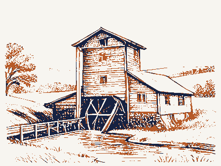
From the form
The catalogue entry the section above was filed under.
NFS Form 10-900 OMB No. 1024-0018 (Rev. 8-86) MAY 0 1 1990 and areas of significance, enter only the categories and subcategories listed in the instructions. For additional space use continuation sheets 1. Name of Property 2. Location street & number city, town Lx vicinity Classification Ownership of Property Category of Property [xxi building(s) Name of related multiple property listing: listed in the National Register - 4. State/Federal Agency Certification As the designated authority under the National Historic Preservation Act of 1966, as amended, 1 hereby certify that this National Park Service Certification 1, hereby, certify that this property is: Jentered in the National Register. determined eligible for the National determined not eligible for the other, (explain:) Lancaster code045 site public-local structure state object district National Register.
NATIONAL REGISTER public-Federal public-State Total Registration Form historic name Noncontributing 850 Number of contributing resources previously Entered in the See continuation sheet. National Park Service other names/site number N/A removed from the National Register. ROCK MILL National Register of Historic Places State or Federal agency and bureau Date (Form 10-900a). Type all entries. N/Anot for publication Number of Resources within Property Signature of certifying official United States Department of the Interior This form is for use innominating or requesting determinations of eligibility for individual properties or districts.See instructions in Guidelines Date of Action Signature of commenting or other official Xprivate Rock Mill Road NW and the Hocking River for Completing National Register Forms (National Register Bulletin 16).
Complete each item by marking "x" in the appropriate box orby entering county Fairfield Register. See continuation sheet. National Register of Historic Places and meets the procedural and professional requirements set forth in 36 CFR Part 60. Ohio code 6. Function or Use manufactur ing facility 7. Description walls _ Rock Mill, Lancaster, Ohio, Fairfield County The nomlnated parcel Includes the mill bullding, dam site, mill race, hand-hewn oak timbers. "The posts,16 in number, four full height for entire mill, thus leaving large unrestricted rooms for the spacing of mill is in four bends [bentsl...The jolsts are mainly 3 x 10 inch x 14 inches." (Stout, p. 175) About every seventh rafter is notched and KX See continuation sheet Metal roof The PROCESSING/ Weatherboard Architectural Classification Describe present and historic physical appearance. NO STYLE forebay and waterwheel.
Materials (enter categories from instructions) Historic Functions (enter categories from instructions) (enter categories from instructions) Current Functions (enter categories from instructions) triangular parcel of land historically associated with the mill, Hockhocking River),in the southeast quarter of Section 25,Bloom VACANT/NOT IN USE the rim of the gorge and two additional levels below the rim which are and windows are of 4 by 4inch material securely mitered into the set on a foundation of approximately 4' of coursed sandstone taken of various widths up to 17 inches and of different lengthsup to 22 ROCK MILL isa rectangular plan,braced frame grist mill built in adjacent to the Rock Mill Covered Bridge 1976)on the old foundation - Township, Fairfield County, about seven miles from Lancaster. The mill is topped with a strong rigid support by 4 by 6 inch timbers.
feet long, spaced on 4 foot centers. hemlock, are 7 inch wide by 1/2 inch thick.... The mill building measures approximately 34' wide, facing the gorge There are nine windows on a side with frames 31 and 1/2 by 56 Sandstone feet. The studs for holding the siding and manmade features in the sandstone gorge showing evidence of the within the basin of the gorge. from a nearby quarry downstream. The massive plates that The building is just below the upper falls of the Hocking River called the 1824.It is built on the edge of a sandstone gorge about 40'in depth throughout the mill is tongue and grooved,1 and 1/8 inch thick and is span across the mill are also hand-hewn oak,14 inches wide by 12 The main floor of the mill is each four short ones for the first 12x 12inches OMB Approval No.
1024-0018 Rock Mill, Lancaster, Ohio, Fairfield County plain wood trim, although many of the existing sash are in very lowest level of the north elevation. frame itself has collapsed into this hole and the buhrstones now lie condition. The ground or first floor level of the interior has the remains of an second floor in the northeast corner, perhaps the remains of power mill was originally built as a combined grist and woolen mill, but the story. Continuation Sheet (Continued) level. National Park Service National Register of Historic Places apparently in the two southern corners that coincide with the story woolen machinery was never installed.
line shafting.A stairway in the northwest corner leads to the second On the second level can be seen evidence of bins in the two southern hursting or husk frame supporting the gearing and the pair of United States Department of the Interior The lowest level of the subgrade of the mill includes remains of the NPS Form 10-900- Section number - - Page - 10 windows. Many of the windows had 6/6 light double hung sash with immediately adjacent to this depression.
The upper sub-level, the floor on top of the hursting frame, exists now only in its collapsed The lower portion of a chute is at Strips are nailed to the vertical posts to hold wide None of the original waterpower milling equipment is existing, with at ground level on the south elevation, and a single vertical board openings are on the lowest level of the north elevation originally intended to provide access to the forebay and waterwheel structures. elevators, and chutes exist in the western half of the floor. Narrow wooden rails are fixed to the bottom of two floor joists for the The central bay of the third level is open. Small bins were corners. shutters. deteriorated condition. holes in the floor for power lines and chutes is on the eastern half office in the southeast corner.Horizontal plank boards are still rafters by wrought-iron hooks and a pulley still hangs from one end.
covered by fragments of wallpaper. buhrstones.This frame isolated the vibration of the gearing and depression approximately 18"in depth and measuring about 18'by 10 pinned to a cross-tie beam gorge elevation has (8-86) NPS Form 10-000-e Rock Mill, Lancaster, Ohio, Fairfield County Originally powered by a 26 foot diameter overshot waterwheel, there was also a dam, millpond, millrace, forebay, penstock, and catwalk through the solid sandstone, measuring about 30" in width and 22' the waterwheel, but proved unsatisfactory so it was then changed to the 20th century, the south and east sides of the mill were covered with corrugated metal siding as a protective measure, due to the later milling equipment. From the exterior, the mill appears to be in very deteriorated the northwest corner, preservation of the mill is feasible.
(Continued) National Park Service Continuation Sheet later metal siding has significantly contributed to the preservation National Register of Historic Places nineteenth-century stone quarrying markings and notches for a was used for agricultural storage thereafter.It is currently vacant. United States Department of the Interior in 1899.It has horizontal siding and is topped with a metal shed large notches of varying size are still intact as well as what appears Evidence also remains in the face of the gorge beneath the mill framework at the opening (photo) and slots for boards at the beginning There is one window on each of the three exposed sides of the The windows in this addition are 2/2 double hung wood sash. Slots cut in the sandstone to hold boards can still be seen at the dam into the walls of the rock just above the brink of the falls. OMB Approval No.
1024-0018 Section number - 7 _ Page - This is still evident. millpond thus created was small, only some 35 rods long...." (Stout) A small frame "office/workshop" addition on the southwest corner of However, upon closer inspection of the interior, the remainder of the extent of deterioration of the wood siding. Nothing remains of the The mill closed c.1905, the equipment was removed, and the building steam power. the building was presumably added at the time the mill was remodeled removed by vandals.The northwest corner of the mill is structurally "The dam was constructed of heavy timbers anchored brick chimney is located in the northwest corner. of the penstock.
unsound.The corner post and foundation plate in this corner have framework and flooring in the mill isin excellent condition.The The race shows evidence of New machinery from Nordyke & Marmon Company to be a dished out shape of the wheelpit at the base of the cliff. (8-86) OMB Approval No. 1024-0018 United States Department of the Interior Rock Mill, Lancaster, Ohio, Fairfield County Section 7, page 4 continued: To the south of Rock Mill, not included in the boundarles of this historically associated with the mill, (Morehart, Alspach), it has Page National Register of Historic Places Continuation Sheet been excluded from the nomination because the age of the structures on National Park Service the parcel postdate the period of significance of Rock Mill farmland with a 1907 farmhouse,1919 barn and several outbuildings. Section number 7 (1824-1904).
NPS Form 10-000e nomination, but under the same ownership, ls a 50+ acre parcel of Although the parcel has been and continues to be owned by families 8. Statement of Significance