 Block
Beaver, Oklahoma
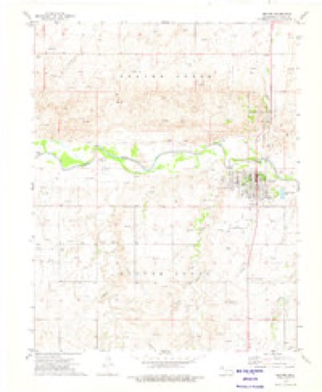
7 topographic sheets cover this place, the earliest surveyed in 1954 and the latest in 1986. It stands in the South Beaver census division. It lies in ZIP code area 73932. It stands on Home Creek. The Survey maps it on the Beaver quadrangle. 1,280 people lived here at the 2020 count. It stands 2,395 feet above sea level.
Research this city
On record in Beaver
Buildings and businesses the archive holds for this place. Each opens its own page, with the source record it came from.
On the National Register within a mile 3 records
The National Register names another town for these. They stand within one mile of this settlement's coordinate.
 Beaver County Courthouselisted 1984 · 0.1 miles away
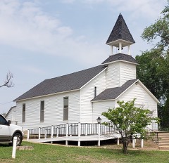 Presbyterian Churchlisted 1974 · 0.1 miles away
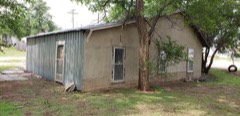 Lane Cabinlisted 1974 · 0.1 miles away
Population over time
2 figuresBeaver fell from 1,515 to 1,280 between 2010 and 2020. These are the recorded population figures Wikidata holds for this place, reached through the Geographic Names Information System number this page is keyed on rather than by name, so they belong to this place and not to another of the same name. Most are census counts, but not all are: an early figure may be a founding or settlement estimate, and an estimate published within five years of a census is left out. The change column is computed, and is left blank where more than 20 years separate a figure from the one before it, because a gap that long is not a change between two counts.
| Year | People | Change |
|---|---|---|
| 2010 | 1,515 | |
| 2020 | 1,280 | -235 (-16%) |
Topographic sheets covering this place
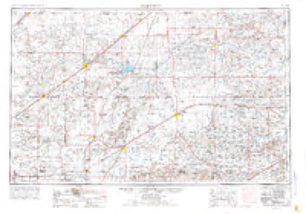
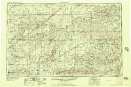
4 surveys from 7 printed sheetsMatched by testing this settlement's coordinate against the published boundary of every sheet in the United States Geological Survey's historical collection. Each opens the scanned sheet at the Survey.
- 1954 USGS Perryton quadrangle1:250000, 3 printings
- 1958 USGS Perryton quadrangle1:250000
- 1973 USGS Beaver quadrangle1:24000
- 1986 USGS Beaver quadrangle1:100000, 2 printings

Fires near this place
1 since 2020Regional context, not property-specific evidence. The federal wildfire occurrence database lists 1 fire within 5 miles of Beaver in 2020, burning about 486 acres in total. None started naturally. None was recorded as arson. Distance is straight-line from the map coordinates, so a fire counted here may appear on a neighbouring settlement's page as well.
| Reported cause | Fires |
|---|---|
| Missing data/not specified/undetermined | 1 |
The most recent of them, most recent first, with the day each was reported and the service that recorded it.
| Date | Cause | Size | Reported by | Name on the report |
|---|---|---|---|---|
| 29 February 2020 | Missing data/not specified/undetermined | 486 acres | Oklahoma Division of Forestry | BEAVER ROAD |
Settlements close enough to share some of these fires:
Mines and quarries near this place
9 within 5 milesRegional context, not property-specific evidence. The federal mineral resources record lists 9 workings within 5 miles of Beaver: 9 past producers. None of them still produces. What was taken out: Sand and Gravel, Construction, Limestone, General, Sand and Gravel, Construction. Distance is straight-line from the map coordinates, so a quarry counted here may appear on a neighbouring settlement's page as well.
| Where | Site | Commodity | Status | Recorded |
|---|---|---|---|---|
| Unknown Caliche Pit | Limestone, General, Sand and Gravel, Construction | Past Producer | ||
| Unknown Gravel Pit | Sand and Gravel, Construction | Past Producer | ||
| Unknown Gravel Pit | Sand and Gravel, Construction | Past Producer | ||
| Unknown Gravel Pit | Sand and Gravel, Construction | Past Producer | ||
| Unknown Gravel Pit | Sand and Gravel, Construction | Past Producer | ||
| Unknown Sand Pit | Sand and Gravel, Construction | Past Producer | ||
| Unknown Sand Pit | Sand and Gravel, Construction | Past Producer | ||
| Unknown Sand Pit | Sand and Gravel, Construction | Past Producer | ||
| Unknown Sand Pit | Sand and Gravel, Construction | Past Producer |
Storms near this place
60 of 217 shownRegional context, not property-specific evidence. The National Weather Service names Beaver in 217 storm reports between 1993 and 2025: 108 thunderstorm wind, 94 hail, 11 flash flood, 3 tornado. No death or injury is recorded in these reports. Each account below is quoted exactly as the forecast office filed it, from the NOAA Storm Events Database, and each date opens the federal record of that event.
| When | Event | Place named | Harm | What the report says |
|---|---|---|---|---|
| September 1999 | Thunderstorm Wind | Beaver | $8,000,000 | Damage reported to be six and a half million dollars in structural damage and one and a half million dollars in damage to vehicles. Fourteen hundred homes in Beaver were damaged with two homes completely destroyed and twenty-three homes deemed to be unlivable. There were no injuries from the storm. |
| May 1995 | Hail | Beaver | $100,000 | Storms produce golf ball-size hail damaging cars and roofs in Beaver. |
| March 2007 | Tornado (EF2) | Beaver | $58,000 | The tornado began just south of the Bar-B Ranch and moved north damaging much of the ranch property...mainly along the western edge. A large horse trailer and several other utility trailers were destroyed as they bounced and rolled and/or became airborne for significant distances. The horse trailer was displaced more than one hundred and fifty yards from its original location. Several power poles and trees were snapped at the base within the path of the tornado. A large grain silo was toppled with parts of the roof of the silo carried over one hundred yards. No injuries were reported. |
| June 1995 | Hail | Beaver | $50,000 | The Oklahoma Highway Patrol and VORTEX storm chasers reported the hail. Most of the damage occurred to vehicles caught on the road with a few buildings receiving roof damaged as well. |
| June 1999 | Thunderstorm Wind | Beaver | $40,000 | Report of roof blown off a building. |
| July 2023 | Thunderstorm Wind | Beaver | $30,000 | A metal outbuilding had been destroyed in Beaver. Multiple power lines were downed between Forgan and Beaver. |
| August 2013 | Flash Flood | Beaver | $30,000 | Heavy rain from a squall line led to flash flooding in the town of Beaver (Beaver County). The Beaver County Emergency Manager reported that 4 inches of rain fell in Beaver over a short period of time. This led to flash flooding in town and on U.S. Highway 270 5 miles south of Beaver (Beaver County). Some roads in Beaver had 4 to 6 inches of water covering the road, and that flood waters had gotten into homes, businesses, and the courthouse. Once precipitation ended over this portion of the county, the flooding slowly receded. No swift water rescues or stranded motorist were reported in association to this flash flooding. |
| July 1996 | Thunderstorm Wind | Beaver | $25,000 | no account filed |
| July 2023 | Thunderstorm Wind | Beaver | $10,000 | Per the emergency manager a mobile home had sustained some roof damage. |
| May 1996 | Thunderstorm Wind | Beaver | $10,000 | no account filed |
| March 2001 | Thunderstorm Wind | Beaver | $6,000 | Power poles and street stop signs were blown down. |
| August 2025 | Thunderstorm Wind | Beaver | $5,000 | The roof of a barn was blown off on East-West 16 Road. |
| June 2009 | Thunderstorm Wind | Beaver | $5,000 | The Beaver County Emergency Manager estimated thunderstorm wind gusts around sixty-one knots about seven miles east southeast of Beaver which snapped several power poles. |
| August 2005 | Thunderstorm Wind | Beaver | $5,000 | A power pole was blown down by the high winds. |
| June 2000 | Thunderstorm Wind | Beaver | $5,000 | Telephone and power lines were reported downed by the strong winds. |
| March 2001 | Thunderstorm Wind | Beaver | $4,000 | Four power poles were blown down and pieces of metal were found in fence rows. |
| June 2012 | Thunderstorm Wind | Beaver | $3,000 | The Emergency Manager for Beaver County Oklahoma reported that a gas station sign was blown over in the town of Beaver Oklahoma. There were no reports of injuries or fatalities. |
| March 2001 | Thunderstorm Wind | Beaver | $3,000 | Tree limbs were reported down and a large fiberglass tank was seen rolling down the road. |
| August 2013 | Thunderstorm Wind | Beaver | $200 | A squall line moved across the Oklahoma Panhandle during the late night hours of the 7th. As the squall line moved across Beaver County the county Emergency Manager reported that 3 to 4 inch diameter tree branches were blown down in the town of Beaver (Beaver County). The squall line continued to move to the east after producing this damage and exited the panhandle by midnight of the 8th. |
| August 2025 | Thunderstorm Wind | Beaver | - | These wind gusts likely occurred due to a heat burst. |
| June 2024 | Flash Flood | Beaver | - | Local emergency manager reports areas of flooding in and around Beaver, Ok. Multiple lane and road closures ongoing in the area due to the flooding, especially HWY 23. Bar ditches were overflowing onto roadways as well. |
| May 2023 | Thunderstorm Wind | Beaver | - | Tree limbs were broken and knocked over, both large and small tree limbs. One tree was blown over onto the road and blocked traffic temporarily. |
| July 2023 | Flash Flood | Beaver | - | Emergency management had reported around 6 of rapidly flowing water across Highway 270 between Forgan and Beaver. |
| May 2022 | Thunderstorm Wind | Beaver | - | Large 4 diameter tree limbs were downed in the south part of town. |
| May 2022 | Thunderstorm Wind | Beaver | - | This was the mesonet station located near Beaver. |
| July 2021 | Thunderstorm Wind | Beaver | - | Emergency Manager reported tree limbs snapped that were 4 to 6 inches in diameter. |
| June 2020 | Hail | Beaver | - | A swath of nickel size hail fell from 3 miles south of Beaver into Beaver. |
| June 2020 | Hail | Beaver | - | Penny size hail fell in Beaver. |
| June 2020 | Hail | Beaver | - | Quarter size hail fell 2 miles south of Beaver. |
| June 2020 | Hail | Beaver | - | Quarter size hail fell 1 mile east of Beaver. |
| August 2019 | Thunderstorm Wind | Beaver | - | Trained spotters reported that a barn was destroyed. A nearby house also suffered damage. |
| August 2019 | Flash Flood | Beaver | - | Flooding was reported in Beaver with water rushing across low lying areas on US Highway 270. Flooding was also reported along other roads in Beaver. |
| August 2019 | Flash Flood | Beaver | - | Water was reported inside a convenience store in north Beaver. |
| June 2018 | Hail | Beaver | - | Largest hail reported was golf ball sized. Other reports around Beaver were quarter sized hail. |
| July 2018 | Thunderstorm Wind | Beaver | - | Several reports of damage to buildings with trees blown down in and around Beaver. Winds estimated at 70 to 80 mph. |
| May 2018 | Thunderstorm Wind | Beaver | - | Beaver mesonet reported a 59 mph wind gust. |
| May 2017 | Hail | Beaver | - | Hen egg size hail reported. |
| June 2015 | Thunderstorm Wind | Beaver | - | The Oklahoma Mesonet site located one mile south-southwest of Beaver measured a wind gust of 64 mph. |
| June 2015 | Thunderstorm Wind | Beaver | - | The KVII School Net site located at Beaver High School measured a wind gust of 60 mph. |
| May 2015 | Hail | Beaver | - | Quarter size hail was reported one mile west of Beaver. |
| May 2015 | Hail | Beaver | - | Half dollar size hail was reported in Beaver. |
| June 2014 | Hail | Beaver | - | A supercell thunderstorm approached the city of Beaver (Beaver County) during the early morning hours of the 1st. As the thunderstorm moved over State Highway 23, the County Emergency Manager reported golf ball size hail (1.75 inches) covering the highway from bar ditch to bar ditch. This thunderstorms continued moving to the southeast after producing this hail. |
| June 2014 | Thunderstorm Wind | Beaver | - | A cluster of thunderstorms moved out of southeastern Colorado and southwestern Kansas and into the Oklahoma Panhandle during the evening hours of the 30th. As this cluster of thunderstorms moved over the town of Beaver (Beaver County), the Oklahoma Mesonet 1 miles south-southwest of Beaver (Beaver County) reported a 85 mph downburst gust. After producing this downburst the cluster of thunderstorms continued to move to the southeast. |
| June 2014 | Thunderstorm Wind | Beaver | - | A cluster of thunderstorms moved out of southeastern Colorado and southwestern Kansas and into the Oklahoma Panhandle during the evening hours of the 30th. As this cluster of thunderstorms moved over the town of Beaver (Beaver County), the Emergency Manager reported several trees down across the county due to a thunderstorm downburst. After producing these downbursts the cluster of thunderstorms continued to move to the southeast. |
| June 2014 | Thunderstorm Wind | Beaver | - | A cluster of thunderstorms moved out of southeastern Colorado and southwestern Kansas and into the Oklahoma Panhandle during the evening hours of the 30th. As this cluster of thunderstorms moved over the town of Beaver (Beaver County), the Oklahoma mesonet site 1 mile south-southwest of Beaver (Beaver County) reported a 72 mph thunderstorm downburst wind. After producing this downburst the cluster of thunderstorms continued to move to the southeast. |
| May 2014 | Hail | Beaver | - | A discrete supercell developed over the eastern Oklahoma Panhandle during the afternoon hours of the 11th. This storm strengthened as it moved northeastward along a dryline. As the storm approached the town of Beaver, a storm chaser 6 miles south-southwest of Beaver reported half dollar size hail (1.25 inches). This storm continued to move to the northeast after producing this hail. |
| June 2014 | Thunderstorm Wind | Beaver | - | A thunderstorm developed over the western portion of Beaver County during the late evening hours of the 11th. As the storm tracked eastward and approached the town of Beaver (Beaver County), the Oklahoma Mesonet site 1 mile south-southwest of Beaver (Beaver County) reported a 58 mph thunderstorm downburst. After producing this downburst the storm continued to move eastward across the county. |
| June 2014 | Thunderstorm Wind | Beaver | - | A cluster of thunderstorms moved out of southeastern Colorado and southwestern Kansas and into the Oklahoma Panhandle during the evening hours of the 30th. As this cluster of thunderstorms moved over the town of Beaver (Beaver County), the Oklahoma mesonet site 1 mile south-southwest of Beaver (Beaver County) reported a 77 mph thunderstorm downburst wind. After producing this downburst the cluster of thunderstorms continued to move to the southeast. |
| June 2014 | Hail | Beaver | - | A supercell thunderstorm moved across the town of Beaver (Beaver County) during the early morning hours of the 1st. The core of this thunderstorm descended while over the town of Beaver, and the County Emergency Manager reported hail up to the size of quarters (1.00 inch). Having become downdraft dominated the thunderstorm quickly diminished below severe levels as it moved into the southeastern corner of Beaver County. |
| June 2014 | Flash Flood | Beaver | - | A line of intense rain producing thunderstorms moved over Beaver County during the evening hours of the 6th. This rain led to flash flooding on rural roads 8 miles east southeast of the town of Beaver (Beaver County). Flash flooding subsided not long after developing as the thunderstorms moved into western Oklahoma. |
| June 2014 | Thunderstorm Wind | Beaver | - | A cluster of thunderstorms moved out of southeastern Colorado and southwestern Kansas and into the Oklahoma Panhandle during the evening hours of the 30th. As this cluster of thunderstorms moved over the town of Beaver (Beaver County), the Oklahoma mesonet site 1 mile south-southwest of Beaver (Beaver County) reported a 66 mph thunderstorm downburst wind. After producing this downburst the cluster of thunderstorms continued to move to the southeast. |
| June 2014 | Thunderstorm Wind | Beaver | - | A cluster of thunderstorms moved out of southeastern Colorado and southwestern Kansas and into the Oklahoma Panhandle during the evening hours of the 30th. As this cluster of thunderstorms moved over the town of Beaver (Beaver County), the Oklahoma mesonet site 1 mile south-southwest of Beaver (Beaver County) reported a 73 mph thunderstorm downburst wind. After producing this downburst the cluster of thunderstorms continued to move to the southeast. |
| June 2013 | Heavy Rain | Beaver | - | A line of thunderstorms moved across the Oklahoma Panhandle during the evening hours on the 16th in response to the passage of a weak upper level wave. These thunderstorms produced periods of heavy rain which lead to minor flooding across Beaver County. The Beaver County Emergency Manager reported low lying areas from Beaver to Elmwood to Bryans Corner had filled with water. No roads were reported to be impacted by this nuisance flooding. After the line of thunderstorms moved to the southeast of the eastern Oklahoma Panhandle the flood waters receded. |
| May 2013 | Thunderstorm Wind | Beaver | - | A storm developed just southwest of the town of Beaver (Beaver County) around 5 PM CST. The storm intensified quickly, and moved over the city. Once over the city, it began to merge with a congealing line stretching northward into the High Plains. During this merger the storm moved over the Oklahoma Mesonet site in Beaver (Beaver County), where it produced a downdraft gust of 59 mph. Once the storm merged with the line it accelerated to the northeast and exited the county. |
| May 2013 | Thunderstorm Wind | Beaver | - | A cluster of thunderstorms developed along a retreating dryline across the north central Texas Panhandle, moved to the northeast, and entered Beaver County. As the thunderstorms were over the city of Beaver (Beaver County), the Oklahoma Mesonet recorded a downburst gust of 59 mph. The cluster of thunderstorms would continue a northeastern track before dissipating over southern Kansas. |
| May 2013 | Thunderstorm Wind | Beaver | - | A cluster of thunderstorms developed along a retreating dryline across the north central Texas Panhandle, moved to the northeast, and entered Beaver County. As the thunderstorms were over the city of Beaver (Beaver County), the Oklahoma Mesonet recorded a downburst gust of 68 mph. The cluster of thunderstorms would continue a northeastern track before dissipating over southern Kansas. |
| June 2013 | Hail | Beaver | - | A discrete thunderstorm developed along a slow moving cold front over southern Kansas. As the thunderstorm moved to the south-southeast into the Oklahoma Panhandle the thunderstorm began to weaken. After moving over the city of Forgan (Beaver County), the thunderstorm began strengthing as it approached the city of Beaver (Beaver County). While over the city, a member of the public reported golfball size hail (1.75 inches) at their residence. |
| June 2013 | Hail | Beaver | - | A discrete thunderstorm developed along a slow moving cold front over southern Kansas. As the thunderstorm moved to the south-southeast into the Oklahoma Panhandle the thunderstorm began to weaken. After moving over the city of Forgan (Beaver County), the thunderstorm began strengthing as it approached the city of Beaver (Beaver County). While over the city, a trained storm spotter reported quarter size hail (1.00 inch) at their residence. |
| June 2013 | Hail | Beaver | - | A discrete thunderstorm developed along a slow moving cold front over southern Kansas. As the thunderstorm moved to the south-southeast into the Oklahoma Panhandle the thunderstorm began to weaken. After moving over the city of Forgan (Beaver County), the thunderstorm began strengthening as it approached the city of Beaver (Beaver County). A member of the public 1 mils southeast of Beaver (Beaver County) reported quarter size hail (1.00 inch). The thunderstorm continued moving to the south-southeast across the county. |
| October 2013 | Flash Flood | Beaver | - | A cluster of thunderstorms stalled over the city of Beaver (Beaver County) during the late night hours of the 28th. These thunderstorms were able to produce 1.55 inches of heavy rain with in a hour as reported by the KVII Schoolnet site at the Beaver High School (Beaver County). This heavy rain led to flash flooding across the city. The Beaver County Ememrgency Manager reported 6 to 8 inches of fast flowing water on Avenue E in front of the Sheriff's office, and on Douglas Ave. This was enough water to span the width of the road from curb to curb of both roads. This flash flooding quickly receded as thunderstorms moved in western Oklahoma. |
Newspapers printed here
8,917 digitised pages1 paper published in this town, digitised by the Library of Congress and free to read: 1,373 issues, 8,917 pages. Every page is searchable, so a name or a street can be looked for directly in what the town printed about itself at the time.
| Newspaper | Published |
|---|---|
| The Beaver Herald | 1895 to 1923 |
What the paper printed
27,741 wordsFront pages of the local paper, read from the Library of Congress scans: 4 issues all from 1895, 27,741 words in total. Each is reproduced on its own page, exactly as the recogniser returned it.
These pages read less well than anything else here, and the number is worth stating: about three words in four come through cleanly, against nine in ten for the building records. An 1896 broadsheet sets eight-point type in seven columns on microfilm, which is the hardest thing in this archive to read by machine. We tested our own recognisers against the Library's and they were not better, so the Library's text is what appears, with the wholly unreadable columns removed. Read it as a guide to what the paper covered, and follow the link to the scan before quoting anything.
| Issue | Paper | Length |
|---|---|---|
| 1895-02-07 | The Beaver Herald | 6,884 words |
| 1895-04-18 | The Beaver Herald | 6,915 words |
| 1895-06-20 | The Beaver Herald | 6,452 words |
| 1895-10-31 | The Beaver Herald | 7,490 words |
Nearest settlements
The eight closest, with where each one stands in the county. Distances are straight-line, computed from the Geographic Names Information System coordinates.
Elsewhere
Matched on this settlement's Geographic Names Information System number rather than its name, so it cannot be a different place of the same name in another state.
| Wikipedia article on Beaver | An encyclopaedic summary. Its text is share-alike, so it is linked here rather than copied. |
| Wikidata item Q2425637 | The structured record the population and elevation above come from. Public domain (CC0). |
Provenance
This settlement is recorded in the Geographic Names Information System as feature 1089924. The sheet list is computed by point-in-boundary test against the United States Geological Survey's historical topographic inventory. Both are works of the United States government and carry no copyright under 17 U.S.C. 105.
Wildfire. Short, Karen C. 2022. Spatial wildfire occurrence data for the United States, 1992-2020 [FPA_FOD_20221014]. 6th Edition. Fort Collins, CO: Forest Service Research Data Archive. https://doi.org/10.2737/RDS-2013-0009.6 Collected with United States Government funding and usable without additional permissions or fees.
Mines and quarries. USGS Mineral Resources Data System (MRDS) https://mrdata.usgs.gov/mrds/ A work of the United States government, no copyright under 17 U.S.C. 105.
Storms. NOAA National Centers for Environmental Information, Storm Events Database https://www.ncei.noaa.gov/stormevents/ A work of the United States government, no copyright under 17 U.S.C. 105. Narratives are quoted verbatim from the National Weather Service report and are not edited or summarised.