 Block
Boise City, Oklahoma
8 topographic sheets cover this place, the earliest surveyed in 1954 and the latest in 1982. It stands in the Boise City census division. It lies in ZIP code area 73933. The Survey maps it on the Boise City quadrangle. 1,166 people lived here at the 2020 count. It stands 4,167 feet above sea level.
On record in Boise City
Buildings and businesses the archive holds for this place. Each opens its own page, with the source record it came from.
On the National Register 1 record
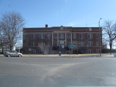 Cimarron County Courthouselisted 1984
Population over time
2 figuresBoise City fell from 1,266 to 1,166 between 2010 and 2020. These are the recorded population figures Wikidata holds for this place, reached through the Geographic Names Information System number this page is keyed on rather than by name, so they belong to this place and not to another of the same name. Most are census counts, but not all are: an early figure may be a founding or settlement estimate, and an estimate published within five years of a census is left out. The change column is computed, and is left blank where more than 20 years separate a figure from the one before it, because a gap that long is not a change between two counts.
| Year | People | Change |
|---|---|---|
| 2010 | 1,266 | |
| 2020 | 1,166 | -100 (-8%) |
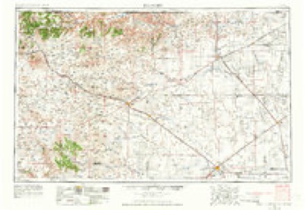
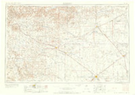
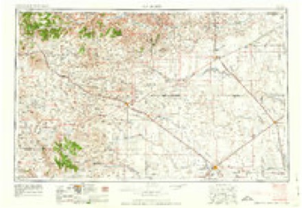
Topographic sheets covering this place
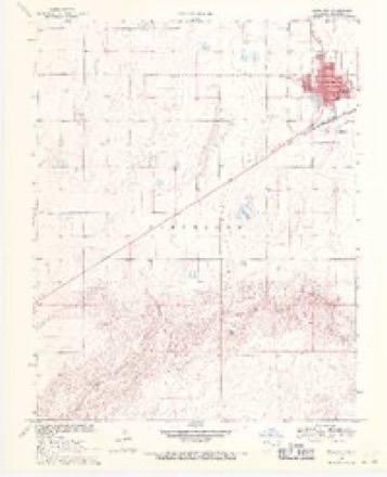
5 surveys from 8 printed sheetsMatched by testing this settlement's coordinate against the published boundary of every sheet in the United States Geological Survey's historical collection. Each opens the scanned sheet at the Survey.
- 1954 USGS Dalhart quadrangle1:250000, 2 printings
- 1958 USGS Dalhart quadrangle1:250000, 2 printings
- 1962 USGS Dalhart quadrangle1:250000
- 1969 USGS Boise City quadrangle1:24000, 2 printings
- 1982 USGS Boise City quadrangle1:100000
Photographs
4 photographs, 1936Taken for the Office of War Information and the Farm Security Administration, who photographed the country between 1935 and 1944. Works of United States government photographers, with no known restriction on use. Each opens its catalogue record.
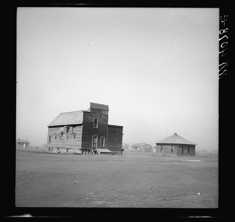
Rothstein, Arthur, 1936. Library of Congress
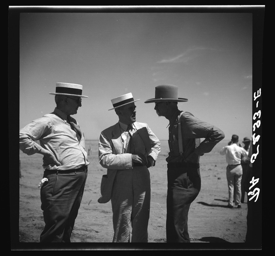
Rothstein, Arthur, 1936. Library of Congress
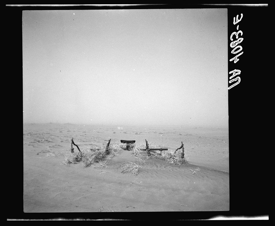
Rothstein, Arthur, 1936. Library of Congress
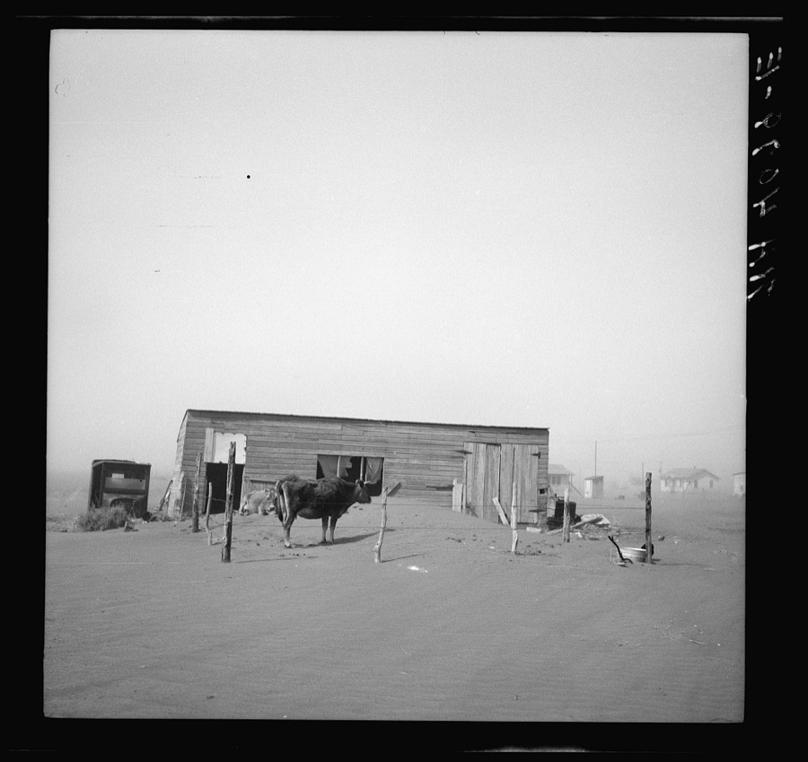
Rothstein, Arthur, 1936. Library of Congress
Storms near this place
60 of 180 shownRegional context, not property-specific evidence. The National Weather Service names Boise City in 180 storm reports between 1993 and 2025: 82 hail, 81 thunderstorm wind, 6 tornado, 4 flash flood. The reports record 1 death and 3 injuries. Each account below is quoted exactly as the forecast office filed it, from the NOAA Storm Events Database, and each date opens the federal record of that event.
| When | Event | Place named | Harm | What the report says |
|---|---|---|---|---|
| August 1997 | Lightning | Boise City | 1 killed | A man was riding a horse at Black Mesa StatePark around Lake Carl Etling and were struck by lightning.Both the man and the horse were killed instantly. |
| May 2000 | Lightning | Boise City | 3 hurt | Three men were injured when lightning struck their pickup truck as they were getting out during a thunderstorm. |
| July 2023 | Thunderstorm Wind | Boise City | $62,000 | Report from emergency manager of an unknown number of downed power lines on EW 21 RD between NS 30 and NS 36 RD. |
| May 2001 | Thunderstorm Wind | Boise City | $60,000 | Tractor trailer reported blown over. |
| June 1995 | Hail | Boise City | $25,000 | Large hail damaged a few cars caught on the open road. |
| June 1994 | Hail | Boise City | $5,000 | Hail up to golf ball-size reported by KYGN radio caused damage to autos and windshields in Boise City. |
| June 1994 | Hail | Boise City | $5,000 | Hail up to golfball size reported by KYGN radio caused damage to autos and windshields in Boise City. |
| July 2020 | Thunderstorm Wind | Boise City | $3,000 | In Boise City, strong winds brought down 2 -inch-diameter tree limbs, and peeled back metal roofing at a lumber yard. |
| April 2007 | Thunderstorm Wind | Boise City | $3,000 | A wooden shed was reportedly blown down by the high winds. No injuries were reported. |
| June 2025 | Tornado (EFU) | Boise City | $2,000 | This tornado pushed a semi-truck off the highway into a ditch approximately six miles north of Boise City on Highway 287. This tornado was later seen by a storm spotter further to the southeast. There is no known damage otherwise with this tornado. |
| May 2024 | Tornado (EFU) | Boise City | - | This tornado occurred in open field near the Santa Fe Trail campground in northwest Cimarron County. No damage is known from this tornado. It was observed and captured via photographic evidence by a storm spotter in that area. It was on the ground for at least a minute, before becoming obscured by rain and may have lifted soon after. |
| June 2024 | Thunderstorm Wind | Boise City | - | A report was received of 25 train cars laid over from thunderstorm winds. No injuries were reported. |
| August 2023 | Thunderstorm Wind | Boise City | - | A barn was damaged and partially collapsed from thunderstorm winds. |
| August 2023 | Thunderstorm Wind | Boise City | - | Another barn was damaged here by the thunderstorm winds. |
| July 2023 | Thunderstorm Wind | Boise City | - | Multiple large (4+ inch diameter) tree | branches were knocked down. A few out | buildings and sheds were damaged or | destroyed by straight line winds. |
| July 2022 | Thunderstorm Wind | Boise City | - | Very high dewpoint and temperature spread at the surface led to gusty conditions as the line of storms moved in. |
| May 2021 | Tornado (EFU) | Boise City | - | Multiple storm chasers reported and recorded video of a brief |tornado around 10 miles south of Boise City. The tornado remained |in open grassland and did not encounter any damage indicators. |
| July 2021 | Thunderstorm Wind | Boise City | - | First severe gust was measured at 2030 CDT with a peak gust measured at 2035 CDT. |
| June 2021 | Thunderstorm Wind | Boise City | - | Two different wind gusts 5 mins apart, highest was 78 mph, were measured by the mesonet station located in Boise City. At the same time reports of cottonwood trees being ripped apart in Boise City came in from the public. |
| June 2020 | Thunderstorm Wind | Boise City | - | This 85 mph wind gust was measured at the Oklahoma Mesonet station 3 miles south-southeast of Boise City. No damage was reported other than some broken small tree limbs in Boise City. |
| June 2020 | Hail | Boise City | - | Penny size hail fell 6 miles west of Boise City. |
| July 2020 | Thunderstorm Wind | Boise City | - | This gust was measured at the Oklahoma Mesonet station 3 miles south-southeast of Boise City. |
| July 2020 | Flood | Boise City | - | Some roads in Boise City became impassable to smaller vehicles. |
| June 2019 | Thunderstorm Wind | Boise City | - | There were 4 to 5 power poles snapped from thunderstorms winds. The lines were laying across the road at County Roads east/west 20 and north/south 26. Extremely low visibility was also reported due to blowing dust east of Boise City. |
| June 2019 | Hail | Boise City | - | Golf ball hail was reported several miles west of Boise City. Hail decreased in size to one inch but continued for over 15 minutes. |
| June 2019 | Flood | Boise City | - | Minor flooding in the southeast part of the county southeast of Boise City. |
| July 2019 | Hail | Boise City | - | Jagged quarter to half dollar size reported, with accumulating hail noted at 1523CST. Emergency Manager reported that the quarter size hail ended around 1529CST. |
| June 2018 | Funnel Cloud | Boise City | - | Storm chaser reported funnel cloud continuing. |
| June 2018 | Hail | Boise City | - | Trained spotter reported half dollar sized hail. |
| May 2018 | Hail | Boise City | - | Quarter sized hail reported west of Boise City. |
| May 2018 | Hail | Boise City | - | Penny size hail near Boise City. |
| May 2018 | Hail | Boise City | - | Quarter size hail in Boise City. |
| May 2018 | Hail | Boise City | - | Ping pong ball size hail southeast of Boise City. |
| June 2017 | Tornado (EF0) | Boise City | - | Sheriffs Office reported tornado on the ground at intersection of HWY 64 and HWY 56 from a law enforcement officer in the field. |
| September 2017 | Hail | Boise City | - | Some hail stones were slightly larger than a Quarter. |
| September 2017 | Hail | Boise City | - | Hail covering ground. |
| November 2015 | Hail | Boise City | - | Quarter size hail was reported 4 miles west of Conrad. |
| July 2015 | Hail | Boise City | - | Hail up to the size of golf balls fell 5 miles southeast of Boise City. |
| June 2014 | Thunderstorm Wind | Boise City | - | A cluster of thunderstorms moved out of southeastern Colorado and southwestern Kansas and into the Oklahoma Panhandle during the evening hours of the 30th. As this cluster of thunderstorms moved over the town of Boise City (Cimarron County), the Oklahoma Mesonet site 3 miles south-southeast of Boise City (Cimarron County) reported a 62 mph downburst gust. After producing this downburst the cluster of thunderstorms continued to move to the southeast. |
| June 2014 | Thunderstorm Wind | Boise City | - | A cluster of thunderstorms moved out of southeastern Colorado and southwestern Kansas and into the Oklahoma Panhandle during the evening hours of the 30th. As this cluster of thunderstorms moved over the town of Boise City (Cimarron County), the Oklahoma Mesonet site 3 miles south-southeast of Boise City (Cimarron County) reported a 73 mph downburst gust. After producing this downburst the cluster of thunderstorms continued to move to the southeast. |
| June 2014 | Thunderstorm Wind | Boise City | - | A cluster of thunderstorms moved out of southeastern Colorado and southwestern Kansas and into the Oklahoma Panhandle during the evening hours of the 30th. As this cluster of thunderstorms moved over the town of Boise City (Cimarron County), the Oklahoma Mesonet site 3 miles south-southeast of Boise City (Cimarron County) reported a 60 mph downburst gust. After producing this downburst the cluster of thunderstorms continued to move to the southeast. |
| June 2014 | Thunderstorm Wind | Boise City | - | A cluster of thunderstorms moved out of southeastern Colorado and southwestern Kansas and into the Oklahoma Panhandle during the evening hours of the 30th. As this cluster of thunderstorms moved over the town of Boise City (Cimarron County), the Oklahoma Mesonet site 3 miles south-southeast of Boise City (Cimarron County) reported a 60 mph downburst gust. After producing this downburst the cluster of thunderstorms continued to move to the southeast. |
| October 2014 | Hail | Boise City | - | A cluster of thunderstorms moved into Cimarron County during the evening hours of the 9th. As this cluster of storms approached the town of Boise City (Cimarron County), local broadcast media reported golf ball size hail (1.75 inches) in town. After producing this hail the cluster of storms continued to move eastward across the county. |
| October 2014 | Hail | Boise City | - | A cluster of thunderstorms moved into Cimarron County during the evening hours of the 9th. As this cluster of storms approached the town of Boise City (Cimarron County), the 911 call center in Boise City reported ping pong ball size hail (1.50 inches) in town. After producing this hail the cluster of storms continued to move eastward across the county. |
| June 2013 | Hail | Boise City | - | A discrete supercell thunderstorm developed over the northeastern New Mexico Plains and moved to the east into the western Oklahoma Panhandle. As it moved into the Oklahoma Panhandle it intensified as a result of a more unstable environment. As this thunderstorm neared Boise City (Cimarron County), a member of the public 1 mile west-northwest of Boise City (Cimarron County) reported golf ball size hail (1.75 inch). After producing this hail the supercell continued moving to the east across the southern portion of the county. |
| June 2013 | Hail | Boise City | - | A discrete supercell thunderstorm developed over the northeastern New Mexico Plains and moved to the east into the western Oklahoma Panhandle. As it moved into the Oklahoma Panhandle it intensified as a result of a more unstable environment. As this thunderstorm neared Boise City (Cimarron County), a trained storm spotter 5 miles southeast of Boise City (Cimarron County) reported golf ball size hail (1.75 inches). After producing this hail the supercell continued moving to the east across the southern portion of the county. |
| June 2013 | Hail | Boise City | - | A discrete supercell thunderstorm developed over the northeastern New Mexico Plains and moved to the east into the western Oklahoma Panhandle. As it moved into the Oklahoma Panhandle it intensified as a result of a more unstable environment. As this thunderstorm neared Boise City (Cimarron County), a trained storm spotter 10 miles southeast of Boise City (Cimarron County) reported ping pong ball size hail (1.50 inch). After producing this hail the supercell continued moving to the east across the southern portion of the county. |
| June 2013 | Hail | Boise City | - | A discrete supercell thunderstorm developed over the northeastern New Mexico Plains and moved to the east into the western Oklahoma Panhandle. As it moved into the Oklahoma Panhandle it intensified as a result of a more unstable environment. As this thunderstorm neared Boise City (Cimarron County), a trained storm spotter 1 mile west of Boise City (Cimarron County) reported quarter size hail (1.00 inch). After producing this hail the supercell continued moving to the east across the southern portion of the county. |
| June 2013 | Hail | Boise City | - | A discrete supercell thunderstorm developed over the northeastern New Mexico Plains and moved to the east into the western Oklahoma Panhandle. As it moved into the Oklahoma Panhandle it intensified as a result of a more unstable environment. As this thunderstorm neared Boise City (Cimarron County), a trained storm spotter 1 mile west of Boise City (Cimarron County) reported ping pong ball size hail (1.50 inch). After producing this hail the supercell continued moving to the east across the southern portion of the county. |
| July 2013 | Heavy Rain | Boise City | - | Scattered thunderstorms developed along a surface trough during the evening hours of the 25th. As thunderstorms moved southeastward across the city of Boise City (Cimarron County), the KVII School net site at Boise City School reported that 1.10 inches of rain fell in less than an hour. The thunderstorm which produced this rain continued to move to the southeast and quickly entered the northern Texas Panhandle. No swift water rescues or flooding was associated with this heavy rain. |
| August 2013 | Thunderstorm Wind | Boise City | - | A developing squall line moved into the western Oklahoma Panhandle during the early evening hours of the 7th. The Oklahoma Mesonet site 3 miles south-southeast of Boise City (Cimarron County) reported a 63 mph thunderstorm wind gust as the squall line moved overhead. This squall line would go on to move eastward across the entire panhandle. |
| August 2013 | Thunderstorm Wind | Boise City | - | A squall line moved across the Oklahoma Panhandle during the late night hours of the 7th. As the squall line moved across Cimarron County, the Oklahoma Mesonet site 3 miles south-southeast of Boise City (Cimarron County) reported a 64 mph thunderstorm wind gust. The squall line continued to move to the east after producing this gust and exited the panhandle by midnight of the 8th. |
| August 2013 | Hail | Boise City | - | A discrete thunderstorm developed across western Cimarron County during the early evening hours of the 7th. The thunderstorm quickly intensified and after initially on a northward track the storm turned to the east. the Cimarron County Emergency Manager reported at the thunderstorm produced baseball size hail (2.75 inches) 4 miles north-northwest of Boise City (Cimarron County). After producing this hail the thunderstorm continued moving to the east before dissipating over western Texas County. |
| October 2011 | Thunderstorm Wind | Boise City | - | The thunderstorm wind gust was measured at the Oklahoma Mesonet station located three miles south southeast of Boise City Oklahoma. |
| October 2011 | Thunderstorm Wind | Boise City | - | The thunderstorm wind gust was measured at the Oklahoma Mesonet station located three miles south southeast of Boise City Oklahoma. |
| July 2009 | Thunderstorm Wind | Boise City | - | A trained spotter estimated thunderstorm wind gusts of fifty-six knots west of Boise City. |
| July 2009 | Thunderstorm Wind | Boise City | - | A trained spotter estimated the thunderstorm wind gusts and reported that six inch tree limbs had been blown down. |
| August 2008 | Thunderstorm Wind | Boise City | - | The thunderstorm wind gusts was measured at the Boise City Oklahoma Mesonet station. |
| August 2008 | Thunderstorm Wind | Boise City | - | The thunderstorm wind gusts was measured at the Boise City Oklahoma Mesonet station. |
| June 2008 | Thunderstorm Wind | Boise City | - | The thunderstorm wind gust was measured at the Boise City Oklahoma Mesonet site located three miles south southeast of Boise City. |
Nearest settlements
The eight closest, with where each one stands in the county. Distances are straight-line, computed from the Geographic Names Information System coordinates.
Elsewhere
Matched on this settlement's Geographic Names Information System number rather than its name, so it cannot be a different place of the same name in another state.
| Wikipedia article on Boise City | An encyclopaedic summary. Its text is share-alike, so it is linked here rather than copied. |
| Wikidata item Q833668 | The structured record the population and elevation above come from. Public domain (CC0). |
Provenance
This settlement is recorded in the Geographic Names Information System as feature 1090365. The sheet list is computed by point-in-boundary test against the United States Geological Survey's historical topographic inventory. Both are works of the United States government and carry no copyright under 17 U.S.C. 105.
Storms. NOAA National Centers for Environmental Information, Storm Events Database https://www.ncei.noaa.gov/stormevents/ A work of the United States government, no copyright under 17 U.S.C. 105. Narratives are quoted verbatim from the National Weather Service report and are not edited or summarised.