 Block
Calumet, Oklahoma
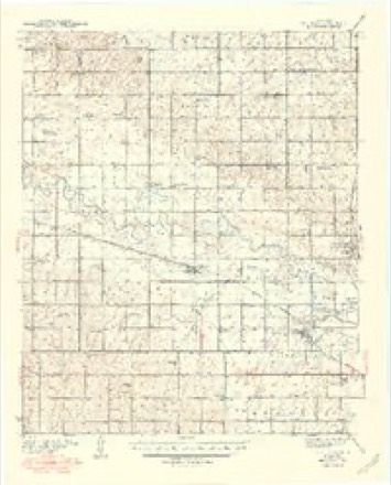
15 topographic sheets cover this place, the earliest surveyed in 1893 and the latest in 1985. It stands in the West Canadian census division. It lies in ZIP code area 73014. The Survey maps it on the Fort Reno quadrangle. 443 people lived here at the 2020 count. It stands 1,381 feet above sea level.
Population over time
2 figuresCalumet fell from 507 to 443 between 2010 and 2020. These are the recorded population figures Wikidata holds for this place, reached through the Geographic Names Information System number this page is keyed on rather than by name, so they belong to this place and not to another of the same name. Most are census counts, but not all are: an early figure may be a founding or settlement estimate, and an estimate published within five years of a census is left out. The change column is computed, and is left blank where more than 20 years separate a figure from the one before it, because a gap that long is not a change between two counts.
| Year | People | Change |
|---|---|---|
| 2010 | 507 | |
| 2020 | 443 | -64 (-13%) |
Topographic sheets covering this place
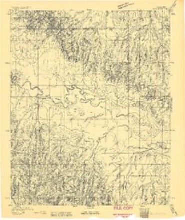
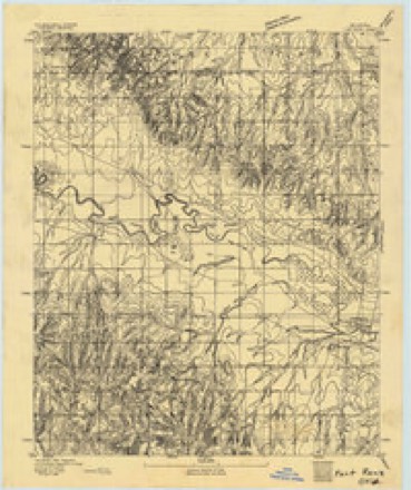
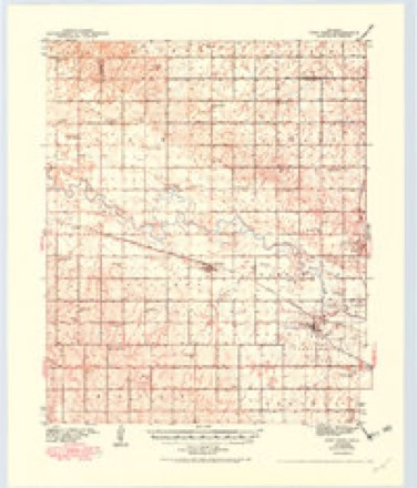
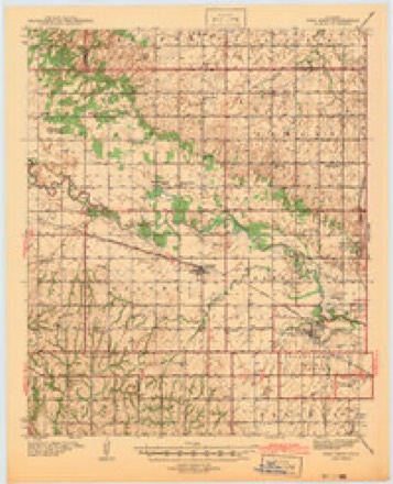
9 surveys from 15 printed sheetsMatched by testing this settlement's coordinate against the published boundary of every sheet in the United States Geological Survey's historical collection. Each opens the scanned sheet at the Survey.
- 1893 USGS Darlington quadrangle1:62500
- 1893 USGS Fort Reno quadrangle1:62500
- 1941 USGS Fort Reno quadrangle1:62500, 3 printings
- 1942 USGS Fort Reno quadrangle1:62500
- 1949 USGS Fort Reno quadrangle1:62500
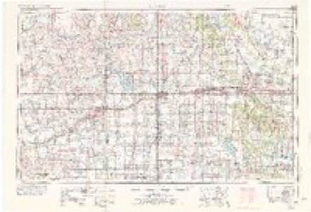
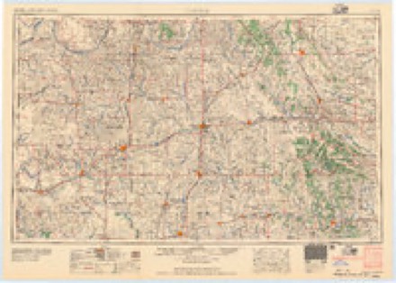
- 1955 USGS Clinton quadrangle1:250000, 3 printings
- 1957 USGS Clinton quadrangle1:250000
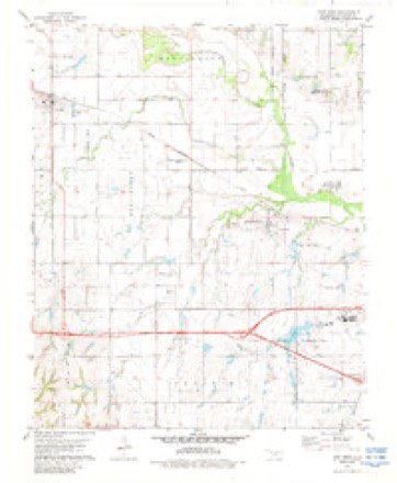
- 1979 USGS Fort Reno quadrangle1:24000, 2 printings
- 1985 USGS Watonga quadrangle1:100000, 2 printings
Fires near this place
5 since 2005Regional context, not property-specific evidence. The federal wildfire occurrence database lists 5 fires within 5 miles of Calumet between 2005 and 2017, burning about 332 acres in total. None started naturally. 1 was recorded as arson. Distance is straight-line from the map coordinates, so a fire counted here may appear on a neighbouring settlement's page as well.
| Reported cause | Fires |
|---|---|
| Debris and open burning | 1 |
| Equipment and vehicle use | 1 |
| Missing data/not specified/undetermined | 1 |
| Power generation/transmission/distribution | 1 |
| Arson/incendiarism | 1 |
The most recent of them, most recent first, with the day each was reported and the service that recorded it.
| Date | Cause | Size | Reported by | Name on the report |
|---|---|---|---|---|
| 6 September 2006 | Debris and open burning | 1.0 acres | Concho Field Office | TIRE |
| 18 August 2006 | Arson/incendiarism | 2.0 acres | Concho Field Office | BALE2 |
| 24 June 2011 | Equipment and vehicle use | 328 acres | Concho Field Office | RANCH RD |
| 14 June 2005 | Missing data/not specified/undetermined | 1.0 acres | Concho Field Office | MEADE |
| 25 December 2017 | Power generation/transmission/distribution | under an acre | Concho Field Office | EDMOND |
Settlements close enough to share some of these fires:
Mines and quarries near this place
2 within 5 milesRegional context, not property-specific evidence. The federal mineral resources record lists 2 workings within 5 miles of Calumet: 2 past producers. None of them still produces. What was taken out: Dolomite. Distance is straight-line from the map coordinates, so a quarry counted here may appear on a neighbouring settlement's page as well.
| Where | Site | Commodity | Status | Recorded |
|---|---|---|---|---|
| Unknown Dolomite Pit | Dolomite | Past Producer | ||
| Unknown Dolomite Pit | Dolomite | Past Producer |
Storms near this place
60 of 85 shownRegional context, not property-specific evidence. The National Weather Service names Calumet in 85 storm reports between 1994 and 2026: 52 hail, 20 thunderstorm wind, 11 tornado, 2 flash flood. The reports record 15 deaths and 138 injuries. Each account below is quoted exactly as the forecast office filed it, from the NOAA Storm Events Database, and each date opens the federal record of that event.
| When | Event | Place named | Harm | What the report says |
|---|---|---|---|---|
| May 2013 | Tornado (EF3) | Calumet | 8 killed, 26 hurt, $300,000 | On 31 May, an intense, long-track tornado formed southwest of El Reno. This exceptionally wide tornado took a complex path, rapidly changing in both speed and direction. The tornado spared El Reno and its airport from a direct hit, tracking just south of those locations. The tornado damaged numerous homes along with a few businesses near El Reno. Additionally, intense sub-vortices destroyed crops in numerous fields in the area.||The tornado developed at 6:03 p.m. just northeast of the intersection of Heaston and Reuter roads. Initially, the tornado moved to the southeast at 20 to 25 mph. At 6:09 p.m., the tornado turned to the east, just south of Reno Road between Heaston and Brandley roads. The tornado continued to expand in size just southwest of the El Reno Municipal Air Park, where its speed increased to 30 to 40 mph. As the tornado passed just south of the airport, two satellite tornadoes formed briefly on the west side of the tornado.||At 6:19 p.m. the tornado crossed Highway 81 near Reno Road as it continued to expand in size. There, the tornado abruptly turned to the north, while also accelerating to greater than 50 mph. From 6:24 to 6:26 p.m., the tornado reached its maximum in size and intensity near the intersection of Radio and Reuter roads. The tornado, still very large, slowed down as it approached I-40. From 6:27 to 6:35 the tornado made a loop just north of the interstate while decelerating to less than 10 mph. After 6:35, the tornado moved east once again, and dissipated at 6:42 p.m. near the intersection of I-40 and Banner Road.| |Eight people were killed in the tornado, all in vehicles. This included three severe storm researchers who were killed east of US-81 as the tornado overtook their position. Additionally, several other people were killed while attempting to escape the tornado near Highway 81. Finally, two people were killed along I-40 while waiting for the storm to pass.||The monetary damages were estimated. This tornado was well sampled by two separate mobile research radar teams the University of Oklahoma RaXPol radar, and the Center for Severe Weather Researchs Doppler on Wheels. Both radars captured high temporal and spatial resolution data relatively close to the large tornado. Both radars measured winds in the tornado of more than 200 mph. The RaXPol radar data shows winds of at least 295 mph very close to the surface. These intense winds were present in very small sub-vortices within the larger tornado circulation. An analysis of the high resolution radar data combined with the results of the ground damage survey indicates that none of these intense sub-vortices impacted any structures in rural Canadian County. So despite the measured wind speeds, surveyors could not find any damage that would support a rating higher than EF3 based solely on the damage indicators used with the EF scale. ||The maximum tornado width was 2.6 miles. However, the damaging wind swath was much larger, as non-tornadic downdraft winds extended for at least a mile south of the tornado. Given the difficulty of separating this damage from tornadic damage, the OU RaXPol radar was used to help determine the width. |
| May 2011 | Tornado (EF5) | Calumet | 7 killed, 112 hurt | This tornado is labeled Tornado B2 (Segment #1 of the Calumet-El Reno-Piedmont-Guthrie tornado). This tornado began very close to the Caddo/Canadian county border and quickly became a strong/violent tornado. The tornado destroyed numerous trees, many of them were debarked, before crossing Interstate 40. Three people died in vehicles near the I-40 Calumet exit, and two other fatalities occurred just northeast of that location. Cars were thrown thousands of feet off the roadways. It is believed that the tornado reached its maximum intensity just after crossing I-40, and it was here that a mobile radar measured winds of greater than 210 mph just off the surface. The El Reno Oklahoma Mesonet station (5 miles west) measured wind gusts of 131 and 151 mph. From this location, the tornado continued northeast, narrowly missing the town of Piedmont. Widespread EF-3, occasional EF-4 damage occurred between El Reno and Piedmont. More widespread EF-4 damage was seen west and north of Piedmont. Especially hard hit was the Falcon Lake neighborhood, near the Kingfisher county border. Two children were killed at this location. The tornado continued into southeastern Kingfisher County. Monetary damage estimates were not available at this time, but were probably going to be well in the tens of millions. |
| May 2004 | Tornado (F2) | Calumet | $1,000,000 | The tornado, 2.5 N of Geary in Blaine county, crossed into Canadian County at 1838 CST. Damage remained confined to the right side of the track of the circulation center. The tornado and the parent mesocyclone then turned to the NE, inflicting F1 and low-F2 damage to several rural homes northeast of Geary. Seven miles NE of Geary, the center turned back to the E at 1852, paralleling 220th Street (EW91 Road) for about 2 miles. It then turned to the NE at 1902 and eventually to the N by 1908. The tornado was wrapped in rain during its entire latter stages, and therefore was not visible. Doppler on Wheels (DOW) data indicate that the tornadic circulation crossed into Kingfisher County 11 miles west of Okarche.One farmstead, approximately 5-6 miles northeast of Geary, received heavy damage with the 100 year old farmhouse sustaining substantial damage and several outbuildings and barns destroyed. |
| July 2000 | Thunderstorm Wind | Calumet | $150,000 | A grain bin was destroyed at Calumet Industries. |
| April 2024 | Tornado (EF1) | Calumet | $100,000 | This tornado was first observed by storm chasers and spotters about 429 PM west of Calumet before it became wrapped in rain. A mobile home was damaged after the tornado crossed US-270 northwest of Calumet. Power poles were damaged along Ranch Road, and then buildings were damaged at an oil field near 192nd Street and Red Rock Road, including an RV that was destroyed and a trailer that was rolled. |
| May 2004 | Tornado (F1) | Calumet | $25,000 | This anti-cyclonic tornado formed from a new lowering that first developed WNW of Calumet. Unlike the earlier tornadoes, this one was not wrapped in rain and was documented visually by numerous spotters as well as the Doppler On Wheels (DOW). The tornadic circulation first formed at 1902 about 2 miles NNW of Calumet, based on DOW data, but spotters observed only a funnel cloud until debris was observed at 1904, 2 miles north of Calumet. The tornado tracked generally east near EW95 Road, with occasional jogs to the NE and SE. It ended 4-5 miles NE of Calumet at 1914 CST. This tornado was visible mainly as a debris cloud on the ground; the condensation funnel reached the ground only briefly at 1904 and again at 1910, otherwise it either remained aloft or was non-existent. The tornado had multiple vortices briefly.Two permanent homes received damage. One home towards the beginning of the tornado sustained minor roof damage with shingles blown off. Another home had an enclosure, that was built over the pool, destroyed. A nearby manufactured home also showed damage to its siding, roof, and windows. Damage was estimated at low end to middle F1. |
| May 2013 | Tornado (EF1) | Calumet | $20,000 | A tornado touched down briefly about 6 miles west of Calumet destroying a barn and damaging a house. Damage was estimated. |
| June 1998 | Thunderstorm Wind | Calumet | $15,000 | Severe thunderstorm winds (combined with golf ball sized hail) blew 3 windows out of homes and downed numerous trees, several billboards, and other signs. |
| July 2023 | Thunderstorm Wind | Calumet | $10,000 | Social media image showing solar panels blown off of the Cedar Lake Fire Department building. Time is radar estimated. |
| May 2017 | Tornado (EF0) | Calumet | $10,000 | A tornado touched down in the northwest corner of Canadian County, about 4.2 miles southeast of Greenfield. There was shingle and siding damage to a house, tin was blown off a barn and a power pole was broken near the beginning of the path just east of the Blaine-Canadian County line. Farther northeast, the damage path could be observed in a wheat field, a barn was damaged and an adjacent house had some roof damage. A center pivot irrigation system was overturned just before the tornado moved into Blaine County. |
| May 2004 | Tornado (F1) | Calumet | $10,000 | This tornado, also anti-cyclonic, formed about 1 mile NW of the previous tornado (4.5 ENE Calumet) shortly after the latter dissipated. It touched down intermittently as it moved ESE, lifting 4 miles NW of Concho at 1920 after forming a very brief, needle-like condensation funnel seen by spotters and caught on video by local media (KWTV Ch. 9). Damage was reported by spotters at a location 3 miles north and 4 miles east of Calumet. |
| May 1999 | Tornado (F1) | Calumet | $10,000 | Tornado E2 (Canadian County portion). See summary at end of May 3rd storm reports. |
| May 1998 | Thunderstorm Wind | Calumet | $6,000 | no account filed |
| June 2025 | Thunderstorm Wind | Calumet | $5,000 | Strong winds caused damage to a power pole and small outbuildings near US-270 and Chisholm Road. The time is estimated. |
| August 2017 | Thunderstorm Wind | Calumet | $5,000 | Sheet metal barn was damaged. |
| March 2015 | Thunderstorm Wind | Calumet | $5,000 | Several trees snapped or uprooted. |
| May 2013 | Tornado (EF0) | Calumet | $1,000 | Storm damage survey and Spotter Network reports confirmed a brief tornado in rural areas south of Calumet. Convergent wheat pattern and minor tree damage were noted. |
| October 2000 | Tornado (F0) | Calumet | $500 | This short-lived tornado was observed by an off-duty National Weather Service meteorologist near mile marker 117 on Interstate 40 in Canadian County. A motorhome was blown over, and a highway sign was ripped off its post, consistent with an F0 rating. |
| June 2003 | Thunderstorm Wind | Calumet | $50 | Several tree limbs were downed. |
| June 2024 | Hail | Calumet | - | MPing report. Based on radar evidence, hailfall likely occurred prior (2315-2325 LST) to report time. |
| May 2019 | Thunderstorm Wind | Calumet | - | Estimated gust. |
| May 2018 | Thunderstorm Wind | Calumet | - | No damage reported. |
| September 2018 | Flash Flood | Calumet | - | Flash flooding reported over Highway 270. |
| September 2018 | Flash Flood | Calumet | - | Significant water over the road at Cherokee trading post. |
| April 2017 | Thunderstorm Wind | Calumet | - | No damage reported. |
| April 2017 | Thunderstorm Wind | Calumet | - | No damage reported. |
| March 2015 | Hail | Calumet | - | No damage was reported. |
| June 2013 | Hail | Calumet | - | Hail lasted 10 to 15 minutes. |
| May 2012 | Hail | Calumet | - | No damage was reported. |
| August 2009 | Thunderstorm Wind | Calumet | - | A tractor trailer was blown over on eastbound Highway 281, three miles northwest of Interstate 40, off of exit 108. Significant tree damage was also reported at this location. Monetary damage estimates were not available. |
| May 2005 | Hail | Calumet | - | Hail was reported on Interstate 40. |
| March 1999 | Hail | Calumet | - | Hail was reported on east side of Calumet. |
| March 2026 | Hail | Calumet | - | no account filed |
| April 2023 | Hail | Calumet | - | no account filed |
| August 2019 | Hail | Calumet | - | no account filed |
| April 2017 | Hail | Calumet | - | no account filed |
| June 2013 | Hail | Calumet | - | no account filed |
| June 2013 | Hail | Calumet | - | no account filed |
| June 2013 | Hail | Calumet | - | no account filed |
| May 2013 | Hail | Calumet | - | no account filed |
| May 2013 | Hail | Calumet | - | no account filed |
| May 2013 | Hail | Calumet | - | no account filed |
| May 2013 | Hail | Calumet | - | no account filed |
| May 2012 | Hail | Calumet | - | no account filed |
| May 2012 | Hail | Calumet | - | no account filed |
| August 2011 | Hail | Calumet | - | no account filed |
| August 2011 | Hail | Calumet | - | no account filed |
| March 2004 | Hail | Calumet | - | no account filed |
| April 2004 | Hail | Calumet | - | no account filed |
| May 2004 | Hail | Calumet | - | no account filed |
| May 2004 | Hail | Calumet | - | no account filed |
| June 2004 | Hail | Calumet | - | no account filed |
| March 2003 | Hail | Calumet | - | no account filed |
| May 2003 | Hail | Calumet | - | no account filed |
| June 2003 | Thunderstorm Wind | Calumet | - | no account filed |
| June 2003 | Thunderstorm Wind | Calumet | - | no account filed |
| May 2003 | Hail | Calumet | - | no account filed |
| May 2002 | Hail | Calumet | - | no account filed |
| July 2002 | Hail | Calumet | - | no account filed |
| April 2001 | Thunderstorm Wind | Calumet | - | no account filed |
Nearest settlements
The eight closest, with where each one stands in the county. Distances are straight-line, computed from the Geographic Names Information System coordinates.
| Map | Place | Distance | Sheets |
|---|---|---|---|
| Cheyenne and Arapaho Agency (historical) | 5.6 miles | 15 | |
| Karns | 5.8 miles | 14 | |
| Concho | 6.7 miles | 13 | |
| El Reno | 9.9 miles | 13 | |
| Okarche | 11.4 miles | 12 | |
| Cedar Lake | 12.6 miles | 9 | |
| Niles | 13.6 miles | 10 | |
| Powers | 13.7 miles | 14 |
Elsewhere
Matched on this settlement's Geographic Names Information System number rather than its name, so it cannot be a different place of the same name in another state.
| Wikipedia article on Calumet | An encyclopaedic summary. Its text is share-alike, so it is linked here rather than copied. |
| Wikidata item Q2755878 | The structured record the population and elevation above come from. Public domain (CC0). |
Provenance
This settlement is recorded in the Geographic Names Information System as feature 1090810. The sheet list is computed by point-in-boundary test against the United States Geological Survey's historical topographic inventory. Both are works of the United States government and carry no copyright under 17 U.S.C. 105.
Wildfire. Short, Karen C. 2022. Spatial wildfire occurrence data for the United States, 1992-2020 [FPA_FOD_20221014]. 6th Edition. Fort Collins, CO: Forest Service Research Data Archive. https://doi.org/10.2737/RDS-2013-0009.6 Collected with United States Government funding and usable without additional permissions or fees.
Mines and quarries. USGS Mineral Resources Data System (MRDS) https://mrdata.usgs.gov/mrds/ A work of the United States government, no copyright under 17 U.S.C. 105.
Storms. NOAA National Centers for Environmental Information, Storm Events Database https://www.ncei.noaa.gov/stormevents/ A work of the United States government, no copyright under 17 U.S.C. 105. Narratives are quoted verbatim from the National Weather Service report and are not edited or summarised.