 Block
El Reno, Oklahoma
13 topographic sheets cover this place, the earliest surveyed in 1892 and the latest in 1990. It stands in the El Reno census division. It lies in ZIP code area 73036. The Survey maps it on the El Reno quadrangle. 16,989 people lived here at the 2020 count. It stands 1,358 feet above sea level.
Research this city
On record in El Reno
Buildings and businesses the archive holds for this place. Each opens its own page, with the source record it came from.
On the National Register 12 of 15 shown
 Avant's Cities Service Stationlisted 2004
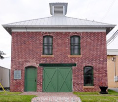 Canadian County Jaillisted 1985
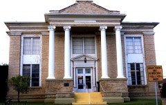 Carnegie Librarylisted 1980
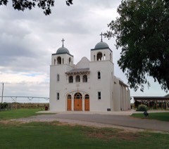 Darlington Agency Sitelisted 1973
 El Reno High Schoollisted 2000
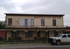 El Reno Hotellisted 1979
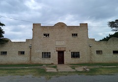 El Reno Municipal Swimming Pool Bath Houselisted 2000
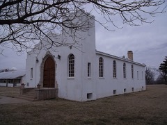 Fort Renolisted 1970
 William I. and Magdalen M. Goff Houselisted 1988
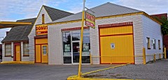 Jackson Conoco Service Stationlisted 2004
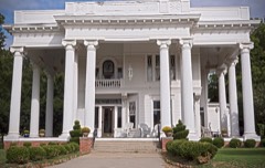 Henry Lassen Houselisted 2008
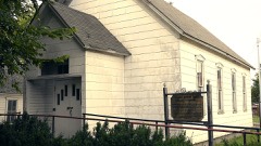 Mennoville Mennonite Churchlisted 1979
Every listing in Canadian County
Surveyed buildings and structures 1 record
- Fort Reno, 1.5 mile north of the intersection of I-40 W / US-66 W with E. 1020 Road, El Renofederal building survey, 1 photograph
Population over time
2 figuresEl Reno grew from 16,749 to 16,989 between 2010 and 2020. These are the recorded population figures Wikidata holds for this place, reached through the Geographic Names Information System number this page is keyed on rather than by name, so they belong to this place and not to another of the same name. Most are census counts, but not all are: an early figure may be a founding or settlement estimate, and an estimate published within five years of a census is left out. The change column is computed, and is left blank where more than 20 years separate a figure from the one before it, because a gap that long is not a change between two counts.
| Year | People | Change |
|---|---|---|
| 2010 | 16,749 | |
| 2020 | 16,989 | +240 (+1%) |
Topographic sheets covering this place
7 surveys from 13 printed sheetsMatched by testing this settlement's coordinate against the published boundary of every sheet in the United States Geological Survey's historical collection. Each opens the scanned sheet at the Survey.
- 1892 USGS Kingfisher quadrangle1:125000
- 1895 USGS Kingfisher quadrangle1:125000, 4 printings
- 1954 USGS Oklahoma City quadrangle1:250000
- 1957 USGS Oklahoma City quadrangle1:250000, 3 printings
- 1963 USGS Oklahoma City quadrangle1:250000
- 1972 USGS El Reno quadrangle1:24000, 2 printings
- 1990 USGS Oklahoma City North quadrangle1:100000
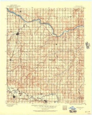
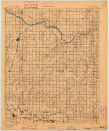
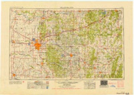
Photographs
5 photographs, 2020Taken for the Office of War Information and the Farm Security Administration, who photographed the country between 1935 and 1944. Works of United States government photographers, with no known restriction on use. Each opens its catalogue record.

Highsmith, Carol M, 2020. Library of Congress

Highsmith, Carol M, 2020. Library of Congress

Highsmith, Carol M, 2020. Library of Congress

Highsmith, Carol M, 2020. Library of Congress

Highsmith, Carol M, 2020. Library of Congress
Fires near this place
14 since 2005Regional context, not property-specific evidence. The federal wildfire occurrence database lists 14 fires within 5 miles of El Reno between 2005 and 2020, burning about 660 acres in total. None started naturally. None was recorded as arson. Distance is straight-line from the map coordinates, so a fire counted here may appear on a neighbouring settlement's page as well.
| Reported cause | Fires |
|---|---|
| Fireworks | 7 |
| Missing data/not specified/undetermined | 4 |
| Equipment and vehicle use | 2 |
| Debris and open burning | 1 |
The most recent of them, most recent first, with the day each was reported and the service that recorded it.
| Date | Cause | Size | Reported by | Name on the report |
|---|---|---|---|---|
| 6 August 2011 | Missing data/not specified/undetermined | 1.0 acres | Concho Field Office | BLACKJACK |
| 4 July 2020 | Missing data/not specified/undetermined | under an acre | Concho Field Office | BEAR ROBE |
| 4 July 2019 | Fireworks | 2.5 acres | Concho Field Office | HWY 81 |
| 4 July 2018 | Fireworks | under an acre | Concho Field Office | TWO START |
| 4 July 2013 | Fireworks | 10 acres | Concho Field Office | COMPASS |
| 4 July 2013 | Fireworks | 1.0 acres | Concho Field Office | BIG JOHNSON |
| 4 July 2012 | Fireworks | 5.0 acres | Concho Field Office | LOCO |
| 4 July 2008 | Fireworks | 1.5 acres | Concho Field Office | CONCHO COMPLEX |
Settlements close enough to share some of these fires:
Mines and quarries near this place
10 within 5 milesRegional context, not property-specific evidence. The federal mineral resources record lists 10 workings within 5 miles of El Reno: 10 past producers. None of them still produces. What was taken out: Sand and Gravel, Construction, Clay. Distance is straight-line from the map coordinates, so a quarry counted here may appear on a neighbouring settlement's page as well.
| Where | Site | Commodity | Status | Recorded |
|---|---|---|---|---|
| Unknown Sand Pit | Clay | Past Producer | ||
| Unknown Shale Pit | Clay | Past Producer | ||
| Unknown Sand Pit | Sand and Gravel, Construction | Past Producer | ||
| Unknown Sand and Gravel Pit | Sand and Gravel, Construction | Past Producer | ||
| Unknown Sand and Gravel Pit | Sand and Gravel, Construction | Past Producer | ||
| Unknown Sand and Gravel Pit | Sand and Gravel, Construction | Past Producer | ||
| Unknown Sand and Gravel Pit | Sand and Gravel, Construction | Past Producer | ||
| Unknown Sand and Gravel Pit | Sand and Gravel, Construction | Past Producer | ||
| Unknown Sand and Gravel Pit | Sand and Gravel, Construction | Past Producer | ||
| Unknown Sand and Gravel Pit | Sand and Gravel, Construction | Past Producer |
Storms near this place
60 of 134 shownRegional context, not property-specific evidence. The National Weather Service names El Reno in 134 storm reports between 1993 and 2024: 60 thunderstorm wind, 52 hail, 11 tornado, 7 flash flood. The reports record 3 deaths and 29 injuries. Each account below is quoted exactly as the forecast office filed it, from the NOAA Storm Events Database, and each date opens the federal record of that event.
| When | Event | Place named | Harm | What the report says |
|---|---|---|---|---|
| May 2019 | Tornado (EF3) | El Reno | 2 killed, 29 hurt, $400,000 | An intense QLCS tornado developed south of El Reno, just south of Interstate 40 and about a mile west of US-81. Initially the tornado affected rural areas, but as it moved east-northeast, it moved through the northwestern portion of an automobile dealership at the northwest corner of Interstate 40 and US-81. There it overturned or displaced a number of vehicles and removed the roof and collapsed many exterior walls of an automobile service building.||Immediately northeast of the automobile dealership, the tornado moved through the southeastern portion of a mobile home park destroying many mobile homes. Although the tornado was relatively narrow, the destruction of mobile homes was complete in the path while mobile homes just a couple of blocks away suffered minimal damage. Two residents of one mobile home were killed when their home was destroyed.||Just to the northeast of the mobile home park, the tornado hit a two-story motel. Most walls of the second story were collapsed in the portion of the motel that was in the most intense part of the tornado path and the tornado was rated EF3 at this motel. ||Crossing US-81, the tornado significantly damaged another automotive service building and produced significant roof damage to a home on SE 27th Street. The tornado weakened as it moved east-northeast along and just north of SE 27th Street damaging trees before dissipating near Alfadale Road. |
| March 2017 | Thunderstorm Wind | El Reno | 1 killed | A man was driving a tractor trailer eastbound on I-40 near mile marker 126 when his truck was hit by severe winds associated with a bow echo. The vehicle veered into the median, where it struck the cable barrier and overturned. The driver was not wearing a seat belt, was partially ejected from the vehicle and died on the scene. |
| May 2007 | Tornado (EF1) | El Reno | $3,000,000 | A tornado developed and moved north through parts of El Reno. The first damage occurred in a complex of industrial/commercial buildings is located on the southwest corner of I-40 and Hwy 81. One building suffered minor roof damage with the roofing peeled away. Another metal building had partial peeling of the side paneling, a large garage door blown in and the businesss dumpster was rolled 100 ft to the west. An outbuilding supply business had its several garage doors blown in and a display outbuilding collapsed and was moved. Some trees in the area were damaged and the damage varied over a wide range. Trees closer to the interstate had large branches and trunks snapped, while trees closer to Hwy 81 were either tipped or limbs up to 6 were snapped. Farther to the west, a building that was under construction had some building material blown to the north northeast towards the area of apparent touchdown. Two businesses just south southwest of the touchdown point also had damage to their garage doors.||Directly across I-40 from the touchdown point was a car dealership. The main building at the dealership had minimal damage and most vehicles in the lot had no damage. One light pole was knocked over and a large sign for the dealership was damaged. A double wide mobile home, which was used as an office at the dealership, was knocked over on its side. Several cars towards the extreme northwest corner of the lot exhibited damage though the original locations of the vehicles are in question. Billboards around the lot were either destroyed or folded over. Farther to the northwest a farm house with outbuildings sustained damage. Most damage appeared to be suffered by the outbuildings. The damage appeared minor with roof and side panels peeled, though one of the buildings sustained some damage to its structure. The tornado then entered into an industrial area. A building west of the farm house sustained damage to its office area and a section of side paneling was peeled. Roofing from the Oklahoma Gas and Electric building, which was across the street, also impacted the northeast corner of the building with enough force to cause a significant dent in the panel. A flag pole at this building was also bent about 50 degrees. The building seemed to have sustained the most damage in the area. It appeared most of the roof was gone, a tree was snapped in two and the power lines were snapped in two. Further, the roof of the small office area appeared to have been partially lifted. A pole near the building also appears to have bent a bit. Other buildings near the building had other damage to siding and roofs.||Along Hwy 81, north of Oklahoma Gas and Electric, several buildings in the industrial/commercial area sustained damage. A convenience store had its windows blown out, a garage door blown out, and a portion of the roof was removed. Metal framed buildings to the west of this area failed at the ends of the buildings but the center portions of the framing remained intact. One structure in particular lost most of its roof and it is believed that this roof actually scraped along and removed the roof to a small strip mall. A metal building to the north of this strip mall had a garage door blown in and two panels were pushed in towards the bottom of the panel on its south side. On the north side the building had 3 garage doors blown in and the northeast corner sustained side panel damage. Across Hwy 81, a snow cone hut was spun about 270 degrees and a metal lining peeled off. Two metal light poles near the hut were damaged; one was bent and another was snapped off its base. To the north of this area a building sustained damage to its roof. People were present inside the building when it was struck but no one was injured. Three power poles, one towards the highway and two near the building were snapped. A storage shed on the north side of the building's parking lot had a garage door blown in; also, plastic skylights were blown out to locations unknown. Power poles just to the north along a side road were blown over and one was snapped. West of this location was a farm supply store which had grain bins blown over and some into a nearby pond. North of the store was a cluster of trees which had a variety of damage. The final damage points were along Choctaw Rd. At the corner of Choctaw and Elm, a metal building had its roof rotated on top it and a power pole near it was snapped. The neighborhood west of Choctaw Rd had some tree and power pole damage. Also the neighborhood northeast of Hwy 81 and Elm sustained probable microburst damage. Monetary damages were estimated. |
| April 2006 | Tornado (F1) | El Reno | $1,500,000 | This unusual anti-cyclonic tornado touched down 5.1 miles southwest of El Reno while another cyclonic tornado (see tornado entry that began at 1823 CST) was still moving across part of the area west of El Reno. These two tornadoes were observed, by numerous storm chasers and 3 media helicopters, moving across the area simultaneously for several minutes before the initial tornado dissipated while the anti-cyclonic tornado continued. The anti-cyclonic tornado moved quickly to the east-southeast. The most significant tornado damage that occurred on April 24 was by the second tornado when it moved through the El Reno Regional Airport (KRQO) which is located southwest of town. A storm survey of the airport showed that the damage was confined to two large hanger buildings, one of which was brand new, that were constructed mainly from tin, sheet metal panel walls on rigid metal frame. The damage was confined to only the metal panel walls and metal seam roof, with no observed damage to the rigid metal frame. Some interior "walls" were damaged, but these were not part of the rigid load-bearing construction, and hanging from the rigid frame and not anchored to the foundation. Ten aircraft, some of which were vintage planes, were also damaged inside the hangars, with 5 planes declared a complete loss. In addition to the numerous videos, there was also some evidence of anti-cyclonic swirls in sprayed aircraft oil. The two structures were estimated at about $1 million. The damage to the airplanes were estimated from $35,000-$225,000 each for an estimated total loss of $500,000 to aircraft at the airport. The total damage to the El Reno Regional Airport was approximately $1.5 million. |
| April 2000 | Thunderstorm Wind | El Reno | $350,000 | A 90 by 120 foot section of the northwest corner of a hospital roof was blown off with debris breaking numerous windows below. Nearly 4 inches of rain covered many rooms of the hospital damaging floors, walls, and medical equipment. |
| May 1999 | Tornado (F2) | El Reno | $125,000 | Tornado G2 (Canadian County portion). See summary at end of May 3rd storm reports. |
| August 2007 | Flash Flood | El Reno | $100,000 | HWY 81 was closed near I-40 due to high water, with a car and semi both stranded due to high water. Other roads that were closed included SW 27th between Miles and South Lawn Drive, and Skyview Drive south of Curtis Street. Numerous homes sustained at least minor damage, and the Russell-Murray Hospice sustained severe damage. Monetary damages were estimated. |
| June 1998 | Thunderstorm Wind | El Reno | $50,000 | Severe thunderstorm winds snapped and uprooted trees and large limbs, damaging homes, businesses, and cars. |
| February 2000 | Thunderstorm Wind | El Reno | $35,000 | A trailer 14 feet wide and 56 feet long and a boat out of the water were blown over. |
| June 2003 | Lightning | El Reno | $25,000 | Lightning caused damage to one of the city's oldest buildings, the Masonic Temple. |
| May 2001 | Thunderstorm Wind | El Reno | $25,000 | Numerous homes sustained shingle damage on the north-facing edges. |
| May 1999 | Tornado (F0) | El Reno | $25,000 | Tornado G1. See summary at end of May 3rd storm reports. |
| August 2017 | Thunderstorm Wind | El Reno | $10,000 | Tractor trailer overturned on I-40 near mile marker 118. |
| June 2000 | Lightning | El Reno | $10,000 | A lightning strike resulted in damage to various equipment at the El Reno Police Department. |
| August 2007 | Thunderstorm Wind | El Reno | $8,000 | Several power poles were blown down on I-40 near Country Club Road. Monetary damages were estimated. |
| August 2022 | Thunderstorm Wind | El Reno | $5,000 | Roof damage to El Reno VFW. Time estimated. |
| May 2019 | Flash Flood | El Reno | $5,000 | Railroad track foundation was washed away. Time estimated. |
| June 2018 | Thunderstorm Wind | El Reno | $5,000 | Multiple semi-trucks were blown over on I-40 west of El Reno. |
| April 2008 | Flash Flood | El Reno | $5,000 | The intersection of state highways 4 and 66 had to be closed due to high water. Other roads around the county were also closed due to high water running over top of them. No damages were reported. |
| September 1993 | Thunderstorm Wind | El Reno | $5,000 | no account filed |
| July 2000 | Thunderstorm Wind | El Reno | $2,500 | Trees were downed in the 300 block of South Robert Avenue, and a sign was damaged at Mazzio's Pizza on Country Club Road. |
| July 2002 | Thunderstorm Wind | El Reno | $1,500 | Three power poles were blown down. |
| April 2006 | Tornado (F1) | El Reno | $1,000 | A cyclonic tornado touched down 5.5 miles west of El Reno mainly moving east-northeast on the evening of April 24. This tornado and an anti-cyclonic tornado that began a few minutes later (see tornado entry that began at 1830 CST) were on the ground simultaneously for several minutes. The first tornado traveled slowly, and mainly through open farm land. However, damage was found, during a storm survey, to a small grove of trees just southwest of the intersection of Elm Road and Chiles Road that occurred around 1830 CST. This was the only damage found, other than a possible path through the vegetation (grass/wheat) just to the west of the trees about 1/2 mile west of the road. A local farmer stated that the tornado also passed through some freshly dug up soil, just south of the Brad Baker household, just south of Interstate 40. This caused a slight jog to the south in the path before the tornado finally dissipated. Storm chasers stated that the main condensation funnel appeared to dissipate around 1832 CST, but a "dental floss" rope was seen as late as 1838 CST. |
| April 2007 | Thunderstorm Wind | El Reno | $200 | A large tree was blown down due to high winds. The tree fell on top of basketball court, damaging one hoop. |
| September 2001 | Thunderstorm Wind | El Reno | $10 | Six-inch diameter limbs from a sycamore tree were downed. |
| April 2024 | Hail | El Reno | - | MPing report. |
| May 2024 | Hail | El Reno | - | MPing report. Time is radar estimated. |
| May 2024 | Thunderstorm Wind | El Reno | - | El Reno (ELRE) Mesonet observation. |
| May 2024 | Hail | El Reno | - | MPing report. |
| August 2024 | Thunderstorm Wind | El Reno | - | El Reno (ELRE) Mesonet observation. |
| June 2023 | Thunderstorm Wind | El Reno | - | El Reno Regional Airport (KRQO) observation. |
| July 2023 | Hail | El Reno | - | MPing report. |
| April 2022 | Thunderstorm Wind | El Reno | - | Truck blow over along I-40. |
| July 2022 | Thunderstorm Wind | El Reno | - | Damage reported to a building outside of El Reno. |
| July 2020 | Thunderstorm Wind | El Reno | - | Estimated severe wind gust. |
| September 2020 | Flash Flood | El Reno | - | Water over several roadways. Vehicles reported stranded. |
| March 2015 | Hail | El Reno | - | Reported at intersection of interstate 40 and route 81. |
| May 2013 | Tornado (EF0) | El Reno | - | A tornado was reported from Spotter Network where a strong radar signal from terminal doppler TOKC was also located. And damage from this tornado would have been indiscernible as this tornado occurred within the damage path of the earlier El Reno EF5 tornado. |
| May 2013 | Tornado (EF0) | El Reno | - | The second of two satellite tornadoes that was observed rotating around the primary El Reno tornado by storm chasers and the RaXPol mobile research radar. |
| May 2013 | Hail | El Reno | - | Very large hail fell in El Reno as the large tornado developed to the south. Photos submitted to a local television station showed hail may have measured as large as 6.3 in diameter. Unfortunately, no official measurements were taken, so the 6 diameter hail near Gotebo, OK on May 23, 2011 remains the record largest hailstone officially documented in Oklahoma. |
| September 2012 | Hail | El Reno | - | Emergency management reported 1 hail on the west side of El Reno. |
| July 2011 | Thunderstorm Wind | El Reno | - | The wind gust was measured at the El Reno Regional Airport - KRQO. |
| May 2011 | Thunderstorm Wind | El Reno | - | The highest wind gust ever recorded at an Oklahoma Mesonet site was measured near El Reno, as an EF-5 tornado tore a path through Canadian county. The wind speed increased from 61 mph at 1618 CDT, to 66 mph at 1619 CDT, to 131 mph at 1620 CDT, to 151 at 1621 CDT, and then to 91 mph at 1622 CDT. The tornado caused considerable damage to the area surrounding the Mesonet as it moved northeast. |
| July 2010 | Thunderstorm Wind | El Reno | - | Minor damage was reported to a nursing home in El Reno. Monetary damage estimates were not available. |
| August 2007 | Heavy Rain | El Reno | - | A total of 8.45 inches of rainfall was recorded over a 24-hour period ending on the 19th. |
| June 2007 | Flash Flood | El Reno | - | Numerous city and county roads were closed due to high water. Hub Reed Complex was also flooded. |
| June 2006 | Thunderstorm Wind | El Reno | - | Wind gust was measured by the Oklahoma mesonet. |
| June 2005 | Thunderstorm Wind | El Reno | - | Wind gust was reported on the west side of town by KWTV Channel 9 in Oklahoma City. |
| June 2005 | Hail | El Reno | - | Hail was reported by KWTV Channel 9 in Oklahoma City. |
| April 2004 | Hail | El Reno | - | Hail was reported falling near the intersection of Highway 66 and Highway 81. |
| March 2004 | Thunderstorm Wind | El Reno | - | Wind was estimated at the intersection of Highway 66 and 81. |
| May 2002 | Thunderstorm Wind | El Reno | - | Wind was measured by the Oklahoma mesonet. |
| June 2002 | Thunderstorm Wind | El Reno | - | Wind was measured by the Oklahoma mesonet. |
| July 2002 | Thunderstorm Wind | El Reno | - | Wind was measured by the Oklahoma mesonet. |
| May 2001 | Thunderstorm Wind | El Reno | - | Wind was measured by Oklahoma mesonet. |
| May 2001 | Thunderstorm Wind | El Reno | - | Wind was measured by Oklahoma mesonet. |
| April 2000 | Thunderstorm Wind | El Reno | - | Wind gust was measured by the Oklahoma mesonet. |
| April 2000 | Flash Flood | El Reno | - | A bridge on Banner Road was flooded. |
| July 2000 | Thunderstorm Wind | El Reno | - | Wind was measured by the Oklahoma mesonet. |
| July 2000 | Thunderstorm Wind | El Reno | - | Wind was measured by the Oklahoma mesonet. |
Nearest settlements
The eight closest, with where each one stands in the county. Distances are straight-line, computed from the Geographic Names Information System coordinates.
| Map | Place | Distance | Sheets |
|---|---|---|---|
| Cheyenne and Arapaho Agency (historical) | 4.4 miles | 15 | |
| Powers | 5.7 miles | 14 | |
| Banner | 5.8 miles | 13 | |
| Concho | 6.1 miles | 13 | |
| Richland | 8.6 miles | 13 | |
| Union City | 9.7 miles | 14 | |
| Calumet | 9.9 miles | 15 | |
| Yukon | 10.4 miles | 13 |
Elsewhere
Matched on this settlement's Geographic Names Information System number rather than its name, so it cannot be a different place of the same name in another state.
| Wikipedia article on El Reno | An encyclopaedic summary. Its text is share-alike, so it is linked here rather than copied. |
| Wikidata item Q1017220 | The structured record the population and elevation above come from. Public domain (CC0). |
Provenance
This settlement is recorded in the Geographic Names Information System as feature 1092512. The sheet list is computed by point-in-boundary test against the United States Geological Survey's historical topographic inventory. Both are works of the United States government and carry no copyright under 17 U.S.C. 105.
Wildfire. Short, Karen C. 2022. Spatial wildfire occurrence data for the United States, 1992-2020 [FPA_FOD_20221014]. 6th Edition. Fort Collins, CO: Forest Service Research Data Archive. https://doi.org/10.2737/RDS-2013-0009.6 Collected with United States Government funding and usable without additional permissions or fees.
Mines and quarries. USGS Mineral Resources Data System (MRDS) https://mrdata.usgs.gov/mrds/ A work of the United States government, no copyright under 17 U.S.C. 105.
Storms. NOAA National Centers for Environmental Information, Storm Events Database https://www.ncei.noaa.gov/stormevents/ A work of the United States government, no copyright under 17 U.S.C. 105. Narratives are quoted verbatim from the National Weather Service report and are not edited or summarised.