 Block
Chickasha, Oklahoma
13 topographic sheets cover this place, the earliest surveyed in 1904 and the latest in 1985. It stands in the Chickasha census division. It lies in ZIP code area 73018. It stands on Rock Hollow Creek. The Survey maps it on the Chickasha quadrangle. 16,051 people lived here at the 2020 count. It stands 1,093 feet above sea level.
Research this city
On record in Chickasha
Buildings and businesses the archive holds for this place. Each opens its own page, with the source record it came from.
On the National Register 8 records
 Grady County Courthouselisted 2005
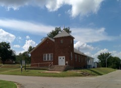 New Hope Baptist Churchlisted 2003
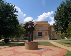 Oklahoma College for Women Historic Districtlisted 2001
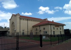 Rock Island Depotlisted 1985
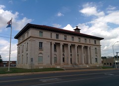 US Post Office and Federal Courthouselisted 1994
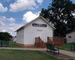 Verden Separate Schoollisted 2005
- Chickasha Downtown Historic Districtlisted 2005
- Griffin Houselisted 2014
Population over time
2 figuresChickasha grew from 16,036 to 16,051 between 2010 and 2020. These are the recorded population figures Wikidata holds for this place, reached through the Geographic Names Information System number this page is keyed on rather than by name, so they belong to this place and not to another of the same name. Most are census counts, but not all are: an early figure may be a founding or settlement estimate, and an estimate published within five years of a census is left out. The change column is computed, and is left blank where more than 20 years separate a figure from the one before it, because a gap that long is not a change between two counts.
| Year | People | Change |
|---|---|---|
| 2010 | 16,036 | |
| 2020 | 16,051 | +15 (+0%) |
Topographic sheets covering this place
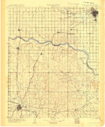
6 surveys from 13 printed sheetsMatched by testing this settlement's coordinate against the published boundary of every sheet in the United States Geological Survey's historical collection. Each opens the scanned sheet at the Survey.
- 1904 USGS Chickasha quadrangle1:125000, 4 printings
- 1954 USGS Oklahoma City quadrangle1:250000
- 1957 USGS Oklahoma City quadrangle1:250000, 3 printings
- 1963 USGS Oklahoma City quadrangle1:250000
- 1966 USGS Chickasha quadrangle1:24000, 2 printings
- 1985 USGS Oklahoma City South quadrangle1:100000, 2 printings
Photographs
3 photographs, 2020Taken for the Office of War Information and the Farm Security Administration, who photographed the country between 1935 and 1944. Works of United States government photographers, with no known restriction on use. Each opens its catalogue record.
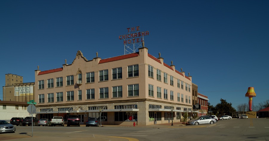
Highsmith, Carol M, 2020. Library of Congress
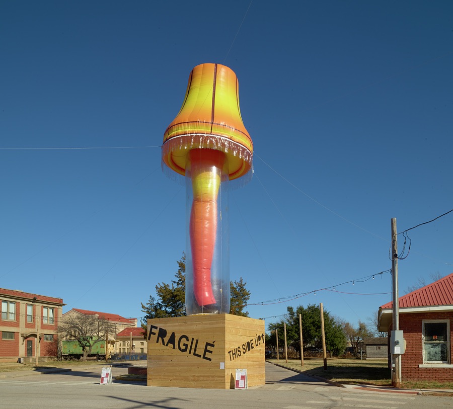
Highsmith, Carol M, 2020. Library of Congress
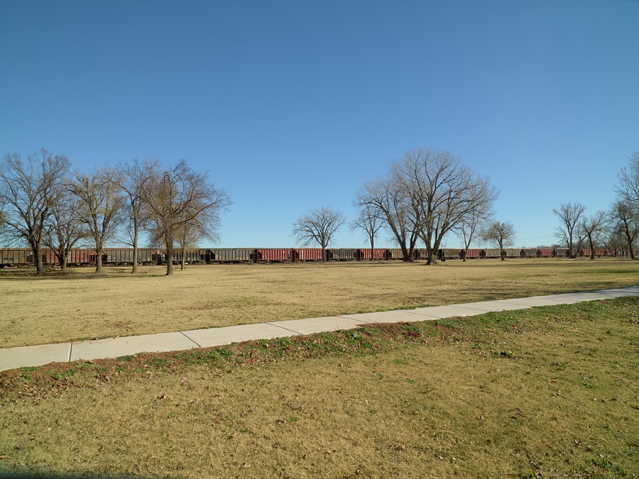
Highsmith, Carol M, 2020. Library of Congress
Fires near this place
3 since 2005Regional context, not property-specific evidence. The federal wildfire occurrence database lists 3 fires within 5 miles of Chickasha between 2005 and 2008, burning about 219 acres in total. None started naturally. 2 were recorded as arson. Distance is straight-line from the map coordinates, so a fire counted here may appear on a neighbouring settlement's page as well.
| Reported cause | Fires |
|---|---|
| Arson/incendiarism | 2 |
| Equipment and vehicle use | 1 |
The most recent of them, most recent first, with the day each was reported and the service that recorded it.
| Date | Cause | Size | Reported by | Name on the report |
|---|---|---|---|---|
| 3 August 2005 | Equipment and vehicle use | 213 acres | Anadarko Agency | SPANKY |
| 30 October 2008 | Arson/incendiarism | 1.0 acres | Anadarko Agency | KEEHKO |
| 26 January 2008 | Arson/incendiarism | 5.0 acres | Chickasaw Agency | FINALLY |
Settlements close enough to share some of these fires:
Mines and quarries near this place
10 of 11 shownRegional context, not property-specific evidence. The federal mineral resources record lists 11 workings within 5 miles of Chickasha: 11 past producers. None of them still produces. What was taken out: Sand and Gravel, Construction, Clay. Distance is straight-line from the map coordinates, so a quarry counted here may appear on a neighbouring settlement's page as well.
| Where | Site | Commodity | Status | Recorded |
|---|---|---|---|---|
| Unknown Shale Pit | Clay | Past Producer | ||
| Unknown Gravel Pit | Sand and Gravel, Construction | Past Producer | ||
| Unknown Gravel Pit | Sand and Gravel, Construction | Past Producer | ||
| Unknown Gravel Pit | Sand and Gravel, Construction | Past Producer | ||
| Unknown Gravel Pit | Sand and Gravel, Construction | Past Producer | ||
| Unknown Gravel Pit | Sand and Gravel, Construction | Past Producer | ||
| Unknown Gravel Pit | Sand and Gravel, Construction | Past Producer | ||
| Unknown Gravel Pit | Sand and Gravel, Construction | Past Producer | ||
| Unknown Gravel Pit | Sand and Gravel, Construction | Past Producer | ||
| Unknown Gravel Pit | Sand and Gravel, Construction | Past Producer |
Storms near this place
60 of 71 shownRegional context, not property-specific evidence. The National Weather Service names Chickasha in 71 storm reports between 1993 and 2007: 36 hail, 27 thunderstorm wind, 4 flash flood, 3 tornado. The reports record 16 injuries. Each account below is quoted exactly as the forecast office filed it, from the NOAA Storm Events Database, and each date opens the federal record of that event.
| When | Event | Place named | Harm | What the report says |
|---|---|---|---|---|
| May 1993 | Thunderstorm Wind | Chickasha | 12 hurt, $50,000 | no account filed |
| May 1999 | Tornado (F2) | Chickasha | 4 hurt, $500,000 | Tornado A8. See summary at end of May 3rd storm reports. |
| August 2007 | Flash Flood | Chickasha | $1,000,000 | The Chickasha PD received major damage due to flooding, including the phone system, the communication system, data system, and the heating and air conditioning systems. Several businesses sustained damage. The River Bend Golf course received significant damage, including several greens destroyed and part of a golf cart path ripped up. It was reported that new flooring would be required at the Chickasha YMCA due to flooding in almost every room, as well as significant damage to the roof. The Grady County Courthouse received some minor flood damage. Performance Plus also received significant damage. HWY 37 was closed due to several feet of water covering the roadway one mile west of Tuttle. Also in Tuttle, the bridge used by the Stillwater Central Railroad received some damage and became impassable. In Minco, the Buggy Creek Bridge had to be closed due to water running over the top of it. Monetary damages were estimated. |
| June 2005 | Thunderstorm Wind | Chickasha | $350,000 | Extensive damage occurred in the River Bend Housing addition. A damage area one to two miles long (north to south) and two to three miles wide (east to west) was reported. Seventeen homes in the addition were damaged. One home that was partially built was completely destroyed. Another 5 homes sustained major damage, with half of the roof of one home completely ripped off. Eleven homes sustained minor damage mainly consisting of shingle damage, damage to garage doors, and windows broken. The Friends School Cafeteria nearby also sustained major roof damage. Widespread tree damage was also reported in the area. |
| March 1998 | Thunderstorm Wind | Chickasha | $150,000 | Severe thunderstorm winds blew out numerous windows, downed large trees, and destroyed several signs and awnings in the downtown business district. Utility poles were downed, damaging and cutting the power to the city's water treatment facility. Nearby a carport was lifted and blown onto a mobile home and a storage shed was blown away. Just south of town a mobile home was overturned by the severe thunderstorm winds. |
| July 1996 | Thunderstorm Wind | Chickasha | $100,000 | no account filed |
| July 1996 | Thunderstorm Wind | Chickasha | $71,500 | no account filed |
| July 2007 | Thunderstorm Wind | Chickasha | $60,000 | Twenty trees were blown down. Several power poles and lines were downed. The new scoreboard at Memorial Stadium was blown over as well. Monetary damages were estimated. |
| August 1997 | Thunderstorm Wind | Chickasha | $50,000 | Severe thunderstorm winds blew 2/3 of the roof off a convenience store, flipped a travel trailer onto a car, lifted another trailer and blew it onto a fence, and blew the roofs off several barns. |
| June 2005 | Thunderstorm Wind | Chickasha | $30,000 | Power poles were downed from mile marker 83 to 89 on Interstate 44. The interstate was closed from 0130 to 0315 CDT. Near mile marker 85, big tree limbs were downed. A small water tower and outbuildings were also blown over on the south side of the interstate near mile marker 90. |
| July 2000 | Thunderstorm Wind | Chickasha | $20,000 | A tree was blown over onto a house and van, and power lines were downed. |
| May 2007 | Thunderstorm Wind | Chickasha | $8,000 | Several large trees were blown over. |
| November 1998 | Thunderstorm Wind | Chickasha | $6,000 | no account filed |
| August 1999 | Thunderstorm Wind | Chickasha | $2,000 | no account filed |
| April 1996 | Thunderstorm Wind | Chickasha | $2,000 | no account filed |
| August 2004 | Thunderstorm Wind | Chickasha | $1,000 | Trees approximately 12 inches in diameter were blown down in the north central portion of town. |
| April 1998 | Thunderstorm Wind | Chickasha | $500 | Severe thunderstorm winds downed a power pole on Highway 277 near Chickasha. |
| June 2007 | Flash Flood | Chickasha | - | US HWY 81 was closed between Almar Drive and Country Club Road due to very heavy rainfall. |
| June 2005 | Thunderstorm Wind | Chickasha | - | Wind was measured by the Oklahoma mesonet. |
| September 2005 | Hail | Chickasha | - | Hail was reported on Highway 92. |
| May 2004 | Hail | Chickasha | - | Hail was observed on Highway 81. |
| May 2001 | Tornado (F0) | Chickasha | - | This tornado was observed by two storm chasers and described as forming in a field with a full condensation funnel extending to the ground. |
| April 2000 | Flash Flood | Chickasha | - | Several streets and county roads were flooded. |
| October 2000 | Flash Flood | Chickasha | - | Numerous streets in downtown were closed due to high water. |
| May 1999 | Tornado (F0) | Chickasha | - | Tornado A7. See summary at end of May 3rd storm reports. |
| June 2007 | Thunderstorm Wind | Chickasha | - | no account filed |
| June 2007 | Hail | Chickasha | - | no account filed |
| June 2007 | Heavy Rain | Chickasha | - | no account filed |
| June 2007 | Thunderstorm Wind | Chickasha | - | no account filed |
| May 2007 | Thunderstorm Wind | Chickasha | - | no account filed |
| July 2007 | Thunderstorm Wind | Chickasha | - | no account filed |
| June 2006 | Hail | Chickasha | - | no account filed |
| June 2005 | Hail | Chickasha | - | no account filed |
| June 2005 | Hail | Chickasha | - | no account filed |
| April 2004 | Hail | Chickasha | - | no account filed |
| April 2004 | Hail | Chickasha | - | no account filed |
| April 2004 | Hail | Chickasha | - | no account filed |
| April 2004 | Hail | Chickasha | - | no account filed |
| March 2003 | Hail | Chickasha | - | no account filed |
| May 2003 | Hail | Chickasha | - | no account filed |
| May 2003 | Hail | Chickasha | - | no account filed |
| May 2002 | Thunderstorm Wind | Chickasha | - | no account filed |
| August 2002 | Thunderstorm Wind | Chickasha | - | no account filed |
| September 2001 | Hail | Chickasha | - | no account filed |
| October 2001 | Hail | Chickasha | - | no account filed |
| March 2000 | Hail | Chickasha | - | no account filed |
| April 2000 | Hail | Chickasha | - | no account filed |
| April 1999 | Hail | Chickasha | - | no account filed |
| December 1999 | Hail | Chickasha | - | no account filed |
| December 1999 | Hail | Chickasha | - | no account filed |
| May 1999 | Hail | Chickasha | - | no account filed |
| November 1998 | Thunderstorm Wind | Chickasha | - | no account filed |
| October 1998 | Hail | Chickasha | - | no account filed |
| April 1998 | Hail | Chickasha | - | no account filed |
| March 1998 | Thunderstorm Wind | Chickasha | - | no account filed |
| March 1998 | Hail | Chickasha | - | no account filed |
| June 1998 | Hail | Chickasha | - | no account filed |
| June 1998 | Hail | Chickasha | - | no account filed |
| June 1996 | Hail | Chickasha | - | no account filed |
| May 1996 | Hail | Chickasha | - | no account filed |
Newspapers printed here
6,324 digitised pages1 paper published in this town, digitised by the Library of Congress and free to read: 6,324 issues, 6,324 pages. Every page is searchable, so a name or a street can be looked for directly in what the town printed about itself at the time.
| Newspaper | Published |
|---|---|
| The Chickasha Daily Express | 1899 to Current |
Nearest settlements
The eight closest, with where each one stands in the county. Distances are straight-line, computed from the Geographic Names Information System coordinates.
Elsewhere
Matched on this settlement's Geographic Names Information System number rather than its name, so it cannot be a different place of the same name in another state.
| Wikipedia article on Chickasha | An encyclopaedic summary. Its text is share-alike, so it is linked here rather than copied. |
| Wikidata item Q2794790 | The structured record the population and elevation above come from. Public domain (CC0). |
Provenance
This settlement is recorded in the Geographic Names Information System as feature 1091277. The sheet list is computed by point-in-boundary test against the United States Geological Survey's historical topographic inventory. Both are works of the United States government and carry no copyright under 17 U.S.C. 105.
Wildfire. Short, Karen C. 2022. Spatial wildfire occurrence data for the United States, 1992-2020 [FPA_FOD_20221014]. 6th Edition. Fort Collins, CO: Forest Service Research Data Archive. https://doi.org/10.2737/RDS-2013-0009.6 Collected with United States Government funding and usable without additional permissions or fees.
Mines and quarries. USGS Mineral Resources Data System (MRDS) https://mrdata.usgs.gov/mrds/ A work of the United States government, no copyright under 17 U.S.C. 105.
Storms. NOAA National Centers for Environmental Information, Storm Events Database https://www.ncei.noaa.gov/stormevents/ A work of the United States government, no copyright under 17 U.S.C. 105. Narratives are quoted verbatim from the National Weather Service report and are not edited or summarised.