 Block
Frederick, Oklahoma
9 topographic sheets cover this place, the earliest surveyed in 1955 and the latest in 1986. It stands in the Frederick census division. It lies in ZIP code area 73542. The Survey maps it on the Frederick quadrangle. 3,468 people lived here at the 2020 count.
On record in Frederick
Buildings and businesses the archive holds for this place. Each opens its own page, with the source record it came from.
On the National Register 3 records
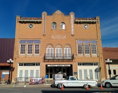 Ramona Theatrelisted 1984
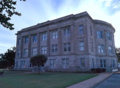 Tillman County Courthouselisted 1984
- J. D. Laney Houselisted 1984
Topographic sheets covering this place
5 surveys from 9 printed sheetsMatched by testing this settlement's coordinate against the published boundary of every sheet in the United States Geological Survey's historical collection. Each opens the scanned sheet at the Survey.
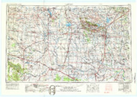
- 1955 USGS Lawton quadrangle1:250000, 5 printings
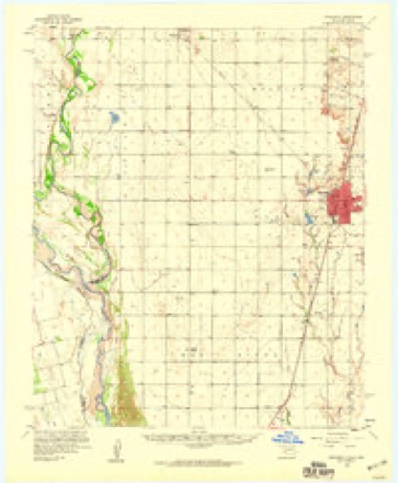
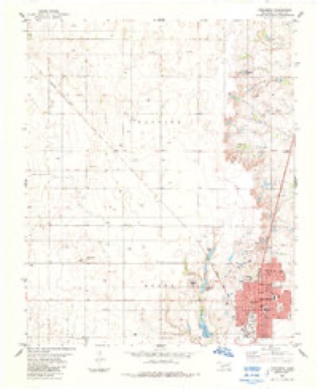
- 1958 USGS Frederick quadrangle1:62500
- 1975 USGS Frederick NE quadrangle1:24000
- 1984 USGS Frederick quadrangle1:24000
- 1986 USGS Vernon quadrangle1:100000
Mines and quarries near this place
6 within 5 milesRegional context, not property-specific evidence. The federal mineral resources record lists 6 workings within 5 miles of Frederick: 6 past producers. None of them still produces. What was taken out: Sand and Gravel, Construction. Distance is straight-line from the map coordinates, so a quarry counted here may appear on a neighbouring settlement's page as well.
| Where | Site | Commodity | Status | Recorded |
|---|---|---|---|---|
| Unknown Gravel Pit | Sand and Gravel, Construction | Past Producer | ||
| Unknown Gravel Pit | Sand and Gravel, Construction | Past Producer | ||
| Unknown Gravel Pit | Sand and Gravel, Construction | Past Producer | ||
| Unknown Gravel Pit | Sand and Gravel, Construction | Past Producer | ||
| Unknown Gravel Pit | Sand and Gravel, Construction | Past Producer | ||
| Unknown Gravel Pit | Sand and Gravel, Construction | Past Producer |
Storms near this place
60 of 169 shownRegional context, not property-specific evidence. The National Weather Service names Frederick in 169 storm reports between 1993 and 2025: 81 hail, 67 thunderstorm wind, 8 flash flood, 6 tornado. No death or injury is recorded in these reports. Each account below is quoted exactly as the forecast office filed it, from the NOAA Storm Events Database, and each date opens the federal record of that event.
| When | Event | Place named | Harm | What the report says |
|---|---|---|---|---|
| July 1995 | Thunderstorm Wind | Frederick | $500,000 | no account filed |
| May 1999 | Flash Flood | Frederick | $60,000 | no account filed |
| October 2021 | Tornado (EF1) | Frederick | $50,000 | This tornado developed 3.5 miles southwest of Fredrick and moved north or just east of due north for 7 miles. A barn had significant wall damage to the northwest of Frederick. Otherwise, there were a few pivot irrigators that were tipped over to the southwest and west of Frederick, and tree and power pole damage was also observed along the path. |
| April 1994 | Thunderstorm Wind | Frederick | $50,000 | no account filed |
| April 1994 | Thunderstorm Wind | Frederick | $50,000 | no account filed |
| March 2004 | Thunderstorm Wind | Frederick | $35,000 | A grain silo and show barn were destroyed. |
| April 1996 | Thunderstorm Wind | Frederick | $31,000 | no account filed |
| October 2023 | Thunderstorm Wind | Frederick | $30,000 | Widespread wind damage occurred in the community of Frederick. The most significant damage was near the intersection of South Main Street and Dahlia Avenue, where a large (older) brick building had its roof and exterior walls collapse. Additional damage included a large barn with total roof collapse, numerous large trees/limbs snapped or blown down and sporadic light roof damage. Time is radar estimated. |
| May 2001 | Thunderstorm Wind | Frederick | $30,000 | A church steeple was blown off. |
| October 2023 | Thunderstorm Wind | Frederick | $20,000 | Relayed image showing silo and machine shed damage at an agricultural facility. Time is radar estimated. |
| May 2022 | Thunderstorm Wind | Frederick | $20,000 | Wind damage was observed along E1850 road where a power pole was broken near N2190 Road. Farther east, winds damaged fences and buildings with sheet metal blown around. |
| November 2024 | Flood | Frederick | $10,000 | Relayed images show minor flooding across portions of the Frederick community, including water encroaching on a motel along U.S. Highway 183. Event time is approximate. |
| May 2022 | Thunderstorm Wind | Frederick | $10,000 | Power poles were damaged by thunderstorm winds along SH-5 from four miles west of Frederick to the west edge of Frederick. |
| April 2016 | Thunderstorm Wind | Frederick | $10,000 | Trees were downed in Frederick. Eight power poles reported down, with one of them falling on a residence. A playground and a metal shed were blown over. |
| June 2005 | Thunderstorm Wind | Frederick | $10,000 | A two foot diameter tree and several large tree limbs were downed. A fence was blown over and power poles were downed. |
| October 2023 | Thunderstorm Wind | Frederick | $8,000 | Multiple power poles blown down near the intersection of U.S. Highway 183 and East 1830 Road. Time is radar estimated. |
| July 2022 | Thunderstorm Wind | Frederick | $5,000 | Power pole downed. Part of a wooden patio thrown on top of a house. |
| May 2020 | Thunderstorm Wind | Frederick | $5,000 | Tin roof removed off house by winds. Time estimated by radar. |
| May 2001 | Thunderstorm Wind | Frederick | $5,000 | Numerous power poles were downed. |
| June 1994 | Thunderstorm Wind | Frederick | $5,000 | no account filed |
| November 1993 | Thunderstorm Wind | Frederick | $5,000 | no account filed |
| March 1993 | Thunderstorm Wind | Frederick | $5,000 | no account filed |
| May 2016 | Thunderstorm Wind | Frederick | $4,000 | Power lines were downed. |
| March 2023 | Thunderstorm Wind | Frederick | $2,000 | Wind driven hail broke windows. |
| February 2001 | Thunderstorm Wind | Frederick | $2,000 | Power poles were downed. |
| May 1999 | Thunderstorm Wind | Frederick | $2,000 | no account filed |
| June 2003 | Thunderstorm Wind | Frederick | $1,000 | A roof was damaged and trees uprooted in this location. |
| May 2025 | Flash Flood | Frederick | - | Roadway flooding occurred near the intersection of Oklahoma Highway 5 and County Road 2230 due to water rise from the Little Deep Red Creek. The event time is approximate. |
| April 2025 | Flash Flood | Frederick | - | A portion of East 1770 Road was washed out due to flooding. Event time is approximate. |
| April 2024 | Hail | Frederick | - | Relayed image along with multiple additional confirmations. |
| April 2024 | Hail | Frederick | - | Social media image. Multiple additional confirmations nearby in time/space. |
| April 2024 | Hail | Frederick | - | MPing report. |
| April 2024 | Hail | Frederick | - | MPing report. |
| April 2024 | Hail | Frederick | - | MPing report. |
| April 2024 | Hail | Frederick | - | MPing report. |
| May 2024 | Hail | Frederick | - | MPing report. |
| May 2024 | Thunderstorm Wind | Frederick | - | Tree limbs blown down near the intersection of Oklahoma Highway 5/East Gladstone Avenue and North 11th Street. Relayed by emergency management. Time is radar estimated. |
| June 2024 | Hail | Frederick | - | MPing report. |
| May 2023 | Hail | Frederick | - | MPing report. |
| October 2023 | Thunderstorm Wind | Frederick | - | Estimated wind gust. |
| May 2022 | Flash Flood | Frederick | - | Some streets reported impassible due to flood water. |
| May 2022 | Thunderstorm Wind | Frederick | - | Powerlines downed. |
| August 2022 | Flood | Frederick | - | Street flooding reported in Frederick. |
| July 2022 | Thunderstorm Wind | Frederick | - | Power poles damaged in the south part of town, time estimate from radar. |
| October 2021 | Tornado (EF0) | Frederick | - | Several storm chasers, including an off-duty meteorologist from the Storm Prediction Center, observed a brief tornado approximately 5 miles southwest of Frederick. No damage was reported and the location is estimated. |
| May 2020 | Flash Flood | Frederick | - | Heavy street flooding with 3 inches of rain. |
| April 2020 | Hail | Frederick | - | Location approximate. Media storm trackers received near baseball sized hail near Frederick. |
| May 2019 | Hail | Frederick | - | Time estimated from radar. |
| May 2019 | Flash Flood | Frederick | - | Significant rainfall caused ponding on streets. |
| May 2019 | Thunderstorm Wind | Frederick | - | Time estimate from radar. |
| May 2019 | Thunderstorm Wind | Frederick | - | Estimated by chaser. |
| September 2018 | Thunderstorm Wind | Frederick | - | Measured with personal anemometer. No damage reported. |
| May 2018 | Thunderstorm Wind | Frederick | - | No damage reported. |
| August 2017 | Flood | Frederick | - | Received via Twitter. |
| May 2016 | Thunderstorm Wind | Frederick | - | Winds estimated by observation. |
| April 2015 | Hail | Frederick | - | Relayed by kswo. No known damage. |
| April 2015 | Hail | Frederick | - | No known damage. |
| March 2013 | Thunderstorm Wind | Frederick | - | Frederick ASOS measured a wind gust to 56 knots. No damage was reported. |
| April 2013 | Thunderstorm Wind | Frederick | - | Winds were generated by the rear flank downdraft of a supercell thunderstorm. |
| April 2013 | Hail | Frederick | - | No damage was reported. |
Nearest settlements
The eight closest, with where each one stands in the county. Distances are straight-line, computed from the Geographic Names Information System coordinates.
| Map | Place | Distance | Sheets |
|---|---|---|---|
| Burt | 5.2 miles | 9 | |
| Manitou | 8.2 miles | 11 | |
| Hollister | 8.5 miles | 8 | |
| Tipton | 10.0 miles | 9 | |
| Davidson | 10.9 miles | 9 | |
| Taylor Corner Gin | 13.0 miles | 9 | |
| Loveland | 14.4 miles | 8 | |
| Grandfield | 21.0 miles | 9 |
Elsewhere
Matched on this settlement's Geographic Names Information System number rather than its name, so it cannot be a different place of the same name in another state.
| Wikipedia article on Frederick | An encyclopaedic summary. Its text is share-alike, so it is linked here rather than copied. |
| Wikidata item Q165941 | The structured record the population and elevation above come from. Public domain (CC0). |
Provenance
This settlement is recorded in the Geographic Names Information System as feature 1093029. The sheet list is computed by point-in-boundary test against the United States Geological Survey's historical topographic inventory. Both are works of the United States government and carry no copyright under 17 U.S.C. 105.
Mines and quarries. USGS Mineral Resources Data System (MRDS) https://mrdata.usgs.gov/mrds/ A work of the United States government, no copyright under 17 U.S.C. 105.
Storms. NOAA National Centers for Environmental Information, Storm Events Database https://www.ncei.noaa.gov/stormevents/ A work of the United States government, no copyright under 17 U.S.C. 105. Narratives are quoted verbatim from the National Weather Service report and are not edited or summarised.